National Register of Historic Places listings in Martin County, North Carolina
This list includes properties and districts listed on the National Register of Historic Places in Martin County, North Carolina. Click the "Map of all coordinates" link to the right to view an online map of all properties and districts with latitude and longitude coordinates in the table below.[1]

Current listings
- This National Park Service list is complete through NPS recent listings posted June 26, 2020.[2]
| [3] | Name on the Register[4] | Image | Date listed[5] | Location | City or town | Description |
|---|---|---|---|---|---|---|
| 1 | Bear Grass Primitive Baptist Church | April 28, 2005 (#05000352) |
NW side NC 1001, 0.1 miles N of jct with NC 1106 35°46′03″N 77°07′42″W |
Bear Grass | ||
| 2 | Bear Grass School | June 1, 2005 (#05000515) |
6344 E. Bear Grass Rd. 35°46′05″N 77°07′38″W |
Bear Grass | ||
| 3 | Asa Biggs House and Site | 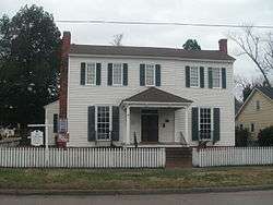 Asa Biggs House and Site |
October 10, 1979 (#79003335) |
100 E. Church St. 35°51′22″N 77°03′24″W |
Williamston | |
| 4 | Burras House | March 30, 1978 (#78001962) |
On U.S. 64 35°48′33″N 76°54′05″W |
Jamesville | ||
| 5 | Conoho Creek Historic District | March 12, 1998 (#98000230) |
Roughly bounded by Conoho Cr., Salsbury Mill Branch, and 0.5 miles S of NC 142 35°54′31″N 77°14′21″W |
Hassell | ||
| 6 | Darden Hotel | December 30, 1975 (#75001280) |
Main St. 35°56′33″N 77°12′32″W |
Hamilton | ||
| 7 | Everetts Christian Church | April 28, 2005 (#05000351) |
109 S. Broad St. 35°49′59″N 77°10′14″W |
Everetts | ||
| 8 | Everetts Historic District | December 2, 2014 (#14000988) |
Roughly bounded by Barnhill, Peel, Main, Ayers & James Sts. 35°50′05″N 77°10′15″W |
Everetts | ||
| 9 | First Christian Church | 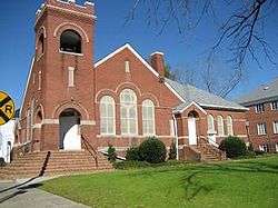 First Christian Church |
April 28, 2005 (#05000353) |
126 S. Main St. 35°49′22″N 77°15′11″W |
Robersonville | |
| 10 | Fort Branch Site | June 18, 1973 (#73001358) |
SE of Hamilton on SR 1416 35°55′39″N 77°10′19″W |
Hamilton | ||
| 11 | W. W. Griffin Farm | October 20, 2001 (#01001134) |
1871 Wendell Griffin Rd. 35°49′45″N 76°57′29″W |
Williamston | ||
| 12 | Hamilton Historic District | June 3, 1980 (#80002884) |
NC 125 35°56′41″N 77°12′31″W |
Hamilton | ||
| 13 | Hickory Hill | December 20, 1984 (#84000546) |
NC 903 35°56′59″N 77°13′14″W |
Hamilton | ||
| 14 | Jamesville Primitive Baptist Church and Cemetery | December 20, 1984 (#84000556) |
E side of NC 171 35°48′35″N 76°53′51″W |
Jamesville | ||
| 15 | Jesse Fuller Jones House | April 29, 1982 (#82003485) |
Off SR 1409 35°53′02″N 77°11′08″W |
Spring Green | ||
| 16 | W. J. Little House | September 19, 1985 (#85002420) |
109 N. Main St. 35°49′30″N 77°15′16″W |
Robersonville | ||
| 17 | Martin County Courthouse |  Martin County Courthouse |
May 10, 1979 (#79001733) |
Main St. 35°51′54″N 77°03′10″W |
Williamston | |
| 18 | Oak City Christian Church | April 28, 2005 (#05000354) |
310 W. Commerce St. 35°57′37″N 77°18′53″W |
Oak City | ||
| 19 | Roberson-Everett-Roebuck House | August 30, 2010 (#10000602) |
105 S. Outerbridge St. 35°49′25″N 77°15′26″W |
Robersonville | ||
| 20 | Robersonville Primitive Baptist Church | 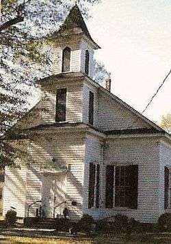 Robersonville Primitive Baptist Church |
April 20, 2005 (#05000322) |
107 N. Outterbridge St. 35°49′28″N 77°15′29″W |
Robersonville | Now known as St. James Place Museum |
| 21 | Sherrod Farm | December 20, 1984 (#84000552) |
W side of NC 125/903 35°55′31″N 77°12′30″W |
Hamilton | ||
| 22 | Skewarkey Primitive Baptist Church |  Skewarkey Primitive Baptist Church |
April 28, 2005 (#05000355) |
W side of US 17, 0.04 miles S. of jct. with US 64 35°50′25″N 77°03′54″W |
Williamston | |
| 23 | Smithwick's Creek Primitive Baptist Church | April 20, 2005 (#05000324) |
Jct. of NC 1106 at NC 1516 35°43′28″N 77°02′16″W |
Farm Life | ||
| 24 | Spring Green Primitive Baptist Church | April 20, 2005 (#05000323) |
Jct. of NC 1409 and NC 903 35°53′40″N 77°11′41″W |
Hamilton | ||
| 25 | Sunny Side Inn |  Sunny Side Inn |
November 29, 1995 (#95001396) |
1102 Washington St. 35°50′32″N 77°03′47″W |
Williamston | |
| 26 | West Martin School | January 25, 2018 (#100002049) |
402 S Cherry St. 35°57′42″N 77°17′58″W |
Oak City | ||
| 27 | Williamston Colored School | 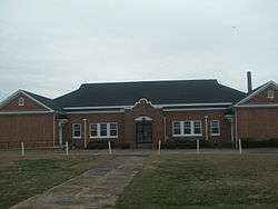 Williamston Colored School |
July 25, 2014 (#14000445) |
705 Washington St. 35°50′45″N 77°03′38″W |
Williamston | |
| 28 | Williamston Commercial Historic District |  Williamston Commercial Historic District |
March 9, 1995 (#95000174) |
Roughly, areas surrounding the 100 blocks of E. Main, W. Main and S. Smithwick Sts. and the 200 block of Washington St. 35°51′17″N 77°03′21″W |
Williamston | |
| 29 | Williamston Historic District | 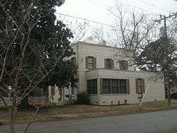 Williamston Historic District |
October 12, 2001 (#01001095) |
Roughly bounded by Franklin, Harrell, Williams, South Haughton, North Railroad, Roberson, and White Sts. 35°51′14″N 77°03′22″W |
Williamston |
See also
| Wikimedia Commons has media related to National Register of Historic Places in Martin County, North Carolina. |
References
- The latitude and longitude information provided in this table was derived originally from the National Register Information System, which has been found to be fairly accurate for about 99% of listings. Some locations in this table may have been corrected to current GPS standards.
- "National Register of Historic Places: Weekly List Actions". National Park Service, United States Department of the Interior. Retrieved on June 26, 2020.
- Numbers represent an ordering by significant words. Various colorings, defined here, differentiate National Historic Landmarks and historic districts from other NRHP buildings, structures, sites or objects.
- "National Register Information System". National Register of Historic Places. National Park Service. April 24, 2008.
- The eight-digit number below each date is the number assigned to each location in the National Register Information System database, which can be viewed by clicking the number.

| Topics | |
|---|---|
| Lists by state |
|
| Lists by insular areas | |
| Lists by associated state | |
| Other areas | |
| Related | |
| |
Municipalities and communities of Martin County, North Carolina, United States | ||
|---|---|---|
| Towns | | |
This article is issued from Wikipedia. The text is licensed under Creative Commons - Attribution - Sharealike. Additional terms may apply for the media files.