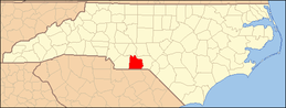
National Register of Historic Places listings in Anson County, North Carolina
This list includes properties and districts listed on the National Register of Historic Places in Anson County, North Carolina. Click the "Map of all coordinates" link to the right to view a Google map of all properties and districts with latitude and longitude coordinates in the table below.[1]
- This National Park Service list is complete through NPS recent listings posted June 19, 2020.[2]
Current listings
| [3] | Name on the Register | Image | Date listed[4] | Location | City or town | Description |
|---|---|---|---|---|---|---|
| 1 | Boggan-Hammond House and Alexander Little Wing | 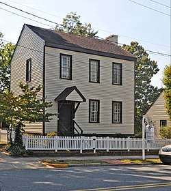 Boggan-Hammond House and Alexander Little Wing |
September 14, 1972 (#72000923) |
210 Wade St. 34°57′57″N 80°04′29″W |
Wadesboro | |
| 2 | Barrett-Faulkner House | 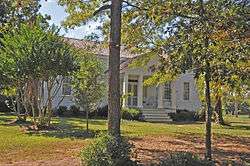 Barrett-Faulkner House |
September 4, 2012 (#12000601) |
2063 Monroe-White Store Rd. 34°54′19″N 80°18′25″W |
Peachland vicinity | |
| 3 | Chambers-Morgan Farm | December 27, 1996 (#96001526) |
West side of NC 1228, 0.1 miles (0.16 km) north of NC 1225 34°52′17″N 80°17′30″W |
White Store | ||
| 4 | Billy Horne Farm | June 9, 1989 (#89000496) |
NC 1246, 0.5 miles (0.80 km) west of the junction with NC 1240 34°56′24″N 80°15′18″W |
Polkton | ||
| 5 | US Post Office | 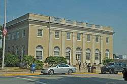 US Post Office |
July 6, 1987 (#87001161) |
105-111 Martin St. 34°58′03″N 80°04′35″W |
Wadesboro | |
| 6 | Wadesboro Downtown Historic District | 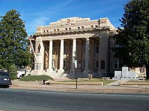 Wadesboro Downtown Historic District |
April 1, 1999 (#99000425) |
Roughly bounded by Martin, Rutherford, Morgan, Lee, and Brent Sts. 34°57′57″N 80°04′37″W |
Wadesboro | |
| 7 | Westview Cemetery | April 29, 2015 (#15000201) |
W. of Madison Ave., S. of Henry St. 34°58′18″N 80°05′10″W |
Wadesboro |
See also
| Wikimedia Commons has media related to National Register of Historic Places in Anson County, North Carolina. |
References
- The latitude and longitude information provided in this table was derived originally from the National Register Information System, which has been found to be fairly accurate for about 99% of listings. Some locations in this table may have been corrected to current GPS standards.
- "National Register of Historic Places: Weekly List Actions". National Park Service, United States Department of the Interior. Retrieved on June 19, 2020.
- Numbers represent an ordering by significant words. Various colorings, defined here, differentiate National Historic Landmarks and historic districts from other NRHP buildings, structures, sites or objects.
- The eight-digit number below each date is the number assigned to each location in the National Register Information System database, which can be viewed by clicking the number.

| Topics | |
|---|---|
| Lists by state |
|
| Lists by insular areas | |
| Lists by associated state | |
| Other areas | |
| Related | |
| |
Municipalities and communities of Anson County, North Carolina, United States | ||
|---|---|---|
| Towns | | |
| Unincorporated community | ||
| Ghost town | ||
This article is issued from Wikipedia. The text is licensed under Creative Commons - Attribution - Sharealike. Additional terms may apply for the media files.