National Register of Historic Places listings in Alamance County, North Carolina
This list includes properties and districts listed on the National Register of Historic Places in Alamance County, North Carolina. Click the "Map of all coordinates" link to the right to view an online map of all properties and districts with latitude and longitude coordinates in the table below.[1]
- This National Park Service list is complete through NPS recent listings posted June 19, 2020.[2]
Current listings
| [3] | Name on the Register[4] | Image | Date listed[5] | Location | City or town | Description |
|---|---|---|---|---|---|---|
| 1 | Alamance Battleground State Historic Site | 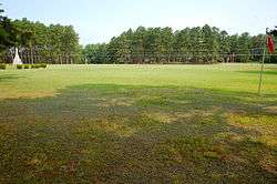 Alamance Battleground State Historic Site |
February 26, 1970 (#70000435) |
SW of Burlington on Rte. 1, off NC 62, near jct. with Rte. 1129 36°00′27″N 79°31′12″W |
Alamance | |
| 2 | Alamance County Courthouse | 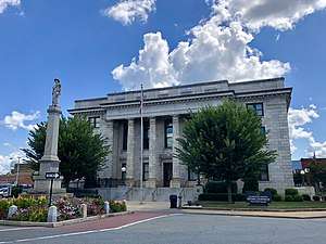 Alamance County Courthouse |
May 10, 1979 (#79001655) |
Courthouse Square 36°04′09″N 79°24′02″W |
Graham | |
| 3 | Alamance Hotel | 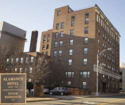 Alamance Hotel |
May 31, 1984 (#84001906) |
Maple Ave. and S. Main St. 36°05′35″N 79°26′24″W |
Burlington | |
| 4 | Alamance Mill Village Historic District | 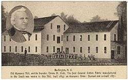 Alamance Mill Village Historic District |
August 16, 2007 (#07000821) |
3927-3981 NC 62 S, Great Alamance Creek W of NC 62S 36°02′22″N 79°29′14″W |
Alamance | |
| 5 | Allen House |  Allen House |
February 26, 1970 (#70000436) |
SW of Burlington on Rte. 1, off SC 62 36°00′33″N 79°31′16″W |
Burlington | |
| 6 | Altamahaw Mill Office | 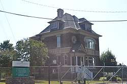 Altamahaw Mill Office |
November 20, 1984 (#84000301) |
SR 1002 and SR 1567 36°11′02″N 79°30′27″W |
Altamahaw | |
| 7 | Atlantic Bank and Trust Company Building | 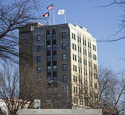 Atlantic Bank and Trust Company Building |
May 31, 1984 (#84001909) |
358 S. Main St. 36°05′36″N 79°26′15″W |
Burlington | |
| 8 | Bellemont Mill Village Historic District | July 1, 1987 (#87001099) |
E and W side of NC 49, S of jct. with Great Alamance Creek 36°01′33″N 79°26′34″W |
Bellemont | ||
| 9 | Beverly Hills Historic District | 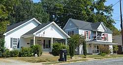 Beverly Hills Historic District |
August 5, 2009 (#09000599) |
Portion of 14 blocks on N. Main St., Rolling Rd., Highland Ave., Virginia Ave., N. Ireland St., N. St. John St. 36°05′54″N 79°25′28″W |
Burlington | |
| 10 | Hiram Braxton House | November 22, 1993 (#93001193) |
3440 Newlin Rd. 35°52′06″N 79°19′06″W |
Snow Camp | ||
| 11 | Charles F. and Howard Cates Farm | September 24, 2001 (#01001025) |
4870 Mebane Rogers Rd. 36°06′48″N 79°16′47″W |
Mebane | ||
| 12 | Cedarock Park Historic District |  Cedarock Park Historic District |
December 4, 1986 (#86003455) |
SR 2409 35°59′26″N 79°26′30″W |
Graham | |
| 13 | William Cook House | November 22, 1993 (#93001194) |
NC 2131 W side at jct. with NC 2132 36°01′59″N 79°17′03″W |
Mebane | ||
| 14 | Cooper School | December 15, 1986 (#86003451) |
S side of SR 2143, E of jct. with SR 2142 35°59′30″N 79°16′19″W |
Mebane | ||
| 15 | Cross Roads Presbyterian Church and Cemetery and Stainback Store |  Cross Roads Presbyterian Church and Cemetery and Stainback Store |
May 22, 1984 (#84001912) |
N of Mebane at SR 1910 and SR 1912 36°10′12″N 79°17′11″W |
Mebane | |
| 16 | Downtown Burlington Historic District | 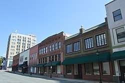 Downtown Burlington Historic District |
September 6, 1990 (#90001320) |
Roughly bounded by Morehead, S. Main, Davis, S. Worth, E. Webb and Spring Sts. 36°05′33″N 79°26′18″W |
Burlington | |
| 17 | Durham Hosiery Mill No. 15 | December 27, 2010 (#10001054) |
301 W. Washington St. 36°05′48″N 79°16′25″W |
Mebane | ||
| 18 | East Davis Street Historic District |  East Davis Street Historic District |
April 20, 2000 (#00000393) |
Roughly bounded by E. Davis St., S. Mebane St., E. Webb Ave., and Tucker St. 36°05′17″N 79°25′52″W |
Burlington | |
| 19 | Efird Building | 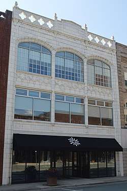 Efird Building |
May 31, 1984 (#84001914) |
133 E. Davis St. 36°05′34″N 79°26′16″W |
Burlington | |
| 20 | Elon College Historic District |  Elon College Historic District |
March 22, 1988 (#88000166) |
S side of Haggard Ave. between William and O'Kelly 36°06′07″N 79°30′17″W |
Elon | |
| 21 | First Baptist Church |  First Baptist Church |
May 31, 1984 (#84001917) |
400 S. Broad St. 36°05′24″N 79°26′04″W |
Burlington | |
| 22 | First Christian Church of Burlington |  First Christian Church of Burlington |
May 31, 1984 (#84001919) |
415 S. Church St. 36°05′41″N 79°26′23″W |
Burlington | |
| 23 | Polly Fogleman House | November 22, 1993 (#93001197) |
4331 Brick Church Rd. 36°00′27″N 79°32′18″W |
Burlington | ||
| 24 | Friends Spring Meeting House | March 19, 1987 (#87000456) |
Jct. of SR 1005 and SR 2338 35°54′07″N 79°19′34″W |
Snow Camp | ||
| 25 | Glencoe Mill Village Historic District |  Glencoe Mill Village Historic District |
February 16, 1979 (#79001654) |
Off NC 62 at Haw River 36°08′27″N 79°25′44″W |
Glencoe | |
| 26 | Glencoe School | December 27, 2010 (#10001055) |
2649 Union Ridge Rd. 36°08′48″N 79°25′25″W |
Glencoe | ||
| 27 | Graham Historic District |  Graham Historic District |
April 7, 1983 (#83001834) |
E. and W. Harden, E. and W. Elm, N. and S. Main and W. Pine Sts. 36°04′08″N 79°24′09″W |
Graham | |
| 28 | Granite-Cora-Holt Mills Historic District |  Granite-Cora-Holt Mills Historic District |
April 23, 2020 (#100005195) |
122, 180, 218, 222, 224, and 226 East Main St.; 100, 102, 104, 106, 108, and 290 Cone Dr.; 115, 121, and 205 Stone St. 36°05′26″N 79°21′48″W |
Haw River | |
| 29 | Granite Mill | September 18, 2017 (#100001627) |
114, 116, 122, 180, 218, 222, 224 & 226 E. Main St. 36°05′23″N 79°21′59″W |
Haw River | ||
| 30 | Griffis-Patton House | 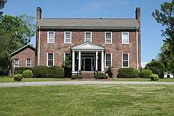 Griffis-Patton House |
March 17, 1983 (#83001835) |
NW of Melbane on SR 1927 36°07′01″N 79°19′03″W |
Mebane | |
| 31 | Thomas Guy House | November 22, 1993 (#93001195) |
NC 2135 N side, 0.3 miles W of jct. with NC 2142 36°00′34″N 79°16′06″W |
Mebane | ||
| 32 | Hawfields Presbyterian Church | December 15, 1978 (#78001926) |
SW of Mebane on NC 119 36°03′28″N 79°18′23″W |
Mebane | ||
| 33 | Henderson Scott Farm Historic District | September 16, 1987 (#87000411) |
Jct. of NC 119 and SR 2135 36°02′23″N 79°19′53″W |
Mebane | ||
| 34 | Charles T. Holt House | June 1, 1982 (#82003421) |
228 Holt St. 36°05′09″N 79°22′11″W |
Haw River | Designed by architect George Franklin Barber | |
| 35 | L. Banks Holt House | April 18, 1977 (#77000988) |
S of Alamance on NC 62 36°01′08″N 79°29′30″W |
Alamance | ||
| 36 | Holt-Frost House |  Holt-Frost House |
May 31, 1984 (#84001920) |
130 Union Ave. 36°05′59″N 79°26′19″W |
Burlington | |
| 37 | Horner Houses | 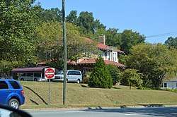 Horner Houses |
May 31, 1984 (#84001921) |
304 and 308 N. Fisher St. 36°05′59″N 79°26′12″W |
Burlington | |
| 38 | Johnston Hall |  Johnston Hall |
March 7, 1994 (#94000130) |
103 Antioch St. 36°06′01″N 79°30′01″W |
Elon | |
| 39 | Kernodle-Pickett House | March 23, 1987 (#87000454) |
Jct. of NC 1136 and NC 1131 36°01′18″N 79°27′43″W |
Bellemont | ||
| 40 | Kerr-Patton House | December 5, 1985 (#85003083) |
NC 2133 36°01′37″N 79°18′48″W |
Thompson | ||
| 41 | Lakeside Mills Historic District | .jpg) Lakeside Mills Historic District |
May 31, 1984 (#84001922) |
404-418 Lakeside Ave., Kent Ave., and 428-437 Hatch St. 36°06′18″N 79°26′21″W |
Burlington | |
| 42 | May Hosiery Mills Knitting Mill |  May Hosiery Mills Knitting Mill |
August 26, 2016 (#16000585) |
612 S. Main St. 36°05′31″N 79°26′23″W |
Burlington | |
| 43 | Camilus McBane House | November 22, 1993 (#93001196) |
Off NC 2345 N side, 0.3 miles W of jct. with NC 2340, 0.2 miles down unnamed rd. 35°52′43″N 79°18′49″W |
Snow Camp | ||
| 44 | McCauley-Watson House | February 4, 1994 (#94000022) |
NC 1762 (Blanchard Rd.) SW side, 1.5 miles NW of jct. with NC 62 36°11′23″N 79°23′48″W |
Union Ridge | ||
| 45 | McCray School | December 4, 1986 (#86003438) |
NW side of NC 62, S of jct. with SR 1757 36°10′49″N 79°22′48″W |
Burlington | ||
| 46 | Mebane Commercial Historic District | December 22, 2011 (#11000952) |
Bounded by N. 3rd, E. Center, N. 4th, & W. Clay Sts. 36°05′49″N 79°16′07″W |
Mebane | ||
| 47 | Menagerie Carousel | August 30, 1982 (#82003420) |
Burlington City Park, S. Main St. 36°05′03″N 79°27′13″W |
Burlington | ||
| 48 | Moore-Holt-White House | May 31, 1984 (#84001924) |
520 Maple ave. 36°05′19″N 79°26′06″W |
Burlington | ||
| 49 | William P. Morrow House | August 9, 2006 (#06000687) |
NC 2146, 0.1 miles W of jct. with NC 2145 (3017 Saxapahaw-Bethlehem Church Rd.) 35°57′15″N 79°16′45″W |
Graham | ||
| 50 | North Main Street Historic District |  North Main Street Historic District |
June 10, 1999 (#99000698) |
Roughly bounded by Whitsett, New Hill, N. Melville, Market, Mill and Sideview Sts. 36°04′30″N 79°23′57″W |
Graham | |
| 51 | Old South Mebane Historic District | December 22, 2011 (#11000953) |
Bounded by Holt, S. 1st, S. 5th, Austin, E. Wilson, & Roosevelt Sts.; also 400 blocks of W. Lee & W. McKinley Sts., 507 S. 4th St., 600-800 blocks of S. 5th St. 36°05′33″N 79°16′17″W |
Mebane | Second address represents a boundary increase of December 16, 2013 | |
| 52 | Oneida Cotton Mills and Scott-Mebane Manufacturing Company Complex | .jpg) Oneida Cotton Mills and Scott-Mebane Manufacturing Company Complex |
June 9, 2014 (#14000291) |
219 & 220 W. Harden St. 36°04′14″N 79°24′15″W |
Graham | |
| 53 | Former Saxapahaw Spinning Mill |  Former Saxapahaw Spinning Mill |
May 20, 1998 (#98000546) |
1647 Saxapahaw Bethlehem Church Rd. 35°56′48″N 79°19′16″W |
Saxapahaw | |
| 54 | Kerr Scott Farm | October 31, 1987 (#87001850) |
N and S side of SR 2123 36°03′33″N 79°21′00″W |
Haw River | ||
| 55 | Snow Camp Mutual Telephone Exchange Building | June 9, 1989 (#89000497) |
SR 1004, .2 miles S of SR 1005 35°53′20″N 79°25′50″W |
Snow Camp | ||
| 56 | South Broad-East Fifth Streets Historic District |  South Broad-East Fifth Streets Historic District |
December 31, 2001 (#01001427) |
Roughly bounded by E. Morehead, S. Broad, Sixth, and W. Main Sts. 36°05′20″N 79°26′25″W |
Burlington | |
| 57 | Southern Railway Passenger Station | May 23, 1980 (#80002800) |
Main and Webb Sts. 36°05′38″N 79°26′12″W |
Burlington | ||
| 58 | A. L. Spoon House | November 22, 1993 (#93001192) |
NC 1107 N side, 0.7 miles SW of jct. with NC 1005 35°54′55″N 79°31′16″W |
Snow Camp | ||
| 59 | St. Athanasius Episcopal Church and Parish House and the Church of the Holy Comforter |  St. Athanasius Episcopal Church and Parish House and the Church of the Holy Comforter |
May 29, 1979 (#79001653) |
300 E. Webb Ave. and 320 E. Davis St. 36°05′30″N 79°26′03″W |
Burlington | |
| 60 | Stagg House |  Stagg House |
May 31, 1984 (#84001926) |
317 N. Park Ave. 36°05′54″N 79°26′40″W |
Burlington | |
| 61 | Sunny Side | March 23, 1987 (#87000457) |
NC 1136, 3 miles E of jct. with NC 62 36°01′13″N 79°28′57″W |
Burlington | ||
| 62 | James Monroe Thompson House | November 22, 1993 (#93001198) |
NC 2158 east side, 0.1 miles south of the junction with NC 2150 35°58′18″N 79°19′19″W |
Saxapahaw | ||
| 63 | US Post Office | US Post Office |
September 23, 1988 (#88001594) |
430 S. Spring St. 36°05′31″N 79°26′26″W |
Burlington | |
| 64 | West Davis Street-Fountain Place Historic District |  West Davis Street-Fountain Place Historic District |
November 5, 1984 (#84000359) |
Roughly Bounded by Front, W. Webb, S. Fisher, E. Willowbrook, W. Davis Sts., and Fountain Pl. 36°05′43″N 79°26′45″W |
Burlington | |
| 65 | Western Electric Company-Tarheel Army Missile Plant |  Western Electric Company-Tarheel Army Missile Plant |
May 2, 2016 (#16000219) |
204 Graham-Hopedale Rd. 36°05′51″N 79°24′22″W |
Burlington | |
| 66 | White Furniture Company | .jpg) White Furniture Company |
July 29, 1982 (#82003422) |
E. Center and N. 5th Sts. 36°05′45″N 79°16′00″W |
Mebane | |
| 67 | Windsor Cotton Mills Office | 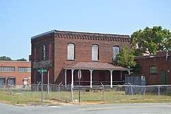 Windsor Cotton Mills Office |
May 31, 1984 (#84001930) |
Market and Gilmer Sts. 36°05′22″N 79°25′47″W |
Burlington | |
| 68 | Woodlawn School | November 29, 1991 (#91001745) |
N side NC 1921 0.15 miles W of jct. with NC 1920 36°06′39″N 79°17′43″W |
Mebane |
See also
| Wikimedia Commons has media related to National Register of Historic Places in Alamance County, North Carolina. |
References
- The latitude and longitude information provided in this table was derived originally from the National Register Information System, which has been found to be fairly accurate for about 99% of listings. Some locations in this table may have been corrected to current GPS standards.
- "National Register of Historic Places: Weekly List Actions". National Park Service, United States Department of the Interior. Retrieved on June 19, 2020.
- Numbers represent an ordering by significant words. Various colorings, defined here, differentiate National Historic Landmarks and historic districts from other NRHP buildings, structures, sites or objects.
- "National Register Information System". National Register of Historic Places. National Park Service. April 24, 2008.
- The eight-digit number below each date is the number assigned to each location in the National Register Information System database, which can be viewed by clicking the number.

| Topics | |
|---|---|
| Lists by state |
|
| Lists by insular areas | |
| Lists by associated state | |
| Other areas | |
| Related | |
| |
Municipalities and communities of Alamance County, North Carolina, United States | ||
|---|---|---|
| Cities | | |
| Towns | ||
| Village | ||
| CDPs | ||
| Unincorporated communities |
| |
| Footnotes | ‡This populated place also has portions in an adjacent county or counties | |
This article is issued from Wikipedia. The text is licensed under Creative Commons - Attribution - Sharealike. Additional terms may apply for the media files.