Dobbins Heights, North Carolina
Dobbins Heights is a town in Richmond County, North Carolina, United States. The population was 866 at the 2010 census.
Dobbins Heights, North Carolina | |
|---|---|
 Dobbins Heights, North Carolina Location within the state of North Carolina | |
| Coordinates: 34°54′12″N 79°41′28″W | |
| Country | United States |
| State | North Carolina |
| County | Richmond |
| Area | |
| • Total | 0.9 sq mi (2.3 km2) |
| • Land | 0.9 sq mi (2.3 km2) |
| • Water | 0.0 sq mi (0.0 km2) |
| Elevation | 387 ft (118 m) |
| Population (2010) | |
| • Total | 866 |
| • Estimate (2018)[1] | 837 |
| • Density | 960/sq mi (380/km2) |
| Time zone | UTC-5 (Eastern (EST)) |
| • Summer (DST) | UTC-4 (EDT) |
| ZIP code | 28345 |
| Area code(s) | 910 |
| FIPS code | 37-17325[2] |
| GNIS feature ID | 1027618[3] |
Geography
Dobbins Heights is located at 34°54′12″N 79°41′28″W (34.903388, -79.691220).[4]
According to the United States Census Bureau, the town has a total area of 0.9 square miles (2.3 km2), all of it land.
Demographics
| Historical population | |||
|---|---|---|---|
| Census | Pop. | %± | |
| 1990 | 1,144 | — | |
| 2000 | 936 | −18.2% | |
| 2010 | 866 | −7.5% | |
| Est. 2018 | 837 | [1] | −3.3% |
| U.S. Decennial Census[5] | |||
As of the census[2] of 2000, there were 936 people, 383 households, and 224 families residing in the town at that time. The population density was 1,047.0 people per square mile (406.1/km2). There were 474 housing units at an average density of 530.2/sq mi (205.6/km2). The racial makeup of the town was 13.68% White, 83.33% African American, 1.18% Native American, 0.21% Asian, 0.75% from other races, and 0.85% from two or more races. Hispanic or Latino of any race were 0.85% of the population.
There were 383 households, out of which 26.1% had children under the age of 18 living with them, 26.4% were married couples living together, 25.8% had a female householder with no husband present, and 41.5% were non-families. 37.9% of all households were made up of individuals, and 17.8% had someone living alone who was 65 years of age or older. The average household size was 2.40 and the average family size was 3.25.
In the town, the population was spread out, with 31.0% under the age of 18, 8.0% from 18 to 24, 24.4% from 25 to 44, 22.8% from 45 to 64, and 13.9% who were 65 years of age or older. The median age was 35 years. For every 100 females, there were 86.8 males. For every 100 females age 18 and over, there were 78.9 males.
The median income for a household in the town was $21,193, and the median income for a family was $23,750. Males had a median income of $22,202 versus $19,706 for females. The per capita income for the town was $12,050. About 27.8% of families and 32.6% of the population were below the poverty line, including 36.2% of those under age 18 and 51.9% of those age 65 or over.
References
- "Population and Housing Unit Estimates". Retrieved February 25, 2020.
- "U.S. Census website". United States Census Bureau. Retrieved 2008-01-31.
- "US Board on Geographic Names". United States Geological Survey. 2007-10-25. Retrieved 2008-01-31.
- "US Gazetteer files: 2010, 2000, and 1990". United States Census Bureau. 2011-02-12. Retrieved 2011-04-23.
- "Census of Population and Housing". Census.gov. Retrieved June 4, 2015.
Municipalities and communities of Richmond County, North Carolina, United States | ||
|---|---|---|
| City | 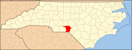 | |
| Towns | ||
| CDPs | ||
| Unincorporated communities | ||