National Register of Historic Places listings in Rowan County, North Carolina
This list includes properties and districts listed on the National Register of Historic Places in Rowan County, North Carolina. Click the "Map of all coordinates" link to the right to view an online map of all properties and districts with latitude and longitude coordinates in the table below.[1]

Current listings
- This National Park Service list is complete through NPS recent listings posted June 19, 2020.[2]
| [3] | Name on the Register[4] | Image | Date listed[5] | Location | City or town | Description |
|---|---|---|---|---|---|---|
| 1 | Back Creek Presbyterian Church and Cemetery |  Back Creek Presbyterian Church and Cemetery |
December 29, 1983 (#83003998) |
SR 1763 35°39′03″N 80°42′24″W |
Mt. Ulla | |
| 2 | Barber Farm | January 15, 2003 (#02001717) |
225 Redmon Rd. 35°42′57″N 80°38′42″W |
Cleveland | ||
| 3 | Bernhardt House |  Bernhardt House |
June 11, 1992 (#92000701) |
305 E. Innes St. 35°39′54″N 80°28′04″W |
Salisbury | |
| 4 | George Matthias Bernhardt House | November 26, 1982 (#82001303) |
South of Rockwell on SR 2361 35°30′27″N 80°25′42″W |
Rockwell | ||
| 5 | Henry Connor Bost House | November 12, 1982 (#82001304) |
East of Woodleaf off U.S. Route 601 35°46′01″N 80°30′45″W |
South River | ||
| 6 | Boyden High School |  Boyden High School |
May 23, 1996 (#96000564) |
500 Lincolnton Rd. 35°39′53″N 80°29′05″W |
Salisbury | After desegregation, school name changed to Salisbury High. |
| 7 | Michael Braun House | .jpg) Michael Braun House |
September 28, 1971 (#71000618) |
Northwest of Granite Quarry on SR 2308 off U.S. Route 52 35°37′20″N 80°26′28″W |
Granite Quarry | |
| 8 | Brooklyn-South Square Historic District |  Brooklyn-South Square Historic District |
July 5, 1985 (#85001449) |
Roughly bounded by Fisher, Shaver, Walls, and Lee Sts. 35°39′49″N 80°28′08″W |
Salisbury | |
| 9 | Maxwell Chambers House | 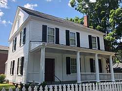 Maxwell Chambers House |
January 20, 1972 (#72000992) |
116 S. Jackson St. 35°40′09″N 80°28′20″W |
Salisbury | |
| 10 | China Grove Roller Mill | 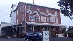 China Grove Roller Mill |
December 29, 1983 (#83003995) |
308 N. Main St. 35°34′16″N 80°34′41″W |
China Grove | |
| 11 | Christ Episcopal Church |  Christ Episcopal Church |
December 5, 2011 (#11000623) |
3430 Old U.S. Route 70 35°43′59″N 80°39′55″W |
Cleveland | |
| 12 | Community Building | 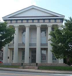 Community Building |
March 5, 1970 (#70000468) |
200 N. Main St. 35°40′06″N 80°28′07″W |
Salisbury | Now home to the Rowan Museum |
| 13 | Corriher Grange Hall | September 23, 1982 (#82003507) |
Northwest of Five Points on SR 1555 35°36′04″N 80°41′43″W |
Enochville | ||
| 14 | Cleveland School | January 10, 2019 (#100003300) |
216 Krider St. 35°44′06″N 80°40′09″W |
Cleveland | ||
| 15 | East Spencer Graded School | 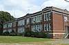 East Spencer Graded School |
January 25, 2018 (#100002050) |
110 S. Long St. 35°40′59″N 80°26′00″W |
East Spencer | |
| 16 | Eastover | January 24, 2011 (#10001176) |
5510 S. Main St. 35°36′31″N 80°32′28″W |
Salisbury | ||
| 17 | Ellis Street Graded School Historic District | 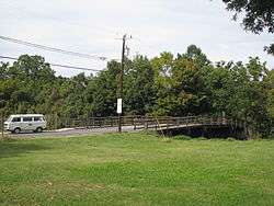 Ellis Street Graded School Historic District |
March 5, 1999 (#99000273) |
Roughly bounded by Craig, Innes, Jackson, and Cemetery Sts. 35°40′20″N 80°28′14″W |
Salisbury | Comprises the Shober Bridge and 76 other contributing properties |
| 18 | Fulton Heights Historic District |  Fulton Heights Historic District |
March 25, 1999 (#99000394) |
Roughly bounded by Fulton St., Heilig Ave., Ridge Ave., and Boyden St. 35°39′40″N 80°29′25″W |
Salisbury | |
| 19 | Grace Evangelical and Reformed Church | .jpg) Grace Evangelical and Reformed Church |
January 20, 1972 (#72000990) |
South of Rockwell on SR 1221 35°31′15″N 80°25′17″W |
Rockwell | |
| 20 | Granite Quarry School | February 7, 2001 (#01000017) |
706 Dunn's Mountain Rd. 35°36′57″N 80°26′07″W |
Granite Quarry | ||
| 21 | Griffith-Sowers House | September 9, 2009 (#09000703) |
5050 Statesville Boulevard 35°42′50″N 80°34′07″W |
Salisbury | ||
| 22 | Grimes Mill |  Grimes Mill |
February 6, 1984 (#84002492) |
600 N. Church St. 35°40′22″N 80°27′56″W |
Salisbury | Destroyed by fire on 1/16/13.[6] |
| 23 | Grubb-Sigmon-Weisiger House |  Grubb-Sigmon-Weisiger House |
February 12, 1999 (#99000198) |
213 McCoy Rd. 35°41′15″N 80°30′06″W |
Salisbury | |
| 24 | Hall Family House |  Hall Family House |
October 5, 1982 (#82001305) |
Northeast of Bear Poplar on NC 801 35°40′54″N 80°39′52″W |
Bear Poplar | |
| 25 | Hambley-Wallace House |  Hambley-Wallace House |
December 15, 1997 (#97001545) |
508 S. Fulton St. 35°39′59″N 80°28′42″W |
Salisbury | |
| 26 | Archibald Henderson Law Office |  Archibald Henderson Law Office |
January 20, 1972 (#72000993) |
Church and Fisher Sts. 35°40′03″N 80°28′20″W |
Salisbury | On the property of Rowan Public Library – Headquarters. |
| 27 | J. C. Price High School |  J. C. Price High School |
April 21, 2010 (#10000208) |
1300-1400 W. Bank St. 35°40′36″N 80°29′07″W |
Salisbury | |
| 28 | Kerr Mill | 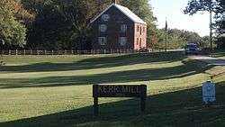 Kerr Mill |
May 11, 1976 (#76001337) |
West of Mill Bridge on Sloan Rd., south of NC 1768 35°31′11″N 80°25′21″W |
Mill Bridge | |
| 29 | Gen. William Kerr House | September 23, 1982 (#82003505) |
Northwest of Enochville on SR 1353 35°32′49″N 80°43′29″W |
Enochville | ||
| 30 | Kesler Manufacturing Co.-Cannon Mills Co. Plant No. 7 Historic District |  Kesler Manufacturing Co.-Cannon Mills Co. Plant No. 7 Historic District |
June 20, 1985 (#85001346) |
Park Ave. and Martin Luther King, Jr. Ave. 35°40′35″N 80°27′44″W |
Salisbury | |
| 31 | Knox Farm Historic District | April 1, 1983 (#83001914) |
Knox and Amity Hill Rds. 35°43′01″N 80°44′49″W |
Cleveland | ||
| 32 | Knox-Johnstone House | August 5, 1993 (#93000737) |
100 Beaumont Farm Rd. 35°44′01″N 80°40′58″W |
Cleveland | ||
| 33 | Livingstone College Historic District |  Livingstone College Historic District |
May 27, 1982 (#82003509) |
W. Monroe St. 35°40′14″N 80°28′59″W |
Salisbury | |
| 34 | Alexander Long House | February 1, 1972 (#72000995) |
North of Spencer on Sowers Ferry Rd. 35°42′38″N 80°25′14″W |
Spencer | ||
| 35 | Lyerly Building for Boys | January 5, 1989 (#88003006) |
Crescent Rd./Rt. 3 35°34′12″N 80°25′47″W |
Gold Hill Township | ||
| 36 | Napoleon Bonaparte McCanless House |  Napoleon Bonaparte McCanless House |
May 22, 2014 (#14000264) |
619 S. Main St. 35°39′45″N 80°28′33″W |
Salisbury | |
| 37 | Walter McCanless House |  Walter McCanless House |
May 21, 2005 (#05000452) |
200 Confederate Ave. 35°40′59″N 80°28′08″W |
Salisbury | |
| 38 | McNeely-Strachan House | 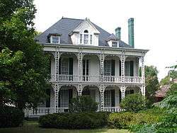 McNeely-Strachan House |
February 1, 1972 (#72000994) |
226 S. Jackson St. 35°40′04″N 80°28′27″W |
Salisbury | |
| 39 | Monroe Street School |  Monroe Street School |
May 19, 2004 (#04000463) |
1100 W. Monroe St. 35°40′24″N 80°29′06″W |
Salisbury | |
| 40 | Mount Vernon | May 27, 1980 (#80002899) |
SR 1003 and 1986 35°47′18″N 80°38′40″W |
Woodleaf | ||
| 41 | Mount Zion Baptist Church | 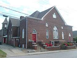 Mount Zion Baptist Church |
December 30, 1985 (#85003188) |
413 N. Church St. 35°40′15″N 80°28′02″W |
Salisbury | |
| 42 | North Long Street-Park Avenue Historic District |  North Long Street-Park Avenue Historic District |
June 20, 1985 (#85001347) |
N. Long St. and Park Ave. 35°40′00″N 80°27′41″W |
Salisbury | |
| 43 | North Main Street Historic District |  North Main Street Historic District |
July 29, 1985 (#85001674) |
Roughly bounded by N. Main, 17th, Lee, and Lafayette Sts. 35°40′33″N 80°27′25″W |
Salisbury | |
| 44 | Owen-Harrison House | July 21, 1983 (#83001911) |
Entrance off north side of SR 1768 35°39′10″N 80°39′37″W |
Mill Bridge | ||
| 45 | John Phifer Farm | December 28, 1990 (#90001991) |
Junction of Phifer Rd. and SR 1978 35°46′48″N 80°43′24″W |
Cleveland | ||
| 46 | John Carlyle and Anita Sherrill House | 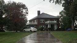 John Carlyle and Anita Sherrill House |
September 1, 2009 (#09000704) |
14175 NC 801 35°39′31″N 80°43′52″W |
Mount Ulla | |
| 47 | Rankin-Sherrill House |  Rankin-Sherrill House |
September 23, 1982 (#82003508) |
NC 801 35°39′27″N 80°43′41″W |
Mt. Ulla | |
| 48 | St. Andrew's Episcopal Church and Cemetery | August 19, 1982 (#82003510) |
Northeast of Woodleaf on SR 1950 35°47′14″N 80°33′44″W |
Woodleaf | ||
| 49 | Salisbury Historic District |  Salisbury Historic District |
November 12, 1975 (#75001289) |
Roughly bounded by Jackson, Innes, Caldwell, Marsh, Church, E. Bank, Lee, and Liberty Sts.; also 117 S. Lee St.; also roughly bounded by Ellis St., Monroe St., Church St., Bank St., S. Main St., and McCubbins St.; also portions of E. Council, E. Innes, Lee, and E. Liberty Sts. between Main and Depot Sts. 35°40′04″N 80°28′10″W |
Salisbury | Legislative center of the historic Salisbury District. Second, third, and fourth sets of boundaries represent boundary increases of January 6, 1988, July 6, 1989, and July 20, 2000 respectively |
| 50 | Salisbury National Cemetery | .jpg) Salisbury National Cemetery |
April 12, 1999 (#99000393) |
202 Government Rd. 35°39′37″N 80°28′27″W |
Salisbury | |
| 51 | Salisbury Railroad Corridor Historic District |  Salisbury Railroad Corridor Historic District |
May 13, 1987 (#86003460) |
Roughly East Council, Liberty, Kerr, Cemetery, Franklin, Lee, and Depot Sts.; also the 300 and 400 blocks of N. Lee St. 35°40′06″N 80°27′53″W |
Salisbury | Second set of addresses represents a boundary increase of May 1, 2003 |
| 52 | Salisbury Southern Railroad Passenger Depot | _station_front.jpg) Salisbury Southern Railroad Passenger Depot |
July 30, 1975 (#75001290) |
Eastern side of Depot St. between Kerr and Council Sts. 35°40′02″N 80°27′58″W |
Salisbury | |
| 53 | Shaver Rental Houses District |  Shaver Rental Houses District |
January 12, 1988 (#87002233) |
303, 309, and 315 W. Council, and 120 N. Jackson 35°40′12″N 80°28′17″W |
Salisbury | |
| 54 | Shuping's Mill Complex | September 23, 1982 (#82003506) |
South of Faith on NC 152 35°33′04″N 80°29′00″W |
Faith | Burned[7] | |
| 55 | Southern Railway Spencer Shops | 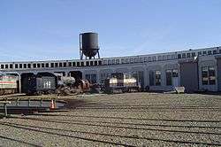 Southern Railway Spencer Shops |
March 17, 1978 (#78001972) |
Salisbury Ave. between 3rd and 8th Sts. 35°41′13″N 80°26′05″W |
Spencer | |
| 56 | Spencer Historic District |  Spencer Historic District |
December 20, 1984 (#84000619) |
Roughly bounded by N. to S. Salisbury Ave., 8th St., Whitehead Ave., and Jefferson St. 35°41′32″N 80°26′04″W |
Spencer | |
| 57 | John Steele House |  John Steele House |
September 12, 1994 (#94001051) |
1010 Richard St. 35°40′27″N 80°27′31″W |
Salisbury | |
| 58 | John Stigerwalt House | December 20, 1984 (#84000595) |
East of Kannapolis off SR 1221 (Old Beatty Ford Rd.) 35°31′06″N 80°31′00″W |
Bostian Heights | ||
| 59 | Third Creek Presbyterian Church and Cemetery | July 21, 1983 (#83001912) |
SR 1973 35°45′39″N 80°41′04″W |
Cleveland | ||
| 60 | Thyatira Presbyterian Church, Cemetery, and Manse |  Thyatira Presbyterian Church, Cemetery, and Manse |
February 17, 1984 (#84002488) |
Off NC 150 35°39′01″N 80°38′12″W |
Mill Bridge | |
| 61 | Calvin H. Wiley School | 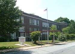 Calvin H. Wiley School |
October 20, 1988 (#88002028) |
200 block of Ridge Ave. 35°39′46″N 80°29′12″W |
Salisbury | School closed in 1983; became Wiley School Apartments in 1985.[8] |
| 62 | Wood Grove |  Wood Grove |
September 23, 1982 (#82003504) |
East of Bear Poplar on SR 1743 35°40′48″N 80°40′28″W |
Bear Poplar | |
| 63 | Zion Lutheran Church | January 20, 1972 (#72000991) |
Southwest of Rockwell on SR 1006 off SR 1221 35°31′40″N 80°27′00″W |
Rockwell |
Former listing
| [3] | Name on the Register | Image | Date listed | Date removed | Location | City or town | Summary |
|---|---|---|---|---|---|---|---|
| 1 | Joseph H. Mingus Farm | October 29, 1987 (#87001551) | March 16, 1995 | Southern side of SR 1947, northeast of its junction with SR 1702 |
Woodleaf |
See also
| Wikimedia Commons has media related to National Register of Historic Places in Rowan County, North Carolina. |
References
- The latitude and longitude information provided in this table was derived originally from the National Register Information System, which has been found to be fairly accurate for about 99% of listings. Some locations in this table may have been corrected to current GPS standards.
- "National Register of Historic Places: Weekly List Actions". National Park Service, United States Department of the Interior. Retrieved on June 19, 2020.
- Numbers represent an ordering by significant words. Various colorings, defined here, differentiate National Historic Landmarks and historic districts from other NRHP buildings, structures, sites or objects.
- "National Register Information System". National Register of Historic Places. National Park Service. April 24, 2008.
- The eight-digit number below each date is the number assigned to each location in the National Register Information System database, which can be viewed by clicking the number.
- Fisher, Hugh (January 17, 2013). "Fire continues to burn in remains of Grimes Mill". The Salisbury Post. Archived from the original on February 16, 2013. Retrieved January 30, 2013.
- "North Carolina Listings in the National Register of Historic Places by County". North Carolina State Historic Preservation Office. 22 October 2008. Archived from the original on 30 November 2012. Retrieved 14 July 2009.
- "Calvin H. Wiley School". Rowan Public Library: Edith M. Clark History Room. Rowan County, NC. Archived from the original on May 22, 2011. Retrieved October 5, 2012.

| Topics | |
|---|---|
| Lists by state |
|
| Lists by insular areas | |
| Lists by associated state | |
| Other areas | |
| Related | |
| |
Municipalities and communities of Rowan County, North Carolina, United States | ||
|---|---|---|
| Cities | Rowan County map | |
| Towns | ||
| Townships | ||
| CDP | ||
| Unincorporated communities | ||
| Footnotes | ‡This populated place also has portions in an adjacent county or counties | |
This article is issued from Wikipedia. The text is licensed under Creative Commons - Attribution - Sharealike. Additional terms may apply for the media files.