National Register of Historic Places listings in Montana
This is a list of properties and historic districts in Montana that are listed on the National Register of Historic Places. The state's more than 1,100 listings are distributed across all of its 56 counties.
The locations of National Register properties and districts (at least for all showing latitude and longitude coordinates below), may be seen in an online map by clicking on "Map of all coordinates".[1]
- This National Park Service list is complete through NPS recent listings posted June 26, 2020.[2]
Current listings by county
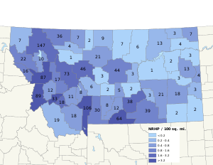
The following are approximate tallies of current listings by county.[3]
.jpg)
Chief Plenty Coups (Alek-Chea-Ahoosh) House, in Big Horn County
Yucca Theatre, in Treasure County
| County | # of Sites | |
|---|---|---|
| 1 | Beaverhead | 23 |
| 2 | Big Horn | 39 |
| 3 | Blaine | 9 |
| 4 | Broadwater | 9 |
| 5 | Carbon | 64 |
| 6 | Carter | 2 |
| 7 | Cascade | 46 |
| 8 | Chouteau | 21 |
| 9 | Custer | 18 |
| 10 | Daniels | 3 |
| 11 | Dawson | 13 |
| 12 | Deer Lodge | 34 |
| 13 | Fallon | 3 |
| 14 | Fergus | 44 |
| 15 | Flathead | 147 |
| 16 | Gallatin | 106 |
| 17 | Garfield | 1 |
| 18 | Glacier | 37 |
| 19 | Golden Valley | 5 |
| 20 | Granite | 12 |
| 21 | Hill | 9 |
| 22 | Jefferson | 13 |
| 23 | Judith Basin | 3 |
| 24 | Lake | 10 |
| 25 | Lewis and Clark | 76 |
| 26 | Liberty | 2 |
| 27 | Lincoln | 8 |
| 28 | Madison | 18 |
| 29 | McCone | 2 |
| 30 | Meagher | 6 |
| 31 | Mineral | 16 |
| 32 | Missoula | 87 |
| 33 | Musselshell | 2 |
| 34 | Park | 30 |
| 35 | Petroleum | 3 |
| 36 | Phillips | 6 |
| 37 | Pondera | 4 |
| 38 | Powder River | 2 |
| 39 | Powell | 17 |
| 40 | Prairie | 3 |
| 41 | Ravalli | 90 |
| 42 | Richland | 3 |
| 43 | Roosevelt | 4 |
| 44 | Rosebud | 21 |
| 45 | Sanders | 22 |
| 46 | Sheridan | 7 |
| 47 | Silver Bow | 20 |
| 48 | Stillwater | 14 |
| 49 | Sweet Grass | 8 |
| 50 | Teton | 1 |
| 51 | Toole | 7 |
| 52 | Treasure | 3 |
| 53 | Valley | 13 |
| 54 | Wheatland | 2 |
| 55 | Wibaux | 4 |
| 56 | Yellowstone | 38 |
| (less duplicates) | (10)[4] | |
| TOTAL | 1,196 | |
Blaine County
| [5] | Name on the Register | Image | Date listed[6] | Location | City or town | Description |
|---|---|---|---|---|---|---|
| 1 | Chief Joseph Battleground of the Bear's Paw |  Chief Joseph Battleground of the Bear's Paw |
October 6, 1970 (#70000355) |
About 15 miles south of Chinook, T30NR19E, Sections 1 and 12 48°22′39″N 109°12′26″W |
Chinook | |
| 2 | Cow Creek Skirmish Historic District | June 28, 2019 (#100004104) |
Address Restricted |
Winifred vicinity | ||
| 3 | Cow Island Landing Skirmish Site |  Cow Island Landing Skirmish Site |
June 27, 2019 (#100004103) |
Approx. 28 mi. NE of Winifred 47°46′25″N 108°56′57″W |
Winifred vicinity | |
| 4 | Dave's Texaco | _-_Blaine_County%2C_Montana.png) Dave's Texaco |
August 16, 1994 (#94000862) |
237 Pennsylvania St. 48°35′35″N 109°13′54″W |
Chinook | |
| 5 | Ervin Homestead-Gist Bottom Historic District | June 23, 2016 (#16000410) |
River Mile 122.3 Left 47°48′18″N 109°00′40″W |
Hays vicinity | Ranch homesteaded beside Missouri River in Missouri Breaks | |
| 6 | Lodgepole Community Hall | February 24, 2000 (#00000148) |
Fort Belknap Indian Community 48°02′04″N 108°31′57″W |
Lodgepole | ||
| 7 | Lohman Block |  Lohman Block |
March 19, 1980 (#80002399) |
239-225 Indiana St. 48°35′35″N 109°13′49″W |
Chinook | |
| 8 | Anna Scherlie Homestead Shack | November 5, 1998 (#98001338) |
Montana Highway 241, south of the Canada–US border 48°51′01″N 108°23′26″W |
Turner | ||
| 9 | Young Brothers Chevrolet Garage | August 16, 1994 (#94000867) |
201 Pennsylvania St. 48°35′38″N 109°13′54″W |
Chinook |
Broadwater County
| [5] | Name on the Register | Image | Date listed[6] | Location | City or town | Description |
|---|---|---|---|---|---|---|
| 1 | Crow Creek Water Ditch | March 29, 2001 (#01000323) |
Helena National Forest-Headwaters Resource Area 46°19′49″N 111°41′04″W |
Townsend | ||
| 2 | Eagle Guard Station | 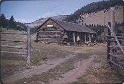 Eagle Guard Station |
September 20, 2001 (#01001014) |
11 miles west of Townsend 46°19′15″N 111°42′26″W |
Townsend | |
| 3 | McCormick's Livery and Feed Stable Sign | July 8, 1981 (#81000339) |
West of Townsend 46°19′06″N 111°37′43″W |
Townsend | ||
| 4 | Rankin Ranch | May 11, 1976 (#76001119) |
Avalanche Gulch Road 46°37′46″N 111°34′11″W |
Townsend vicinity | ||
| 5 | St. Joseph's Catholic Mission Church |  St. Joseph's Catholic Mission Church |
November 5, 1998 (#98001339) |
3497 Montana Highway 284 46°24′32″N 111°26′55″W |
Townsend | |
| 6 | State Bank of Townsend | _-_Broadwater_County%2C_Montana.png) State Bank of Townsend |
January 13, 1992 (#91001941) |
400 Broadway 46°19′12″N 111°31′51″W |
Townsend | |
| 7 | Stone Hill Springs Prehistoric District | September 5, 2017 (#100001569) |
Address Restricted |
Townsend vicinity | ||
| 8 | Toston Bridge | _-_Broadwater_County%2C_Montana.png) Toston Bridge |
July 20, 2005 (#05000720) |
Spanning the Missouri River, on an abandoned segment of old U.S. Route 287, at Toston 46°10′19″N 111°26′34″W |
Toston | |
| 9 | Valley Masonic Lodge No. 21 | August 7, 2019 (#100004236) |
131 South Spruce Street 46°19′10″N 111°31′06″W |
Townsend |
Carter County
| [5] | Name on the Register | Image | Date listed[6] | Location | City or town | Description |
|---|---|---|---|---|---|---|
| 1 | First National Bank of Ekalaka and Rickard Hardware Store Building | November 19, 2015 (#15000815) |
103 & 105 N. Main St. 45°53′25″N 104°32′54″W |
Ekalaka | ||
| 2 | Medicine Rocks State Park |  Medicine Rocks State Park |
January 17, 2017 (#100000539) |
1141 MT 7 46°02′43″N 104°27′30″W |
Ekalaka vicinity |
Daniels County
| [5] | Name on the Register | Image | Date listed[6] | Location | City or town | Description |
|---|---|---|---|---|---|---|
| 1 | Daniels County Courthouse | 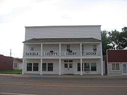 Daniels County Courthouse |
May 4, 1995 (#95000535) |
213 Main St. 48°47′27″N 105°25′12″W |
Scobey | |
| 2 | Mansfield A. Daniels House | June 4, 1997 (#97000503) |
Approximately 2 miles west of Montana Highway 13 and 2 miles southwest of Scobey 48°46′23″N 105°27′51″W |
Scobey | ||
| 3 | LaPierre Barn | April 11, 2005 (#05000279) |
Approximately 3.5 miles northwest of Scobey on Tande Ranch Rd. 48°50′41″N 105°28′42″W |
Scobey |
Fallon County
| [5] | Name on the Register | Image | Date listed[6] | Location | City or town | Description |
|---|---|---|---|---|---|---|
| 1 | Baker Hotel | _(destroyed)_-_Fallon_County%2C_Montana.png) Baker Hotel |
January 5, 2005 (#04001435) |
4 S. Main St. 46°22′07″N 104°16′28″W |
Baker | |
| 2 | Cottonwood Creek Bridge | _-_Fallon_County%2C_Montana.png) Cottonwood Creek Bridge |
March 14, 2014 (#14000079) |
Mi. 2.2 Ismay Rd. 46°27′24″N 104°47′19″W |
Ismay | |
| 3 | Fallon County Jail | _-_Fallon_County%2C_Montana.png) Fallon County Jail |
July 31, 1998 (#98000946) |
723 S. Main St. 46°21′37″N 104°16′31″W |
Baker |
Garfield County
| [5] | Name on the Register | Image | Date listed[6] | Location | City or town | Description |
|---|---|---|---|---|---|---|
| 1 | Hornaday Camp | March 26, 1991 (#91000298) |
10 miles south of Montana Highway 200 46°58′11″N 107°23′58″W |
Sand Springs |
Golden Valley County
| [5] | Name on the Register | Image | Date listed[6] | Location | City or town | Description |
|---|---|---|---|---|---|---|
| 1 | Adams Hotel | 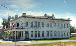 Adams Hotel |
December 6, 2005 (#05001377) |
1 Main St. 46°17′43″N 108°56′16″W |
Lavina | |
| 2 | Grace Lutheran Church of Barber | 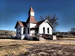 Grace Lutheran Church of Barber |
February 1, 1982 (#82003171) |
West of Ryegate 46°18′51″N 109°23′04″W |
Ryegate | |
| 3 | Lavina State Bank | 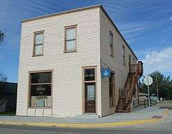 Lavina State Bank |
December 17, 2007 (#07001293) |
101 Main St. 46°17′40″N 108°56′15″W |
Lavina | |
| 4 | Sims-Garfield Ranch | August 27, 1980 (#80002419) |
East of Ryegate on US 12 46°18′05″N 109°12′47″W |
Ryegate | ||
| 5 | Slayton Mercantile Co. | 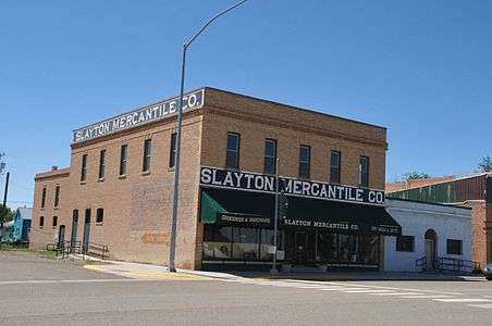 Slayton Mercantile Co. |
December 28, 2000 (#00001567) |
23 Main St. 46°17′47″N 108°56′17″W |
Lavina |
Hill County
| [5] | Name on the Register | Image | Date listed[6] | Location | City or town | Description |
|---|---|---|---|---|---|---|
| 1 | Carnegie Public Library | _-_Hill_County%2C_Montana.png) Carnegie Public Library |
July 24, 1986 (#86001934) |
447 4th Ave. 48°32′57″N 109°40′35″W |
Havre | |
| 2 | H. Earl Clack House | October 24, 1985 (#85003385) |
532 2nd Ave. 48°32′54″N 109°40′48″W |
Havre | ||
| 3 | Fort Assinniboine | 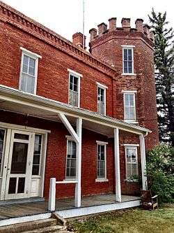 Fort Assinniboine |
May 31, 1989 (#89000040) |
County Route 82nd Ave. West, 0.5 miles southeast of U.S. Route 87 48°29′59″N 109°47′39″W |
Havre | Boundary increase approved April 2, 2018 |
| 4 | Havre Residential Historic District |  Havre Residential Historic District |
October 5, 1989 (#89001630) |
Roughly bounded by 3rd St., 7th Ave., 11th St., 5th Ave., 10th St., 3rd Ave., 7th St., and 1st Ave. 48°32′48″N 109°40′38″W |
Havre | |
| 5 | Heltne Oil Company | August 16, 1994 (#94000865) |
140 1st St. 48°33′14″N 109°40′44″W |
Havre | ||
| 6 | Kiwanis Meeting Hall | March 31, 2010 (#10000133) |
17863 Beaver Creek Rd. 48°17′32″N 109°39′51″W |
Havre | ||
| 7 | Too Close for Comfort Site (24HL101) |  Too Close for Comfort Site (24HL101) |
December 30, 1974 (#74001098) |
Behind the Wahkpa Chu'gn Meat Market on U.S. Route 2[7] 48°33′40″N 109°42′55″W |
Havre | |
| 8 | US Post Office and Courthouse-Havre Main | 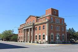 US Post Office and Courthouse-Havre Main |
March 14, 1986 (#86000682) |
306 3rd Ave. 48°33′05″N 109°40′42″W |
Havre | |
| 9 | Young-Almas House | October 14, 1980 (#80002421) |
419 4th Ave. 48°32′59″N 109°40′35″W |
Havre |
Jefferson County
| [5] | Name on the Register | Image | Date listed[6] | Location | City or town | Description |
|---|---|---|---|---|---|---|
| 1 | Boulder Hot Springs Hotel | 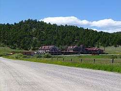 Boulder Hot Springs Hotel |
January 12, 1979 (#79001403) |
Southeast of Boulder on Montana Highway 281 46°12′02″N 112°05′33″W |
Boulder | |
| 2 | W.C. Child Ranch | _-_Jefferson_County%2C_Montana.png) W.C. Child Ranch |
November 23, 1977 (#77000819) |
South of East Helena on Montana Highway 518 46°34′05″N 111°54′42″W |
East Helena | |
| 3 | Fraternity Hall | 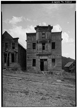 Fraternity Hall |
April 3, 1975 (#75001084) |
Main St. 46°16′30″N 111°56′44″W |
Elkhorn | |
| 4 | The Grant-Marshall Lime Kiln Historic District | December 14, 2017 (#100001898) |
1000 ft. S of S end of Crystal Dr. 46°34′06″N 111°59′47″W |
Helena | ||
| 5 | Homestake Airway Beacon | May 31, 2019 (#100004037) |
Along Continental Divide at Homestake Pass in Beaverhead-Deerlodge National Forest 45°55′11″N 112°25′00″W |
Butte vicinity | Extends into Silver Bow County. | |
| 6 | Jefferson Canyon Highway Historic District |  Jefferson Canyon Highway Historic District |
July 23, 2018 (#100002692) |
Milepost .5 to 12.3 of MT 2 45°50′24″N 111°54′34″W |
Cardwell vicinity | |
| 7 | Jefferson County Courthouse |  Jefferson County Courthouse |
August 6, 1980 (#80002422) |
200 Centennial Ave. 46°14′09″N 112°07′16″W |
Boulder | |
| 8 | Lewis and Clark Caverns Historic District | 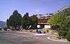 Lewis and Clark Caverns Historic District |
May 29, 2018 (#100002505) |
Lewis & Clark Caverns Rd 45°49′30″N 111°51′05″W |
LaHood vicinity | |
| 9 | MacHaffie Site (24JF4) | April 3, 1986 (#86000619) |
Address Restricted |
Montana City | ||
| 10 | Modern Hotel |  Modern Hotel |
December 22, 2011 (#11000951) |
Legion Ave. & Main St. 45°52′11″N 112°05′58″W |
Whitehall | |
| 11 | Montana Deaf and Dumb Asylum | _-_Jefferson_County%2C_Montana.png) Montana Deaf and Dumb Asylum |
May 10, 1985 (#85000994) |
Off Montana Highway 281 46°13′52″N 112°08′24″W |
Boulder | |
| 12 | Montana State Training School Historic District | November 24, 2014 (#14000957) |
Roughly bounded by Montana Highway 69, Riverside Road, and the Boulder River 46°13′40″N 112°07′09″W |
Boulder | ||
| 13 | Whitetail Airway Beacon | March 13, 2020 (#100005094) |
16 miles north of Whitehall 46°04′48″N 112°08′25″W |
Whitehall vicinity |
Judith Basin County
| [5] | Name on the Register | Image | Date listed[6] | Location | City or town | Description |
|---|---|---|---|---|---|---|
| 1 | Judith River Ranger Station | 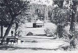 Judith River Ranger Station |
April 10, 1992 (#92000333) |
Along the Middle Fork of the Judith River, southwest of Utica in Lewis and Clark National Forest 46°50′51″N 110°17′25″W |
Utica | |
| 2 | Meadowbrook Stock Farm | January 13, 1992 (#91001938) |
U.S. Route 87 47°01′35″N 109°50′57″W |
Hobson | ||
| 3 | Wood Lawn Farm | January 27, 1993 (#92001762) |
5 miles west of Hobson on Utica Road 239 46°59′17″N 109°58′36″W |
Hobson |
Lake County
| [5] | Name on the Register | Image | Date listed[6] | Location | City or town | Description |
|---|---|---|---|---|---|---|
| 1 | Big Arm School | 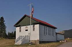 Big Arm School |
August 16, 2007 (#07000816) |
7th and D Sts. 47°47′48″N 114°17′41″W |
Big Arm | |
| 2 | Dayton State Bank | 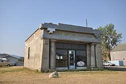 Dayton State Bank |
October 3, 2012 (#12000829) |
133 C St. 47°51′52″N 114°16′40″W |
Dayton | |
| 3 | Fort Connah Site | 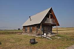 Fort Connah Site |
April 28, 1982 (#82003173) |
U.S. Route 93 47°24′20″N 114°05′14″W |
Post Creek | |
| 4 | Kootenai Lodge Historic District | January 17, 1984 (#84002476) |
Sunburst Dr. 48°01′16″N 113°58′33″W |
Bigfork | ||
| 5 | Frank Bird Linderman House | February 22, 1984 (#84002479) |
Address Restricted |
Lakeside | Lodge of writer and politician Frank Bird Linderman. | |
| 6 | Don E. Olsson House and Garage |  Don E. Olsson House and Garage |
January 15, 2009 (#08001325) |
503 4th Ave. SW. 47°31′29″N 114°06′11″W |
Ronan | |
| 7 | Polson Feed Mill | April 29, 1980 (#80002423) |
501 Main St. 47°41′28″N 114°09′44″W |
Polson | Demolished. | |
| 8 | St. Ignatius Mission | _2002-05.jpg) St. Ignatius Mission |
June 19, 1973 (#73001053) |
About 0.1 miles (0.16 km) southeast of U.S. Route 93 in St. Ignatius 47°18′54″N 114°06′07″W |
St. Ignatius | |
| 9 | St. Joseph's Catholic Church | _2.jpg) St. Joseph's Catholic Church |
March 18, 1999 (#99000345) |
D'Aste Townsite 47°23′07″N 114°11′47″W |
Moiese | |
| 10 | Swan Lake Rock House Historic District | August 1, 1984 (#84002485) |
Off Montana Highway 83 47°57′18″N 113°53′33″W |
Swan Lake |
Liberty County
| [5] | Name on the Register | Image | Date listed[6] | Location | City or town | Description |
|---|---|---|---|---|---|---|
| 1 | First Episcopal Methodist Church of Chester | August 29, 1997 (#97000974) |
Junction of 2nd St. and Madison 48°30′39″N 110°57′44″W |
Chester | ||
| 2 | First State Bank of Chester |  First State Bank of Chester |
August 29, 1997 (#97000975) |
Junction of Washington Ave. and 1st St., E. 48°30′47″N 110°57′52″W |
Chester |
Lincoln County
| [5] | Name on the Register | Image | Date listed[6] | Location | City or town | Description |
|---|---|---|---|---|---|---|
| 1 | Ant Flat Ranger Station |  Ant Flat Ranger Station |
December 30, 1996 (#94001021) |
United States Forest Service Road 36, 2 miles south of Fortine in the Kootenai National Forest 48°43′26″N 114°52′35″W |
Fortine | |
| 2 | The Coram Hotel |  The Coram Hotel |
September 4, 2012 (#12000593) |
302 California Ave. 48°23′36″N 115°33′08″W |
Libby | |
| 3 | Eureka Community Hall | October 18, 1985 (#85003236) |
Cliff St. 48°52′46″N 116°02′00″W |
Eureka | ||
| 4 | Farmers and Merchants State Bank |  Farmers and Merchants State Bank |
August 31, 1995 (#95001062) |
223 Dewey Ave. 48°52′50″N 115°03′08″W |
Eureka | |
| 5 | The Heritage Museum | March 27, 2020 (#100005148) |
34067 US 2 48°22′19″N 115°32′38″W |
Libby | ||
| 6 | Libby High School | August 20, 2008 (#08000823) |
Southwestern corner of the junction of Mineral Ave. and E. Lincoln Boulevard 48°23′27″N 115°33′10″W |
Libby | ||
| 7 | Theodore Roosevelt Memorial Bridge |  Theodore Roosevelt Memorial Bridge |
December 27, 2006 (#06001178) |
Crossing the Kootenai River at Riverside Dr. 48°28′12″N 115°53′11″W |
Troy | |
| 8 | Troy Jail | .jpg) Troy Jail |
December 27, 2006 (#06001179) |
316 E. Yaak Ave. 48°27′47″N 115°53′21″W |
Troy |
McCone County
| [5] | Name on the Register | Image | Date listed[6] | Location | City or town | Description |
|---|---|---|---|---|---|---|
| 1 | Gladstone Hotel | .jpg) Gladstone Hotel |
August 28, 1980 (#80004592) |
101 Main St. 47°25′02″N 105°35′15″W |
Circle | |
| 2 | Lewis and Clark Bridge |  Lewis and Clark Bridge |
November 24, 1997 (#97001451) |
Montana Highway 13 over the Missouri River 48°04′02″N 105°32′06″W |
Wolf Point | Extends into Roosevelt County |
Meagher County
| [5] | Name on the Register | Image | Date listed[6] | Location | City or town | Description |
|---|---|---|---|---|---|---|
| 1 | Fort Logan and Blockhouse | 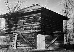 Fort Logan and Blockhouse |
October 6, 1970 (#70000360) |
17 miles northwest of White Sulphur Springs 46°40′48″N 111°10′03″W |
White Sulphur Springs | |
| 2 | Parberry Block East | 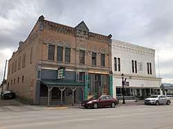 Parberry Block East |
April 22, 2009 (#09000237) |
18–20 East Main Street 46°32′53″N 110°54′11″W |
White Sulphur Springs | |
| 3 | Byron R. Sherman House |  Byron R. Sherman House |
September 15, 1977 (#77000820) |
310 2nd Ave., NE. 46°33′03″N 110°54′00″W |
White Sulphur Springs | |
| 4 | Stockmen's Bank of Martinsdale | _-_Meagher_County%2C_Montana.png) Stockmen's Bank of Martinsdale |
May 1, 2013 (#13000224) |
9 Main St. 46°27′31″N 110°18′54″W |
Martinsdale | |
| 5 | Union League of America Hall |  Union League of America Hall |
August 20, 1998 (#98001084) |
Crawford St. at Central Ave., S. 46°32′42″N 110°54′08″W |
White Sulphur Springs | |
| 6 | Wellman Block |  Wellman Block |
March 7, 1994 (#94000140) |
206 E. Main St. 46°32′52″N 110°54′04″W |
White Sulphur Springs |
Musselshell County
| [5] | Name on the Register | Image | Date listed[6] | Location | City or town | Description |
|---|---|---|---|---|---|---|
| 1 | Roundup Central School | 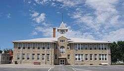 Roundup Central School |
December 6, 2007 (#07001243) |
600 1st St., W. 46°26′50″N 108°32′37″W |
Roundup | |
| 2 | St. Benedict's Catholic School | 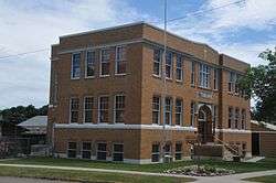 St. Benedict's Catholic School |
July 21, 1988 (#88001120) |
524 1st St., W. 46°26′47″N 108°32′33″W |
Roundup |
Petroleum County
| [5] | Name on the Register | Image | Date listed[6] | Location | City or town | Description |
|---|---|---|---|---|---|---|
| 1 | Cat Creek Oil Field Sign | 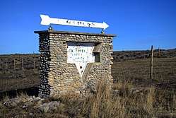 Cat Creek Oil Field Sign |
January 7, 2015 (#14001127) |
Mi. 150, MT 200 47°00′29″N 108°00′34″W |
Mosby vicinity | |
| 2 | Winnett Block |  Winnett Block |
October 8, 2009 (#09000815) |
301 E. Main St. 47°00′16″N 108°20′53″W |
Winnett | |
| 3 | Winnett School | April 6, 1995 (#95000383) |
Junction of Moulton Ave. and Rowley St. 47°00′07″N 108°21′12″W |
Winnett | Possibly replaced by new building |
Phillips County
| [5] | Name on the Register | Image | Date listed[6] | Location | City or town | Description |
|---|---|---|---|---|---|---|
| 1 | H. Earl Clack Service Station | _-_Phillips_County%2C_Montana.png) H. Earl Clack Service Station |
August 16, 1994 (#94000863) |
Southern side of U.S. Route 2 48°27′23″N 107°20′37″W |
Saco | |
| 2 | Lookout Cave | October 22, 2018 (#100003039) |
Address Restricted |
Zortman vicinity | ||
| 3 | Phillips County Carnegie Library | _-_Phillips_County%2C_Montana.png) Phillips County Carnegie Library |
August 27, 1980 (#80002428) |
S. 1st St. 48°21′35″N 107°52′34″W |
Malta | |
| 4 | Fred Robinson Bridge | March 26, 2012 (#12000171) |
Milepost 88, US 191, 51 miles (82 km) north of Lewistown 47°37′51″N 108°41′06″W |
Lewistown vicinity | Montana's Steel Stringer and Steel Girder Bridges Multiple Property Submission; extends into Fergus County | |
| 5 | Saco Mercantile | _-_Phillips_County%2C_Montana.png) Saco Mercantile |
December 8, 1997 (#97001452) |
201 Taylor St. 48°27′22″N 107°20′30″W |
Saco | |
| 6 | Sleeping Buffalo Rock | _-_Phillips_County%2C_Montana.png) Sleeping Buffalo Rock |
May 17, 1996 (#96000548) |
Junction of U.S. Route 2 and Montana Highway 243 48°28′10″N 107°32′56″W |
Saco |
Pondera County
| [5] | Name on the Register | Image | Date listed[6] | Location | City or town | Description |
|---|---|---|---|---|---|---|
| 1 | Conrad City Hall | 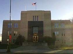 Conrad City Hall |
February 1, 1980 (#80002429) |
15 4th Ave., SW. 48°10′10″N 111°56′49″W |
Conrad | |
| 2 | Froggie's Stopping Place on the Whoop-Up Trail | April 15, 1993 (#93000277) |
Address Restricted |
Conrad | ||
| 3 | Two Medicine Fight Site | October 6, 1970 (#70000361) |
About 25 miles southeast of Browning 48°28′N 112°28′W |
Browning | ||
| 4 | Valier Public School | March 28, 1985 (#85000646) |
820 3rd St. 48°18′16″N 112°15′21″W |
Valier |
Powder River County
| [5] | Name on the Register | Image | Date listed[6] | Location | City or town | Description |
|---|---|---|---|---|---|---|
| 1 | Cheever-Cain Ranch | April 13, 2010 (#10000184) |
8 Trails End Rd. 45°36′47″N 105°55′19″W |
Volborg | ||
| 2 | Cross Ranch Headquarters | February 23, 1996 (#96000118) |
East of Montana Highway 59, roughly 26 miles south of Broadus 45°05′44″N 105°19′10″W |
Broadus |
Prairie County
| [5] | Name on the Register | Image | Date listed[6] | Location | City or town | Description |
|---|---|---|---|---|---|---|
| 1 | Grandey Elementary School | 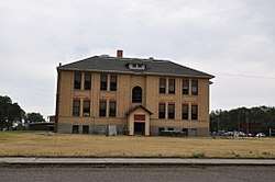 Grandey Elementary School |
November 16, 1978 (#78001689) |
Off U.S. Route 10 46°47′29″N 105°18′30″W |
Terry | |
| 2 | Powder River Bridge | 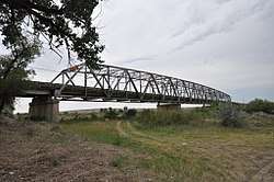 Powder River Bridge |
January 4, 2010 (#09001186) |
Old U.S. Route 10 SW of Terry 46°44′14″N 105°25′43″W |
Terry | |
| 3 | Yellowstone River Bridge | 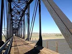 Yellowstone River Bridge |
January 4, 2010 (#09001187) |
Milepost 1 on Interstate 94 (Old U.S. Route 10) 46°51′20″N 105°06′59″W |
Fallon |
Richland County
| [5] | Name on the Register | Image | Date listed[6] | Location | City or town | Description |
|---|---|---|---|---|---|---|
| 1 | Burgess Garage | December 30, 2004 (#04001434) |
Corner of 3rd and Main 47°41′06″N 104°37′15″W |
Fox Lake | ||
| 2 | Fort Union Trading Post National Historic Site |  Fort Union Trading Post National Historic Site |
October 15, 1966 (#66000103) |
15550 Highway 1804 47°59′58″N 104°02′13″W |
Williston, North Dakota, vicinity | |
| 3 | Peoples' Congregational Church |  Peoples' Congregational Church |
April 30, 1982 (#82003179) |
203 2nd Ave., SW. 47°42′53″N 104°09′33″W |
Sidney |
Roosevelt County
| [5] | Name on the Register | Image | Date listed[6] | Location | City or town | Description |
|---|---|---|---|---|---|---|
| 1 | Fort Peck Agency |  Fort Peck Agency |
May 19, 1970 (#70000365) |
In Poplar 48°06′51″N 105°11′36″W |
Poplar | |
| 2 | Fort Union Trading Post National Historic Site | Fort Union Trading Post National Historic Site |
October 15, 1966 (#66000103) |
15550 Highway 1804 47°59′58″N 104°02′13″W |
Williston, North Dakota, vicinity | |
| 3 | Hale's Filling Station and Grocery | August 16, 1994 (#94000864) |
Lanark Townsite 48°08′34″N 104°21′26″W |
Bainville | ||
| 4 | Lewis and Clark Bridge | Lewis and Clark Bridge |
November 24, 1997 (#97001451) |
Montana Highway 13 over the Missouri River 48°04′02″N 105°32′06″W |
Wolf Point | Extends into McCone County |
Sheridan County
| [5] | Name on the Register | Image | Date listed[6] | Location | City or town | Description |
|---|---|---|---|---|---|---|
| 1 | Comertown Historic District | October 27, 1993 (#93001149) |
Roughly the entire community of Comertown, west of Westby 48°53′49″N 104°15′00″W |
Comertown | ||
| 2 | Aage and Kristine Larsen Homestead | October 27, 1993 (#93001146) |
County Highway 516 north of Dagmar 48°37′46″N 104°11′14″W |
Dagmar | ||
| 3 | Outlook Depot | October 27, 1993 (#93001144) |
South of the western edge of Marr St., south of Block 10 48°53′08″N 104°46′37″W |
Outlook | ||
| 4 | Raymond Grain Elevators Historic District | October 27, 1993 (#93001148) |
Unnamed county road east of Montana Highway 16, northeast of Raymond 48°52′43″N 104°34′39″W |
Raymond | ||
| 5 | Rocky Valley Lutheran Church | October 27, 1993 (#93001145) |
Junction of Ueland St. and an unnamed county road 48°52′54″N 104°23′18″W |
Dooley | ||
| 6 | Thornwood School | October 28, 1993 (#93001147) |
Unnamed county road approximately 17 miles west of Reserve 48°36′06″N 104°47′55″W |
Reserve | ||
| 7 | Tipi Hills | August 1, 1975 (#75001085) |
Address Restricted |
Medicine Lake | Includes tepee ring circles.[8] |
Stillwater County
| [5] | Name on the Register | Image | Date listed[6] | Location | City or town | Description |
|---|---|---|---|---|---|---|
| 1 | 4K Ranch | February 14, 2002 (#02000049) |
Fiddler Creek Rd. 45°22′48″N 109°41′45″W |
Dean | ||
| 2 | Atlas Block |  Atlas Block |
August 24, 2011 (#11000588) |
523 & 528 E. Pike Ave. 45°38′13″N 109°15′11″W |
Columbus | |
| 3 | Dean School | December 2, 2019 (#100004713) |
1367 Nye Rd. 45°24′16″N 109°41′24″W |
Dean | One-room schoolhouse | |
| 4 | Halfway House | February 21, 2002 (#02000047) |
3951 Montana Highway 78 45°34′08″N 109°19′57″W |
Columbus | ||
| 5 | Oliver H. Hovda House |  Oliver H. Hovda House |
August 16, 1984 (#84002506) |
N. Woodward St. 45°31′19″N 109°26′23″W |
Absarokee | |
| 6 | Michael Jacobs House |  Michael Jacobs House |
January 28, 1987 (#86003676) |
4 W. 1st Ave., N. 45°38′24″N 109°15′33″W |
Columbus | |
| 7 | Mountain View Cemetery | July 16, 1987 (#87001200) |
U.S. Route 10 and Rapelje Rd. 45°38′31″N 109°16′22″W |
Columbus | ||
| 8 | W.H. Norton House |  W.H. Norton House |
October 25, 1982 (#82000597) |
3rd Ave. 45°38′27″N 109°15′11″W |
Columbus | |
| 9 | Charles and Gladys Pelton House | April 24, 2017 (#100000916) |
303 W. Rosebud Rd. 45°24′30″N 109°31′32″W |
Fishtail | ||
| 10 | Sandstone and Cobblestone Schools | 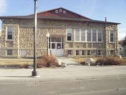 Sandstone and Cobblestone Schools |
January 15, 1987 (#86002949) |
142 S. Woodard Ave. 45°30′37″N 109°26′45″W |
Absarokee | |
| 11 | Stillwater County Courthouse | 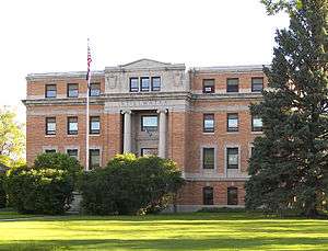 Stillwater County Courthouse |
August 14, 2019 (#100004277) |
400 East 3rd Ave. North 45°38′25″N 109°15′14″W |
Columbus | |
| 12 | Stoltz House | April 16, 1991 (#91000422) |
405 SW. 1st St. 45°37′45″N 108°54′44″W |
Park City | ||
| 13 | Torgrimson Place | August 31, 2001 (#01000921) |
W. Rosebud Rd. 45°23′39″N 109°32′52″W |
Fishtail | ||
| 14 | United Methodist Episcopal Church | July 26, 2010 (#10000497) |
Southeast corner of Clark St. and Second Ave. 45°37′50″N 108°54′54″W |
Park City |
Sweet Grass County
| [5] | Name on the Register | Image | Date listed[6] | Location | City or town | Description |
|---|---|---|---|---|---|---|
| 1 | Big Timber Town Hall | 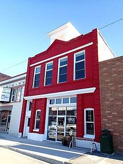 Big Timber Town Hall |
February 13, 1998 (#98000125) |
225 McLeod St. 45°50′02″N 109°57′11″W |
Big Timber | |
| 2 | Brannin Ranch | January 13, 1989 (#88003142) |
West of Melville on Sweet Grass Creek 46°07′27″N 110°11′53″W |
Melville | ||
| 3 | Carnegie Public Library | 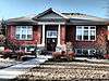 Carnegie Public Library |
July 11, 2002 (#02000725) |
314 McLeod St. 45°49′57″N 109°57′07″W |
Big Timber | |
| 4 | Grand Hotel |  Grand Hotel |
September 19, 1985 (#85002424) |
139 McLeod St. 45°50′04″N 109°57′14″W |
Big Timber | |
| 5 | Waborn (Wabe) and Sarah E. Harrison Ranch House | August 28, 1998 (#98001111) |
Roughly located at the confluence of the Sweet Grass Creek and the Yellowstone River 45°47′16″N 109°46′57″W |
Greycliff | ||
| 6 | John Otto Spannring Family Farm | February 23, 1995 (#95000145) |
7 miles east of Big Timber 45°48′50″N 109°50′48″W |
Big Timber | ||
| 7 | St. Mark's Episcopal Church |  St. Mark's Episcopal Church |
July 21, 1995 (#95000900) |
W. 4th Ave. 45°49′53″N 109°57′12″W |
Big Timber | |
| 8 | Yellowstone Crossing, Bozeman Trail | December 1, 1978 (#78003407) |
Northeast of Springdale on U.S. Route 10 45°45′13″N 110°09′56″W |
Springdale | part of the Bozeman Trail |
Teton County
| [5] | Name on the Register | Image | Date listed[6] | Location | City or town | Description |
|---|---|---|---|---|---|---|
| 1 | Teton County Courthouse | 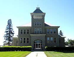 Teton County Courthouse |
November 29, 2006 (#06001093) |
1 Main Ave., S. 47°48′39″N 112°10′53″W |
Choteau |
Toole County
| [5] | Name on the Register | Image | Date listed[6] | Location | City or town | Description |
|---|---|---|---|---|---|---|
| 1 | Bethany Lutheran Church |  Bethany Lutheran Church |
December 14, 1993 (#93001375) |
0.25 miles (0.40 km) south of Gus Blaze Rd. 48°41′37″N 111°38′41″W |
Oilmont | |
| 2 | Kevin Depot | Kevin Depot |
August 11, 1980 (#80002433) |
Central Ave. and 1st St. 48°44′45″N 111°58′04″W |
Kevin | |
| 3 | Marias River Bridge | March 26, 2012 (#12000173) |
Mile 6, Marias Valley Rd. 48°25′38″N 111°53′26″W |
Shelby vicinity | part of the Montana's Steel Stringer and Steel Girder Bridges Multiple Property Submission | |
| 4 | Rainbow Conoco | 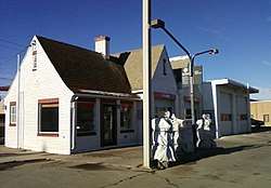 Rainbow Conoco |
August 16, 1994 (#94000866) |
400 Main St. 48°30′23″N 111°51′31″W |
Shelby | |
| 5 | Rocky Springs Segment of the Whoop-Up Trail | April 15, 1993 (#93000278) |
Address Restricted |
Kevin | ||
| 6 | Shelby Town Hall | February 14, 2006 (#06000040) |
100 Montana Ave. 48°30′16″N 111°51′15″W |
Shelby | ||
| 7 | US Customs Building | February 28, 1991 (#91000152) |
Interstate 15 just south of the Canada–US border 48°59′54″N 111°57′31″W |
SweetGrass |
Treasure County
| [5] | Name on the Register | Image | Date listed[6] | Location | City or town | Description |
|---|---|---|---|---|---|---|
| 1 | Big Horn River Bridge | January 4, 2010 (#09001188) |
Milepost 2 on Montana Highway 104 (Old U.S. Route 10) 46°08′50″N 107°28′03″W |
Custer | ||
| 2 | Sanders Gymnasium and Community Hall | August 29, 1997 (#97000976) |
Old Montana Highway 10, 6 miles east of Hysham 46°17′25″N 107°06′06″W |
Sanders | ||
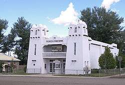
| 3 | Yucca Theatre | Yucca Theatre |
January 7, 1994 (#93001447) |
520 Division St. 46°17′34″N 107°14′00″W |
Hysham |
Wheatland County
| [5] | Name on the Register | Image | Date listed[6] | Location | City or town | Description |
|---|---|---|---|---|---|---|
| 1 | Graves Hotel |  Graves Hotel |
August 6, 1980 (#80002434) |
106 S. Central Ave. 46°26′01″N 109°49′50″W |
Harlowton | |
| 2 | Milwaukee Road Historic District |  Milwaukee Road Historic District |
July 8, 1988 (#88001024) |
Southern end of Central Ave. 46°25′49″N 109°49′38″W |
Harlowton |
Wibaux County
| [5] | Name on the Register | Image | Date listed[6] | Location | City or town | Description |
|---|---|---|---|---|---|---|
| 1 | St. Peter's Catholic Church | .jpg) St. Peter's Catholic Church |
March 14, 1990 (#90000356) |
W. Orgain Ave. 46°59′14″N 104°11′28″W |
Wibaux | |
| 2 | Vogt-Nunberg Farm | April 10, 2008 (#08000269) |
7262 Montana Highway 7 46°53′07″N 104°12′01″W |
Wibaux | ||
| 3 | Wibaux Commercial Historic District | _-_Wibaux_County%2C_Montana.png) Wibaux Commercial Historic District |
December 28, 1989 (#89002170) |
Roughly bounded by W. Orgain Ave., Wibaux, E. 1st Ave., S., and E 46°59′11″N 104°11′15″W |
Wibaux | |
| 4 | Pierre Wibaux House |  Pierre Wibaux House |
September 10, 1971 (#71000483) |
Orgain Ave. 46°59′12″N 104°11′06″W |
Wibaux |
References
- The latitude and longitude information provided in this table was derived originally from the National Register Information System, which has been found to be fairly accurate for about 99% of listings. Some locations in this table may have been corrected to current GPS standards.
- "National Register of Historic Places: Weekly List Actions". National Park Service, United States Department of the Interior. Retrieved on June 26, 2020.
- These counts are based on entries in the National Register Information Database as of March 13, 2009 and new weekly listings posted since then on the National Register of Historic Places web site. There are frequent additions to the listings and occasional delistings and the counts here are approximate and not official. New entries are added to the official Register on a weekly basis. Also, the counts in this table exclude boundary increase and decrease listings which only modify the area covered by an existing property or district, although carrying a separate National Register reference number.
- Going-to-the-Sun Road and Great Northern Railway Buildings are listed in both Flathead and Glacier counties, the Lewis and Clark Bridge spans the Missouri River between McCone and Roosevelt counties, the Butte, Anaconda and Pacific Railway Historic District and the Butte-Anaconda Historic District are split between Deer Lodge and Silver Bow counties, Fort Union Trading Post National Historic Site is listed in both Richland and Roosevelt counties (as well as McKenzie and Williams counties, North Dakota), Froggie's Stopping Place on the Whoop-Up Trail is listed in both Chouteau and Pondera counties, the Fred Robinson Bridge spans the Missouri River between Fergus and Phillips counties, the Judith Landing Historic District is listed in both Chouteau and Fergus counties, and the Red Lodge-Cooke City Approach Road Historic District is listed in both Carbon and Park counties. The Homestake Airway Beacon is in both Jefferson and Silver Bow counties.
- Numbers represent an ordering by significant words. Various colorings, defined here, differentiate National Historic Landmarks and historic districts from other NRHP buildings, structures, sites or objects.
- The eight-digit number below each date is the number assigned to each location in the National Register Information System database, which can be viewed by clicking the number.
- Bradshaw, Glenda Clay. Montana's Historical Highway Markers. 4th ed. Helena: Montana Historical Society Press, 2008, 83.
- Mark Hufstetler, Mitzi Rossillon, Dale Martin, Alice Emerson (September 1, 1992). "National Register of Historic Places Multiple Resources Documentation: Archaeological and Historic Resources of Sheridan County, Montana". National Park Service.CS1 maint: multiple names: authors list (link)
External links
| Wikimedia Commons has media related to National Register of Historic Places in Montana. |
- Montana History Wiki section on National Register of Historic Places sign texts.
| Topics | |
|---|---|
| Lists by state |
|
| Lists by insular areas | |
| Lists by associated state | |
| Other areas | |
| Related | |
| |
This article is issued from Wikipedia. The text is licensed under Creative Commons - Attribution - Sharealike. Additional terms may apply for the media files.