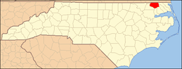
National Register of Historic Places listings in Gates County, North Carolina
This list includes properties and districts listed on the National Register of Historic Places in Gates County, North Carolina. Click the "Map of all coordinates" link to the right to view a Google map of all properties and districts with latitude and longitude coordinates in the table below.[1]
Current listings
- This National Park Service list is complete through NPS recent listings posted June 19, 2020.[2]
| [3] | Name on the Register | Image | Date listed[4] | Location | City or town | Description |
|---|---|---|---|---|---|---|
| 1 | Buckland | 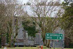 Buckland |
March 5, 1986 (#86000407) |
NC 37 at SR 1220 36°28′32″N 76°45′47″W |
Buckland | |
| 2 | Elmwood Plantation | 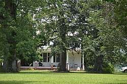 Elmwood Plantation |
February 1, 1972 (#72000963) |
East of Gatesville near junction of SR 1400 and NC 37 36°23′39″N 76°41′58″W |
Gatesville | |
| 3 | Eure-Roberts House | 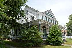 Eure-Roberts House |
September 20, 2006 (#06000868) |
212 W. Main St. 36°24′17″N 76°45′10″W |
Gatesville | |
| 4 | Freeman House | 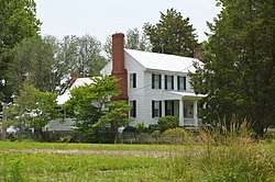 Freeman House |
September 23, 1982 (#82003454) |
North of Gates on U.S. Route 13 36°33′03″N 76°45′20″W |
Gates | Extends into Suffolk, Virginia |
| 5 | Joseph Freeman Farm |  Joseph Freeman Farm |
November 12, 1999 (#99001333) |
Northwest side of SR 1213, 0.7 miles northeast of the junction with SR 1212 36°32′18″N 76°47′19″W |
Gates | |
| 6 | Gates County Courthouse | 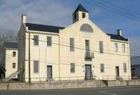 Gates County Courthouse |
October 22, 1976 (#76001325) |
Court St. 36°24′13″N 76°45′11″W |
Gatesville | |
| 7 | Reid's Grove School | 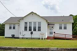 Reid's Grove School |
August 30, 2011 (#11000621) |
931 Main St. 36°25′08″N 76°45′27″W |
Gatesville | |
| 8 | Roberts-Carter House |  Roberts-Carter House |
March 1, 1984 (#84002310) |
Off NC 37 36°21′40″N 76°43′01″W |
Gatesville | Destroyed by tornado, 1984.[5] |
| 9 | Rountree Family Farm | 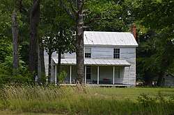 Rountree Family Farm |
August 2, 2000 (#00000881) |
049 NC 37 N 36°26′26″N 76°45′29″W |
Gatesville | |
| 10 | Sunbury High School |  Sunbury High School |
May 12, 2009 (#09000332) |
101 NC 32 N. 36°26′48″N 76°36′19″W |
Sunbury |
See also
| Wikimedia Commons has media related to National Register of Historic Places in Gates County, North Carolina. |
References
- The latitude and longitude information provided in this table was derived originally from the National Register Information System, which has been found to be fairly accurate for about 99% of listings. Some locations in this table may have been corrected to current GPS standards.
- "National Register of Historic Places: Weekly List Actions". National Park Service, United States Department of the Interior. Retrieved on June 19, 2020.
- Numbers represent an ordering by significant words. Various colorings, defined here, differentiate National Historic Landmarks and historic districts from other NRHP buildings, structures, sites or objects.
- The eight-digit number below each date is the number assigned to each location in the National Register Information System database, which can be viewed by clicking the number.
- "Assistance to Gates County". North Carolina State Historic Preservation Office. Retrieved 19 December 2011.

| Topics | |
|---|---|
| Lists by state |
|
| Lists by insular areas | |
| Lists by associated state | |
| Other areas | |
| Related | |
| |
Municipalities and communities of Gates County, North Carolina, United States | ||
|---|---|---|
| Town | Gates County map | |
| CDP | ||
| Unincorporated communities | ||
This article is issued from Wikipedia. The text is licensed under Creative Commons - Attribution - Sharealike. Additional terms may apply for the media files.