National Register of Historic Places listings in Jones County, North Carolina
This list includes properties and districts listed on the National Register of Historic Places in Jones County, North Carolina. Click the "Map of all coordinates" link to the right to view a Google map of all properties and districts with latitude and longitude coordinates in the table below.[1]
Current listings
- This National Park Service list is complete through NPS recent listings posted June 19, 2020.[2]
| [3] | Name on the Register | Image | Date listed[4] | Location | City or town | Description |
|---|---|---|---|---|---|---|
| 1 | Bryan-Bell Farm |  Bryan-Bell Farm |
December 21, 1989 (#89002155) |
NC 58, 1 miles E of SR 1119 34°59′51″N 77°15′20″W |
Pollocksville | |
| 2 | Eagle Nest | 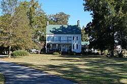 Eagle Nest |
November 13, 1974 (#74001356) |
SE of Pink Hill off NC 41 35°01′05″N 77°34′02″W |
Pink Hill | |
| 3 | Foscue and Simmons Plantations | 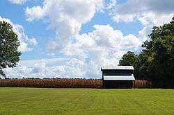 Foscue and Simmons Plantations |
October 7, 1998 (#98000197) |
US 17, from Trent R. and Banks Rd. 35°02′21″N 77°12′01″W |
Pollocksville | |
| 4 | Foscue Plantation House | 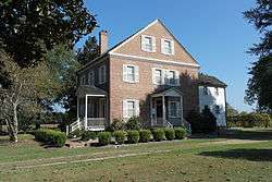 Foscue Plantation House |
November 19, 1971 (#71000598) |
Off U.S. 17 near jct. with SR 1002 35°02′23″N 77°12′32″W |
Pollocksville | |
| 5 | Grace Episcopal Church | 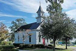 Grace Episcopal Church |
January 20, 1972 (#72000966) |
Lake View Dr. and Weber St. 35°03′43″N 77°21′14″W |
Trenton | |
| 6 | Bryan Lavender House |  Bryan Lavender House |
April 25, 1985 (#85000904) |
Off US 17 South of Trent River Bridge 35°00′31″N 77°13′10″W |
Pollocksville | |
| 7 | Sanderson House |  Sanderson House |
December 16, 1971 (#71000599) |
SW of Pollocksville on SR 1115 34°59′03″N 77°16′33″W |
Pollocksville | |
| 8 | Trenton Historic District |  Trenton Historic District |
July 3, 1974 (#74001357) |
Roughly bounded by Trent, Lower and Pollock Sts., and Brock Mill Pond 35°03′53″N 77°21′31″W |
Trenton |
See also
| Wikimedia Commons has media related to National Register of Historic Places in Jones County, North Carolina. |
References
- The latitude and longitude information provided in this table was derived originally from the National Register Information System, which has been found to be fairly accurate for about 99% of listings. Some locations in this table may have been corrected to current GPS standards.
- "National Register of Historic Places: Weekly List Actions". National Park Service, United States Department of the Interior. Retrieved on June 19, 2020.
- Numbers represent an ordering by significant words. Various colorings, defined here, differentiate National Historic Landmarks and historic districts from other NRHP buildings, structures, sites or objects.
- The eight-digit number below each date is the number assigned to each location in the National Register Information System database, which can be viewed by clicking the number.

| Topics | |
|---|---|
| Lists by state |
|
| Lists by insular areas | |
| Lists by associated state | |
| Other areas | |
| Related | |
| |
Municipalities and communities of Jones County, North Carolina, United States | ||
|---|---|---|
| Towns | | |
| Unincorporated communities | ||
This article is issued from Wikipedia. The text is licensed under Creative Commons - Attribution - Sharealike. Additional terms may apply for the media files.