National Register of Historic Places listings in Person County, North Carolina
This list includes properties and districts listed on the National Register of Historic Places in Person County, North Carolina. Click the "Map of all coordinates" link to the right to view a Google map of all properties and districts with latitude and longitude coordinates in the table below.[1]
Current listings
- This National Park Service list is complete through NPS recent listings posted June 19, 2020.[2]
| [3] | Name on the Register[4] | Image | Date listed[5] | Location | City or town | Description |
|---|---|---|---|---|---|---|
| 1 | Burleigh |  Burleigh |
May 1, 1980 (#80002893) |
NW of Concord on NC 57 36°28′59″N 79°07′10″W |
Concord | |
| 2 | Henry-Vernon House | 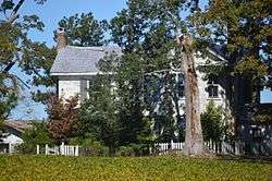 Henry-Vernon House |
February 3, 1983 (#83001902) |
SW of Bushy Fork on NC 49 36°18′03″N 79°06′13″W |
Bushy Fork | |
| 3 | Holloway-Jones-Day House | 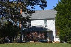 Holloway-Jones-Day House |
June 9, 1988 (#88000698) |
US 501 and SR 1322 36°29′38″N 78°55′05″W |
Roxboro | |
| 4 | Holloway-Walker Dollarhite House |  Holloway-Walker Dollarhite House |
June 1, 1982 (#82003496) |
SR 1514 36°29′13″N 78°54′27″W |
Bethel Hill | |
| 5 | House on Wagstaff Farm |  House on Wagstaff Farm |
April 5, 2006 (#06000229) |
NE side NC 57, 1.4 miles NW of jct. with NC 1300 36°27′45″N 79°04′47″W |
Roxboro | |
| 6 | James A. and Laura Thompson Long House |  James A. and Laura Thompson Long House |
April 6, 2005 (#05000267) |
217 S. Main St. 36°23′31″N 78°59′08″W |
Roxboro | |
| 7 | Merritt-Winstead House |  Merritt-Winstead House |
September 15, 2005 (#05001031) |
7891 Boston Rd. 36°28′57″N 78°55′06″W |
Roxboro | |
| 8 | Person County Courthouse | 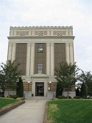 Person County Courthouse |
May 10, 1979 (#79001744) |
Main St. between Abbitt and Court Sts. 36°23′38″N 78°59′03″W |
Roxboro | |
| 9 | Roxboro Commercial Historic District |  Roxboro Commercial Historic District |
March 1, 1984 (#84002415) |
Roughly bounded by Courthouse Sq., Court, Abbit, Reams, Depot, N. and S. Main Sts. 36°23′38″N 78°59′03″W |
Roxboro | |
| 10 | Roxboro Cotton Mill |  Roxboro Cotton Mill |
August 27, 2009 (#09000660) |
115 Lake Dr. 36°23′34″N 78°58′44″W |
Roxboro | |
| 11 | Roxboro Male Academy and Methodist Parsonage |  Roxboro Male Academy and Methodist Parsonage |
July 29, 1982 (#82003497) |
315 N. Main St. 36°23′48″N 78°58′52″W |
Roxboro | |
| 12 | Waverly Plantation | 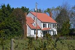 Waverly Plantation |
October 9, 1974 (#74001369) |
S of U.S. 58 36°32′20″N 79°04′44″W |
Cunningham |
See also
| Wikimedia Commons has media related to National Register of Historic Places in Person County, North Carolina. |
References
- The latitude and longitude information provided in this table was derived originally from the National Register Information System, which has been found to be fairly accurate for about 99% of listings. Some locations in this table may have been corrected to current GPS standards.
- "National Register of Historic Places: Weekly List Actions". National Park Service, United States Department of the Interior. Retrieved on June 19, 2020.
- Numbers represent an ordering by significant words. Various colorings, defined here, differentiate National Historic Landmarks and historic districts from other NRHP buildings, structures, sites or objects.
- "National Register Information System". National Register of Historic Places. National Park Service. April 24, 2008.
- The eight-digit number below each date is the number assigned to each location in the National Register Information System database, which can be viewed by clicking the number.

| Topics | |
|---|---|
| Lists by state |
|
| Lists by insular areas | |
| Lists by associated state | |
| Other areas | |
| Related | |
| |
Municipalities and communities of Person County, North Carolina, United States | ||
|---|---|---|
| City | | |
| CDP | ||
| Unincorporated communities | ||
| Footnotes | ‡This populated place also has portions in an adjacent county or counties | |
This article is issued from Wikipedia. The text is licensed under Creative Commons - Attribution - Sharealike. Additional terms may apply for the media files.