Palilula, Belgrade
| Palilula Палилула | ||
|---|---|---|
| Municipality | ||
| ||
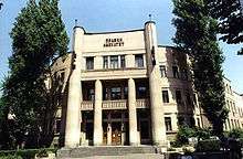
 Location of Palilula within the city of Belgrade | ||
| Country |
| |
| City | Belgrade | |
| Status | Municipality | |
| Settlements | 8 | |
| Government | ||
| • Type | Municipality of Belgrade | |
| • Mun. president | Aleksandar Jovičić (SNS) | |
| Area | ||
| • Municipality | 450.62 km2 (173.99 sq mi) | |
| • Urban | 70.34 km2 (27.16 sq mi) | |
| Population (2011) | ||
| • Municipality | 170,593 | |
| • Density | 380/km2 (980/sq mi) | |
| Time zone | UTC+1 (CET) | |
| • Summer (DST) | UTC+2 (CEST) | |
| Postal code | 11000 | |
| Area code(s) | +381(0)11 | |
| Car plates | BG | |
| Website |
www | |

Palilula (Serbian Cyrillic: Палилула, pronounced [pǎlilula]) is a municipality of the city of Belgrade. It has the largest area of all municipalities of Belgrade. The core of Palilula is close to the center of the city, but the municipality also includes sparsely populated land left of the Danube.
Neighborhood
Location
Palilula is located east of Terazije in downtown Belgrade. Like most of Belgrade's neighborhoods it has no firm boundaries and is roughly bordered by the Ruzveltova street and the municipality and neighborhood of Zvezdara on the east, the neighborhood of Hadžipopovac in its own municipality on the north, the neighborhood and municipality of Stari Grad and Jevremovac on the northwest (Jevremovac actually belongs to the neighborhood of Palilula, but administratively is part of Stari Grad), and the Tašmajdan and Bulevar kralja Aleksandra on the south, bordering the municipality of Vračar.
Population
Six local communities, sub-municipal administrative units, which make up the neighborhood of Palilula had a population of 36,216 in 1981,[1] 35,579 in 1991,[2] 34,559 in 2002[3] and 26,942 in 2011.[4] Palilula in the narrowest sense (local communities of Stara Palilula and Starina Novak, excluding the neighborhoods of Tašmajda, Hadžipopovac, Profesorska Kolonija and Bogoslovija) had a population of 12,638 in 1981, 12,178 in 1991, 11,590 in 2002 and 9,817 in 2011.
History
First houses in the area were built in the 16th century. In the direction from today's Tašmajdan and Cvijićeva street there were gardens, vineyards, pastures but also mills and summer houses of the wealthier citizens of Belgrade. The neighborhood originated in the first half of the 18th century, when the Habsburg Monarchy occupied northern Serbia 1717–1739. The settlement, built as an outer suburb of Belgrade, was originally named Karlstadt and was known for agriculture and skilled crafts and was considered as the most beautiful part of Belgrade at that time. In the early 19th century, it became overwhelmingly populated by the Serbs and was described as "the village one quarter of the hour walk" away from Belgrade.[5] In 1840, villagers of Palilula rejected the regulatory plan of Belgrade, on the basis that projected new streets would be too wide, and later even tried to split from the municipality of Belgrade because of the city government's low funding for the village. However, in the late 19th century Palilula became part of the continuously built-up area of Belgrade. The neighborhood was mostly residential, with commercial facilities closer to the center of Belgrade. When Belgrade was divided into six quarters in 1860, Palilula was one of them. By the census of 1883 it became the most populous one in Belgrade with 7,318 inhabitants,[6] and that number grew to 10,563 in 1890.[5]
In 1930, a large, wooden stadium was built in the neighborhood. A work of Momir Korunović, it was constructed in only two months for the slet, a massive gymnastic festival held as part of the Sokol movement. It had a capacity of 45,000 spectators. In terms of architecture, it was noted for its ornamented doors, whick Korunović embelished with the elements carved in the Serbian national style. After the slet was finished, the construction was dismantled and re-used as a mobile construction for other festivities. On the location of the stadium, the building of the University of Belgrade's Mechanical Engineering Faculty is situated today.[7]
Characteristics
A section of Palilula is dedicated to the hajduk Starina Novak. Features bearing his name include the street, a local community, an elementary school founded in 1922 and a park. Area occupied by the park today, bounded by the streets of Starine Novaka, Cvijićeva and Dalmatinska, was named Starina Novak Square until 1954. In October 2017 city administration announced that a monument to Starina Novak will be erected in the park.[8]
Area bounded by the streets of Stanoja Glavaša, Dalmatinska, Starine Novaka and Kneza Danila was, for the most part, occupied by the complex of the IKL factory. Before World War II, it was the Rogožarski factory, the first aircraft factory in Yugoslavia. After the war new Communist authorities nationalized the company, while the factory complex in Palilula was transformed into the IKL (ball bearing factory) in 1948.[9] The complex was demolished and in 2015 construction of the residential and commercial neighborhood of "Central Garden" began. Apart from the commercial and business sections, it will have 400 apartments. In November 2017 a construction of the 16-storey "Business Garden Tower" was announced, with the deadline of 18 months.[10]
Name
The name Palilula comes from the expression pali lulu which in English means light a pipe. One anecdote goes back to times when Belgrade and Serbia were occupied by the Ottoman Empire and Palilula was the area where most crops were, so Turkish rulers banned smoking due to a few instances of accidentally setting crops on fire. In the late summer and early autumn when all the crops had been harvested, the smoking ban was lifted and locals announced this by calling neighbours, letting them know that pipes might be lit. Another explanation comes from the time of Prince Miloš Obrenović's rule; he banned smoking in Belgrade so people could only smoke outside the city gates.
Municipality
Area
The area of Palilula is generally the north of Belgrade. It is the northernmost of all Belgrade's municipalities and the easternmost of all municipalities. It is located on both banks of the Danube, which divides it in two: Šumadija section (on the right bank) and Banat section (on the left bank).
Šumadija section borders the municipalities of Stari Grad to the west, Vračar and Zvezdara to the south and Grocka to the extreme southeast. It also has a river border on the Danube to the province of Vojvodina (Municipality of Pančevo).
Banat section has no land borders to the other Belgrade municipalities, but has a river border on the Danube to the municipalities of Zemun and Stari Grad. The Danube also forms a complete western border to the rest of the Syrmia region in Vojvodina (municipality of Stara Pazova), while the river Tamiš is the eastern border (municipalities of Pančevo and Opovo). On the extreme north, Palilula borders the municipality of Zrenjanin (village of Čenta on the Karaš canal which connects the Danube and the Tamiš).
Geography
Šumadija section marks the northernmost point of Šumadija with Karaburma headland extending into the Danube. The prominent features in this part are the hills of Karaburma and Milićevo brdo, the spa of Višnjička Banja and the peninsula (formerly an island) Ada Huja.
Banat section is the extreme southwestern part of Banat region, known as Pančevački Rit. A 400 km2 (150 sq mi) large, flat, marshy floodplain of the Danube and Tamiš, it has been drained since 1945 but still has many features of a swamp, including slow, meandering and flooding streams (Vizelj, Mokri Sebeš, Jojkićev Dunavac, Dunavac, etc.) and marshy bogs (Sebeš, Veliko Blato, Široka Bara). An island of Kožara is located on the Danube, and is the projected starting point of the planned, much larger, artificial island of Čaplja. The spa of Ovčanska Banja is also located here. The area close to the Danube is heavily forested.
In the Pančevački Rit section there are two official, unfenced hunting grounds. One is named Pančevački Rit, while the other is called simply Rit. The Rit is located near Padinska Skela, 15 km (9.3 mi) from Belgrade along the Zrenjaninski put. It covers an area of 82.63 km2 (31.90 sq mi), of which 0.5 km2 (0.19 sq mi) is a pheasantry. Animals bred in the facility include roe deer, hare, quail, mallard, greylag goose and 13,000 pheasants per year.[11]
History and administration
The municipality was created in 1956. On January 3, 1957 the municipality of Karaburma was annexed to it, while in 1965 the municipality of Krnjača (with entire Pančevački Rit) also administratively joined Palilula.
Presidents of the Municipal Assembly:
- 1997–2000: Gordana Todić (b. 1955)
- 2000–October 21, 2004: Milan Marković (b. 1970)
- October 21, 2004 – June 18, 2012: Danilo Bašić (b. 1973)
- June 18, 2012 – June 6, 2016: Stojan Nikolić (b. 1976)
- June 6, 2016–present: Aleksandar Jovičić (b. 1976)
Dunavski Venac and Čenta
The idea of separating the area of former municipality of Krnjača start gaining momentum in the 2000s, this time under the name of Dunavski Venac. As procedure in the city statute provides that the municipal assembly (in this case, of Palilula) needs to start the motion in the city assembly, after years of public agitation, the municipal assembly of Palilula agreed to do so in summer 2005. However it did not officially do so, and the organization for the separation of Dunavski Venac announced it will go to court.
The village of Čenta in the Vojvodina's municipality of Zrenjanin is located on the northern border of the municipality of Palilula. From time to time local residents have asked for Čenta to be annexed to the City of Belgrade. The majority of the population work in the territory of Belgrade and until recently, one regular bus line of Belgrade City public transportation connected Čenta to Belgrade.
Demographics
| Historical population | ||
|---|---|---|
| Year | Pop. | ±% p.a. |
| 1948 | 47,168 | — |
| 1953 | 59,085 | +4.61% |
| 1961 | 89,141 | +5.27% |
| 1971 | 126,380 | +3.55% |
| 1981 | 150,484 | +1.76% |
| 1991 | 156,587 | +0.40% |
| 2002 | 155,902 | −0.04% |
| 2011 | 173,521 | +1.20% |
| 2015 | 178,670 | +0.73% |
| Source: [12][13] | ||
With a population of 173,521 inhabitants, according to the 2011 census results, Palilula is the third most populous municipality of Belgrade (after Novi Beograd and Čukarica), but the growth of population, as in the rest of Belgrade, is slowing. The fastest-growing population in the municipality is still the suburb of Borča.
Ethnic structure
According to the 2002 Census of population:
- Serbs = 135,586 (86.97%)
- Romani = 3,897 (2.50%)
- Yugoslavs = 2,279 (1.46%)
- Montenegrins = 1,858 (1.19%)
- Macedonians = 1,035 (0.66%)
- Croats = 931 (0.59%)
- Gorani = 836 (0.53%)
- Muslims = 823 (0.52%)
- Romanians = 781 (0.50%), mainly in Ovča
Neighborhoods and settlements

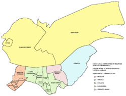
- Right bank of Danube
Neighborhoods of urban Palilula on the right bank of Danube:
Settlements of suburban Palilula on the right bank of the Danube:
- Left bank of Danube
Neighborhoods of urban Palilula on the left bank of Danube:
Settlements and neighborhoods of suburban Palilula on the left bank of Danube:
Note: Borča and Ovča are classified as urban settlements (towns).
- Neighborhoods of Borča
|
|
|
|
Economy and transportation
Railways in Palilula municipality | |||||||||||||||||||||||||||||||||||||||||||||||||||||||||||||||||||||||||||||||||||||||||||||||||||||||||||||||||||||||||||||||||||||||||||||||||||
|---|---|---|---|---|---|---|---|---|---|---|---|---|---|---|---|---|---|---|---|---|---|---|---|---|---|---|---|---|---|---|---|---|---|---|---|---|---|---|---|---|---|---|---|---|---|---|---|---|---|---|---|---|---|---|---|---|---|---|---|---|---|---|---|---|---|---|---|---|---|---|---|---|---|---|---|---|---|---|---|---|---|---|---|---|---|---|---|---|---|---|---|---|---|---|---|---|---|---|---|---|---|---|---|---|---|---|---|---|---|---|---|---|---|---|---|---|---|---|---|---|---|---|---|---|---|---|---|---|---|---|---|---|---|---|---|---|---|---|---|---|---|---|---|---|---|---|---|
| |||||||||||||||||||||||||||||||||||||||||||||||||||||||||||||||||||||||||||||||||||||||||||||||||||||||||||||||||||||||||||||||||||||||||||||||||||
Industry and adjoining economic activities are located mostly along the right bank of the Danube. It includes the highly industrialized neighborhoods of Viline Vode (TEMPO cash-and-carry center, several gravel and sand extracting companies on the Danube's bank, Beograd railway, Centroprom, Martez, Tehnohemija, Jugopapir, Duga, the Avala cardboard factory, Balkan, the eastern part of the port of Belgrade and the railway station Beograd-Dunav) and Ada Huja (hangars and companies for building and construction, including a series of concrete plants and gravel and aggregates storing and treating facilities, paper and cardboard factory Avala-Ada, furniture factory Novi Dom, gravel storages of Tembo and DV Trade, etc.). It also includes a series of brickworks which occupy extensive areas of the northern ridge of the Field of Višnjica (Polet, Trudbenik, Jedinstvo, Kozara, Balkan, Rekord). There is also an extensive industrial zone in Krnjača and agricultural industry in Padinska Skela.
Palilula is crisscrossed by some of the major railroads in Belgrade area: Zrenjaninski put, Pančevački put, Višnjička street, Slanački put, etc. Belgrade's only bridge over the Danube, Pančevo Bridge (with railway) is located in Palilula.
Intensive agricultural production has developed in Banat section and eastern areas around Veliko Selo and Slanci, producing large amounts of food (grains, fruits, vegetables, dairy products, etc.) for the population of Belgrade. Palilula has the largest agricultural area of all municipalities of Belgrade. It covers an area of 298 square kilometers, or 66,5% of the entire municipal territory.[5][14]
Palilula Greenmarket (Paliluska pijaca) is a small market in the neighborhood of Palilula, along the 27. marta Street, below the Tašmajdan.[15] In November 2017 it was closed as the construction of the combined shopping center, which would partially include the modernized greenmarket, will begin. Some of the market stalls have been placed on the open, at the plateau near the Tašmajdan Sports and Recreation Center in the Ilije Garašanina Street, until the works are finished. The estimated length of the reconstruction is 18 months.[16]
The following table gives a preview of total number of employed people per their core activity (as of 2016):[17]
| Activity | Total |
|---|---|
| Agriculture, forestry and fishing | 2,404 |
| Mining | 109 |
| Processing industry | 7,070 |
| Distribution of power, gas and water | 193 |
| Distribution of water and water waste management | 585 |
| Construction | 2,567 |
| Wholesale and retail, repair | 10,115 |
| Traffic, storage and communication | 4,363 |
| Hotels and restaurants | 2,008 |
| Media and telecommunications | 4,387 |
| Finance and insurance | 1,690 |
| Property stock and charter | 245 |
| Professional, scientific, innovative and technical activities | 3,455 |
| Administrative and other services | 5,064 |
| Administration and social assurance | 8,470 |
| Education | 4,158 |
| Healthcare and social work | 2,211 |
| Art, leisure and recreation | 1,696 |
| Other services | 1,109 |
| Total | 61,901 |
Culture, education and sports
Urban Palilula hosts some of the most important faculties within Belgrade University: the Technical Faculty, the Faculty of Law and the Mining and Geology Faculty. Also, the building of Radio Television of Serbia, St. Mark's Church, Tašmajdan Park, Pionir Hall for sports, and the stadium of the OFK Belgrade soccer team are all located in the municipality.
Park "Đuro Strugar" is located between the streets Mitropolita Petra, Braće Grim, Jaše Prodanovića and Čarlija Čaplina, which is effectively split in two by the park. It is situated north of the "Rade Končar" school of electrotechnics and west of the Pionir Ice Hall in the Hall Aleksandar Nikolić complex. The park have a children's playground and basketball court and has been renovated in May 2017.[18]
Tourism
The spas of Višnjička Banja and Ovčanska Banja are not used or developed enough. Belgrade's largest kart racing track is located in Ada Huja. The future artificial island of Čaplja on the Danube is planned as a modern entertainment park, with aqua parks, golf courses, etc.
International cooperation
Palilula is twinned with following cities and municipalities:[19]
See also
References
- ↑ Osnovni skupovi stanovništva u zemlji – SFRJ, SR i SAP, opštine i mesne zajednice 31.03.1981, tabela 191. Savezni zavod za statistiku (txt file). 1983.
- ↑ Stanovništvo prema migracionim obeležjima – SFRJ, SR i SAP, opštine i mesne zajednice 31.03.1991, tabela 018. Savezni zavod za statistiku (txt file).
- ↑ Popis stanovništva po mesnim zajednicama, Saopštenje 40/2002, page 4. Zavod za informatiku i statistiku grada Beograda. 26 July 2002.
- ↑ Stanovništvo po opštinama i mesnim zajednicama, Popis 2011. Grad Beograd – Sektor statistike (xls file). 23 April 2015.
- 1 2 3 Dejan Aleksić (9 May 2017), "Šest decenija opštine Palilula - Nekad selo, a danas urbana celina grada", Politika (in Serbian)
- ↑ Belgrade by the 1883 census
- ↑ Dejan Aleksić (22 April 2018). "Zaboravljeni srpski Gaudi" [Forgotten Serbian Gaudi]. Politika (in Serbian).
- ↑ Ana Vuković (28 October 2017), "Spomenik Starini Novaku na Paliluli" [Monument to Starina Novak in Palilula], Politika (in Serbian), p. 14
- ↑ N.N. (23 April 2018). "Prva domaća fabrika aeroplana" [First domestic airplane factory]. Politika (in Serbian). p. 11.
- ↑ Daliborka Mučibabić (29 November 2017), "Kula od 16 spratova u "Central gardenu"" [16-storey tower in "Central Garden"], Politika (in Serbian), p. 16
- ↑ Branka Vasiljević (5 August 2018). "Lovci u Beograd stižu porodično" [Hunters travel to Belgrade with their families]. Politika (in Serbian).
- ↑ "2011 Census of Population, Households and Dwellings in the Republic of Serbia" (PDF). stat.gov.rs. Statistical Office of the Republic of Serbia. Retrieved 25 February 2017.
- ↑ Saopštenje – Vitalni događaji u Republici Srbiji 2015, broj 168, god. LXVI. Republički zavod za statistiku. 30 June 2016. ISSN 0353-9555.
- ↑ "Srpska prestonica u brojkama", Politika (in Serbian), p. 30, 2008-04-26
- ↑ Dragan Perić (22 October 2017), "Beogradski vremeplov - Pijace: mesto gde grad hrani selo" [Belgrade chronicles - greenmarkets: a place where village feeds the city], Politika-Magazin, No. 1047 (in Serbian), pp. 26–27
- ↑ Ana Vuković (13 November 2017), "Zatvorena Palilulska pijaca" [Palilula greenmarket was closed], Politika (in Serbian), p. 15
- ↑ "ОПШТИНЕ И РЕГИОНИ У РЕПУБЛИЦИ СРБИЈИ, 2017" (PDF). stat.gov.rs (in Serbian). Statistical Office of the Republic of Serbia. Retrieved 22 June 2018.
- ↑ Branka Vasiljević (11 May 2017), "Obnavlja se parkić u Ulici Čarlija Čaplina", Politika (in Serbian), p. 17
- ↑ "Archived copy". Archived from the original on 2008-10-14. Retrieved 2007-06-18. Stalna konferencija gradova i opština. Retrieved on 2007-06-18.
External links
| Wikimedia Commons has media related to Palilula (Belgrade). |
| Municipalities | ||
|---|---|---|


Coordinates: 44°48′42″N 20°30′58″E / 44.81167°N 20.51611°E