Kovin
| Kovin Ковин | ||
|---|---|---|
| Town and municipality | ||
| ||
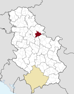 Location of Kovin within Serbia | ||
| Coordinates: 44°45′N 20°58′E / 44.750°N 20.967°ECoordinates: 44°45′N 20°58′E / 44.750°N 20.967°E | ||
| Country |
| |
| Province | Vojvodina | |
| District | South Banat | |
| Government | ||
| • Mayor | Zoran Nikolić | |
| Area | ||
| • Town | 96.72 km2 (37.34 sq mi) | |
| • Municipality | 738.30 km2 (285.06 sq mi) | |
| Elevation | 68 m (223 ft) | |
| Population (2011 census)[1] | ||
| • Town | 13,515 | |
| • Town density | 140/km2 (360/sq mi) | |
| • Municipality | 33,722 | |
| • Municipality density | 46/km2 (120/sq mi) | |
| Time zone | UTC+1 (CET) | |
| • Summer (DST) | UTC+2 (CEST) | |
| Postal code | 26220, 26221, 26223 | |
| Area code(s) | +381(0)13 | |
| Car plates | KO | |
| Website | http://www.kovin.org.rs/ | |


Kovin (Serbian Cyrillic: Ковин) is a town and municipality located in the South Banat District of the autonomous province of Vojvodina, Serbia. The town has a population of 13,515, while the municipality has 33,722 inhabitants.
In Romanian, the town is known as Cuvin, in Hungarian as Kevevára or (until 1899) Temeskubin, and in German as Kubin or Temeschkubin. In the past, the town was also known as Donji Kovin ("lower Kovin") in contrast to the town with same name in Hungary that was known in Serbian as Gornji Kovin ("upper Kovin") and in Hungarian as Ráckeve ("the Serb Kovin").
History
The Dacian tribe of Albocenses dwelled in this area in the 2nd century AD.[2] There are remains of the ancient Roman fortress called Contra Margum, opposite to the Margum, a fortress on the other side of the Danube. In the 9th and 10th centuries, this area was populated by Slavs and Romanians[3] and Voivode Glad ruled over the region. Glad was defeated by the Hungarians, and the area was included into the medieval Kingdom of Hungary. In the 11th century, one of the descendants of Glad, Ahtum, ruled over the region but he, too, was defeated by the Hungarians.
The earliest mention of the settlement was in 1071 as Keuee. Kovin is mentioned in the 12th century as a seat of the county, which included most of the western Banat. Since the 14th century, the city has had a large Serb population that escaped there from Serbia under threat by the Ottomans. The Serbian despot Lazar Branković took control over the city in 1457, but in the next year it came again under control of the Kingdom of Hungary.
In the 16th century, the city was included in the Ottoman Empire and became a part of the Ottoman Province of Temeşvar. During the Ottoman rule (16th-17th century), Kovin was mostly populated by ethnic Serbs. In 1716, it became part of the Habsburg Monarchy and belonged to the Habsburg Banat of Temeswar until 1751 when it became part of the Habsburg Military Frontier (Banat Krajina).
In 1848/1849, Kovin was part of the Serbian Voivodship, but in 1849 it was again placed under administration of the Military Frontier. With the abolishment of the Military Frontier in 1873, Kovin was incorporated into Temes county within the Kingdom of Hungary. According to the 1910 census, Kovin District had a population of 35,482, of whom 21,795 spoke Serbian, 6,587 German, 5,705 Romanian, and 5,355 Hungarian.[4]
This town had a significant role in the outbreak of World War I.[5] In July 1914, a purported military skirmish here was a proximate cause of the declaration of war against Serbia by Franz Joseph I of Austria, but the report of such skirmish was apparently false, or greatly exaggerated.[5]
In 1918, Kovin became part of the Kingdom of Serbs, Croats and Slovenes (renamed to Yugoslavia in 1929). Between 1918 and 1922, it was part of Banat county; between 1922 and 1929 part of the Podunavska oblast; and between 1929 and 1941 part of the Danube Banovina. Between 1941 and 1944, Kovin was under Axis occupation and was part of the autonomous Banat region within German-occupied Serbia. The town was heavily bombed by the Allies in 1944.[6] In 1945, it became part of the Socialist Autonomous Province of Vojvodina within the Socialist Republic of Serbia and the Socialist Federal Republic of Yugoslavia. In 1992, Kovin became part of the Federal Republic of Yugoslavia, which was in 2003 transformed into the state union of Serbia and Montenegro. Since 2006, the town is part of an independent Serbia.
Inhabited places
Kovin municipality includes the town of Kovin and the following villages:
- Bavanište
- Gaj
- Deliblato
- Dubovac
- Malo Bavanište
- Mramorak
- Pločica
- Skorenovac (Hungarian: Székelykeve)
- Šumarak
There is also this unofficial settlement in municipality:
Demographics
| Historical population | ||
|---|---|---|
| Year | Pop. | ±% p.a. |
| 1948 | 35,465 | — |
| 1953 | 38,061 | +1.42% |
| 1961 | 39,994 | +0.62% |
| 1971 | 39,808 | −0.05% |
| 1981 | 39,843 | +0.01% |
| 1991 | 38,263 | −0.40% |
| 2002 | 36,802 | −0.35% |
| 2011 | 33,722 | −0.97% |
| Source: [7] | ||
According to the 2011 census, the total population of the municipality of Kovin was 33,722 inhabitants.
Ethnic groups
- Municipality
| Year | Population | Serbs | Germans | Romanians | Hungarians | Croats | Romani | Slovaks | Rest |
|---|---|---|---|---|---|---|---|---|---|
| 1910 | 34,034 | 45.52% | 19.30% | 16.65% | 15.64% | 0.09% | 1.28% | 0.12% | 1.70% |
| 1931 | 35,600 | 50.66% | 20.68% | n/d | 13.0% | n/d | n/d | n/d | 15.64% |
| 1961 | 39,994 | 73.1% | n/d | 17.6% | 13.59% | n/d | 0.04% | 0.14% | 5.27% |
| 1991 | 38,263 | 73.53% | 0.20% | 4.54% | 10.28% | 0.39% | 2.47% | 0.05% | 8.54% |
| 2002 | 36,802 | 76.75% | 0.13% | 3.7% | 9.26% | 0.3% | 3.1% | 0.11% | 7.44% |
| 2011[8] | 33,722 | 74.58% | 0.14% | 3.47% | 8.90% | 0.19% | 4.5% | 0.04% | 8.18% |
Settlements with a Serb ethnic majority are: Kovin, Bavanište, Gaj, Deliblato, Dubovac, Malo Bavanište, Mramorak, and Pločica. Skorenovac has a Hungarian ethnic majority. Šumarak is an ethnically-mixed settlement with a relative Hungarian majority.
- Town
| Year | Total | Serbs | Hungarians | Romanians | Romani | Montenegrins | Yugoslavs | Macedonians | Rest |
|---|---|---|---|---|---|---|---|---|---|
| 1991 | 13,669 | 76.19% | 6.78% | 3.47% | 1.40% | 1.67% | 6.81% | 0.76% | 2.21% |
| 2002 | 14,250 | 80.79% | 5.51% | 2.93% | 2.00% | 0.92% | 1.26% | 0.50% | 6.09% |
| 2011[8] | 13,515 | 79.22% | 5.18% | 2.60% | 2.40% | 0.50% | 0.43% | 0.50% | 9.17% |
Economy
The following table gives a preview of total number of employed people per their core activity (as of 2016):[9]
| Activity | Total |
|---|---|
| Agriculture, forestry and fishing | 453 |
| Mining | 146 |
| Processing industry | 1,145 |
| Distribution of power, gas and water | 52 |
| Distribution of water and water waste management | 116 |
| Construction | 264 |
| Wholesale and retail, repair | 740 |
| Traffic, storage and communication | 192 |
| Hotels and restaurants | 134 |
| Media and telecommunications | 43 |
| Finance and insurance | 65 |
| Property stock and charter | 6 |
| Professional, scientific, innovative and technical activities | 156 |
| Administrative and other services | 171 |
| Administration and social assurance | 300 |
| Education | 414 |
| Healthcare and social work | 795 |
| Art, leisure and recreation | 48 |
| Other services | 100 |
| Total | 5,342 |
Twin cities
See also
References
- ↑ "2011 Census of Population, Households and Dwellings in the Republic of Serbia: Comparative Overview of the Number of Population in 1948, 1953, 1961, 1971, 1981, 1991, 2002 and 2011, Data by settlements" (PDF). Statistical Office of Republic Of Serbia, Belgrade. 2014. ISBN 978-86-6161-109-4. Retrieved 2014-06-27.
- ↑ Ptolemy's Geographia
- ↑ Anonymus, Gesta Hungarorum, Mentor Publishers,2000, p.120, ISBN 973-98955-9-X
- ↑ “Temes County”, talmamedia.com.
- 1 2 Manfried, Rauchensteiner. The First World War and the End of the Habsburg Monarchy, 1914-1918, p. 27 (Böhlau Verlag, Vienna, 2014).
- ↑ Serbs were not specially chosen as targets Archived 2011-07-25 at the Wayback Machine., Danas
- ↑ "2011 Census of Population, Households and Dwellings in the Republic of Serbia" (PDF). stat.gov.rs. Statistical Office of the Republic of Serbia. Retrieved 19 March 2017.
- 1 2 "Population by ethnicity – Kovin". Statistical Office of the Republic of Serbia (SORS). Retrieved 28 February 2013.
- ↑ "ОПШТИНЕ И РЕГИОНИ У РЕПУБЛИЦИ СРБИЈИ, 2017" (PDF). stat.gov.rs (in Serbian). Statistical Office of the Republic of Serbia. Retrieved 16 March 2018.
- Jovan Erdeljanović, Srbi u Banatu, Novi Sad, 1992.
- Slobodan Ćurčić, Broj stanovnika Vojvodine, Novi Sad, 1996.
External links
| Wikimedia Commons has media related to Kovin. |
- Municipality of Kovin
- Radio BUS - News from Kovin
- Kovin Ekspres - online news and newspaper from Kovin
- NETcom - Information technologies - services and data recovery


