Mladenovac
| Mladenovac Младеновац | ||
|---|---|---|
| Municipality | ||
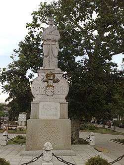 A monument in Mladenovac | ||
| ||
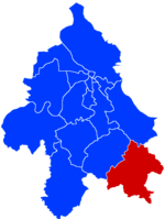 Location of Mladenovac within the city of Belgrade | ||
| Coordinates: 44°26′N 20°42′E / 44.433°N 20.700°ECoordinates: 44°26′N 20°42′E / 44.433°N 20.700°E | ||
| Country |
| |
| City | Belgrade | |
| Settlements | 22 | |
| Government | ||
| • Municipality president | Vladan Glišić (SNS) | |
| Area[1] | ||
| • Urban | 11.36 km2 (4.39 sq mi) | |
| • Municipality | 338.97 km2 (130.88 sq mi) | |
| Population (2011 census)[2] | ||
| • Urban | 23,314 | |
| • Urban density | 2,100/km2 (5,300/sq mi) | |
| • Municipality | 53,050 | |
| • Municipality density | 160/km2 (410/sq mi) | |
| Time zone | UTC+1 (CET) | |
| • Summer (DST) | UTC+2 (CEST) | |
| Postal code | 11400 | |
| Area code | +381 11 | |
| Car plates | BG | |
| Website |
www | |
.png)
Mladenovac (Serbian Cyrillic: Младеновац, pronounced [mlâde̞nɔ̝v̞at͡s]) is a municipality of the city of Belgrade. According to the 2011 census results, the municipality has a population of 53,050 inhabitants, while the urban area has 23,314 inhabitants.
Name
Its name stems from word "youth" in Serbian language. After the legend the emergence of the name is brought in connection with a man named Mladen, who established himself after the battle on the Kosovo in 1389 with his two brothers in this desert area. The brothers separated and the place, where Mladen had established himself, was called Mladenovac.
History
The first official data over a settlement in this area are mentioned in the Ottoman census of 1528. The day of the urban district is 2 August, when Mladenovac was given the status of a town in 1893.
In 1971, the municipality of Mladenovac, along with Lazarevac, was annexed to the city of Belgrade.
Geography
This town, situated about 47 km (29.20 mi) in the south of Belgrade, is a part of the district of the capital city of Serbia. Together with the suburban settlements Kovačevac, Koraćica, Markovac, Jagnjilo, Senaja, Granice, Velika Krsna, Dubona, Šepšin, Velika Ivanča, Rajkovac, Selo Mladenovac, Rabrovac, Amerić, Vrbica the municipality of Mladenovac extends over 339 km2 (130.89 sq mi) and has 53,050 inhabitants.
Features
Kosmaj with its altitude of 628 m is the highest point in this region. On the top of this mountain there is a monument in remembrance to the numerous Serbs (Partizans) who have fallen during World War II battles in this area.
Between the city central and the mountain Kosmaj you can find a monastery "Tresije", which was built in the 13th century.
Mladenovac is also a crossing point of many trading and transporting routes such as Belgrade, Kragujevac, Aranđelovac, Smederevo, Smederevska Palanka.
Neighborhoods and settlements
Suburban:
|
|
Demographics
| Historical population | ||
|---|---|---|
| Year | Pop. | ±% p.a. |
| 1948 | 37,662 | — |
| 1953 | 39,945 | +1.18% |
| 1961 | 44,769 | +1.44% |
| 1971 | 47,134 | +0.52% |
| 1981 | 52,489 | +1.08% |
| 1991 | 56,389 | +0.72% |
| 2002 | 52,490 | −0.65% |
| 2011 | 53,096 | +0.13% |
| Source: [3] | ||
According to the 2011 census results, the municipality has a population of 53,096 inhabitants.
Ethnic groups
The ethnic composition of the municipality (as of 2011):[4]
| Ethnic group | Population |
|---|---|
| Serbs | 50,231 |
| Romani | 1,022 |
| Montenegrins | 118 |
| Macedonians | 94 |
| Yugoslavs | 68 |
| Croats | 65 |
| Russians | 36 |
| Hungarians | 33 |
| Bulgarians | 25 |
| Gorani | 17 |
| Muslims | 15 |
| Slovenians | 11 |
| Others | 1,361 |
| Total | 53,096 |
Economy
Most of the inhabitants of Mladenovac are working in the industrial factories. Keramika, Petar Drapšin, Progres, Minel trafo, Elektrošumadija, Cobest, Makovica and are counting to the biggest companies of this part of Serbia.
There is a game hunting ground "Varovnica" in the municipality.[5]
Selters Spa
The Selters Institute for Rehabilitation is located 50 km (31 mi) southeast from Belgrade, in the urban area of Mladenovac. The first water well with warm salty water was dug in 1893. After the water from the thermo-mineral spring was analyzed, it showed similarities with the waters from spas Bad Ems in Germany, Royat in France and Luhačovice in Bohemia, but it was most comparable to the Selters Spa in Germany, so it was named the same way. Water was awarded with medals in Brussels (1906) and London (1907). The health resort was initially developed by Dr. Naum Atanasijević, who sold his inheritance, a steam mill, and invested the money into the villa with 30 beds.[6]
The water is beneficial for the patients with strokes, rheumatism, orthopedic problems and cerebral palsy. The institute also provides the mud healing therapies though it has no natural healing mud. It is made from the mixture of thermal water, clay and zeolite, which matures in special pools and then is kept at 40 °C (104 °F). As of 2017, the complex has a floor area of 26,000 m2 (280,000 sq ft) with 300 beds, wellness and spa centers, a park of 14 ha (35 acres) and 7,000 patients yearly.[6]
With the surrounding neighborhoods, Selters forms one of the "local communities", sub-municipal administrative units, of the town of Mladenovac. It had a population of 3,619 in 1981,[7] 4,468 in 1991,[8] 5,094 in 2002[9] and 4,601 in 2011.[10]
Education
The biggest primary school is "Momcilo Zivojinovic" with over 2000 pupils. Second in size is "Sveti Sava" primary school. There is also a primary school "Kosta Đukić" in Mladenovac. Also in Mladenovac exist 8 primary schools and 2 secondary schools. It has a long history, educating many pupils and having many teachers work in it. Every one of them left a trace in the school's history. The primary school Kosta Đukić was founded in 1968. Its pupils have shown very good results in mathematics, chemistry, and physics. It is one of three town’s schools in Mladenovac and its nearby Selters Institute for Rehabilitation. This school has also classes in villages Međulužje, Pružatovac, Markovac, Koraćica, and Velika Ivanča. The school in Koraćica has existed for over 150 years. The school is very successful in many fields. Its pupils in recent years have shown good results in various republic and national competitions. The school also has a lot of playgrounds for basketball, football, etc. The Grammar School in Mladenovac is very successful in Serbian and history, especially in republic competitions.
See also
References
- ↑ "Municipalities of Serbia, 2006". Statistical Office of Serbia. Retrieved 2010-11-28.
- ↑ "2011 Census of Population, Households and Dwellings in the Republic of Serbia: Comparative Overview of the Number of Population in 1948, 1953, 1961, 1971, 1981, 1991, 2002 and 2011, Data by settlements" (PDF). Statistical Office of Republic Of Serbia, Belgrade. 2014. ISBN 978-86-6161-109-4. Retrieved 2014-06-27.
- ↑ "2011 Census of Population, Households and Dwellings in the Republic of Serbia" (PDF). stat.gov.rs. Statistical Office of the Republic of Serbia. Retrieved 28 March 2017.
- ↑ "ETHNICITY Data by municipalities and cities" (PDF). stat.gov.rs. Statistical Office of Serbia. Retrieved 1 March 2018.
- ↑ Branka Vasiljević (5 August 2018). "Lovci u Beograd stižu porodično" [Hunters travel to Belgrade with their families]. Politika (in Serbian).
- 1 2 Danijela Davidov Kesar (5 October 2017), "Lekovita Selters banja spremna za Arape", Politika (in Serbian), p. 113
- ↑ Osnovni skupovi stanovništva u zemlji – SFRJ, SR i SAP, opštine i mesne zajednice 31.03.1981, tabela 191. Savezni zavod za statistiku (txt file). 1983.
- ↑ Stanovništvo prema migracionim obeležjima – SFRJ, SR i SAP, opštine i mesne zajednice 31.03.1991, tabela 018. Savezni zavod za statistiku (txt file).
- ↑ Popis stanovništva po mesnim zajednicama, Saopštenje 40/2002, page 4. Zavod za informatiku i statistiku grada Beograda. 26 July 2002.
- ↑ Stanovništvo po opštinama i mesnim zajednicama, Popis 2011. Grad Beograd – Sektor statistike (xls file). 23 April 2015.
External links
| Wikimedia Commons has media related to Mladenovac. |
| Municipalities | ||
|---|---|---|


