Ćuprija
| Ćuprija Ћуприја | ||
|---|---|---|
| Town and municipality | ||
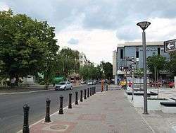 Main street, 2010 | ||
| ||
 Location of the municipality of Ćuprija within Serbia | ||
| Coordinates: 43°56′N 21°22′E / 43.933°N 21.367°ECoordinates: 43°56′N 21°22′E / 43.933°N 21.367°E | ||
| Country |
| |
| Region | Šumadija and Western Serbia | |
| District | Pomoravlje | |
| Settlements | 16 | |
| Government | ||
| • Mayor | Ninoslav Erić (SNS) | |
| Area[1] | ||
| • Municipality | 287 km2 (111 sq mi) | |
| Elevation | 124 m (407 ft) | |
| Population (2011 census)[2] | ||
| • Town | 22,302 | |
| • Municipality | 33,356 | |
| Time zone | UTC+1 (CET) | |
| • Summer (DST) | UTC+2 (CEST) | |
| Postal code |
35230 35231 | |
| Area code | +381(0)35 | |
| Car plates | ĆU | |
| Website |
www | |

Ćuprija (Serbian Cyrillic: Ћуприја, pronounced [tɕǔprija]) is a town and municipality located in the Pomoravlje District of central Serbia. The population of the town is 19,380, while the municipality has 30,020 inhabitants.
History
The Romans founded the town as a fort Horreum Margi (Horreum: Granary, Margi: Morava) on the road from Constantinople to Rome, where it crosses the river now known as Velika Morava. It served as a Roman military base, had a shield factory[3] and gained the status of municipium before 224AD. In 505, the Romans were defeated by Goths and Huns under Mundo, a descendant of Attila the Hun.[4]
Under Slavic rule, it became known as Ravno (literal translation to English would be "flat"), since it is in a flat river valley. Some local names (of the villages Paljane and Isakovo, of the river Mirosava) recall the major clash in autumn 1191 between the Serbs (under Stefan Nemanja) and the Byzantines (under Emperor Isaac II Angelos).
In the 15th century, Ćuprija became part of Ottoman Empire. After conquering this settlement, the Turks built a bridge or "köprü" in Turkish - hence the name of the town.
Shortly after the First Serbian Uprising began, in 1805 one of the first and most important battles was won by Ivankovac, near Ćuprija. Serbian uprisers under the leadership of dukes Milenko Stojković, Petar Dobrnjac, and Stevan Sinđelić defeated a Turkish army which led to further spreading of the Uprising through all of Belgrade Pashaluk. Four years after that, in 1809, Ćuprija Elementary school was founded.
During the Second Serbian Uprising, Serbian prince Miloš Obrenović made an oral agreement in Ćuprija which enabled Serbs in Belgrade Pashaluk to collect their own taxes, to participate in proceedings against Serbs and to establish a National Office composed of Serbian princes. After Turks left Ćuprija in 1834, the town started to grow economically and eventually merged with the nearby villages of Mućava, Mrčajevci, and Žirovnica. In 1853, "Dobričevo" farm was founded. This led to the establishment of the Agricultural school in 1899. In 1911, a Sugar factory called "ŠELK 911" was founded.
During the 19th century, Ćuprija was the center of Nahiyah. After 1890, it was the seat of Morvaski okrug (Morava county).
From 1929 to 1941, Ćuprija was part of the Morava Banovina of the Kingdom of Yugoslavia.
In World War Two, a special Ćuprija-Paraćin partisan troop was formed in order to fight against the German Wehrmacht. On September 26, 1941, 35 members of this troop were shot by German occupiers. The Second World War finally ended in Ćuprija on October 13, 1944, when town was liberated from the Wehrmacht during the so-called Belgrade Operation.
During the NATO bombing of Yugoslavia in 1999, the town's centre was heavily damaged. Some buildings still remain in ruins. According to 2002 Census, the population was 20,411.
Settlements
Aside from the town of Ćuprija, the municipality includes the following 16 settlements:
Demographics
| Historical population | ||
|---|---|---|
| Year | Pop. | ±% p.a. |
| 1948 | 28,806 | — |
| 1953 | 32,313 | +2.32% |
| 1961 | 34,028 | +0.65% |
| 1971 | 36,529 | +0.71% |
| 1981 | 38,841 | +0.62% |
| 1991 | 38,747 | −0.02% |
| 2002 | 33,567 | −1.30% |
| 2011 | 30,645 | −1.01% |
| Source: [5] | ||
The municipality of Ćuprija has a population of 30,645 inhabitants, according to the 2011 census results. All settlements in municipality have Serb ethnic majority except two villages, Bigrenica and Isakovo with Vlach ethnic majority.
Economy
The following table gives a preview of total number of employed people per their core activity (as of 2016):[6]
| Activity | Total |
|---|---|
| Agriculture, forestry and fishing | 58 |
| Mining | 4 |
| Processing industry | 1,388 |
| Distribution of power, gas and water | 82 |
| Distribution of water and water waste management | 203 |
| Construction | 491 |
| Wholesale and retail, repair | 1,029 |
| Traffic, storage and communication | 216 |
| Hotels and restaurants | 257 |
| Media and telecommunications | 36 |
| Finance and insurance | 81 |
| Property stock and charter | 3 |
| Professional, scientific, innovative and technical activities | 208 |
| Administrative and other services | 33 |
| Administration and social assurance | 476 |
| Education | 574 |
| Healthcare and social work | 1,331 |
| Art, leisure and recreation | 120 |
| Other services | 117 |
| Total | 6,706 |
Society and culture
Education
Elementary school "Đura Jakšić"
Elementary school "Vuk Stefanović Karadžić"
Elementary school "13. Oktobar"
High school in Ćuprija
Medical High-School
Technical School
Medical College in Ćuprija
Musical Elementary School "Dušan Skovran"
School for musically gifted children
Faculty for banking and trade, Alpha University
College of Health Studies
Sports
Sport activities in Ćuprija are developed. Thanks to many athletes and coaches (such as Vera Nikolić, Dragan Zdravković, Snežana Jolović-Pajkić, Zora Antić -Tomecić, Miroslav Pavlović, Vladan Đorđević, Dušan Košutić, Vlada Jovanović, Ljiljana Šušnjar and Aleksandar Petrović etc., )Ćuprija was well known as "the Athletics town". Beside athletic, soccer (football in Europe), basketball, handball, tennis and volleyball are extremely popular sports in Ćuprija.
Ćuprija's football club "Morava" was founded in 1918 and is currently competing in Pomoravsko-Timočka football zone. It has its own stadium with a capacity of 10,000 sport fans. In Ćuprija, there could be found a dance club for those who love to dance.
Features
Ćuprija lies on international road and railway links 150 kilometres (93 miles) south of Belgrade and 90 km (56 mi) north of Niš. The main source of income is the College of Nursing and Agriculture. Ravanica Monastery, built in 1381 by Lazar of Serbia, is 8 km (5 mi) to the east.
Climate
| Climate data for Ćuprija (1981–2010, extremes 1961–2010) | |||||||||||||
|---|---|---|---|---|---|---|---|---|---|---|---|---|---|
| Month | Jan | Feb | Mar | Apr | May | Jun | Jul | Aug | Sep | Oct | Nov | Dec | Year |
| Record high °C (°F) | 20.6 (69.1) |
23.8 (74.8) |
29.0 (84.2) |
33.0 (91.4) |
35.4 (95.7) |
40.1 (104.2) |
44.6 (112.3) |
42.7 (108.9) |
38.0 (100.4) |
32.7 (90.9) |
28.0 (82.4) |
21.4 (70.5) |
44.6 (112.3) |
| Average high °C (°F) | 4.4 (39.9) |
6.9 (44.4) |
12.5 (54.5) |
18.3 (64.9) |
23.6 (74.5) |
26.7 (80.1) |
29.2 (84.6) |
29.5 (85.1) |
24.4 (75.9) |
18.4 (65.1) |
11.1 (52) |
5.5 (41.9) |
17.5 (63.5) |
| Daily mean °C (°F) | 0.2 (32.4) |
1.6 (34.9) |
6.1 (43) |
11.5 (52.7) |
16.7 (62.1) |
19.7 (67.5) |
21.5 (70.7) |
21.3 (70.3) |
16.5 (61.7) |
11.4 (52.5) |
5.8 (42.4) |
1.5 (34.7) |
11.1 (52) |
| Average low °C (°F) | −3.3 (26.1) |
−2.8 (27) |
0.7 (33.3) |
5.1 (41.2) |
9.7 (49.5) |
12.6 (54.7) |
14.1 (57.4) |
13.9 (57) |
10.2 (50.4) |
6.1 (43) |
1.7 (35.1) |
−1.9 (28.6) |
5.5 (41.9) |
| Record low °C (°F) | −27.1 (−16.8) |
−25.8 (−14.4) |
−17.3 (0.9) |
−8.1 (17.4) |
−3.2 (26.2) |
1.0 (33.8) |
4.1 (39.4) |
3.6 (38.5) |
−3.3 (26.1) |
−8.0 (17.6) |
−18.6 (−1.5) |
−20.8 (−5.4) |
−27.1 (−16.8) |
| Average precipitation mm (inches) | 46.1 (1.815) |
45.4 (1.787) |
45.1 (1.776) |
60.6 (2.386) |
64.1 (2.524) |
80.2 (3.157) |
57.0 (2.244) |
46.6 (1.835) |
52.2 (2.055) |
50.6 (1.992) |
53.8 (2.118) |
56.5 (2.224) |
658.2 (25.913) |
| Average precipitation days (≥ 0.1 mm) | 15 | 13 | 12 | 14 | 13 | 12 | 10 | 8 | 10 | 10 | 12 | 16 | 146 |
| Average snowy days | 9 | 8 | 4 | 1 | 0 | 0 | 0 | 0 | 0 | 0 | 3 | 8 | 33 |
| Average relative humidity (%) | 82 | 77 | 71 | 68 | 69 | 70 | 68 | 67 | 73 | 77 | 79 | 83 | 74 |
| Mean monthly sunshine hours | 68.9 | 94.0 | 146.6 | 180.8 | 235.7 | 261.0 | 297.1 | 282.9 | 205.5 | 154.6 | 92.8 | 58.2 | 2,078.1 |
| Source: Republic Hydrometeorological Service of Serbia[7] | |||||||||||||
International relations
Twin towns — Sister cities
Ćuprija is twinned with:
Notable people
- Dušan Matić, poet
- Dragoslav Mihailović, writer
- Snežana Pajkić, middle distance runner
- Vera Nikolić, athlete and coach
See also
References
- ↑ "Municipalities of Serbia, 2006". Statistical Office of Serbia. Retrieved 2010-11-28.
- ↑ "2011 Census of Population, Households and Dwellings in the Republic of Serbia: Comparative Overview of the Number of Population in 1948, 1953, 1961, 1971, 1981, 1991, 2002 and 2011, Data by settlements" (PDF). Statistical Office of Republic Of Serbia, Belgrade. 2014. ISBN 978-86-6161-109-4. Retrieved 2014-06-27.
- ↑ The later Roman Empire, 284-602: a social economic and administrative survey -Arnold Hugh Martin Jones
- ↑ Dictionary of Battles and Sieges: F-O by Tony Jaques
- ↑ "2011 Census of Population, Households and Dwellings in the Republic of Serbia" (PDF). stat.gov.rs. Statistical Office of the Republic of Serbia. Retrieved 11 January 2017.
- ↑ "ОПШТИНЕ И РЕГИОНИ У РЕПУБЛИЦИ СРБИЈИ, 2017" (PDF). stat.gov.rs (in Serbian). Statistical Office of the Republic of Serbia. Retrieved 20 February 2018.
- ↑ "Monthly and annual means, maximum and minimum values of meteorological elements for the period 1981 - 2010" (in Serbian). Republic Hydrometeorological Service of Serbia. Retrieved February 25, 2017.
External links
| Wikimedia Commons has media related to Ćuprija. |


