Bosilegrad
| Босилеград Bosilegrad | |||
|---|---|---|---|
| Town and municipality | |||
| |||
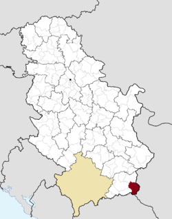 Location of the municipality of Bosilegrad within Serbia | |||
| Coordinates: 42°30′N 22°28′E / 42.500°N 22.467°ECoordinates: 42°30′N 22°28′E / 42.500°N 22.467°E | |||
| Country |
| ||
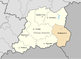
| Region | Southern and Eastern Serbia | ||
| District | Pčinja | ||
| Settlements | 37 | ||
| Government | |||
| • Mayor | Vladimir Zaharijev (DSS) | ||
| Area[1] | |||
| • Town | 18.37 km2 (7.09 sq mi) | ||
| • Municipality | 571 km2 (220 sq mi) | ||
| Elevation | 696 m (2,283 ft) | ||
| Population (2011 census)[2] | |||
| • Town | 2,624 | ||
| • Town density | 140/km2 (370/sq mi) | ||
| • Municipality | 8,129 | ||
| • Municipality density | 14/km2 (37/sq mi) | ||
| Time zone | UTC+1 (CET) | ||
| • Summer (DST) | UTC+2 (CEST) | ||
| Postal code | 17540 | ||
| Area code | +381(0)17 | ||
| Car plates | VR | ||
| Website |
www | ||
Bosilegrad (Serbian Cyrillic: Босилеград) is a town and municipality located in the Pčinja District of southern Serbia. The municipality comprises an area of 571 km2 (220 sq mi). According to 2011 census, town has a population of 2,624 inhabitants, while the municipality has 8,129 inhabitants.
History
.jpg)
Historically a Bulgarian land, The Kingdom of Serbs, Croats and Slovenes gained some territory from Bulgaria as part of the Treaty of Neuilly-sur-Seine, following the invasion and occupation of part of the Kingdom of Serbia by Bulgaria and subsequent Allied defeat of the Central Powers in the First World War. From 1929 to 1941, it was part of Vardar Banovina. The Bulgarian army occupied Bosilegrad during the Second World War from 1941 to 1944. At the end of the Second World War, Yugoslavia liberated the area from the Bulgarians.
Settlements
Aside from the town of Bosilegrad, the municipality is consisted of the following villages:
Demographics
| Historical population | ||
|---|---|---|
| Year | Pop. | ±% p.a. |
| 1948 | 18,816 | — |
| 1953 | 19,751 | +0.97% |
| 1961 | 18,368 | −0.90% |
| 1971 | 17,306 | −0.59% |
| 1981 | 14,196 | −1.96% |
| 1991 | 11,644 | −1.96% |
| 2002 | 9,931 | −1.44% |
| 2011 | 8,129 | −2.20% |
| Source: [3] | ||
According to the 2011 census, the municipality of Bosilegrad has a population of 8,129 inhabitants. Only 32.28% of inhabitants live in urban areas.
Ethnic groups
The majority of municipality's population are Bulgarians, amounting to over 70% of total population. Other minor ethnic groups are Serbs and Roma people. The ethnic composition of the municipality:
| Ethnic group | Population 1961[4] |
Population 1971[5] |
Population 1981[6] |
Population 1991[7] |
Population 2002[8] |
Population 2011[9] |
|---|---|---|---|---|---|---|
| Bulgarians | - | - | - | - | 7,037 | 5,839 |
| Serbs | 291 | 292 | 616 | 1,165 | 1,308 | 895 |
| Macedonians | 40 | 58 | 49 | - | 42 | 38 |
| Montenegrins | 10 | 13 | 6 | 6 | 3 | 2 |
| Romani | 1 | 13 | 10 | 3 | - | 162 |
| Muslims | - | 1 | 1 | 10 | - | - |
| Yugoslavs | 2 | 255 | 3,976 | 1,649 | 288 | 20 |
| Others | 18,024 | 16,675 | 9,538 | 8,811 | 1,253 | 1,173 |
| Total | 18,368 | 17,306 | 14,196 | 11,644 | 9,931 | 8,129 |
Gallery
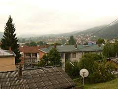 Town of Bosilegrad
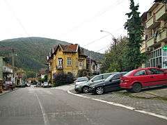 Bosilegrad town street
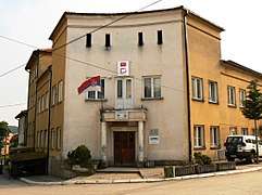 Bosilegrad town hall
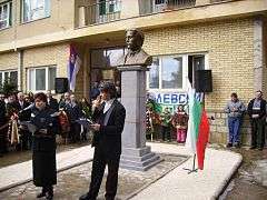 Unveiling of the monument of Bulgarian revolutionary Vasil Levski
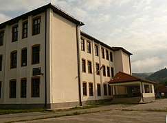 School in Bosilegrad
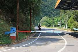 Serbia–Bulgaria State border
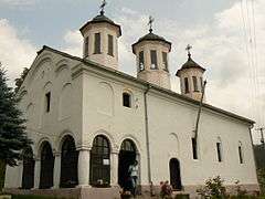 Bosilegrad Church
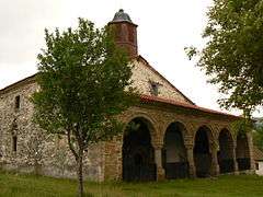 Church in Izvor, Bosilegrad
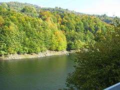 Lisinsko Lake in Bosilegrad
References
- ↑ "Municipalities of Serbia, 2006". Statistical Office of Serbia. Retrieved 2010-11-28.
- ↑ "2011 Census of Population, Households and Dwellings in the Republic of Serbia: Comparative Overview of the Number of Population in 1948, 1953, 1961, 1971, 1981, 1991, 2002 and 2011, Data by settlements" (PDF). Statistical Office of Republic Of Serbia, Belgrade. 2014. ISBN 978-86-6161-109-4. Retrieved 2014-06-27.
- ↑ "2011 Census of Population, Households and Dwellings in the Republic of Serbia" (PDF). stat.gov.rs. Statistical Office of the Republic of Serbia. Archived from the original (PDF) on 14 July 2014. Retrieved 11 January 2017.
- ↑ "Knjiga III: Nacionalni sastav stanovništva FNR Jugoslavije (1961)" (PDF). stat.gov.rs (in Serbian). Republički zavod za statistiku. Archived from the original (PDF) on 20 December 2013. Retrieved 2 June 2015.
- ↑ "Knjiga III: Nacionalni sastav stanovništva FNR Jugoslavije (1971)" (PDF). stat.gov.rs (in Serbian). Republički zavod za statistiku. Archived from the original (PDF) on 4 March 2016. Retrieved 2 June 2015.
- ↑ "Nacionalni sastav stanovništva SFR Jugoslavije (1981)" (PDF). stat.gov.rs. Republički zavod za statistiku. Archived from the original (PDF) on 4 March 2016. Retrieved 2 June 2015.
- ↑ "STANOVNIŠTVO PREMA NACIONALNOJ PRIPADNOSTI (1991)" (PDF). stat.gov.rs. Republički zavod za statistiku. Archived from the original (PDF) on 4 March 2016. Retrieved 2 June 2015.
- ↑ "Popis stanovnistva, domacinstava i stanova u 2002" (PDF). stat.gov.rs (in Serbian). Archived from the original (PDF) on 14 October 2013. Retrieved 3 March 2015.
- ↑ "Попис становништва, домаћинстава и станова 2011. у Републици Србији" (PDF). stat.gov.rs. Republički zavod za statistiku. Archived from the original (PDF) on 11 August 2014. Retrieved 2 June 2015.
External links
| Wikimedia Commons has media related to Bosilegrad. |
