Pantelej
| Pantelej Пантелеј | ||
|---|---|---|
| City municipality | ||
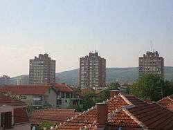 Panorama of some of Pantelej's neighborhoods | ||
| ||
| Country |
| |
| Region | Southern and Eastern Serbia | |
| District | Nišava | |
| City | Niš | |
| Settlements | 16 | |
| Government | ||
| • Mayor | Srđan Savić | |
| Area[1] | ||
| • Municipality | 140.97 km2 (54.43 sq mi) | |
| Population (2011 census)[2] | ||
| • Urban | 62,837 | |
| • Municipality | 73,290 | |
| Time zone | UTC+1 (CET) | |
| • Summer (DST) | UTC+2 (CEST) | |
| Postal code | 18000 | |
| Area code | +381(0)18 | |
| Car plates | NI | |
| Website | www.pantelej.org.rs | |

Pantelej (Serbian Cyrillic: Пантелеј) is one of five city municipalities which constitute the city of Niš. The municipality has a population of 79,290 inhabitants, according to the 2011 census results.
Geography
The municipality borders Crveni Krst municipality in the west, Svrljig municipality in the north, Niška Banja municipality in the south-east, and Medijana municipality in the south.
Settlements
Neighborhoods
Neighborhoods of municipality of Pantelej include:
- Pantelej
- Jagodin Mala (partly)
- Durlan
- Vrežina
- Čalije
- Somborska
- Durlan 2
- Durlan 3
Suburbs
References
- ↑ "Municipalities of Serbia, 2006". Statistical Office of Serbia. Retrieved 2010-11-28.
- ↑ "2011 Census of Population, Households and Dwellings in the Republic of Serbia: Comparative Overview of the Number of Population in 1948, 1953, 1961, 1971, 1981, 1991, 2002 and 2011, Data by settlements" (PDF). Statistical Office of Republic Of Serbia, Belgrade. 2014. ISBN 978-86-6161-109-4. Retrieved 2014-06-27.
See also
External links
| Wikimedia Commons has media related to Pantelej, Niš. |

Coordinates: 43°20′13″N 21°54′47″E / 43.33694°N 21.91306°E
This article is issued from
Wikipedia.
The text is licensed under Creative Commons - Attribution - Sharealike.
Additional terms may apply for the media files.