Raška, Serbia
| Raška Рашка | ||
|---|---|---|
| Town and municipality | ||
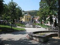 Town center square | ||
| ||
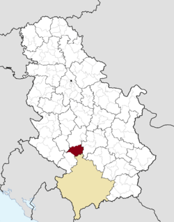 Location of the municipality of Raška within Serbia | ||
| Country |
| |
| Region | Šumadija and Western Serbia | |
| District | Raška | |
| Settlements | 61 | |
| Government | ||
| • Mayor | Ignjat Rakitić (SNS) | |
| Area[1] | ||
| • Town | 3.90 km2 (1.51 sq mi) | |
| • Municipality | 670 km2 (260 sq mi) | |
| Elevation | 497 m (1,631 ft) | |
| Population (2011 census)[2] | ||
| • Town | 6,574 | |
| • Town density | 1,700/km2 (4,400/sq mi) | |
| • Municipality | 24,680 | |
| • Municipality density | 37/km2 (95/sq mi) | |
| Time zone | UTC+1 (CET) | |
| • Summer (DST) | UTC+2 (CEST) | |
| Postal code | 36350 | |
| Area code | +381(0)36 | |
| Car plates | RA | |
| Website |
www | |

Raška (Serbian Cyrillic: Рашка, pronounced [râʃkaː]) is a town and municipality located in the Raška District of southwestern Serbia. The municipality has a population of 24,680 people, while the town has a population of 6,574 people (2011 census). It covers an area of 670 km². The town is situated on the rivers Raška and Ibar.
History
The town and municipality bears the name of the historical Raška region. From 1929 to 1941, Raška was part of the Zeta Banovina of the Kingdom of Yugoslavia.
In December 2013 whilst excavating the village of Rudnica in Raška, EULEX found the remains of Kosovo-Albanians from the Kosovo War; there are believed to be up to 250 Kosovo Albanians buried in Rudnica.[3]
Demographics
| Historical population | ||
|---|---|---|
| Year | Pop. | ±% p.a. |
| 1948 | 25,837 | — |
| 1953 | 28,008 | +1.63% |
| 1961 | 29,856 | +0.80% |
| 1971 | 29,367 | −0.17% |
| 1981 | 29,475 | +0.04% |
| 1991 | 28,747 | −0.25% |
| 2002 | 26,981 | −0.57% |
| 2011 | 24,678 | −0.99% |
| Source: [4] | ||
According to the 2011 census results, the municipality of Raška has 24,678 inhabitants.
Ethnic groups
Ethnic composition of the municipality:[5]
| Ethnic group | Population |
|---|---|
| Serbs | 24,135 |
| Romani | 202 |
| Montenegrins | 45 |
| Macedonians | 21 |
| Albanians | 12 |
| Gorani | 12 |
| Others | 251 |
| Total | 24,678 |
Economy
The following table gives a preview of total number of employed people per their core activity (as of 2016):[6]
| Activity | Total |
|---|---|
| Agriculture, forestry and fishing | 88 |
| Mining | 621 |
| Processing industry | 836 |
| Distribution of power, gas and water | 92 |
| Distribution of water and water waste management | 148 |
| Construction | 183 |
| Wholesale and retail, repair | 707 |
| Traffic, storage and communication | 363 |
| Hotels and restaurants | 704 |
| Media and telecommunications | 68 |
| Finance and insurance | 39 |
| Property stock and charter | 11 |
| Professional, scientific, innovative and technical activities | 83 |
| Administrative and other services | 72 |
| Administration and social assurance | 472 |
| Education | 425 |
| Healthcare and social work | 210 |
| Art, leisure and recreation | 207 |
| Other services | 123 |
| Total | 5,451 |
Gallery
 Town center square
 Town center square
.jpg) Train station in Raška
Train station in Raška Church of St. Archangel
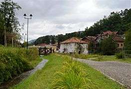 Park in Jošanička Banja
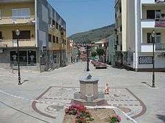
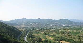 Baljevac na Ibru town panorama
 Brvenik village panorama
 Brvenik village panorama
Notable people
- Miša Aleksić-Marinko, Chetnik voivode from 1905 to 1918
- Savatije Milošević, Serbian hajduk and Chetnik commander, born in Pavlica
- Serbian Patriarch German
- Goran Bogdanović, Serbian politician
- Đorđe Jokić, Serbian footballer
- Milenković family (Svetozar Milenković (1907-1983), Vida Milenković (1912-1992), and Aleksandar Petrović), Righteous Among the Nations
- Zoran Pešić, Serbian footballer
- Mihailo Petrović (1871-1941), Chetnik
- Lazar Popović, Serbian footballer
- Marko Sočanac, Serbian footballer
See also
References
- ↑ "Municipalities of Serbia, 2006". Statistical Office of Serbia. Retrieved 2010-11-28.
- ↑ "2011 Census of Population, Households and Dwellings in the Republic of Serbia: Comparative Overview of the Number of Population in 1948, 1953, 1961, 1971, 1981, 1991, 2002 and 2011, Data by settlements" (PDF). Statistical Office of Republic Of Serbia, Belgrade. 2014. ISBN 978-86-6161-109-4. Retrieved 2014-06-27.
- ↑ "EULEX: Human remains found in Rudnica". B92. 13 December 2013. Retrieved 15 December 2013.
- ↑ "2011 Census of Population, Households and Dwellings in the Republic of Serbia" (PDF). stat.gov.rs. Statistical Office of the Republic of Serbia. Retrieved 11 January 2017.
- ↑ "Попис становништва, домаћинстава и станова 2011. у Републици Србији" (PDF). stat.gov.rs. Republički zavod za statistiku. Retrieved 14 January 2017.
- ↑ "ОПШТИНЕ И РЕГИОНИ У РЕПУБЛИЦИ СРБИЈИ, 2017" (PDF). stat.gov.rs (in Serbian). Statistical Office of the Republic of Serbia. Retrieved 20 February 2018.
External links
| Wikimedia Commons has media related to Raška. |


Coordinates: 43°17′31″N 20°36′56″E / 43.29194°N 20.61556°E