Table
The table below describes the 54 United States statistical areas and 88 counties of the State of Ohio with the following information:[5]
- The combined statistical area (CSA) as designated by the OMB.[4]
- The CSA population as of April 1, 2010, as enumerated by the 2010 United States Census.[6]
- Where the CSA includes counties from more than one state, the population of the portion of the CSA in Ohio.
- The core based statistical area (CBSA)[7] as designated by the OMB.[4]
- The CBSA population as of April 1, 2010, as enumerated by the 2010 United States Census.[6]
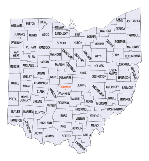
- The county name.[6]
- The county population as of April 1, 2010, as enumerated by the 2010 United States Census.[6]
The 54 United States statistical areas and 88 counties of the State of Ohio
| Combined Statistical Area |
2010 Census |
Core Based Statistical Area |
2010 Census |
County |
2010 Census |
| Cleveland–Akron–Canton, OH CSA |
3,515,646 |
Cleveland–Elyria, OH MSA |
2,077,240 |
Cuyahoga County, Ohio |
1,280,122 |
| Lorain County, Ohio |
301,356 |
| Lake County, Ohio |
232,892 |
| Medina County, Ohio |
172,332 |
| Geauga County, Ohio |
95,676 |
| Akron, OH MSA |
703,200 |
Summit County, Ohio |
541,781 |
| Portage County, Ohio |
161,419 |
| Canton–Massillon, OH MSA |
404,422 |
Stark County, Ohio |
378,664 |
| Carroll County, Ohio |
28,836 |
| Ashtabula, OH μSA |
100,767 |
Ashtabula County, Ohio |
100,767 |
| New Philadelphia-Dover, OH μSA |
91,766 |
Tuscarawas County, Ohio |
91,766 |
| Norwalk, OH μSA |
60,313 |
Huron County, Ohio |
60,313 |
| Sandusky, OH μSA |
78,116 |
Erie County, Ohio |
78,116 |
| Columbus–Marion–Chillicothe, OH CSA |
2,308,509 |
Columbus, OH MSA |
1,836,536 |
Franklin County, Ohio |
1,163,414 |
| Delaware County, Ohio |
165,026 |
| Licking County, Ohio |
156,287 |
| Fairfield County, Ohio |
141,318 |
| Pickaway County, Ohio |
53,606 |
| Union County, Ohio |
46,702 |
| Madison County, Ohio |
41,496 |
| Morrow County, Ohio |
34,520 |
| Bellefontaine, OH μSA |
46,189 |
Logan County, Ohio |
46,189 |
| Cambridge, OH μSA |
40,876 |
Guernsey County, Ohio |
40,876 |
| Chillicothe, OH μSA |
75,972 |
Ross County, Ohio |
75,972 |
| Marion, OH μSA |
65,655 |
Marion County, Ohio |
65,655 |
| Mount Vernon, OH μSA |
59,637 |
Knox County, Ohio |
59,637 |
| Washington Court House, OH μSA |
28,117 |
Fayette County, Ohio |
28,117 |
| Zanesville, OH μSA |
86,125 |
Muskingum County, Ohio |
86,125 |
| Cincinnati–Wilmington–Maysville, OH–KY–IN CSA |
2,174,110
1,667,023 |
Cincinnati, OH-KY-IN MSA |
2,114,580
1,624,983 |
Hamilton County, Ohio |
802,374 |
| Butler County, Ohio |
368,130 |
| Warren County, Ohio |
212,693 |
| Clermont County, Ohio |
197,363 |
| Kenton County, Kentucky |
159,720 |
| Boone County, Kentucky |
118,811 |
| Campbell County, Kentucky |
90,336 |
| Dearborn County, Indiana |
50,047 |
| Brown County, Ohio |
44,423 |
| Grant County, Kentucky |
24,769 |
| Franklin County, Indiana |
23,087 |
| Pendleton County, Kentucky |
15,334 |
| Bracken County, Kentucky |
8,488 |
| Gallatin County, Kentucky |
8,153 |
| Ohio County, Indiana |
6,128 |
| Wilmington, OH μSA |
42,040 |
Clinton County, Ohio |
42,040 |
| Maysville, KY μSA |
17,490 |
Mason County, Kentucky |
17,490 |
| Dayton–Springfield–Sidney, OH CSA |
1,115,246 |
Dayton, OH MSA |
841,502 |
Montgomery County, Ohio |
535,153 |
| Greene County, Ohio |
161,573 |
| Miami County, Ohio |
102,506 |
| Preble County, Ohio |
42,270 |
| Springfield, OH MSA |
133,333 |
Clark County, Ohio |
133,333 |
| Greenville, OH μSA |
51,814 |
Darke County, Ohio |
51,814 |
| Sidney, OH μSA |
48,884 |
Shelby County, Ohio |
48,884 |
| Urbana, OH μSA |
39,713 |
Champaign County, Ohio |
39,713 |
| Toledo–Port Clinton, OH CSA |
651,429 |
Toledo, OH MSA |
610,001 |
Lucas County, Ohio |
441,815 |
| Wood County, Ohio |
125,399 |
| Fulton County, Ohio |
42,562 |
| Port Clinton, OH μSA |
41,428 |
Ottawa County, Ohio |
41,428 |
| Youngstown–Warren, OH–PA CSA |
673,614
556,976 |
Youngstown–Warren–Boardman, OH–PA MSA |
565,773
449,135 |
Mahoning County, Ohio |
240,420 |
| Trumbull County, Ohio |
213,475 |
| Mercer County, Pennsylvania |
116,638 |
| Salem, OH μSA |
107,841 |
Columbiana County, Ohio |
107,841 |
| Lima–Van Wert–Celina, OH CSA |
221,838 |
Lima, OH MSA |
106,331 |
Allen County, Ohio |
106,331 |
| Celina, OH μSA |
41,303 |
Mercer County, Ohio |
41,303 |
| Van Wert, OH μSA |
28,496 |
Van Wert County, Ohio |
28,496 |
| Wapakoneta, OH μSA |
46,699 |
Auglaize County, Ohio |
46,699 |
| Mansfield–Ashland–Bucyrus, OH CSA |
221,398 |
Mansfield, OH MSA |
124,475 |
Richland County, Ohio |
124,475 |
| Ashland, OH μSA |
54,727 |
Ashland County, Ohio |
54,727 |
| Bucyrus, OH μSA |
43,403 |
Crawford County, Ohio |
43,403 |
| Findlay–Tiffin, OH CSA |
131,527 |
Findlay, OH μSA |
74,538 |
Hancock County, Ohio |
74,538 |
| Tiffin, OH μSA |
56,152 |
Seneca County, Ohio |
56,152 |
| Pittsburgh PA-OH-WV CSA |
2,660,840
70,125 |
Weirton-Steubenville, WV-OH MSA |
125,168
70,125 |
Jefferson County, Ohio |
70,125 |
| Hancock County, West Virginia |
30,911 |
| Brooke County, West Virginia |
24,132 |
| none |
Wooster, OH μSA |
113,950 |
Wayne County, Ohio |
113,950 |
| Portsmouth, OH μSA |
76,441 |
Scioto County, Ohio |
76,441 |
| Wheeling, WV-OH MSA |
147,329
68,771 |
Belmont County, Ohio |
68,771 |
| Ohio County, West Virginia |
44,662 |
| Marshall County, West Virginia |
33,896 |
| Huntington-Ashland, WV-KY-OH MSA |
285,475
63,179 |
Cabell County, West Virginia |
93,904 |
| Lawrence County, Ohio |
63,179 |
| Boyd County, Kentucky |
49,371 |
| Wayne County, West Virginia |
41,647 |
| Greenup County, Kentucky |
37,374 |
| Parkersburg-Marietta-Vienna, WV-OH MSA |
161,724
61,867 |
Wood County, West Virginia |
86,597 |
| Washington County, Ohio |
61,867 |
| Pleasants County, West Virginia |
7,280 |
| Wirt County, West Virginia |
5,980 |
| Athens, OH μSA |
61,860 |
Athens County, Ohio |
61,860 |
| Fremont, OH μSA |
60,944 |
Sandusky County, Ohio |
60,944 |
| Sidney, OH μSA |
48,884 |
Shelby County, Ohio |
48,884 |
| Defiance, OH μSA |
39,091 |
Defiance County, Ohio |
39,091 |
| Coshocton, OH μSA |
36,976 |
Coshocton County, Ohio |
36,976 |
| Point Pleasant, WV-OH μSA |
57,069
31,313 |
Gallia County, Ohio |
31,313 |
| Mason County, West Virginia |
25,756 |
| none |
Highland County, Ohio |
42,833 |
| Holmes County, Ohio |
41,574 |
| Williams County, Ohio |
38,719 |
| Perry County, Ohio |
35,313 |
| Putnam County, Ohio |
34,744 |
| Jackson County, Ohio |
33,543 |
| Hardin County, Ohio |
31,966 |
| Henry County, Ohio |
29,520 |
| Hocking County, Ohio |
28,973 |
| Adams County, Ohio |
28,516 |
| Pike County, Ohio |
28,269 |
| Meigs County, Ohio |
23,092 |
| Wyandot County, Ohio |
22,553 |
| Paulding County, Ohio |
19,432 |
| Harrison County, Ohio |
15,799 |
| Morgan County, Ohio |
14,821 |
| Monroe County, Ohio |
14,606 |
| Noble County, Ohio |
14,165 |
| Vinton County, Ohio |
13,519 |
| State of Ohio |
11,536,504 |
References
- ↑ The United States Office of Management and Budget (OMB) defines a metropolitan statistical area (MSA) as a core based statistical area having at least one urbanized area of 50,000 or more population, plus adjacent territory that has a high degree of social and economic integration with the core as measured by commuting ties.
- ↑ The United States Office of Management and Budget (OMB) defines a micropolitan statistical area (μSA) as a core based statistical area having at least one urban cluster of at least 10,000 but less than 50,000 population, plus adjacent territory that has a high degree of social and economic integration with the core as measured by commuting ties.
- ↑ The United States Office of Management and Budget (OMB) defines a combined statistical area (CSA) as an aggregate of adjacent core based statistical areas that are linked by commuting ties.
- 1 2 3 "OMB Bulletin No. 13-01" (PDF). United States Office of Management and Budget. February 28, 2013. Retrieved May 23, 2014.
See also: Combined Statistical Areas of the United States and Puerto Rico, February 2013
- ↑ An out-of-state area and its population are displayed in green. An area that extends into more than one state is displayed in teal. A teal population number over a black population number show the total population versus the in-state population.
- 1 2 3 4 "American Factfinder". United States Census Bureau. Archived from the original on August 15, 2014. Retrieved May 23, 2014.
- ↑ The United States Office of Management and Budget (OMB) defines a core based statistical area as one or more adjacent counties or county-equivalents having at least one urban cluster of at least 10,000 population, plus adjacent territory that has a high degree of social and economic integration with the core as measured by commuting ties. The core based statistical areas comprise the metropolitan statistical areas and the micropolitan statistical areas.