Noble County, Ohio
| Noble County, Ohio | |||
|---|---|---|---|
| County | |||
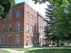 The Noble County Courthouse in Caldwell in 2007 | |||
| |||
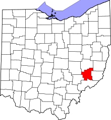 Location in the U.S. state of Ohio | |||
 Ohio's location in the U.S. | |||
| Founded | April 1, 1851[1] | ||
| Named for | either James Noble or Warren P. Noble | ||
| Seat | Caldwell | ||
| Largest village | Caldwell | ||
| Area | |||
| • Total | 405 sq mi (1,049 km2) | ||
| • Land | 398 sq mi (1,031 km2) | ||
| • Water | 6.6 sq mi (17 km2), 1.6% | ||
| Population | |||
| • (2010) | 14,645 | ||
| • Density | 37/sq mi (14/km2) | ||
| Congressional district | 6th | ||
| Time zone | Eastern: UTC−5/−4 | ||


Noble County is a county located in the U.S. state of Ohio. As of the 2010 census, the population was 14,645,[2] making it the third-least populous county in Ohio. Its county seat is Caldwell.[3] The county is named for Rep. Warren P. Noble of the Ohio House of Representatives, who was an early settler there.[4]
History
Noble County was formed on March 11, 1851 from portions of Guernsey, Morgan, Monroe and Washington counties.[5] It was the last and youngest county to be formed in the state.[6][7] It was named for either James Noble or Warren P. Noble, each of whom was an early settler in this region.[8]
Noble County was home to the first North American oil well, the Thorla-McKee Well, which struck oil in 1814.[9] For a time this was a center of oil production in the state.
In 1925, a United States Navy dirigible, USS Shenandoah (ZR-1), was caught in a storm over Noble County. It broke into several pieces, resulting in the deaths of 14 persons on board; 29 survived.
Geography
According to the U.S. Census Bureau, the county has a total area of 405 square miles (1,050 km2), of which 398 square miles (1,030 km2) is land and 6.6 square miles (17 km2) (1.6%) is water.[10]
Adjacent counties
- Guernsey County (north)
- Belmont County (northeast)
- Monroe County (east)
- Washington County (south)
- Morgan County (west)
- Muskingum County (northwest)
National protected area
- Wayne National Forest (part)
Demographics
| Historical population | |||
|---|---|---|---|
| Census | Pop. | %± | |
| 1860 | 20,751 | — | |
| 1870 | 19,949 | −3.9% | |
| 1880 | 21,138 | 6.0% | |
| 1890 | 20,753 | −1.8% | |
| 1900 | 19,466 | −6.2% | |
| 1910 | 18,601 | −4.4% | |
| 1920 | 17,849 | −4.0% | |
| 1930 | 14,961 | −16.2% | |
| 1940 | 14,587 | −2.5% | |
| 1950 | 11,750 | −19.4% | |
| 1960 | 10,982 | −6.5% | |
| 1970 | 10,428 | −5.0% | |
| 1980 | 11,310 | 8.5% | |
| 1990 | 11,336 | 0.2% | |
| 2000 | 14,058 | 24.0% | |
| 2010 | 14,645 | 4.2% | |
| Est. 2017 | 14,406 | [11] | −1.6% |
| U.S. Decennial Census[12] 1790-1960[13] 1900-1990[14] 1990-2000[15] 2010-2017[2] | |||
2000 census
As of the census[16] of 2000, there were 14,058 people, 4,546 households, and 3,318 families residing in the county. The population density was 35 people per square mile (14/km²). There were 5,480 housing units at an average density of 14 per square mile (5/km²). The racial makeup of the county was 92.55% White, 6.69% Black or African American, 0.26% Native American, 0.09% Asian, 0.03% from other races, and 0.38% from two or more races. 0.43% of the population were Hispanic or Latino of any race.
There were 4,546 households out of which 33.50% had children under the age of 18 living with them, 61.50% were married couples living together, 7.70% had a female householder with no husband present, and 27.00% were non-families. 24.30% of all households were made up of individuals and 12.60% had someone living alone who was 65 years of age or older. The average household size was 2.61 and the average family size was 3.10.
In the county, the population was spread out with 22.60% under the age of 18, 11.70% from 18 to 24, 31.80% from 25 to 44, 20.80% from 45 to 64, and 13.10% who were 65 years of age or older. The median age was 36 years. For every 100 females there were 130.80 males. For every 100 females age 18 and over, there were 140.50 males.
The median income for a household in the county was $32,940, and the median income for a family was $38,939. Males had a median income of $30,911 versus $20,222 for females. The per capita income for the county was $14,100. About 8.30% of families and 11.40% of the population were below the poverty line, including 13.90% of those under age 18 and 11.90% of those age 65 or over.
2010 census
As of the 2010 United States Census, there were 14,645 people, 4,852 households, and 3,394 families residing in the county.[17] The population density was 36.8 inhabitants per square mile (14.2/km2). There were 6,053 housing units at an average density of 15.2 per square mile (5.9/km2).[18] The racial makeup of the county was 96.1% white, 2.5% black or African American, 0.3% American Indian, 0.1% Asian, 0.2% from other races, and 0.8% from two or more races. Those of Hispanic or Latino origin made up 0.4% of the population.[17] In terms of ancestry, 25.9% were German, 13.1% were Irish, 9.1% were American, and 9.0% were English.[19]
Of the 4,852 households, 30.4% had children under the age of 18 living with them, 55.8% were married couples living together, 8.6% had a female householder with no husband present, 30.0% were non-families, and 25.7% of all households were made up of individuals. The average household size was 2.47 and the average family size was 2.94. The median age was 48.6 years.[17]
The median income for a household in the county was $39,500 and the median income for a family was $44,773. Males had a median income of $42,456 versus $29,551 for females. The per capita income for the county was $20,029. About 11.6% of families and 14.9% of the population were below the poverty line, including 22.9% of those under age 18 and 13.8% of those age 65 or over.[20]
Politics
| Year | Republican | Democratic | Third parties |
|---|---|---|---|
| 2016 | 75.3% 4,549 | 20.2% 1,221 | 4.5% 269 |
| 2012 | 60.5% 3,563 | 36.2% 2,131 | 3.3% 197 |
| 2008 | 55.8% 3,450 | 40.0% 2,474 | 4.3% 264 |
| 2004 | 58.7% 3,841 | 40.6% 2,654 | 0.7% 45 |
| 2000 | 57.4% 3,435 | 38.3% 2,296 | 4.3% 257 |
| 1996 | 39.6% 2,183 | 42.9% 2,366 | 17.5% 965 |
| 1992 | 37.8% 2,223 | 37.4% 2,201 | 24.8% 1,459 |
| 1988 | 59.4% 3,155 | 39.2% 2,079 | 1.4% 74 |
| 1984 | 67.7% 3,853 | 31.2% 1,777 | 1.1% 61 |
| 1980 | 57.4% 3,025 | 36.9% 1,944 | 5.8% 303 |
| 1976 | 52.5% 3,007 | 45.6% 2,612 | 1.9% 111 |
| 1972 | 68.2% 3,274 | 30.2% 1,449 | 1.6% 76 |
| 1968 | 53.1% 2,615 | 35.0% 1,726 | 11.9% 587 |
| 1964 | 43.5% 2,250 | 56.5% 2,925 | |
| 1960 | 66.0% 3,951 | 34.0% 2,036 | |
| 1956 | 66.5% 3,861 | 33.5% 1,943 | |
| 1952 | 66.3% 4,046 | 33.7% 2,054 | |
| 1948 | 58.8% 3,494 | 40.8% 2,425 | 0.4% 24 |
| 1944 | 64.9% 4,130 | 35.1% 2,235 | |
| 1940 | 61.8% 4,922 | 38.2% 3,037 | |
| 1936 | 52.7% 4,384 | 46.5% 3,865 | 0.8% 70 |
| 1932 | 49.3% 3,950 | 49.5% 3,966 | 1.3% 104 |
| 1928 | 66.5% 4,462 | 32.6% 2,190 | 0.9% 63 |
| 1924 | 60.8% 4,284 | 35.3% 2,485 | 4.0% 279 |
| 1920 | 59.1% 4,197 | 40.9% 2,909 | |
| 1916 | 50.3% 2,290 | 47.8% 2,175 | 1.9% 85 |
| 1912 | 40.1% 1,804 | 40.9% 1,842 | 19.1% 858 |
| 1908 | 54.3% 2,707 | 43.2% 2,154 | 2.6% 127 |
| 1904 | 58.9% 2,700 | 36.5% 1,671 | 4.7% 213 |
| 1900 | 54.5% 2,704 | 43.8% 2,173 | 1.6% 80 |
| 1896 | 51.9% 2,559 | 47.0% 2,318 | 1.2% 57 |
| 1892 | 50.7% 2,307 | 44.5% 2,026 | 4.8% 218 |
| 1888 | 53.2% 2,515 | 44.1% 2,087 | 2.7% 127 |
| 1884 | 52.3% 2,385 | 45.2% 2,061 | 2.6% 117 |
| 1880 | 50.6% 2,316 | 44.6% 2,044 | 4.9% 222 |
| 1876 | 50.9% 2,225 | 47.9% 2,096 | 1.2% 54 |
| 1872 | 54.8% 2,016 | 44.2% 1,627 | 1.0% 37 |
Government
Noble County has a three-member Board of County Commissioners that oversee and administer the various County departments, similar to all but two of the 88 Ohio counties. Noble County's elected commissioners are:
- County Commissioners: Virgil Thompson (R), Garry Rossiter (R), and Ty Moore (R).[22]
Education
Noble County is served by the Caldwell Exempted Village School District and Noble Local School District.
Communities

Villages
- Batesville
- Belle Valley
- Caldwell (county seat)
- Dexter City
- Sarahsville
- Summerfield
Townships
https://web.archive.org/web/20160715023447/http://www.ohiotownships.org/township-websites
Unincorporated communities
See also
Footnotes
- ↑ "Ohio County Profiles: Noble County" (PDF). Ohio Department of Development. Archived from the original (PDF) on 2007-06-21. Retrieved 2007-04-28.
- 1 2 "State & County QuickFacts". United States Census Bureau. Archived from the original on July 15, 2011. Retrieved February 9, 2015.
- ↑ "Find a County". National Association of Counties. Archived from the original on May 31, 2011. Retrieved 2011-06-07.
- ↑ "Noble County data". Ohio State University Extension Data Center. Archived from the original on 2008-02-13. Retrieved 2007-04-28.
- ↑ Noble County, Ohio | Learn | FamilySearch.org
- ↑ "Noble County". Ohio University Small Business Development Center. Archived from the original on 2007-09-27. Retrieved 2007-04-28.
- ↑ 1832 Ball-Caldwell House in Noble County, Ohio Archived 2012-07-30 at the Wayback Machine.
- ↑ Noble County, Ohio definition of Noble County, Ohio in the Free Online Encyclopedia
- ↑ Thorla-McKee Well, First Oil Well in North America, Noble County, Ohio Archived 2007-08-06 at the Wayback Machine., Noble County, 2004. Accessed 2005-08-05.
- ↑ "2010 Census Gazetteer Files". United States Census Bureau. August 22, 2012. Archived from the original on May 4, 2014. Retrieved February 9, 2015.
- ↑ "Population and Housing Unit Estimates". Retrieved June 9, 2017.
- ↑ "U.S. Decennial Census". United States Census Bureau. Archived from the original on May 12, 2015. Retrieved February 9, 2015.
- ↑ "Historical Census Browser". University of Virginia Library. Retrieved February 9, 2015.
- ↑ Forstall, Richard L., ed. (March 27, 1995). "Population of Counties by Decennial Census: 1900 to 1990". United States Census Bureau. Retrieved February 9, 2015.
- ↑ "Census 2000 PHC-T-4. Ranking Tables for Counties: 1990 and 2000" (PDF). United States Census Bureau. April 2, 2001. Retrieved February 9, 2015.
- ↑ "American FactFinder". United States Census Bureau. Archived from the original on September 11, 2013. Retrieved 2008-01-31.
- 1 2 3 "DP-1 Profile of General Population and Housing Characteristics: 2010 Demographic Profile Data". United States Census Bureau. Retrieved 2015-12-27.
- ↑ "Population, Housing Units, Area, and Density: 2010 - County". United States Census Bureau. Retrieved 2015-12-27.
- ↑ "DP02 SELECTED SOCIAL CHARACTERISTICS IN THE UNITED STATES – 2006-2010 American Community Survey 5-Year Estimates". United States Census Bureau. Retrieved 2015-12-27.
- ↑ "DP03 SELECTED ECONOMIC CHARACTERISTICS – 2006-2010 American Community Survey 5-Year Estimates". United States Census Bureau. Retrieved 2015-12-27.
- ↑ Leip, David. "Dave Leip's Atlas of U.S. Presidential Elections". uselectionatlas.org. Retrieved 2018-05-03.
- ↑ "Noble County, Ohio". County Commissioner of Ohio Homepage. Retrieved January 11, 2014.
Further reading
- Thomas William Lewis, History of Southeastern Ohio and the Muskingum Valley, 1788-1928. In Three Volumes. Chicago: S.J. Clarke Publishing Co., 1928.
External links
Places adjacent to Noble County, Ohio | ||||||||||
|---|---|---|---|---|---|---|---|---|---|---|
| ||||||||||
Municipalities and communities of Noble County, Ohio, United States | ||
|---|---|---|
| Villages | | |
| Townships | ||
| Unincorporated communities | ||
