Gallatin County, Kentucky
| Gallatin County, Kentucky | |
|---|---|
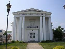 Gallatin County Courthouse in Warsaw | |
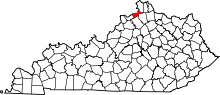 Location in the U.S. state of Kentucky | |
 Kentucky's location in the U.S. | |
| Founded | 1798 |
| Named for | Albert Gallatin |
| Seat | Warsaw |
| Largest city | Warsaw |
| Area | |
| • Total | 105 sq mi (272 km2) |
| • Land | 101 sq mi (262 km2) |
| • Water | 3.5 sq mi (9 km2), 3.3% |
| Population | |
| • (2010) | 8,589 |
| • Density | 85/sq mi (33/km2) |
| Congressional district | 4th |
| Time zone | Eastern: UTC−5/−4 |
| Website |
gallatincounty |
Gallatin County, is a county in the northeastern part of the U.S. state of Kentucky. As of the 2010 census, the population was 8,589.[1] Its county seat is Warsaw.[2]
The county was founded in 1798 and named for Albert Gallatin, the Secretary of the Treasury under President Thomas Jefferson.[3][4]
Gallatin County is included in the Cincinnati-Middletown, OH-KY-IN Metropolitan Statistical Area. It is located along the Ohio River across from Indiana.
History
The county was formed on December 14, 1798. Gallatin was the 31st Kentucky county to be established. It was derived from parts of Franklin and Shelby counties.[5] Later, parts of the county were pared off to create three additional counties: Owen in 1819, Trimble in 1836, and Carroll in 1838. Today Gallatin is one tenth of its original size. Its northern border is the Ohio River.
The population of Gallatin County in 1800 was 1,291, according to the Second Census of Kentucky, composed of 960 whites, 329 slaves, and 2 "freemen of color".[6]
During the Civil War, several skirmishes occurred in the county and the Union Army arrested a number of men for treason for supporting the Confederates.
The 1866 Gallatin County Race Riot happened just after the Civil War, when bands of lawless Ku Klux Klansmen terrorized parts of the Bluegrass State. "A band of five hundred whites in Gallatin County... forced hundreds of blacks to flee across the Ohio River."[7]
On December 4, 1868, two passenger steamers, the America and the United States, collided on the Ohio River near Warsaw. The United States carried a cargo of barrels of kerosene, which caught fire. The flames soon spread to the America, and many passengers perished by burning or drowning. The combined death toll was 162, making it one of the most deadly steamboat accidents in American history.
The Lynchings of the Frenches of Warsaw were conducted by a white mob on May 3, 1876. It was unusual as Benjamin and Mollie French were killed for the murder of Lake Jones, another, older African-American man. They were hanged by local masked KKK members.[8]
As the 20th century progressed, commercial river trade began to decline, and the steamboat era ended, as faster means of transportation became available. Rail lines expanded, automobiles and trucks became reliable, and aircraft soon arrived on the scene. In the postwar period after World War II, numerous major highways were constructed, leading to greater auto travel and commuting. Gallatin County is traversed by I-71, U.S. 42, and U.S. 127. By the 1980s, more than 50 percent of the population was employed outside the county.[9]
Construction on the Markland Locks and Dam began in 1956 and was completed in 1964. In 1967 a hydroelectric power plant was built at the dam, which provided jobs.
Marco Allen Chapman was executed in 2008 for multiple murders he committed on August 23, 2002 in Warsaw, Kentucky. [10] He murdered two children, Chelbi Sharon, 7, and Cody Sharon, 6, by slitting their throats.[11] He raped and stabbed their mother, Carolyn Marksberry, more than 15 times.[12] A third child, daughter 10-year-old Courtney Sharon, played dead after being stabbed and then escaped.[13] Thirty-seven-year-old Chapman was executed on November 21, 2008 by lethal injection at the Kentucky State Penitentiary in Eddyville, Kentucky. He was the last person executed by the Commonwealth.[14]
Geography
According to the U.S. Census Bureau, the county has a total area of 105 square miles (270 km2), of which 101 square miles (260 km2) is land and 3.5 square miles (9.1 km2) (3.3%) is water.[15] It is the second smallest county by area in Kentucky.[16]
Adjacent counties
- Switzerland County, Indiana (north)
- Boone County (northeast)
- Grant County (southeast)
- Owen County (south)
- Carroll County (west)
Demographics
| Historical population | |||
|---|---|---|---|
| Census | Pop. | %± | |
| 1800 | 1,291 | — | |
| 1810 | 3,307 | 156.2% | |
| 1820 | 7,075 | 113.9% | |
| 1830 | 6,674 | −5.7% | |
| 1840 | 4,003 | −40.0% | |
| 1850 | 5,137 | 28.3% | |
| 1860 | 5,056 | −1.6% | |
| 1870 | 5,074 | 0.4% | |
| 1880 | 4,832 | −4.8% | |
| 1890 | 4,611 | −4.6% | |
| 1900 | 5,163 | 12.0% | |
| 1910 | 4,697 | −9.0% | |
| 1920 | 4,664 | −0.7% | |
| 1930 | 4,437 | −4.9% | |
| 1940 | 4,307 | −2.9% | |
| 1950 | 3,969 | −7.8% | |
| 1960 | 3,867 | −2.6% | |
| 1970 | 4,134 | 6.9% | |
| 1980 | 4,842 | 17.1% | |
| 1990 | 5,393 | 11.4% | |
| 2000 | 7,870 | 45.9% | |
| 2010 | 8,589 | 9.1% | |
| Est. 2016 | 8,609 | [17] | 0.2% |
| U.S. Decennial Census[18] 1790–1960[19] 1900–1990[20] 1990–2000[21] 2010–2013[1] | |||
As of the 2010 United States Census, there were 8,589 people residing in the county. 94.7% were White, 1.3% Black or African American, 0.2% Asian, 0.1% Native American, 1.6% of some other race and 2.0% of two or more races. 4.3% were Hispanic or Latino (of any race). 22.6% were of German, 21.4% American, 13.8% Irish and 6.5% English ancestry.[22]
As of the census[23] of 2000, there were 7,870 people, 2,902 households, and 2,135 families residing in the county. The population density was 80 per square mile (31/km2). There were 3,362 housing units at an average density of 34 per square mile (13/km2). The racial makeup of the county was 96.72% White, 1.59% Black or African American, 0.18% Native American, 0.22% Asian, 0.25% from other races, and 1.04% from two or more races. 1.04% of the population were Hispanic or Latino of any race.
There were 2,902 households out of which 37.00% had children under the age of 18 living with them, 58.00% were married couples living together, 10.70% had a female householder with no husband present, and 26.40% were non-families. 22.00% of all households were made up of individuals and 8.20% had someone living alone who was 65 years of age or older. The average household size was 2.68 and the average family size was 3.11.
In the county, the population was spread out with 28.60% under the age of 18, 7.70% from 18 to 24, 31.00% from 25 to 44, 22.50% from 45 to 64, and 10.30% who were 65 years of age or older. The median age was 35 years. For every 100 females there were 98.90 males. For every 100 females age 18 and over, there were 96.00 males.
The median income for a household in the county was $36,422, and the median income for a family was $41,136. Males had a median income of $32,081 versus $21,803 for females. The per capita income for the county was $16,416. About 11.60% of families and 13.40% of the population were below the poverty line, including 16.60% of those under age 18 and 16.40% of those age 65 or over.
Politics
| Year | Republican | Democratic | Third parties |
|---|---|---|---|
| 2016 | 73.2% 2,443 | 22.4% 749 | 4.4% 146 |
| 2012 | 57.4% 1,758 | 40.4% 1,238 | 2.1% 65 |
| 2008 | 57.6% 1,840 | 40.0% 1,278 | 2.4% 75 |
| 2004 | 60.8% 1,869 | 38.7% 1,188 | 0.5% 16 |
| 2000 | 54.7% 1,345 | 42.7% 1,049 | 2.6% 65 |
| 1996 | 35.7% 838 | 50.7% 1,189 | 13.6% 319 |
| 1992 | 30.0% 699 | 50.3% 1,171 | 19.7% 459 |
| 1988 | 45.1% 881 | 54.3% 1,060 | 0.6% 11 |
| 1984 | 49.8% 1,042 | 49.8% 1,042 | 0.4% 9 |
| 1980 | 40.1% 684 | 58.0% 988 | 1.9% 32 |
| 1976 | 26.9% 436 | 71.7% 1,164 | 1.4% 23 |
| 1972 | 53.4% 719 | 45.4% 612 | 1.2% 16 |
| 1968 | 29.4% 413 | 48.7% 685 | 22.0% 309 |
| 1964 | 17.6% 267 | 82.1% 1,246 | 0.3% 4 |
| 1960 | 42.4% 756 | 57.6% 1,028 | 0.0% 0 |
| 1956 | 30.9% 547 | 69.1% 1,223 | 0.1% 1 |
| 1952 | 25.1% 465 | 74.7% 1,383 | 0.2% 3 |
| 1948 | 19.7% 342 | 79.4% 1,381 | 0.9% 16 |
| 1944 | 27.3% 516 | 72.0% 1,360 | 0.6% 12 |
| 1940 | 25.1% 495 | 74.7% 1,473 | 0.2% 4 |
| 1936 | 21.6% 404 | 77.7% 1,456 | 0.8% 15 |
| 1932 | 16.9% 365 | 82.9% 1,792 | 0.3% 6 |
| 1928 | 55.0% 1,010 | 44.9% 823 | 0.1% 2 |
| 1924 | 42.1% 750 | 56.6% 1,007 | 1.3% 23 |
| 1920 | 23.0% 536 | 76.6% 1,782 | 0.4% 9 |
| 1916 | 21.0% 283 | 78.7% 1,060 | 0.3% 4 |
| 1912 | 14.6% 174 | 75.9% 906 | 9.6% 114 |
Communities
Infrastructure
Transportation
Public transportation is provided by Senior Services of Northern Kentucky with demand-response service.[25]
Notable residents
- Samuel Brenton (November 22, 1810 – March 29, 1857) a US Representative from Indiana; born in Gallatin County, Kentucky.
- John Taylor (Baptist preacher), a notable pioneer preacher and church historian, who became part of the frontier planter elite, holding 20 slaves and 2,000 acres (8.1 km2) in the county by the early 19th century.
See also
References
- 1 2 "State & County QuickFacts". United States Census Bureau. Archived from the original on July 10, 2011. Retrieved March 6, 2014.
- ↑ "Find a County". National Association of Counties. Archived from the original on 2011-05-31. Retrieved 2011-06-07.
- ↑ Gannett, Henry (1905). The Origin of Certain Place Names in the United States. Govt. Print. Off. p. 133.
- ↑ E., Kleber, John; Kentucky, University Press of; Policy, Institute for Regional Analysis and Public; Library, Camden-Carroll; University, Morehead State (1 January 2000). "The Kentucky Encyclopedia".
- ↑ Collins, Lewis (1882). Collins' Historical Sketches of Kentucky: History of Kentucky, Volume 2. Collins & Company. p. 26.
- ↑ Libraries, University of Kentucky. "Notable Kentucky African Americans - Gallatin County (KY) Slaves, Free Blacks, and Free Mulattoes, 1850-1870".
- ↑ Harrison, Lowell H. and James C. Klotter 1997. A New History of Kentucky. University Press of Kentucky. Lexington, Kentucky. pg. 237.
- ↑ Wright, George C. 1990. Racial Violence in Kentucky, 1865–1940: Lynchings, Mob Rule, and "Legal Lynchings". Baton Rouge and London: Louisiana State University Press, pp. 98-99.
- ↑ "Gallatin County", Rootsweb
- ↑ "Kentucky death row inmate: 'I'm ready and I'm sorry'". USATODAY.com. Retrieved 2017-02-24.
- ↑ Estep, Bill. "Killer is Executed", Lexington Herald-Leader. November 22, 2008
- ↑ "Supreme Court of Kentucky. Marco Allen CHAPMAN, Appellant, v. COMMONWEALTH of Kentucky, Appellee. No. 2005-SC-000070-MR. Decided: August 23, 2007". FindLaw. Retrieved February 13, 2017.
- ↑ Mark Pitsch. Two Gallatin Children Killed in Knife Attack; Mom, Sister Hurt; Suspect Arrested in West Virginia. August 24, 2002. Courier-Journal. Louisville, Ky.
- ↑ , WCPO-TV, News Local
- ↑ "2010 Census Gazetteer Files". United States Census Bureau. August 22, 2012. Archived from the original on August 12, 2014. Retrieved August 14, 2014.
- ↑ "Kentucky Counties". Uky.edu. Retrieved 2017-02-24.
- ↑ "Population and Housing Unit Estimates". Retrieved June 9, 2017.
- ↑ "U.S. Decennial Census". United States Census Bureau. Archived from the original on May 12, 2015. Retrieved August 14, 2014.
- ↑ "Historical Census Browser". University of Virginia Library. Retrieved August 14, 2014.
- ↑ "Population of Counties by Decennial Census: 1900 to 1990". United States Census Bureau. Retrieved August 14, 2014.
- ↑ "Census 2000 PHC-T-4. Ranking Tables for Counties: 1990 and 2000" (PDF). United States Census Bureau. Retrieved August 14, 2014.
- ↑ Bureau, U.S. Census. "American FactFinder".
- ↑ "American FactFinder". United States Census Bureau. Archived from the original on 2013-09-11. Retrieved 2008-01-31.
- ↑ Leip, David. "Dave Leip's Atlas of U.S. Presidential Elections". uselectionatlas.org. Retrieved 2018-07-01.
- ↑ "SSNK Transportation Services". Senior Services of Northern Kentucky. Archived from the original on 2015-05-20. Retrieved 2015-05-19.
External links
Municipalities and communities of Gallatin County, Kentucky, United States | ||
|---|---|---|
| Cities | | |
| Unincorporated communities | ||
| Ghost town | ||
| Footnotes | ‡This populated place also has portions in an adjacent county or counties | |
