Bracken County, Kentucky
| Bracken County, Kentucky | |
|---|---|
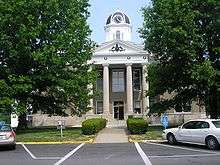 Bracken County Courthouse in Brooksville | |
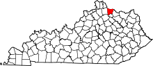 Location in the U.S. state of Kentucky | |
 Kentucky's location in the U.S. | |
| Founded | 1796 |
| Named for | William Bracken |
| Seat | Brooksville |
| Largest city | Augusta |
| Area | |
| • Total | 209 sq mi (541 km2) |
| • Land | 206 sq mi (534 km2) |
| • Water | 3.3 sq mi (9 km2), 1.6% |
| Population | |
| • (2010) | 8,488 |
| • Density | 41/sq mi (16/km2) |
| Congressional district | 4th |
| Time zone | Eastern: UTC−5/−4 |
| Website |
www |
Bracken County is a county located in the U.S. state of Kentucky. As of the 2010 census, the population was 8,488.[1] Its county seat is Brooksville.[2] The county was formed in 1796.
Bracken County is included in the Cincinnati-Middletown, OH-KY-IN Metropolitan Statistical Area.
History
Bracken County was organized as Kentucky's 23rd county in 1796 from parts of Mason and Campbell counties.[3][4] It was named after two creeks, the Big and Little Bracken, which in turn were named for William Bracken, an 18th-century explorer and surveyor who visited the area in 1773.[5] He was later killed by Indians during the Northwest Indian War. The county originally extended to southern Nicholas County, north to the Ohio River, west to the Licking River and east to Dover, Kentucky.[6]
Several early settlers were veterans of the American Revolutionary War, including Captain Abner Howell, who brought his family came from Pennsylvania. He died in Bracken County in 1797.
The county government moved from Augusta to Woodward's Crossing (now Brooksville) in 1833.
Bracken was the birthplace of John Gregg Fee, founder of Berea College and Kentucky's most noted abolitionist. He was a graduate of Augusta College and Lane Theological Seminary. In 1822 Augusta College was founded as the first Methodist college in the world.
Anti-slavery activists in Bracken County played a major role in the movement known as the Underground Railroad. There are several Underground Railroad sites in the Augusta area. A network of citizens sympathetic to escaping slaves helped them cross the Ohio River to nearby Ripley, Ohio and other points north.[7]
Bracken County's economy was largely agricultural. Its chief crops before the Civil War were tobacco and corn. White burley tobacco, a light, adaptable leaf that revolutionized the industry, was first sold at the 1867 St. Louis Fair by the farmer Mr. Webb from Higginsport, Ohio. He had produced it in 1864 from Bracken County seed and developed the type.[8] It became a major product of central Kentucky and central Tennessee.
Agriculture remains vital to the economy, with farms occupying 83.8 percent of the land area in 1982. Commodities include wheat, hay, and milk. Burley tobacco production in 1988 amounted to 5,406,000 pounds. Agricultural receipts in 1986 totaled $19,158,000.[9]
Historic schools
Augusta:
- Bracken Academy
- Augusta Methodist College
- Saint James Elementary and High School
- Germantown College
Milford:
Law and government
- Judge Executives
- Earl Bush (2011–Present)
- Gary Riggs (2007–2011)
- Leslie Newman (2002–2007)
- Dwayne "Pie" Jett (1987–2002)
| Year | Republican | Democratic | Third parties |
|---|---|---|---|
| 2016 | 76.9% 2,711 | 20.0% 705 | 3.2% 111 |
| 2012 | 62.8% 2,029 | 35.5% 1,147 | 1.7% 56 |
| 2008 | 60.8% 2,066 | 36.5% 1,241 | 2.7% 92 |
| 2004 | 65.5% 2,363 | 33.6% 1,213 | 0.9% 34 |
| 2000 | 68.4% 2,065 | 29.4% 888 | 2.2% 66 |
| 1996 | 50.4% 1,371 | 38.8% 1,055 | 10.8% 294 |
| 1992 | 39.6% 1,162 | 42.9% 1,259 | 17.4% 511 |
| 1988 | 57.7% 1,630 | 41.6% 1,176 | 0.6% 18 |
| 1984 | 60.9% 1,812 | 38.2% 1,136 | 0.9% 28 |
| 1980 | 43.7% 1,154 | 53.7% 1,420 | 2.7% 70 |
| 1976 | 35.2% 879 | 63.2% 1,577 | 1.6% 39 |
| 1972 | 64.3% 1,628 | 34.5% 873 | 1.2% 31 |
| 1968 | 40.8% 1,115 | 39.1% 1,067 | 20.1% 550 |
| 1964 | 30.5% 861 | 69.5% 1,958 | 0.0% 0 |
| 1960 | 60.2% 2,002 | 39.8% 1,326 | 0.0% 0 |
| 1956 | 53.5% 1,754 | 46.3% 1,515 | 0.2% 7 |
| 1952 | 49.1% 1,690 | 50.9% 1,753 | 0.0% 1 |
| 1948 | 39.1% 1,239 | 58.8% 1,863 | 2.0% 64 |
| 1944 | 43.4% 1,483 | 56.0% 1,915 | 0.6% 19 |
| 1940 | 44.1% 1,551 | 55.7% 1,961 | 0.3% 9 |
| 1936 | 41.7% 1,436 | 56.8% 1,956 | 1.5% 52 |
| 1932 | 37.5% 1,471 | 61.4% 2,407 | 1.1% 43 |
| 1928 | 70.0% 2,820 | 29.8% 1,201 | 0.2% 9 |
| 1924 | 51.7% 1,779 | 43.1% 1,485 | 5.2% 179 |
| 1920 | 40.1% 1,791 | 58.7% 2,621 | 1.3% 56 |
| 1916 | 38.3% 1,082 | 59.4% 1,676 | 2.3% 65 |
| 1912 | 29.2% 693 | 55.4% 1,315 | 15.5% 367 |
Geography
According to the U.S. Census Bureau, the county has a total area of 209 square miles (540 km2), of which 206 square miles (530 km2) is land and 3.3 square miles (8.5 km2) (1.6%) is water.[11]
Adjacent counties
- Clermont County, Ohio (north – across the Ohio River)
- Brown County, Ohio (northeast – across the Ohio River)
- Mason County (east)
- Robertson County (south)
- Harrison County (southwest)
- Pendleton County (west)
Demographics
| Historical population | |||
|---|---|---|---|
| Census | Pop. | %± | |
| 1800 | 2,606 | — | |
| 1810 | 3,706 | 42.2% | |
| 1820 | 5,280 | 42.5% | |
| 1830 | 6,518 | 23.4% | |
| 1840 | 7,053 | 8.2% | |
| 1850 | 8,903 | 26.2% | |
| 1860 | 11,021 | 23.8% | |
| 1870 | 11,409 | 3.5% | |
| 1880 | 13,509 | 18.4% | |
| 1890 | 12,369 | −8.4% | |
| 1900 | 12,137 | −1.9% | |
| 1910 | 10,308 | −15.1% | |
| 1920 | 10,210 | −1.0% | |
| 1930 | 9,616 | −5.8% | |
| 1940 | 9,389 | −2.4% | |
| 1950 | 8,424 | −10.3% | |
| 1960 | 7,422 | −11.9% | |
| 1970 | 7,227 | −2.6% | |
| 1980 | 7,738 | 7.1% | |
| 1990 | 7,766 | 0.4% | |
| 2000 | 8,279 | 6.6% | |
| 2010 | 8,488 | 2.5% | |
| Est. 2016 | 8,400 | [12] | −1.0% |
| U.S. Decennial Census[13] 1790-1960[14] 1900-1990[15] 1990-2000[16] 2010-2013[1] | |||
As of the census[17] of 2000, there were 8,279 people, 3,228 households, and 2,346 families residing in the county. The population density was 41 per square mile (16/km2). There were 3,715 housing units at an average density of 18 per square mile (6.9/km2). The racial makeup of the county was 98.48% White, 0.62% Black or African American, 0.25% Native American, 0.06% Asian, 0.04% Pacific Islander, 0.21% from other races, and 0.35% from two or more races. 0.47% of the population were Hispanic or Latino of any race.
There were 3,228 households out of which 33.50% had children under the age of 18 living with them, 57.30% were married couples living together, 10.70% had a female householder with no husband present, and 27.30% were non-families. 23.90% of all households were made up of individuals and 11.30% had someone living alone who was 65 years of age or older. The average household size was 2.55 and the average family size was 3.00.
In the county, the population was spread out with 25.50% under the age of 18, 8.40% from 18 to 24, 29.50% from 25 to 44, 23.00% from 45 to 64, and 13.50% who were 65 years of age or older. The median age was 37 years. For every 100 females, there were 98.00 males. For every 100 females age 18 and over, there were 95.90 males.
The median income for a household in the county was $34,823, and the median income for a family was $40,469. Males had a median income of $31,503 versus $21,139 for females. The per capita income for the county was $16,478. About 7.60% of families and 10.80% of the population were below the poverty line, including 10.50% of those under age 18 and 17.30% of those age 65 or over.
Education
Communities
- Augusta
- Brooksville (county seat)
- Foster
- Germantown
Notable residents
- Nick Clooney, a Cincinnati journalist and former newsanchor, and his wife Nina live in Augusta.
- George Clooney, their son and an actor, grew up in Augusta and went to high school there.
- Heather French Henry, Miss America 2000, grew up in Augusta and still lives there. Heather and her husband, former Ky. Lt. Governor Steve Henry, are the curators of the Rosemary Clooney Museum in Augusta.
- Rosemary Clooney, singer and actress, lived in Augusta. Her most notable film was White Christmas.
- John G. Fee, Minister and Educator, Born in Bracken Co. Founder Berea College.
See also
References
- 1 2 "State & County QuickFacts". United States Census Bureau. Retrieved March 5, 2014.
- ↑ "Find a County". National Association of Counties. Archived from the original on 31 May 2011. Retrieved 2011-06-07.
- ↑ Collins, Lewis (1882). Collins' Historical Sketches of Kentucky: History of Kentucky, Volume 2. Collins & Company. p. 26.
- ↑ "Bracken County". The Kentucky Encyclopedia. 2000. Archived from the original on August 21, 2014. Retrieved August 20, 2014.
- ↑ The Register of the Kentucky State Historical Society, Volume 1. Kentucky State Historical Society. 1903. p. 34.
- ↑ "Bracken County History", Kentucky Historical Society
- ↑ "Underground Railroad" Archived 21 September 2006 at the Wayback Machine., Augusta, Kentucky Website
- ↑ J.M. Stoddart, Encyclopædia Britannica. American Supplement (Stoddart's Encyclopaedia Americana: A Dictionary of Arts, Sciences, and General Literature, and Companion to the Encyclopædia Britannica. (9th ed.) and to All Other Encyclopaedias, Volume 1), 1883, pp. 120-123, accessed 5 February 2011
- ↑ "Bracken County, KY", Genealogy Inc
- ↑ Leip, David. "Dave Leip's Atlas of U.S. Presidential Elections". uselectionatlas.org. Retrieved 2018-06-29.
- ↑ "2010 Census Gazetteer Files". United States Census Bureau. August 22, 2012. Archived from the original on August 12, 2014. Retrieved August 12, 2014.
- ↑ "Population and Housing Unit Estimates". Retrieved June 9, 2017.
- ↑ "U.S. Decennial Census". United States Census Bureau. Archived from the original on 12 May 2015. Retrieved August 12, 2014.
- ↑ "Historical Census Browser". University of Virginia Library. Retrieved August 12, 2014.
- ↑ "Population of Counties by Decennial Census: 1900 to 1990". United States Census Bureau. Retrieved August 12, 2014.
- ↑ "Census 2000 PHC-T-4. Ranking Tables for Counties: 1990 and 2000" (PDF). United States Census Bureau. Retrieved August 12, 2014.
- ↑ "American FactFinder". United States Census Bureau. Archived from the original on 11 September 2013. Retrieved 2008-01-31.
External links
Municipalities and communities of Bracken County, Kentucky, United States | ||
|---|---|---|
| Cities | | |
| Unincorporated communities | ||
| Ghost towns | ||
| Footnotes | ‡This populated place also has portions in an adjacent county or counties | |
