Franklin County, Ohio
| Franklin County, Ohio | ||
|---|---|---|
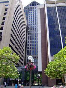 Franklin County Government Center | ||
| ||
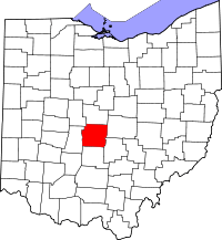 Location in the U.S. state of Ohio | ||
 Ohio's location in the U.S. | ||
| Founded | April 30, 1803[1] | |
| Named for | Benjamin Franklin | |
| Seat | Columbus | |
| Largest city | Columbus | |
| Area | ||
| • Total | 544 sq mi (1,409 km2) | |
| • Land | 532 sq mi (1,378 km2) | |
| • Water | 11 sq mi (28 km2), 2.1% | |
| Population (est.) | ||
| • (2016) | 1,291,981 | |
| • Density | 2,186/sq mi (844/km2) | |
| Congressional districts | 3rd, 12th, 15th | |
| Time zone | Eastern: UTC−5/−4 | |
| Website |
www | |
.svg.png)
Franklin County is a county in the U.S. state of Ohio. As of 2017 census estimates, the population was 1,291,981,[2] making it the most populous county in Ohio. Its county seat is Columbus,[3] the state capital and most populous city in Ohio. The county was established on April 30, 1803, less than two months after Ohio became a state, and was named after Benjamin Franklin.[4] Franklin County originally extended all the way north to Lake Erie before Ohio subdivided further into more counties.
Franklin County is included in the Columbus, OH Metropolitan Statistical Area.
Franklin County, particularly Columbus, has been a centerpiece for presidential and congressional politics, most notably the 2000 presidential election, the 2004 presidential election, and the 2006 midterm elections. Franklin County is home to one of the largest universities in the United States, The Ohio State University, which as of fall 2017 has an enrollment of 59,837 students on its main Columbus campus.[5]
History
On March 30, 1803, the Ohio government authorized the creation of Franklin County. The county originally was part of Ross County. Residents named the county in honor of Benjamin Franklin.[6] In 1816, Franklin County’s Columbus became Ohio’s state capital. Surveyors laid out the city in 1812, and officials incorporated it in 1816. Columbus was not Ohio’s original capital, but the state legislature chose to move the state government there after its location for a short time at Chillicothe and at Zanesville. Columbus was chosen as the site for the new capital because of its central location within the state and access by way of major transportation routes (primarily rivers) at that time. The legislature chose it as Ohio’s capital over a number of other competitors, including Franklinton, Dublin, Worthington, and Delaware.
On May 5, 1802 a group of prospective settlers founded the Scioto Company at the home of Rev. Eber B. Clark in Granby, Connecticut for the purpose of forming a settlement between the Muskingum River and Great Miami River in the Ohio Country. James Kilbourne was elected president and Josiah Topping secretary (McCormick 1998:7). On August 30, 1802 James Kilbourne and Nathaniel Little arrived at Colonel Thomas Worthington's home in Chillicothe, Ohio. They tentatively reserved land along the Scioto River on the Pickaway Plains for their new settlement (McCormick 1998:17).
On October 5, 1802, the Scioto Company met in Granby, Connecticut and decided not to purchase the lands along the Scioto River on the Pickaway Plains, but rather to buy land 30 miles (48 km) farther north from Dr. Jonas Stanbery and his partner, an American Revolutionary War general, Jonathan Dayton. Sixteen thousand acres (65 km²) were purchased along the Whetstone River (now known as the Olentangy River) at $1.50 per acre (McCormick 1998:19-27). This land was part of the United States Military District surveyed by Israel Ludlow in 1797 and divided into townships 5 miles (8.0 km) square.[7]
Before the state legislature’s decision in 1812, Columbus did not exist. The city was designed from the first as the state’s capital, preparing itself for its role in Ohio’s political, economic, and social life. In the years between first ground-breaking and the actual movement of the capital in 1816, Columbus and Franklin County grew significantly. By 1813, workers had built a penitentiary, and by the following year, residents had established the first church, school, and newspaper in Columbus. Workers completed the Ohio Statehouse in 1861. Columbus and Franklin County grew quickly in population, with the city having 700 people by 1815. Columbus officially became the county seat in 1824. By 1834, the population of Columbus was 4,000 people, officially elevating it to "city" status.
Geography
According to the U.S. Census Bureau, the county has a total area of 544 square miles (1,410 km2), of which 532 square miles (1,380 km2) is land and 11 square miles (28 km2) (2.1%) is water.[8] The county is located in the Till Plains and the Appalachian Plateau land regions.
The county is drained by the Olentangy River and the Scioto River. Major creeks in the county include Big Darby Creek, Big Walnut Creek, and Alum Creek. There are two large reservoirs in the county, Hoover Reservoir and Griggs Reservoir.[9]
Adjacent counties
- Delaware County (north)
- Fairfield County (southeast)
- Licking County (east)
- Madison County (west)
- Pickaway County (south)
- Union County (northwest)
Major highways
Demographics
| Historical population | |||
|---|---|---|---|
| Census | Pop. | %± | |
| 1810 | 3,486 | — | |
| 1820 | 10,292 | 195.2% | |
| 1830 | 14,741 | 43.2% | |
| 1840 | 25,049 | 69.9% | |
| 1850 | 42,909 | 71.3% | |
| 1860 | 50,361 | 17.4% | |
| 1870 | 63,019 | 25.1% | |
| 1880 | 86,797 | 37.7% | |
| 1890 | 124,087 | 43.0% | |
| 1900 | 164,460 | 32.5% | |
| 1910 | 221,567 | 34.7% | |
| 1920 | 283,951 | 28.2% | |
| 1930 | 361,055 | 27.2% | |
| 1940 | 388,712 | 7.7% | |
| 1950 | 503,410 | 29.5% | |
| 1960 | 682,962 | 35.7% | |
| 1970 | 833,249 | 22.0% | |
| 1980 | 869,132 | 4.3% | |
| 1990 | 961,437 | 10.6% | |
| 2000 | 1,068,978 | 11.2% | |
| 2010 | 1,163,414 | 8.8% | |
| Est. 2017 | 1,291,981 | [10] | 11.1% |
| U.S. Decennial Census[11] 1790-1960[12] 1900-1990[13] 1990-2000[14] 2010-2013[15] | |||
2000 census
At the 2000 United States Census there were 1,068,978 people, 438,778 households, and 263,705 families residing in the county.[16] The population density was 1,980 per square mile (765/km²). There were 471,016 housing units at an average density of 872 per square mile (337/km²).[17] The racial makeup of the county was 75.48% White, 17.89% Black or African American, 0.27% Native American, 3.07% Asian, 0.04% Pacific Islander, 1.03% from other races, and 2.23% from two or more races. 2.27% of the population were Hispanic or Latino of any race.[16]
There were 438,778 households of which 30.40% had children under the age of 18 living with them, 43.00% were married couples living together, 13.00% had a female householder with no husband present, and 39.90% were non-families. 30.90% of all households were made up of individuals and 7.40% had someone living alone who was 65 years of age or older. The average household size was 2.39 and the average family size was 3.03.[16]
25.10% of the population were under the age of 18, 11.70% from 18 to 24, 33.30% from 25 to 44, 20.10% from 45 to 64, and 9.80% who were 65 years of age or older. The median age was 32 years. For every 100 females there were 94.50 males. For every 100 females age 18 and over, there were 91.50 males.[16]
The median household income was $42,734 and the median family income was $53,905. Males had a median income of $37,672 versus $29,856 for females. The per capita income for the county was $23,059. About 8.20% of families and 11.60% of the population were below the poverty line, including 14.20% of those under age 18 and 8.60% of those age 65 or over.[18]
2010 census
As of the 2010 United States Census, there were 1,163,414 people, 477,235 households, and 278,030 families residing in the county.[19] The population density was 2,186.1 inhabitants per square mile (844.1/km2). There were 527,186 housing units at an average density of 990.6 per square mile (382.5/km2).[20] The racial makeup of the county was 69.2% white, 21.2% black or African American, 3.9% Asian, 0.2% American Indian, 0.1% Pacific islander, 2.3% from other races, and 3.0% from two or more races. Those of Hispanic or Latino origin made up 4.8% of the population.[19] In terms of ancestry, 24.2% were German, 14.4% were Irish, 9.1% were English, 5.5% were Italian, and 5.0% were American.[21]
Of the 477,235 households, 31.0% had children under the age of 18 living with them, 39.0% were married couples living together, 14.4% had a female householder with no husband present, 41.7% were non-families, and 31.9% of all households were made up of individuals. The average household size was 2.38 and the average family size was 3.05. The median age was 33.4 years.[19]
The median income for a household in the county was $49,087 and the median income for a family was $62,372. Males had a median income of $45,920 versus $37,685 for females. The per capita income for the county was $26,909. About 12.1% of families and 17.0% of the population were below the poverty line, including 23.0% of those under age 18 and 9.4% of those age 65 or over.[22]
Politics
For most of the 20th century, Franklin county has been Republican leaning. Since the 1996 presidential election though, Franklin County has trended solidly Democratic. Columbus and most of its northern suburbs in the county lean Democratic, and the southern section of the county leans Republican. In congress, it is represented by Joyce Beatty(3rd) and Steve Stivers(15th), while the 12th district is currently vacant.
| Year | Republican | Democratic | Third parties |
|---|---|---|---|
| 2016 | 33.9% 199,331 | 59.8% 351,198 | 6.3% 36,995 |
| 2012 | 37.8% 215,997 | 60.5% 346,373 | 1.7% 9,818 |
| 2008 | 38.9% 218,486 | 59.6% 334,709 | 1.5% 8,568 |
| 2004 | 45.1% 237,253 | 54.4% 285,801 | 0.5% 2,773 |
| 2000 | 47.8% 197,862 | 48.8% 202,018 | 3.4% 14,194 |
| 1996 | 44.6% 178,412 | 48.1% 192,795 | 7.3% 29,308 |
| 1992 | 41.9% 186,324 | 39.7% 176,656 | 18.4% 81,821 |
| 1988 | 60.0% 226,265 | 39.1% 147,585 | 0.9% 3,507 |
| 1984 | 64.1% 250,360 | 33.7% 131,530 | 2.2% 8,584 |
| 1980 | 53.9% 200,948 | 38.6% 143,932 | 7.6% 28,165 |
| 1976 | 55.7% 189,645 | 41.6% 141,624 | 2.8% 9,443 |
| 1972 | 63.7% 219,771 | 34.1% 117,562 | 2.2% 7,475 |
| 1968 | 51.8% 148,933 | 35.2% 101,240 | 13.0% 37,451 |
| 1964 | 46.0% 131,345 | 54.1% 154,527 | |
| 1960 | 59.4% 161,178 | 40.6% 110,283 | |
| 1956 | 65.8% 151,544 | 34.2% 78,852 | |
| 1952 | 60.3% 138,894 | 39.8% 91,620 | |
| 1948 | 53.4% 98,707 | 45.8% 84,806 | 0.8% 1,486 |
| 1944 | 52.6% 99,292 | 47.4% 89,394 | |
| 1940 | 48.9% 92,533 | 51.1% 96,601 | |
| 1936 | 40.4% 63,830 | 57.4% 90,746 | 2.2% 3,471 |
| 1932 | 52.2% 67,957 | 45.0% 58,539 | 2.8% 3,664 |
| 1928 | 65.9% 92,019 | 33.7% 47,084 | 0.4% 609 |
| 1924 | 57.7% 61,891 | 24.7% 26,505 | 17.6% 18,899 |
| 1920 | 54.2% 59,691 | 44.0% 48,452 | 1.8% 1,921 |
| 1916 | 40.4% 24,107 | 57.1% 34,103 | 2.5% 1,517 |
| 1912 | 25.2% 12,791 | 40.8% 20,697 | 34.0% 17,227 |
| 1908 | 53.5% 28,914 | 43.1% 23,314 | 3.5% 1,869 |
| 1904 | 61.5% 27,439 | 34.7% 15,502 | 3.8% 1,681 |
| 1900 | 52.2% 22,237 | 46.5% 19,809 | 1.3% 550 |
| 1896 | 52.0% 20,291 | 46.9% 18,320 | 1.1% 442 |
| 1892 | 46.5% 14,341 | 50.3% 15,495 | 3.2% 999 |
| 1888 | 47.6% 13,453 | 50.0% 14,126 | 2.5% 692 |
| 1884 | 47.7% 11,194 | 50.4% 11,842 | 1.9% 441 |
| 1880 | 48.3% 9,438 | 50.5% 9,863 | 1.2% 240 |
| 1876 | 44.4% 7,557 | 55.1% 9,383 | 0.6% 97 |
| 1872 | 43.9% 5,796 | 55.7% 7,345 | 0.4% 56 |
Government
_Clerk_of_Courts.svg.png) Seal of the Clerk of Courts
Seal of the Clerk of Courts_Treasurer.svg.png) Seal of the Treasurer
Seal of the Treasurer
Communities
Franklin County is currently made up of 16 cities, 10 villages, and 17 townships.
Cities
Villages
Townships
https://web.archive.org/web/20160715023447/http://www.ohiotownships.org/township-websites
Census-designated places
Other unincorporated communities
See also
Footnotes
- ↑ "Ohio County Profiles: Franklin County" (PDF). Ohio Department of Development. Archived from the original (PDF) on 2007-06-21. Retrieved 2007-04-28.
- ↑ "American Factfinder".
- ↑ "Find a County". National Association of Counties. Archived from the original on 2011-05-31. Retrieved 2011-06-07.
- ↑ "Franklin County data". Ohio State University Extension Data Center. Archived from the original on 2007-12-03. Retrieved 2007-04-28.
- ↑ "Statistical Summary". osu.edu. Retrieved 21 February 2018.
- ↑ Gannett, Henry (1905). The Origin of Certain Place Names in the United States. Govt. Print. Off. p. 131.
- ↑ "A Century of Lawmaking for a New Nation: U.S. Congressional Documents and Debates, 1774 - 1875". memory.loc.gov. Retrieved 19 April 2018.
- ↑ "2010 Census Gazetteer Files". United States Census Bureau. August 22, 2012. Archived from the original on May 4, 2014. Retrieved February 7, 2015.
- ↑ Query of Geographic Names Information System
- ↑ "Population and Housing Unit Estimates". Retrieved June 9, 2017.
- ↑ "U.S. Decennial Census". United States Census Bureau. Archived from the original on May 12, 2015. Retrieved February 7, 2015.
- ↑ "Historical Census Browser". University of Virginia Library. Retrieved February 7, 2015.
- ↑ Forstall, Richard L., ed. (March 27, 1995). "Population of Counties by Decennial Census: 1900 to 1990". United States Census Bureau. Retrieved February 7, 2015.
- ↑ "Census 2000 PHC-T-4. Ranking Tables for Counties: 1990 and 2000" (PDF). United States Census Bureau. April 2, 2001. Retrieved February 7, 2015.
- ↑ "Franklin County now most populous in Ohio". Columbus Dispatch. Retrieved March 31, 2017.
- 1 2 3 4 "SF 1 Profile of General Demographic Characteristics: 2000, Franklin County, Ohio". United States Census Bureau. 2000. Retrieved September 28, 2017.
- ↑ "Population, Housing Units, Area, and Density: 2000 - County, Franklin County, Ohio". United States Census Bureau. 2000. Retrieved September 29, 2017.
- ↑ "SF 3 Profile of Selected Economic Characteristics: 2000, Franklin County, Ohio". United States Census Bureau. 2000. Retrieved September 29, 2017.
- 1 2 3 "DP-1 Profile of General Population and Housing Characteristics: 2010 Demographic Profile Data". United States Census Bureau. Retrieved 2015-12-27.
- ↑ "Population, Housing Units, Area, and Density: 2010 - County". United States Census Bureau. Retrieved 2015-12-27.
- ↑ "DP02 SELECTED SOCIAL CHARACTERISTICS IN THE UNITED STATES – 2006-2010 American Community Survey 5-Year Estimates". United States Census Bureau. Retrieved 2015-12-27.
- ↑ "DP03 SELECTED ECONOMIC CHARACTERISTICS – 2006-2010 American Community Survey 5-Year Estimates". United States Census Bureau. Retrieved 2015-12-27.
- ↑ Leip, David. "Dave Leip's Atlas of U.S. Presidential Elections". uselectionatlas.org. Retrieved 19 April 2018.
- ↑ "Archived copy" (PDF). Archived from the original (PDF) on 2015-02-06. Retrieved 2013-02-14.
Further reading
- Henry Howe, History of Franklin County, Ohio, 1803-1889. Knightstown, IN: Bookmark, 1977.
- William T. Martin, History of Franklin County: A Collection of Reminiscences of the Early Settlement of the County: With Biographical Sketches and a Complete History of the County to the Present Time. Columbus, OH: Follett, Forster & Co., 1858.
- Opha Moore, History of Franklin County, Ohio. In Two Volumes. Topeka: Historical Publishing Company, 1930.
- William Alexander Taylor, Centennial History of Columbus and Franklin County, Ohio. Chicago: S. J. Clarke Publishing Co., 1909.
- A Centennial Biographical History of the City of Columbus and Franklin County, Ohio... Chicago: Lewis Publishing Co., 1901.
External links
- Franklin County official site
- Franklin County history Provided by Ohio History Central
Municipalities and communities of Franklin County, Ohio, United States | ||
|---|---|---|
| Cities | | |
| Villages | ||
| Townships | ||
| CDPs | ||
| Unincorporated communities | ||
| Footnotes | ‡This populated place also has portions in an adjacent county or counties | |
