Fairfield County, Ohio
| Fairfield County, Ohio | ||
|---|---|---|
_Courhouse.jpg) Fairfield County Courthouse | ||
| ||
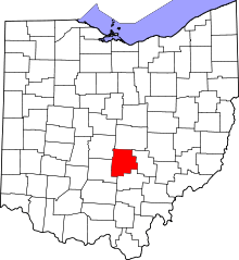 Location in the U.S. state of Ohio | ||
 Ohio's location in the U.S. | ||
| Founded | December 9, 1800[1] | |
| Named for | the Fairfield area of Lancaster, Lancashire, UK | |
| Seat | Lancaster | |
| Largest city | Lancaster | |
| Area | ||
| • Total | 509 sq mi (1,318 km2) | |
| • Land | 504 sq mi (1,305 km2) | |
| • Water | 4.2 sq mi (11 km2), 0.8% | |
| Population | ||
| • (2010) | 146,156 | |
| • Density | 290/sq mi (110/km2) | |
| Congressional district | 15th | |
| Time zone | Eastern: UTC−5/−4 | |
| Website |
www | |
.svg.png)
Fairfield County is a county located in the U.S. state of Ohio. As of the 2010 census, the population was 146,156.[2] Its county seat is Lancaster.[3] Its name is a reference to the Fairfield area of the original Lancaster.
Fairfield County is part of the Columbus, OH Metropolitan Statistical Area.
History
Fairfield County originally encompassed all or parts of present day Knox, Hocking, Licking, Perry, and Pickaway counties.[4] Fairfield is a descriptive name referring to the beauty of their fields.[5]
Geography
According to the U.S. Census Bureau, the county has a total area of 509 square miles (1,320 km2), of which 504 square miles (1,310 km2) is land and 4.2 square miles (11 km2) (0.8%) is water.[6]
Fairfield County sits just on the edge of Ohio's Appalachian region. While the once-glaciated northern portion of the county is fairly flat, as one travels south along U.S. 33 one can easily recognize the foothills of a mountainous region beginning around the village of Carroll. Although not officially part of the state or federal definition of Appalachia, certain areas of Fairfield County—particularly south of U.S. 22—bear a distinctly Appalachian feel in both physical geography and demographics.
The scenic Hocking Hills region lies immediately to the south, mostly in neighboring Hocking County. A large portion of Buckeye Lake is located in northeastern Fairfield County.
Mudhouse Mansion, an alleged haunted house, was located in the county.
Adjacent counties
- Licking County (north)
- Perry County (east)
- Hocking County (south)
- Pickaway County (southwest)
- Franklin County (northwest)
Demographics
| Historical population | |||
|---|---|---|---|
| Census | Pop. | %± | |
| 1810 | 11,361 | — | |
| 1820 | 16,633 | 46.4% | |
| 1830 | 24,786 | 49.0% | |
| 1840 | 31,924 | 28.8% | |
| 1850 | 30,264 | −5.2% | |
| 1860 | 30,538 | 0.9% | |
| 1870 | 31,138 | 2.0% | |
| 1880 | 34,284 | 10.1% | |
| 1890 | 33,939 | −1.0% | |
| 1900 | 34,259 | 0.9% | |
| 1910 | 39,201 | 14.4% | |
| 1920 | 40,484 | 3.3% | |
| 1930 | 44,010 | 8.7% | |
| 1940 | 48,490 | 10.2% | |
| 1950 | 52,130 | 7.5% | |
| 1960 | 63,912 | 22.6% | |
| 1970 | 73,301 | 14.7% | |
| 1980 | 93,678 | 27.8% | |
| 1990 | 103,461 | 10.4% | |
| 2000 | 122,759 | 18.7% | |
| 2010 | 146,156 | 19.1% | |
| Est. 2017 | 154,733 | [7] | 5.9% |
| U.S. Decennial Census[8] 1790-1960[9] 1900-1990[10] 1990-2000[11] 2010-2017[2] | |||
2000 census
As of the census[12] of 2010, there were 146,156 people, 54,310 households, and 39,846 families residing in the county. The population density was 289 people per square mile (111/km²). There were 58,678 housing units at an average density of 116 per square mile (44/km²). The racial makeup of the county was 90.02% White, 6.00% Black or African American, 0.20% Native American, 1.10% Asian, 0.00% Pacific Islander, 0.23% from other races, and 1.90% from two or more races. 1.70% of the population were Hispanic or Latino of any race.
There were 54,310 households out of which 34.10% had children under the age of 18 living with them, 57.30% were married couples living together, 11.20% had a female householder with no husband present, and 26.60% were non-families. 21.90% of all households were made up of individuals and 8.40% had someone living alone who was 65 years of age or older. The average household size was 2.64 and the average family size was 3.07.
In the county, the population was spread out with 26.30% under the age of 18, 8.00% from 18 to 24, 30.20% from 25 to 44, 23.90% from 45 to 64, and 12.40% who were 65 years of age or older. The median age was 38.2 years. For every 100 females there were 99.20 males. For every 100 females age 18 and over, there were 96.30 males.
The median income for a household in the county was $47,962, and the median income for a family was $55,539. Males had a median income of $39,566 versus $27,353 for females. The per capita income for the county was $21,671. About 4.50% of families and 5.90% of the population were below the poverty line, including 7.40% of those under age 18 and 6.20% of those age 65 or over.
2010 census
As of the 2010 United States Census, there were 146,156 people, 54,310 households, and 39,846 families residing in the county.[13] The population density was 289.8 inhabitants per square mile (111.9/km2). There were 58,687 housing units at an average density of 116.3 per square mile (44.9/km2).[14] The racial makeup of the county was 90.2% white, 6.0% black or African American, 1.1% Asian, 0.2% American Indian, 0.6% from other races, and 1.9% from two or more races. Those of Hispanic or Latino origin made up 1.7% of the population.[13] In terms of ancestry, 31.2% were German, 16.2% were Irish, 11.7% were English, 8.6% were American, and 5.2% were Italian.[15]
Of the 54,310 households, 37.3% had children under the age of 18 living with them, 57.3% were married couples living together, 11.2% had a female householder with no husband present, 26.6% were non-families, and 21.9% of all households were made up of individuals. The average household size was 2.64 and the average family size was 3.07. The median age was 38.2 years.[13]
The median income for a household in the county was $56,796 and the median income for a family was $65,835. Males had a median income of $49,314 versus $37,209 for females. The per capita income for the county was $26,130. About 7.5% of families and 10.4% of the population were below the poverty line, including 14.7% of those under age 18 and 6.7% of those age 65 or over.[16]
Politics
| Year | Republican | Democratic | Third parties |
|---|---|---|---|
| 2016 | 60.3% 44,314 | 33.8% 24,881 | 5.9% 4,359 |
| 2012 | 56.8% 41,034 | 41.4% 29,890 | 1.8% 1,296 |
| 2008 | 57.6% 41,580 | 40.5% 29,250 | 1.8% 1,317 |
| 2004 | 62.9% 42,715 | 36.5% 24,783 | 0.6% 384 |
| 2000 | 62.0% 33,523 | 35.2% 19,065 | 2.8% 1,506 |
| 1996 | 53.0% 26,850 | 37.1% 18,821 | 9.9% 5,013 |
| 1992 | 47.5% 24,125 | 28.1% 14,249 | 24.4% 12,415 |
| 1988 | 69.5% 29,208 | 29.7% 12,504 | 0.8% 339 |
| 1984 | 75.2% 30,843 | 23.9% 9,817 | 0.9% 373 |
| 1980 | 61.0% 24,096 | 33.3% 13,144 | 5.8% 2,275 |
| 1976 | 57.7% 19,098 | 40.4% 13,361 | 1.9% 620 |
| 1972 | 71.7% 21,909 | 25.3% 7,746 | 3.0% 913 |
| 1968 | 52.0% 14,810 | 33.5% 9,533 | 14.5% 4,124 |
| 1964 | 42.4% 11,480 | 57.6% 15,611 | |
| 1960 | 66.0% 17,743 | 34.0% 9,128 | |
| 1956 | 65.2% 15,647 | 34.8% 8,337 | |
| 1952 | 62.2% 15,027 | 37.8% 9,140 | |
| 1948 | 50.1% 9,471 | 49.6% 9,375 | 0.3% 61 |
| 1944 | 56.9% 11,135 | 43.1% 8,439 | |
| 1940 | 48.9% 10,813 | 51.1% 11,298 | |
| 1936 | 38.7% 8,062 | 59.2% 12,322 | 2.1% 446 |
| 1932 | 43.0% 8,050 | 55.7% 10,410 | 1.3% 244 |
| 1928 | 67.9% 12,072 | 31.6% 5,619 | 0.6% 97 |
| 1924 | 53.8% 8,281 | 38.3% 5,890 | 7.9% 1,222 |
| 1920 | 46.5% 7,572 | 52.8% 8,610 | 0.7% 116 |
| 1916 | 34.7% 3,380 | 63.3% 6,172 | 2.0% 192 |
| 1912 | 18.8% 1,672 | 57.5% 5,101 | 23.7% 2,106 |
| 1908 | 40.2% 4,023 | 58.2% 5,821 | 1.5% 154 |
| 1904 | 45.3% 4,084 | 51.3% 4,632 | 3.4% 308 |
| 1900 | 40.1% 3,738 | 58.3% 5,431 | 1.5% 143 |
| 1896 | 39.2% 3,432 | 60.0% 5,250 | 0.9% 74 |
| 1892 | 37.8% 3,004 | 58.6% 4,650 | 3.6% 287 |
| 1888 | 37.6% 3,058 | 59.7% 4,846 | 2.7% 220 |
| 1884 | 38.9% 3,210 | 59.7% 4,922 | 1.4% 112 |
| 1880 | 38.9% 3,103 | 60.7% 4,842 | 0.4% 29 |
| 1876 | 37.6% 2,770 | 62.4% 4,597 | 0.1% 5 |
| 1872 | 39.4% 2,540 | 60.3% 3,888 | 0.3% 19 |
Government
_Auditor.svg.png)
Roster of County Officials (as of Sept. 2018):
- Commissioners: David L. Levacy (R), Steve Davis (R), Mike Kiger (R)
- Prosecutor: Kyle Witt (R)
- Sheriff: David Phalen (R)
- Auditor: Jon A. Slater, Jr. (R)
- Treasurer: James Bahnsen, CPA (R)
- Recorder: Gene Wood (R)
- Clerk of Courts: Branden Meyer (R)
- Engineer: Jeremiah Upp (R)
- Coroner: Dr. L. Brian Varney, M.D. (R)
- Judge, Common Pleas Court: David A. Trimmer (R)
- Judge, Common Pleas Court: Richard Berens (R)
- Judge, Common Pleas Court (General/Domestic Relations): Laura B. Smith (R)
- Judge, Common Pleas Court (Juvenile/Probate): Terre L. Vandervoort (R)
Education
School districts
- Amanda Clearcreek Local School District
- Berne Union Local School District
- Bloom-Carroll Local School District
- Canal Winchester Local School District (Franklin & Fairfield)
- Fairfield Union Local School District
- Lancaster City Schools
- Liberty Union-Thurston Local School District
- Pickerington Local School District
- Teays Valley Local School District (Almost entirely Pickaway)
- Walnut Township Local School District
Elementary schools
- St. Mary's School
- St. Bernadette School
- Mount Pleasant Elementary
- Medill Elementary (housed at former East Elementary location during reconstruction)
- Sanderson Elementary (to be closed upon completion of Medill Elementary reconstruction)
- Tallmadge Elementary (housed at former West Elementary location during reconstruction)
- Tarhe Trails Elementary
- Gorsuch West Elementary
High schools
- Amanda Clearcreek Digital Academy
- Amanda Clearcreek High School
- Liberty Union High School
- Bloom-Carroll High School
- Fairfield Career Center
- Fairfield Union High School
- Lancaster Fairfield Alternative School
- Lancaster High School
- Millersport Jr/Sr High School
- Walnut Township Academy
- Pickerington High School Central
- Pickerington High School North
- Berne Union High School
- William V. Fisher Catholic High School
Communities

Cities
- Columbus
- Lancaster (county seat)
- Pickerington
- Reynoldsburg
Villages
Townships
https://web.archive.org/web/20160715023447/http://www.ohiotownships.org/township-websites
Census-designated places
Unincorporated communities
- Cedar Hill
- Clearport
- Colfax
- Delmont
- Drinkle
- Dumontsville
- Geneva
- Greencastle
- Hamburg
- Havensport
- Hooker
- Horns Mill
- Jefferson
- Lockville
- Marcy
- New Salem
- North Berne
- Oakland
- Oakthorpe
- Revenge
- Royalton
- Waterloo
Source:[18]
See also
References
- ↑ "Ohio County Profiles: Fairfield County" (PDF). Ohio Department of Development. Retrieved April 28, 2007.
- 1 2 "State & County QuickFacts". United States Census Bureau. Archived from the original on July 10, 2011. Retrieved February 7, 2015.
- ↑ "Find a County". National Association of Counties. Archived from the original on May 31, 2011. Retrieved June 7, 2011.
- ↑ Miller, Charles Christian (1912). History of Fairfield County, Ohio, and representative citizens. Chicago: Richmond-Arnold Publishing Company. p. 82.
- ↑ Gannett, Henry (1905). The Origin of Certain Place Names in the United States. Govt. Print. Off. p. 123.
- ↑ "2010 Census Gazetteer Files". United States Census Bureau. August 22, 2012. Archived from the original on May 4, 2014. Retrieved February 7, 2015.
- ↑ "Population and Housing Unit Estimates". Retrieved June 9, 2017.
- ↑ "U.S. Decennial Census". United States Census Bureau. Archived from the original on May 12, 2015. Retrieved February 7, 2015.
- ↑ "Historical Census Browser". University of Virginia Library. Retrieved February 7, 2015.
- ↑ Forstall, Richard L., ed. (March 27, 1995). "Population of Counties by Decennial Census: 1900 to 1990". United States Census Bureau. Retrieved February 7, 2015.
- ↑ "Census 2000 PHC-T-4. Ranking Tables for Counties: 1990 and 2000" (PDF). United States Census Bureau. April 2, 2001. Retrieved February 7, 2015.
- ↑ "American FactFinder". United States Census Bureau. Archived from the original on September 11, 2013. Retrieved January 31, 2008.
- 1 2 3 "DP-1 Profile of General Population and Housing Characteristics: 2010 Demographic Profile Data". United States Census Bureau. Retrieved December 27, 2015.
- ↑ "Population, Housing Units, Area, and Density: 2010 - County". United States Census Bureau. Retrieved December 27, 2015.
- ↑ "DP02 SELECTED SOCIAL CHARACTERISTICS IN THE UNITED STATES – 2006-2010 American Community Survey 5-Year Estimates". United States Census Bureau. Retrieved December 27, 2015.
- ↑ "DP03 SELECTED ECONOMIC CHARACTERISTICS – 2006-2010 American Community Survey 5-Year Estimates". United States Census Bureau. Retrieved December 27, 2015.
- ↑ Leip, David. "Dave Leip's Atlas of U.S. Presidential Elections". uselectionatlas.org. Retrieved 2018-05-01.
- ↑ "Archived copy" (PDF). Archived from the original (PDF) on January 13, 2012. Retrieved October 27, 2011.
External links
- Fairfield County Government's website
- Fairfield County Visitors & Convention Bureau
- Lancaster-Fairfield County Annual July 4 Celebration
Places adjacent to Fairfield County, Ohio | ||||||||||
|---|---|---|---|---|---|---|---|---|---|---|
| ||||||||||
Municipalities and communities of Fairfield County, Ohio, United States | ||
|---|---|---|
| Cities | | |
| Villages | ||
| Townships | ||
| CDPs | ||
| Unincorporated communities | ||
| Footnotes | ‡This populated place also has portions in an adjacent county or counties | |
