Dearborn County, Indiana
| Dearborn County, Indiana | |
|---|---|
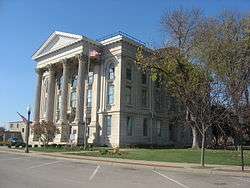 Dearborn County Courthouse | |
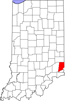 Location in the U.S. state of Indiana | |
 Indiana's location in the U.S. | |
| Founded | 1803 |
| Named for | Dr. Henry Dearborn |
| Seat | Lawrenceburg |
| Largest city | Lawrenceburg |
| Area | |
| • Total | 307.42 sq mi (796 km2) |
| • Land | 305.03 sq mi (790 km2) |
| • Water | 2.38 sq mi (6 km2), 0.77% |
| Population | |
| • (2010) | 50,047 |
| • Density | 164/sq mi (63.31/km2) |
| Congressional district | 6th |
| Time zone | Eastern: UTC−5/−4 |
| Website |
www |
|
Footnotes: Indiana county number 15 | |

Dearborn County is a county located in the U.S. state of Indiana. In 2010, the population was 50,047.[1] The county seat and largest city is Lawrenceburg.[2]
Dearborn County is part of the Cincinnati-Middletown, OH-KY-IN Metropolitan Statistical Area.
History
Dearborn County was formed in 1803.[3] It was named for Dr. Henry Dearborn.[4] Dearborn was U.S. Secretary of War at the time the county was named. Early growth was centered on Lawrenceburg which was an important railroad junction connecting two of the regions major rail lines.[5]
Dearborn County originally included what is now Ohio County when it was organized in 1803. Lawrenceburg was then designated as the county seat. However, from the start, a contention existed between the towns of Lawrenceburg and Rising Sun over that designation. The contention between the two towns was resolved in 1844 when the Indiana State legislature separated the portion of Dearborn County south of Laughery Creek and created the new county of Ohio on March 1, 1844, with Rising Sun designated as its county seat.[6]
Geography
According to the 2010 census, the county has a total area of 307.42 square miles (796.2 km2), of which 305.03 square miles (790.0 km2) (or 99.22%) is land and 2.38 square miles (6.2 km2) (or 0.77%) is water.[7] Part of the southeastern county line is formed by the Ohio River.
Dearborn County contains the Perfect North Slopes ski resort.[8]
Cities
Towns
Census-designated places
Other unincorporated communities
Townships
Adjacent counties
- Franklin County (north)
- Butler County, Ohio (northeast)
- Hamilton County, Ohio (east)
- Boone County, Kentucky (southeast)
- Ohio County (south)
- Ripley County (west)
Climate
In recent years, average temperatures in Lawrenceburg have ranged from a low of 21 °F (−6 °C) in January to a high of 86 °F (30 °C) in July, although a record low of −25 °F (−32 °C) was recorded in January 1977 and a record high of 107 °F (42 °C) was recorded in July 1988. Average monthly precipitation ranged from 2.94 inches (75 mm) in September to 5.53 inches (140 mm) in May.[9]
| Lawrenceburg, Indiana | ||||||||||||||||||||||||||||||||||||||||||||||||||||||||||||
|---|---|---|---|---|---|---|---|---|---|---|---|---|---|---|---|---|---|---|---|---|---|---|---|---|---|---|---|---|---|---|---|---|---|---|---|---|---|---|---|---|---|---|---|---|---|---|---|---|---|---|---|---|---|---|---|---|---|---|---|---|
| Climate chart (explanation) | ||||||||||||||||||||||||||||||||||||||||||||||||||||||||||||
| ||||||||||||||||||||||||||||||||||||||||||||||||||||||||||||
| ||||||||||||||||||||||||||||||||||||||||||||||||||||||||||||
Demographics
| Historical population | |||
|---|---|---|---|
| Census | Pop. | %± | |
| 1810 | 7,310 | — | |
| 1820 | 11,468 | 56.9% | |
| 1830 | 13,974 | 21.9% | |
| 1840 | 19,327 | 38.3% | |
| 1850 | 20,166 | 4.3% | |
| 1860 | 24,406 | 21.0% | |
| 1870 | 24,116 | −1.2% | |
| 1880 | 26,671 | 10.6% | |
| 1890 | 23,364 | −12.4% | |
| 1900 | 22,194 | −5.0% | |
| 1910 | 21,396 | −3.6% | |
| 1920 | 20,033 | −6.4% | |
| 1930 | 21,056 | 5.1% | |
| 1940 | 23,053 | 9.5% | |
| 1950 | 25,141 | 9.1% | |
| 1960 | 28,674 | 14.1% | |
| 1970 | 29,430 | 2.6% | |
| 1980 | 34,291 | 16.5% | |
| 1990 | 38,835 | 13.3% | |
| 2000 | 46,109 | 18.7% | |
| 2010 | 50,047 | 8.5% | |
| Est. 2016 | 49,331 | [10] | −1.4% |
| U.S. Decennial Census[11] 1790-1960[12] 1900-1990[13] 1990-2000[14] 2010-2013[1] | |||
At the 2010 United States Census, there were 50,047 people, 18,743 households and 13,773 families residing in the county.[15] The population density was 164.1 inhabitants per square mile (63.4/km2). There were 20,171 housing units at an average density of 66.1 per square mile (25.5/km2).[7] The racial makeup of the county was 97.5% white, 0.6% black or African American, 0.4% Asian, 0.2% American Indian, 0.1% Pacific islander, 0.3% from other races, and 1.0% from two or more races. Those of Hispanic or Latino origin made up 1.0% of the population.[15] In terms of ancestry, 46.5% were German, 19.2% were Irish, 11.4% were English, and 7.8% were American.[16]
Of the 18,743 households, 35.1% had children under the age of 18 living with them, 58.5% were married couples living together, 10.0% had a female householder with no husband present, 26.5% were non-families, and 22.0% of all households were made up of individuals. The average household size was 2.64 and the average family size was 3.07. The median age was 40.0 years.[15]
The median household income was $47,697 and the median family income was $66,561. Males had a median income of $45,270 and females $33,353. The per capita income was $25,023. About 4.5% of families and 7.2% of the population were below the poverty line, including 8.5% of those under age 18 and 6.3% of those age 65 or over.[17]
Government
The county government is a constitutional body, and is granted specific powers by the Constitution of Indiana, and by the Indiana Code.
County Council: The county council is the legislative branch of the county government and controls all the spending and revenue collection in the county. Representatives are elected from county districts. The council members serve four-year terms. They are responsible for setting salaries, the annual budget, and special spending. The council also has limited authority to impose local taxes, in the form of an income and property tax that is subject to state level approval, excise taxes, and service taxes.[18][19]
Board of Commissioners: The executive body of the county is made of a board of commissioners. The commissioners are elected county-wide, in staggered terms, and each serves a four-year term. One of the commissioners, typically the most senior, serves as president. The commissioners are charged with executing the acts legislated by the council, collecting revenue, and managing the day-to-day functions of the county government.[18][19]
Court: Dearborn County's courts consist of a Circuit Court (shared with Ohio County in the only such arrangement in the state[20]) and two Superior Courts. Judges are elected to six-year terms. Lawrenceburg and Aurora also have City Courts. Judges there serve four-year terms.
County Officials: The county has several other elected offices, including sheriff, prosecuting attorney, coroner, auditor, treasurer, recorder, surveyor, and circuit court clerk. Each of these elected officers serves a term of four years and oversees a different part of county government. Members elected to county government positions are required to declare a party affiliation and to be residents of the county.[19]
Dearborn County is part of Indiana's 6th congressional district; Indiana Senate district 43;[21] and Indiana House of Representatives districts 55 and 68.[22]
| Year | Republican | Democratic | Third parties |
|---|---|---|---|
| 2016 | 75.5% 18,113 | 20.4% 4,883 | 4.1% 991 |
| 2012 | 68.9% 15,394 | 29.2% 6,528 | 1.9% 434 |
| 2008 | 67.0% 14,886 | 32.1% 7,123 | 0.9% 208 |
| 2004 | 67.9% 14,231 | 31.5% 6,596 | 0.7% 142 |
| 2000 | 64.9% 11,452 | 34.1% 6,020 | 1.0% 178 |
| 1996 | 50.6% 8,318 | 38.1% 6,269 | 11.3% 1,852 |
| 1992 | 44.8% 6,974 | 32.9% 5,116 | 22.3% 3,477 |
| 1988 | 61.6% 8,195 | 38.1% 5,066 | 0.4% 48 |
| 1984 | 64.7% 9,149 | 34.8% 4,920 | 0.5% 63 |
| 1980 | 56.4% 7,467 | 38.8% 5,135 | 4.9% 647 |
| 1976 | 49.0% 6,176 | 50.4% 6,348 | 0.6% 71 |
| 1972 | 64.7% 7,689 | 34.8% 4,137 | 0.5% 59 |
| 1968 | 48.7% 6,208 | 38.0% 4,842 | 13.4% 1,710 |
| 1964 | 41.5% 5,473 | 58.3% 7,699 | 0.2% 26 |
| 1960 | 55.0% 7,619 | 44.9% 6,216 | 0.1% 19 |
| 1956 | 56.4% 7,189 | 43.4% 5,535 | 0.2% 22 |
| 1952 | 54.8% 7,091 | 44.9% 5,810 | 0.3% 33 |
| 1948 | 46.7% 5,353 | 52.7% 6,040 | 0.6% 69 |
| 1944 | 51.3% 5,487 | 48.2% 5,157 | 0.4% 47 |
| 1940 | 49.3% 5,908 | 50.4% 6,038 | 0.3% 41 |
| 1936 | 41.5% 4,669 | 56.6% 6,366 | 2.0% 221 |
| 1932 | 41.8% 4,716 | 57.0% 6,429 | 1.2% 130 |
| 1928 | 58.5% 6,334 | 41.2% 4,459 | 0.3% 36 |
| 1924 | 48.1% 4,588 | 45.4% 4,330 | 6.5% 618 |
| 1920 | 50.7% 5,159 | 48.0% 4,884 | 1.4% 140 |
| 1916 | 42.2% 2,318 | 54.8% 3,010 | 3.1% 167 |
| 1912 | 25.9% 1,366 | 56.1% 2,957 | 17.9% 945 |
| 1908 | 41.8% 2,520 | 55.8% 3,365 | 2.4% 142 |
| 1904 | 43.0% 2,588 | 54.2% 3,264 | 2.8% 168 |
| 1900 | 42.0% 2,533 | 55.9% 3,371 | 2.1% 127 |
| 1896 | 44.8% 2,714 | 54.6% 3,313 | 0.6% 38 |
| 1892 | 39.2% 2,274 | 58.6% 3,397 | 2.2% 130 |
| 1888 | 42.3% 2,648 | 56.3% 3,531 | 1.4% 89 |
Infrastructure
Major highways
Notable people
- Erwin "Cannonball" Baker, motorcycle and auto racer, 1989 inductee in Motorsports Hall of Fame of America
- John Whiteaker, first state Governor of Oregon from 1859 until 1862 and Oregon's Congressman from 1879 to 1881[24]
- Jim Lyttle, professional baseball player
- Lonnie Mack, influential guitar soloist of early rock 'n' roll
See also
References
- 1 2 "Dearborn County QuickFacts". United States Census Bureau. Archived from the original on July 9, 2011. Retrieved September 17, 2011.
- ↑ "Find a County". National Association of Counties. Archived from the original on May 31, 2011. Retrieved June 7, 2011.
- ↑ History of Dearborn and Ohio Counties, Indiana. F. E. Weakley. 1885. p. 111.
- ↑ "Profile for Dearborn County, Indiana, IN". ePodunk. Retrieved August 24, 2012.
- Gannett, Henry (1905). The Origin of Certain Place Names in the United States. Govt. Print. Off. p. 102. - ↑ De Witt Clinton Goodrich & Charles Richard Tuttle (1875). An Illustrated History of the State of Indiana. Indiana: R. S. Peale & co. p. 553.
- ↑ "More About Dearborn County". Indiana County History Preservation Society. Archived from the original on January 31, 2011. Retrieved December 16, 2012.
- 1 2 "Population, Housing Units, Area, and Density: 2010 - County". United States Census Bureau. Retrieved July 10, 2015.
- ↑ "Neighborhoods". Cincinnati magazine. Archived from the original on July 12, 2014. Retrieved July 25, 2014.
- 1 2 "Monthly Averages for Lawrenceburg, Indiana". The Weather Channel. Retrieved January 27, 2011.
- ↑ "Population and Housing Unit Estimates". Retrieved June 9, 2017.
- ↑ "U.S. Decennial Census". United States Census Bureau. Archived from the original on May 12, 2015. Retrieved July 10, 2014.
- ↑ "Historical Census Browser". University of Virginia Library. Retrieved July 10, 2014.
- ↑ "Population of Counties by Decennial Census: 1900 to 1990". United States Census Bureau. Retrieved July 10, 2014.
- ↑ "Census 2000 PHC-T-4. Ranking Tables for Counties: 1990 and 2000" (PDF). United States Census Bureau. Retrieved July 10, 2014.
- 1 2 3 "DP-1 Profile of General Population and Housing Characteristics: 2010 Demographic Profile Data". United States Census Bureau. Retrieved July 10, 2015.
- ↑ "DP02 SELECTED SOCIAL CHARACTERISTICS IN THE UNITED STATES – 2006-2010 American Community Survey 5-Year Estimates". United States Census Bureau. Retrieved July 10, 2015.
- ↑ "DP03 SELECTED ECONOMIC CHARACTERISTICS – 2006-2010 American Community Survey 5-Year Estimates". United States Census Bureau. Retrieved July 10, 2015.
- 1 2 Indiana Code. "Title 36, Article 2, Section 3". IN.gov. Retrieved September 16, 2008.
- 1 2 3 Indiana Code. "Title 2, Article 10, Section 2" (PDF). IN.gov. Retrieved September 16, 2008.
- ↑ "Archived copy". Archived from the original on 2011-10-19. Retrieved 2011-12-03.
- ↑ "Indiana Senate Districts". State of Indiana. Retrieved January 23, 2011.
- ↑ "Indiana House Districts". State of Indiana. Retrieved January 23, 2011.
- ↑ Leip, David. "Dave Leip's Atlas of U.S. Presidential Elections". uselectionatlas.org. Retrieved 2018-05-14.
- ↑ "John Whiteaker". Find A Grave. Retrieved August 25, 2012.
External links
Places adjacent to Dearborn County, Indiana | ||||||||||
|---|---|---|---|---|---|---|---|---|---|---|
| ||||||||||
Municipalities and communities of Dearborn County, Indiana, United States | ||
|---|---|---|
| Cities | ||
| Towns | ||
| Townships | ||
| CDPs | ||
| Other unincorporated communities | ||
