Preble County, Ohio
| Preble County, Ohio | ||
|---|---|---|
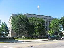 Preble County Courthouse | ||
| ||
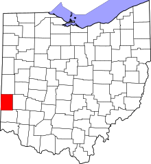 Location in the U.S. state of Ohio | ||
 Ohio's location in the U.S. | ||
| Founded | March 1, 1808[1][2] | |
| Named for | Edward Preble | |
| Seat | Eaton | |
| Largest city | Eaton | |
| Area | ||
| • Total | 426 sq mi (1,103 km2) | |
| • Land | 424 sq mi (1,098 km2) | |
| • Water | 2.3 sq mi (6 km2), 0.5% | |
| Population | ||
| • (2010) | 42,270 | |
| • Density | 100/sq mi (40/km2) | |
| Congressional district | 8th | |
| Time zone | Eastern: UTC−5/−4 | |
| Website |
www | |

Preble County is a county located in the U.S. state of Ohio. As of the 2010 census, the population was 42,270.[3] Its county seat is Eaton.[4] The county was formed on February 15, 1808 from portions of Butler and Montgomery Counties. It is named for Edward Preble, a naval officer who fought in the American Revolutionary War and against the Barbary Pirates.[5]
Geography
According to the U.S. Census Bureau, the county has a total area of 426 square miles (1,100 km2), of which 424 square miles (1,100 km2) is land and 2.3 square miles (6.0 km2) (0.5%) is water.[6]
Adjacent counties
- Darke County (north)
- Montgomery County (east)
- Butler County (south)
- Union County, Indiana (southwest)
- Wayne County, Indiana (northwest)
Rivers and streams
- Little Four Mile Creek[7]
- Harker's Run
- Seven Mile Creek
- Twin Creek
- Price Creek[8]
- Goose Creek
Demographics
| Historical population | |||
|---|---|---|---|
| Census | Pop. | %± | |
| 1810 | 3,304 | — | |
| 1820 | 10,237 | 209.8% | |
| 1830 | 16,291 | 59.1% | |
| 1840 | 19,482 | 19.6% | |
| 1850 | 21,736 | 11.6% | |
| 1860 | 21,820 | 0.4% | |
| 1870 | 21,809 | −0.1% | |
| 1880 | 24,533 | 12.5% | |
| 1890 | 23,421 | −4.5% | |
| 1900 | 23,713 | 1.2% | |
| 1910 | 23,834 | 0.5% | |
| 1920 | 23,238 | −2.5% | |
| 1930 | 22,455 | −3.4% | |
| 1940 | 23,329 | 3.9% | |
| 1950 | 27,081 | 16.1% | |
| 1960 | 32,498 | 20.0% | |
| 1970 | 34,719 | 6.8% | |
| 1980 | 38,223 | 10.1% | |
| 1990 | 40,113 | 4.9% | |
| 2000 | 42,337 | 5.5% | |
| 2010 | 42,270 | −0.2% | |
| Est. 2017 | 41,120 | [9] | −2.7% |
| U.S. Decennial Census[10] 1790-1960[11] 1900-1990[12] 1990-2000[13] 2010-2017[3] | |||
2000 census
As of the census[14] of 2000, there were 42,337 people, 16,001 households, and 12,144 families residing in the county. The population density was 100 people per square mile (38/km²). There were 17,186 housing units at an average density of 40 per square mile (16/km²). The racial makeup of the county was 98.47% White, 0.32% Black or African American, 0.21% Native American, 0.26% Asian, 0.02% Pacific Islander, 0.11% from other races, and 0.60% from two or more races. 0.43% of the population were Hispanic or Latino of any race.
There were 16,001 households out of which 34.20% had children under the age of 18 living with them, 63.50% were married couples living together, 8.50% had a female householder with no husband present, and 24.10% were non-families. 20.60% of all households were made up of individuals and 8.90% had someone living alone who was 65 years of age or older. The average household size was 2.62 and the average family size was 3.02.
In the county, the population was spread out with 26.00% under the age of 18, 7.70% from 18 to 24, 28.70% from 25 to 44, 24.40% from 45 to 64, and 13.20% who were 65 years of age or older. The median age was 38 years. For every 100 females there were 99.30 males. For every 100 females age 18 and over, there were 95.70 males.
The median income for a household in the county was $42,093, and the median income for a family was $47,547. Males had a median income of $35,313 versus $23,573 for females. The per capita income for the county was $18,444. About 4.50% of families and 6.10% of the population were below the poverty line, including 7.00% of those under age 18 and 6.10% of those age 65 or over.
2010 census
As of the 2010 United States Census, there were 42,270 people, 16,341 households, and 11,867 families residing in the county.[15] The population density was 99.7 inhabitants per square mile (38.5/km2). There were 17,888 housing units at an average density of 42.2 per square mile (16.3/km2).[16] The racial makeup of the county was 97.6% white, 0.4% black or African American, 0.4% Asian, 0.2% American Indian, 0.2% from other races, and 1.2% from two or more races. Those of Hispanic or Latino origin made up 0.6% of the population.[15] In terms of ancestry, 34.3% were German, 14.6% were Irish, 12.7% were American, and 11.5% were English.[17]
Of the 16,341 households, 32.7% had children under the age of 18 living with them, 57.5% were married couples living together, 10.1% had a female householder with no husband present, 27.4% were non-families, and 23.2% of all households were made up of individuals. The average household size was 2.56 and the average family size was 2.99. The median age was 40.9 years.[15]
The median income for a household in the county was $49,780 and the median income for a family was $57,711. Males had a median income of $46,383 versus $30,876 for females. The per capita income for the county was $23,290. About 6.3% of families and 9.4% of the population were below the poverty line, including 13.1% of those under age 18 and 6.8% of those age 65 or over.[18]
Politics
| Year | Republican | Democratic | Third parties |
|---|---|---|---|
| 2016 | 74.7% 15,446 | 20.9% 4,325 | 4.4% 910 |
| 2012 | 66.9% 13,535 | 30.7% 6,211 | 2.4% 479 |
| 2008 | 64.4% 13,562 | 33.3% 6,999 | 2.3% 488 |
| 2004 | 65.0% 13,734 | 34.4% 7,274 | 0.6% 119 |
| 2000 | 61.5% 11,176 | 35.1% 6,375 | 3.4% 615 |
| 1996 | 47.5% 8,139 | 38.6% 6,611 | 13.9% 2,383 |
| 1992 | 44.3% 8,023 | 30.7% 5,557 | 25.0% 4,518 |
| 1988 | 67.0% 10,297 | 32.1% 4,937 | 1.0% 147 |
| 1984 | 71.8% 11,065 | 27.3% 4,198 | 0.9% 140 |
| 1980 | 56.9% 8,376 | 36.8% 5,416 | 6.3% 931 |
| 1976 | 52.2% 6,654 | 45.9% 5,850 | 1.9% 243 |
| 1972 | 70.3% 8,993 | 27.1% 3,472 | 2.6% 330 |
| 1968 | 52.6% 6,544 | 30.7% 3,817 | 16.7% 2,073 |
| 1964 | 43.5% 5,839 | 56.5% 7,574 | |
| 1960 | 61.7% 8,802 | 38.3% 5,467 | |
| 1956 | 63.9% 8,099 | 36.1% 4,574 | |
| 1952 | 63.5% 8,405 | 36.5% 4,836 | |
| 1948 | 55.5% 5,837 | 44.3% 4,656 | 0.2% 23 |
| 1944 | 57.6% 6,609 | 42.4% 4,872 | |
| 1940 | 53.2% 6,511 | 46.8% 5,735 | |
| 1936 | 45.5% 5,593 | 51.8% 6,366 | 2.7% 331 |
| 1932 | 44.8% 5,205 | 53.5% 6,221 | 1.7% 199 |
| 1928 | 65.2% 6,693 | 34.2% 3,513 | 0.6% 57 |
| 1924 | 56.8% 5,676 | 40.3% 4,033 | 2.9% 292 |
| 1920 | 55.7% 6,258 | 43.9% 4,933 | 0.4% 40 |
| 1916 | 45.2% 2,881 | 53.1% 3,387 | 1.8% 112 |
| 1912 | 34.7% 2,135 | 46.4% 2,859 | 18.9% 1,164 |
| 1908 | 51.0% 3,519 | 47.1% 3,247 | 2.0% 135 |
| 1904 | 54.9% 3,647 | 42.0% 2,792 | 3.2% 210 |
| 1900 | 51.4% 3,548 | 46.5% 3,206 | 2.1% 145 |
| 1896 | 49.6% 3,300 | 48.9% 3,254 | 1.6% 105 |
| 1892 | 49.4% 2,957 | 45.1% 2,699 | 5.5% 331 |
| 1888 | 49.1% 3,157 | 46.1% 2,966 | 4.9% 312 |
| 1884 | 51.2% 3,178 | 45.4% 2,817 | 3.4% 211 |
| 1880 | 53.0% 3,183 | 45.2% 2,711 | 1.8% 109 |
| 1876 | 53.5% 3,004 | 45.4% 2,551 | 1.1% 64 |
| 1872 | 56.1% 2,715 | 43.4% 2,101 | 0.4% 20 |
Education
Public school districts
- Eaton Community Schools
- Eaton High School, Eaton (the Eagles)
- National Trail Local School District
- National Trail High School, New Paris (the Blazers)
- Preble Shawnee Local School District
- Preble Shawnee High School, Camden (the Arrows)
- Tri-County North Local School District
- Tri-County North High School, Lewisburg (the Panthers)
- Twin Valley Community Local School District
- Twin Valley South High School, West Alexandria (the Panthers)
- Union County College Corner Joint School District (the Patriots)
- College Corner Union School (grades K-5) is physically located in both Ohio and Indiana (the state line runs through the middle of the building) and serves students from both College Corner, Ohio, and West College Corner, Indiana. After finishing fifth grade, Preble County students attend Union County Middle School and Union County High School, both located across the state line in Liberty, Indiana.[20]
Higher education
- Sinclair Community College
- Preble County Learning Center, Eaton
Communities

City
- Eaton (county seat)
Villages
Townships
https://web.archive.org/web/20160715023447/http://www.ohiotownships.org/township-websites
Census-designated place
Other unincorporated communities
Notable residents
- Sherwood Anderson - writer
- Victor J. Banis - "the godfather of modern popular gay fiction."
- Benjamin Hanby - wrote the Christmas carol "Up On The House Top" while living in Preble County.
- Andrew L. Harris - Civil War general and former governor of Ohio.
- William Stephens - former governor of California.
See also
References
- ↑ "Welcome to the Preble County Commissioners' Website: History". Archived from the original on 2007-08-12. Retrieved 2007-04-28.
- ↑ "Ohio County Profiles: Preble County" (PDF). Ohio Department of Development. Archived from the original (PDF) on 2007-06-21. Retrieved 2007-04-28.
- 1 2 "State & County QuickFacts". United States Census Bureau. Retrieved February 10, 2015.
- ↑ "Find a County". National Association of Counties. Archived from the original on 2011-05-31. Retrieved 2011-06-07.
- ↑ "Preble County data". Ohio State University Extension Data Center. Retrieved 2007-04-28.
- ↑ "2010 Census Gazetteer Files". United States Census Bureau. August 22, 2012. Archived from the original on May 4, 2014. Retrieved February 10, 2015.
- ↑ "GNIS Detail - Little Four Mile Creek". geonames.usgs.gov. Retrieved 2017-08-23.
- ↑ "GNIS Detail - Price Creek". geonames.usgs.gov. Retrieved 2017-08-23.
- ↑ "Population and Housing Unit Estimates". Retrieved June 9, 2017.
- ↑ "U.S. Decennial Census". United States Census Bureau. Archived from the original on May 12, 2015. Retrieved February 10, 2015.
- ↑ "Historical Census Browser". University of Virginia Library. Retrieved February 10, 2015.
- ↑ Forstall, Richard L., ed. (March 27, 1995). "Population of Counties by Decennial Census: 1900 to 1990". United States Census Bureau. Retrieved February 10, 2015.
- ↑ "Census 2000 PHC-T-4. Ranking Tables for Counties: 1990 and 2000" (PDF). United States Census Bureau. April 2, 2001. Retrieved February 10, 2015.
- ↑ "American FactFinder". United States Census Bureau. Archived from the original on 2013-09-11. Retrieved 2008-01-31.
- 1 2 3 "DP-1 Profile of General Population and Housing Characteristics: 2010 Demographic Profile Data". United States Census Bureau. Retrieved 2015-12-27.
- ↑ "Population, Housing Units, Area, and Density: 2010 - County". United States Census Bureau. Retrieved 2015-12-27.
- ↑ "DP02 SELECTED SOCIAL CHARACTERISTICS IN THE UNITED STATES – 2006-2010 American Community Survey 5-Year Estimates". United States Census Bureau. Retrieved 2015-12-27.
- ↑ "DP03 SELECTED ECONOMIC CHARACTERISTICS – 2006-2010 American Community Survey 5-Year Estimates". United States Census Bureau. Retrieved 2015-12-27.
- ↑ Leip, David. "Dave Leip's Atlas of U.S. Presidential Elections". uselectionatlas.org. Retrieved 2018-05-03.
- ↑ "College Corner School - Ohio/Indiana border - Border Crossings on Waymarking.com". www.waymarking.com. Retrieved 2018-05-03.
External links
- Preble County Commissioners
- Eaton-Preble County Chamber of Commerce
- Preble County District Library
- Preble County Information Resource
Places adjacent to Preble County, Ohio | ||||||||||
|---|---|---|---|---|---|---|---|---|---|---|
| ||||||||||
Municipalities and communities of Preble County, Ohio, United States | ||
|---|---|---|
| City | | |
| Villages | ||
| Townships | ||
| CDP | ||
| Unincorporated communities | ||
| Ghost towns | ||
| Footnotes | ‡This populated place also has portions in an adjacent county or counties | |
