Pendleton County, Kentucky
| Pendleton County, Kentucky | |
|---|---|
 Pendleton County courthouse in Falmouth | |
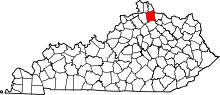 Location in the U.S. state of Kentucky | |
 Kentucky's location in the U.S. | |
| Founded | 1798 |
| Named for | Edmund Pendleton |
| Seat | Falmouth |
| Largest city | Falmouth |
| Area | |
| • Total | 282 sq mi (730 km2) |
| • Land | 277 sq mi (717 km2) |
| • Water | 4.8 sq mi (12 km2), 1.7% |
| Population | |
| • (2010) | 14,877 |
| • Density | 54/sq mi (21/km2) |
| Congressional district | 4th |
| Time zone | Eastern: UTC−5/−4 |
| Website |
pendletoncounty |
Pendleton County is a county located in the U.S. state of Kentucky. As of the 2010 census, the population was 14,877.[1] Its county seat is Falmouth.[2] The county was founded December 13, 1798,[3]
Pendleton County is included in the Cincinnati-Middletown, OH-KY-IN Metropolitan Statistical Area.
History
Pendleton County was created from parts of Campbell and Bracken counties in 1798.[4] The county was named after Edmund Pendleton, a longtime member of the Virginia House of Burgesses, the Continental Congress and chief justice of Virginia.[5][6]
Falmouth, the future county seat, began as a settlement called Forks of Licking, circa 1776.[7] It was the site of the Battle of Blue Licks during the Revolutionary War. Native Americans who were helping the British ambushed Kentuckians on August 19, 1782 on the Licking River. In a matter of fifteen minutes, 60 were killed.[8]
Falmouth was chartered in 1793. Its name originated from the Virginians who settled there from Falmouth, Virginia.[9] It was also in 1793 that one of the first sawmills in Kentucky was built in Falmouth.[8] Falmouth was designated the county seat in 1799.[10] The county courthouse was erected in 1848.[8]
During the American Civil War, the county sent men to both armies. A Union Army recruiting camp was established in Falmouth in September 1861. Two Confederate recruiters were captured and executed by the Union Army in the Peach Grove area of northern Pendleton County. In July 1862, a number of county citizens were rounded up by Union troops during a crackdown against suspected Confederate sympathizers. In June 1863, a number of women were arrested at Demossville because they were believed to be potential spies dangerous to the Federal government. Falmouth was the site of a small skirmish on September 18, 1862, between twenty-eight Confederates and eleven Home Guardsmen.
The city of Butler was established circa 1852 when the Kentucky Central Railroad was built through the area. The city was named for William O. Butler, U.S. congressman from the area, when it was incorporated on February 1, 1868.
Geography
According to the U.S. Census Bureau, the county has a total area of 282 square miles (730 km2), of which 277 square miles (720 km2) is land and 4.8 square miles (12 km2) (1.7%) is water.[11] The county's northeastern border with Ohio is formed by the Ohio River.
Adjacent counties
- Kenton County (northwest)
- Campbell County (north)
- Clermont County, Ohio (northeast)
- Bracken County (east)
- Harrison County (south)
- Grant County (west)
Demographics
| Historical population | |||
|---|---|---|---|
| Census | Pop. | %± | |
| 1800 | 1,613 | — | |
| 1810 | 3,061 | 89.8% | |
| 1820 | 3,086 | 0.8% | |
| 1830 | 3,863 | 25.2% | |
| 1840 | 4,455 | 15.3% | |
| 1850 | 6,774 | 52.1% | |
| 1860 | 10,443 | 54.2% | |
| 1870 | 14,030 | 34.3% | |
| 1880 | 16,702 | 19.0% | |
| 1890 | 16,346 | −2.1% | |
| 1900 | 14,947 | −8.6% | |
| 1910 | 11,985 | −19.8% | |
| 1920 | 11,719 | −2.2% | |
| 1930 | 10,876 | −7.2% | |
| 1940 | 10,392 | −4.5% | |
| 1950 | 9,610 | −7.5% | |
| 1960 | 9,968 | 3.7% | |
| 1970 | 9,949 | −0.2% | |
| 1980 | 10,989 | 10.5% | |
| 1990 | 12,036 | 9.5% | |
| 2000 | 14,390 | 19.6% | |
| 2010 | 14,877 | 3.4% | |
| Est. 2016 | 14,560 | [12] | −2.1% |
| U.S. Decennial Census[13] 1790-1960[14] 1900-1990[15] 1990-2000[16] 2010-2013[1] | |||
As of the census[17] of 2000, there were 14,390 people, 5,170 households, and 3,970 families residing in the county. The population density was 51 per square mile (20/km2). There were 5,756 housing units at an average density of 20 per square mile (7.7/km2). The racial makeup of the county was 98.39% White, 0.49% Black or African American, 0.19% Native American, 0.11% Asian, 0.01% Pacific Islander, 0.35% from other races, and 0.44% from two or more races. 0.67% of the population were Hispanic or Latino of any race.
There were 5,170 households out of which 39.00% had children under the age of 18 living with them, 62.80% were married couples living together, 9.60% had a female householder with no husband present, and 23.20% were non-families. 20.10% of all households were made up of individuals and 8.30% had someone living alone who was 65 years of age or older. The average household size was 2.75 and the average family size was 3.14.
In the county, the population was spread out with 28.40% under the age of 18, 8.50% from 18 to 24, 31.20% from 25 to 44, 21.50% from 45 to 64, and 10.40% who were 65 years of age or older. The median age was 34 years. For every 100 females there were 100.30 males. For every 100 females age 18 and over, there were 97.90 males.
The median income for a household in the county was $38,125, and the median income for a family was $42,589. Males had a median income of $31,885 versus $23,234 for females. The per capita income for the county was $16,551. About 9.80% of families and 11.40% of the population were below the poverty line, including 14.80% of those under age 18 and 11.60% of those age 65 or over.
Education
Pendleton County High School, just north of Falmouth, is the public high school. It currently is home to fewer than 1,000 students. The mascot for PCHS is the wildcat, and the school colors are red, black and white. The school features two gyms and a 450-seat auditorium.
Other schools in the county are Sharp Middle School, named for Phillip Allen Sharp, American geneticist and molecular biologist and winner of the Nobel Prize in Physiology or Medicine (1993) and National Medal of Science (2004), located between Falmouth and Butler, Northern Elementary in Butler, and Southern Elementary in Falmouth.
Library
Pendleton County Public Library is located at 801 Robbins Avenue, Falmouth. The library provides public access computers with high speed internet and free wifi. The library also offers copying, a fax service, and a public meeting room that can be reserved.
Politics
| Year | Republican | Democratic | Third parties |
|---|---|---|---|
| 2016 | 76.6% 4,604 | 19.4% 1,164 | 4.0% 239 |
| 2012 | 64.3% 3,556 | 33.6% 1,859 | 2.2% 119 |
| 2008 | 63.4% 3,676 | 34.9% 2,027 | 1.7% 99 |
| 2004 | 67.1% 4,045 | 32.2% 1,940 | 0.7% 40 |
| 2000 | 63.4% 3,044 | 34.8% 1,670 | 1.9% 89 |
| 1996 | 47.2% 2,177 | 41.8% 1,926 | 11.0% 509 |
| 1992 | 38.8% 1,810 | 37.3% 1,740 | 24.0% 1,119 |
| 1988 | 60.8% 2,487 | 38.5% 1,576 | 0.7% 28 |
| 1984 | 63.8% 2,767 | 35.2% 1,529 | 1.0% 44 |
| 1980 | 45.5% 1,757 | 51.5% 1,992 | 3.0% 117 |
| 1976 | 35.9% 1,230 | 62.7% 2,147 | 1.5% 50 |
| 1972 | 67.3% 1,966 | 31.1% 909 | 1.6% 47 |
| 1968 | 45.7% 1,614 | 32.7% 1,156 | 21.6% 763 |
| 1964 | 34.4% 1,313 | 65.4% 2,495 | 0.2% 7 |
| 1960 | 61.5% 2,387 | 38.5% 1,497 | 0.0% 0 |
| 1956 | 54.5% 2,273 | 45.3% 1,889 | 0.3% 12 |
| 1952 | 51.2% 1,993 | 48.7% 1,895 | 0.1% 4 |
| 1948 | 40.2% 1,373 | 57.3% 1,958 | 2.5% 86 |
| 1944 | 48.3% 1,977 | 51.3% 2,096 | 0.4% 17 |
| 1940 | 48.2% 2,029 | 51.5% 2,165 | 0.3% 14 |
| 1936 | 42.6% 1,837 | 56.4% 2,432 | 1.0% 42 |
| 1932 | 39.2% 1,812 | 59.4% 2,745 | 1.4% 63 |
| 1928 | 67.0% 3,196 | 32.9% 1,567 | 0.1% 5 |
| 1924 | 49.7% 2,148 | 46.9% 2,028 | 3.4% 145 |
| 1920 | 44.3% 2,105 | 54.7% 2,598 | 1.0% 49 |
| 1916 | 40.6% 1,206 | 58.1% 1,728 | 1.3% 39 |
| 1912 | 29.8% 746 | 52.4% 1,310 | 17.8% 445 |
Culture
Pendleton County is home to Kincaid Regional Theatre. Its performances take place at the Falmouth School Center (Old Middle School) in Falmouth.
Infrastructure
Transportation
Public transportation is provided by Senior Services of Northern Kentucky with demand-response service.[19]
Communities
- Butler
- DeMossville
- Falmouth (county seat)
See also
- Bethel Cemetery and Church, a historic frame church 5 miles north of Falmouth
- Fryer House, an 1811 stone house, home of the Pendleton County Historical Society
- National Register of Historic Places listings in Pendleton County, Kentucky
References
- 1 2 "State & County QuickFacts". United States Census Bureau. Archived from the original on July 16, 2011. Retrieved March 6, 2014.
- ↑ "Find a County". National Association of Counties. Retrieved 2011-06-07.
- ↑ "PENDLETON COUNTY". kyenc.org.
- ↑ Collins, Lewis (1882). Collins' Historical Sketches of Kentucky: History of Kentucky, Volume 2. Collins & Company. p. 26.
- ↑ "Neighborhood History: Pendleton County". mypendleton.com. Archived from the original on 2006-02-16.
- ↑ The Register of the Kentucky State Historical Society, Volume 1. Kentucky State Historical Society. 1903. p. 36.
- ↑ "Place Names of Pendleton County: Falmouth," Northern Kentucky Views: a broad collection of images and texts on the history of Northern Kentucky, "Archived copy". Archived from the original on 2012-03-18. Retrieved 2012-12-23. , Original source E. E. Barton, typescript, 1941; Paul T. Hellmann, Historical Gazetteer of the United States (New York: Routledge, 2005): 248.
- 1 2 3 Hellmann, 248.
- ↑ Lewis Collins, Historical Sketches of Kentucky, (Maysville, KY: Lewis Collins, 1848): 494.
- ↑ "Find A County". National Association of Counties (NACo). Archived from the original on 2010-08-04.
- ↑ "2010 Census Gazetteer Files". United States Census Bureau. August 22, 2012. Archived from the original on August 12, 2014. Retrieved August 19, 2014.
- ↑ "Population and Housing Unit Estimates". Retrieved June 9, 2017.
- ↑ "U.S. Decennial Census". United States Census Bureau. Retrieved August 19, 2014.
- ↑ "Historical Census Browser". University of Virginia Library. Retrieved August 19, 2014.
- ↑ "Population of Counties by Decennial Census: 1900 to 1990". United States Census Bureau. Retrieved August 19, 2014.
- ↑ "Census 2000 PHC-T-4. Ranking Tables for Counties: 1990 and 2000" (PDF). United States Census Bureau. Retrieved August 19, 2014.
- ↑ "American FactFinder". United States Census Bureau. Retrieved 2008-01-31.
- ↑ Leip, David. "Dave Leip's Atlas of U.S. Presidential Elections". uselectionatlas.org. Retrieved 2018-07-05.
- ↑ "SSNK Transportation Services". Senior Services of Northern Kentucky. Archived from the original on 2015-05-20. Retrieved 2015-05-19.
External links
| Wikimedia Commons has media related to Pendleton County, Kentucky. |
- Official website
- Pendleton County Historical Images and Documents: Northern Kentucky Views
- Pendleton County Genealogy - a KYGenWeb site
Municipalities and communities of Pendleton County, Kentucky, United States | ||
|---|---|---|
| Cities | | |
| Unincorporated communities | ||
| Footnotes | ‡This populated place also has portions in an adjacent county or counties | |
