Shelby County, Ohio
| Shelby County, Ohio | ||
|---|---|---|
 Shelby County Courthouse | ||
| ||
 Location in the U.S. state of Ohio | ||
 Ohio's location in the U.S. | ||
| Founded | April 1, 1819[1] | |
| Named for | Isaac Shelby | |
| Seat | Sidney | |
| Largest city | Sidney | |
| Area | ||
| • Total | 411 sq mi (1,064 km2) | |
| • Land | 408 sq mi (1,057 km2) | |
| • Water | 3.0 sq mi (8 km2), 0.7% | |
| Population | ||
| • (2010) | 49,423 | |
| • Density | 121/sq mi (47/km2) | |
| Congressional district | 4th | |
| Time zone | Eastern: UTC−5/−4 | |
| Website |
co | |

Shelby County is a county located in the U.S. state of Ohio. As of the 2010 census, the population was 49,423.[2] Its county seat is Sidney.[3] Its name honors Isaac Shelby, former governor of Kentucky.[4]
Shelby County comprises the Sidney, OH Micropolitan Statistical Area, which is also included in the Dayton-Springfield-Sidney, OH Combined Statistical Area.
History
The Algonquian-speaking Shawnee Native Americans had come into the area in the 18th century, displacing the Ojibwa-speaking Ottawa of the Anishinaabeg, a related language group who moved northwest. The Shawnee were joined by the Iroquois, Seneca and Mingo peoples as well, displaced by colonial encroachment to the east. In 1792 the European-American pioneer John Hardin was killed by the Shawnee in Shelby County. Early settlers named the first county seat of Hardin after him.
Shelby County was created in 1819 from Miami County. For many years it contained Minster, New Bremen, etc.; these were included in Auglaize County when it was created from Shelby and Allen counties.
In 1846, a group of 383 free blacks from Virginia, called the "Randolph Slaves", settled in the county, most at Rumley. They had been freed by the 1833 will of the Virginia planter John Randolph of Roanoke. He provided money for their transportation and resettlement on land in a free state.[5][6] Their gaining freedom was delayed by court challenges to Randolph's will, but the families were freed and traveled in 1846. Randolph had provided that those over the age of 40 were given 10 acres each for resettlement.[7] A contemporary history described Rumley in the following way: "There are 400 Negroes (half the population of Van Buren Township) as prosperous as their white neighbors and equal to the whites in morals, religion and intelligence."[8]
Several towns in Shelby County were established by German immigrants. The Miami and Erie Canal, which reached Shelby County in 1841, provided jobs for many of the county’s European immigrants. It also changed the way new immigrants traveled to Shelby County from Cincinnati in the south and by 1845, Lake Erie in the north. The actual construction provided the initial boost; the real benefit proved to be the opportunity for increased commerce presented by this new transportation link. The canal brought a business boom which in turn elevated farm product prices up to previously unknown heights. German immigrants arrived to work on the canal, on the land, and in the shops, business in Sidney and Shelby County began to expand. The German natives penchant for thrift proved to be a valuable asset to the area’s economic and social growth. Sidney’s population increased from 713 in 1840 to 1,284 by 1850. During this period, the residents’ national origins went from being almost entirely English, or of English descent, to at least fifty percent German and Alsatian French.[9] There were also many families from England who arrived as immigrants in the 19th century as well, the English immigrants who came to Shelby County, Ohio were exclusively of working class rural origins. It was easier for working class people to own land in America and by this time parts of the United States also had the practice of universal male suffrage so all men over the age of 18, regardless of property or wealth were allowed to vote. Both of these were pull factors for immigration from England. In the case of Shelby County English immigrants came from the villages of Penkridge, Gailey, Lapley, Wheaton ASton, Bishop's Wood, Brewood, Coven, Featherstone, Essington, Four Ashes, Perton, Pattingham, Seisdon, Wombourne, Himley, Swindon and Enville, all of which were in the region of south Staffordshire in central England, and for this reason these immigrants were sometimes known as "the Staffordshire settlers".[10]
In 1900 survivors and descendants formed the Randolph Ex-Slaves Association (later they changed the name to the Randolph Slave Association) and held their first reunion at Midway Park near Piqua. Sixty-two of the original settlers attended who had been born in Virginia into slavery. After being manumitted, they had come to Ohio as small children with their families. They were called the "Old Dominions" after the nickname of Virginia; the "Buckeyes" were those descendants born in Ohio. Over the years, the reunions were also held at Troy and the Shelby County Fairgrounds, with 100-300 attending.[11]
Geography
According to the U.S. Census Bureau, the county has a total area of 411 square miles (1,060 km2), of which 408 square miles (1,060 km2) is land and 3.0 square miles (7.8 km2) (0.7%) is water.[12]
Adjacent counties
- Auglaize County (north)
- Logan County (east)
- Champaign County (southeast)
- Miami County (south)
- Darke County (west)
- Mercer County (northwest)
Demographics
| Historical population | |||
|---|---|---|---|
| Census | Pop. | %± | |
| 1820 | 2,106 | — | |
| 1830 | 3,671 | 74.3% | |
| 1840 | 12,154 | 231.1% | |
| 1850 | 13,958 | 14.8% | |
| 1860 | 17,493 | 25.3% | |
| 1870 | 20,748 | 18.6% | |
| 1880 | 24,137 | 16.3% | |
| 1890 | 24,707 | 2.4% | |
| 1900 | 24,625 | −0.3% | |
| 1910 | 24,663 | 0.2% | |
| 1920 | 25,923 | 5.1% | |
| 1930 | 24,924 | −3.9% | |
| 1940 | 26,071 | 4.6% | |
| 1950 | 28,488 | 9.3% | |
| 1960 | 33,586 | 17.9% | |
| 1970 | 37,748 | 12.4% | |
| 1980 | 43,089 | 14.1% | |
| 1990 | 44,915 | 4.2% | |
| 2000 | 47,910 | 6.7% | |
| 2010 | 49,423 | 3.2% | |
| Est. 2017 | 48,759 | [13] | −1.3% |
| U.S. Decennial Census[14] 1790-1960[15] 1900-1990[16] 1990-2000[17] 2010-2017[2] | |||
2000 census
As of the census[18] of 2010, there were 49,423 people, 18,488 households, 2.63 persons per household. There were 20,185 housing units The racial makeup of the county was 95.1% White, 2.1% Black or African American, 0.2% Native American, 1.0% Asian, 0.1% Pacific Islander, 1.4% from other races, and 1.6% from two or more races. 0.1% of the population were Hispanic or Latino of any race.
There were 18,488 households out of which 36.90% had children under the age of 18 living with them, 60.70% were married couples living together, 9.30% had a female householder with no husband present, and 25.80% were non-families. 22.00% of all households were made up of individuals and 8.90% had someone living alone who was 65 years of age or older. The average household size was 2.63 and the average family size was 3.13.
In the county, the population was spread out with 28.60% under the age of 18, 8.20% from 18 to 24, 29.30% from 25 to 44, 21.70% from 45 to 64, and 12.20% who were 65 years of age or older. The median age was 35 years. For every 100 females there were 98.60 males. For every 100 females age 18 and over, there were 96.40 males.
The median income for a household in the county was $48,475, and the median income for a family was $51,331. Males had a median income of $36,212 versus $24,470 for females. The per capita income for the county was $20,255. About 5.30% of families and 6.70% of the population were below the poverty line, including 8.30% of those under age 18 and 5.30% of those age 65 or over.
2010 census
As of the 2010 United States Census, there were 49,423 people, 18,467 households, and 13,409 families residing in the county.[19] The population density was 121.2 inhabitants per square mile (46.8/km2). There were 20,173 housing units at an average density of 49.5 per square mile (19.1/km2).[20] The racial makeup of the county was 94.7% white, 1.9% black or African American, 0.9% Asian, 0.2% American Indian, 0.1% Pacific islander, 0.5% from other races, and 1.9% from two or more races. Those of Hispanic or Latino origin made up 1.3% of the population.[19] In terms of ancestry, 39.8% were German, 11.0% were Irish, 9.2% were American, and 7.8% were English.[21]
Of the 18,467 households, 36.0% had children under the age of 18 living with them, 56.9% were married couples living together, 10.4% had a female householder with no husband present, 27.4% were non-families, and 23.0% of all households were made up of individuals. The average household size was 2.64 and the average family size was 3.09. The median age was 37.9 years.[19]
The median income for a household in the county was $48,475 and the median income for a family was $58,473. Males had a median income of $41,924 versus $30,487 for females. The per capita income for the county was $21,948. About 8.9% of families and 11.9% of the population were below the poverty line, including 18.1% of those under age 18 and 7.5% of those age 65 or over.[22]
Politics
| Year | Republican | Democratic | Third parties |
|---|---|---|---|
| 2016 | 78.0% 18,590 | 17.8% 4,243 | 4.2% 996 |
| 2012 | 71.7% 17,142 | 26.5% 6,343 | 1.8% 418 |
| 2008 | 67.1% 15,924 | 30.9% 7,316 | 2.0% 478 |
| 2004 | 70.9% 16,204 | 28.6% 6,535 | 0.5% 116 |
| 2000 | 63.4% 12,476 | 33.5% 6,593 | 3.1% 601 |
| 1996 | 47.8% 8,773 | 36.7% 6,729 | 15.6% 2,860 |
| 1992 | 44.3% 8,854 | 26.3% 5,262 | 29.5% 5,895 |
| 1988 | 70.0% 12,198 | 29.1% 5,065 | 0.9% 162 |
| 1984 | 75.1% 13,509 | 24.0% 4,315 | 0.9% 159 |
| 1980 | 54.3% 8,988 | 38.8% 6,425 | 6.8% 1,131 |
| 1976 | 53.9% 8,011 | 43.2% 6,414 | 2.9% 434 |
| 1972 | 61.8% 9,089 | 32.1% 4,721 | 6.1% 893 |
| 1968 | 47.6% 7,248 | 42.6% 6,479 | 9.9% 1,499 |
| 1964 | 34.2% 5,190 | 65.8% 10,004 | |
| 1960 | 56.1% 8,766 | 43.9% 6,866 | |
| 1956 | 67.7% 9,452 | 32.3% 4,515 | |
| 1952 | 62.7% 8,957 | 37.3% 5,333 | |
| 1948 | 43.7% 5,406 | 56.1% 6,939 | 0.3% 32 |
| 1944 | 55.8% 7,084 | 44.3% 5,622 | |
| 1940 | 53.9% 7,130 | 46.1% 6,105 | |
| 1936 | 33.7% 4,482 | 53.4% 7,110 | 12.9% 1,715 |
| 1932 | 33.6% 4,281 | 65.1% 8,299 | 1.3% 161 |
| 1928 | 52.1% 5,975 | 47.5% 5,448 | 0.3% 37 |
| 1924 | 44.4% 4,359 | 49.3% 4,840 | 6.3% 617 |
| 1920 | 48.8% 5,452 | 50.5% 5,642 | 0.7% 82 |
| 1916 | 37.3% 2,352 | 60.3% 3,801 | 2.4% 148 |
| 1912 | 27.3% 1,613 | 56.0% 3,305 | 16.7% 984 |
| 1908 | 40.1% 2,646 | 58.7% 3,879 | 1.2% 80 |
| 1904 | 44.7% 2,737 | 53.7% 3,286 | 1.6% 97 |
| 1900 | 38.7% 2,482 | 59.8% 3,837 | 1.6% 100 |
| 1896 | 38.4% 2,488 | 60.7% 3,941 | 0.9% 59 |
| 1892 | 37.1% 2,062 | 58.3% 3,244 | 4.6% 256 |
| 1888 | 39.7% 2,447 | 58.3% 3,597 | 2.0% 124 |
| 1884 | 40.6% 2,420 | 58.7% 3,496 | 0.7% 39 |
| 1880 | 40.5% 2,274 | 59.1% 3,320 | 0.4% 20 |
| 1876 | 38.7% 1,985 | 61.3% 3,141 | |
| 1872 | 42.4% 1,717 | 57.1% 2,311 | 0.4% 18 |
Communities
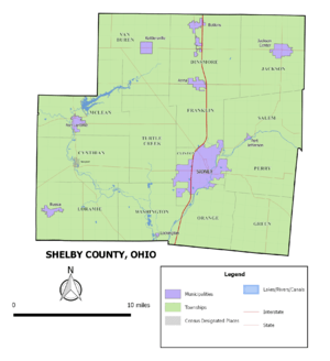

City
- Sidney (county seat)
Villages
Townships
https://web.archive.org/web/20160715023447/http://www.ohiotownships.org/township-websites
Census-designated places
Unincorporated communities
Notable people
- Paul Lauterbur, chemist and Nobel Prize laureate
- J. Edward Russell, former U.S. Representative from Ohio
- Bill Steinkemper, American football player
See also
References
- ↑ "Ohio County Profiles: Shelby County" (PDF). Ohio Department of Development. Archived from the original (PDF) on 2007-05-08. Retrieved 2007-04-28.
- 1 2 "State & County QuickFacts". United States Census Bureau. Retrieved February 11, 2015.
- ↑ "Find a County". National Association of Counties. Archived from the original on 2011-05-31. Retrieved 2011-06-07.
- ↑ "Shelby County data". Ohio State University Extension Data Center. Retrieved 2007-04-28.
- ↑ Peter Finkelman, "Thomas Jefferson and Anti-Slavery: The Myth Goes On", Virginia Historical Quarterly, Vol. 102, No. 2 (April 1994), p. 222, accessed 14 March 2011
- ↑

- ↑ David Lodge, "John Randolph and His Slaves", Shelby County Historical Society, 1998, accessed 15 March 2011
- ↑ David Lodge, "Rumley", from Howe's History of Ohio (1846), Shelby County Historical Society, 1998, accessed 15 March 2011
- ↑ History of Shelby County, Ohio, and Representative Citizens
- ↑ History of Shelby County, Ohio, and Representative Citizens by Almon Baldwin Carrington Hitchcock pg. 24-25
- ↑ David Lodge, "Randolph Slaves Reunion", Shelby County Historical Society, 1998, accessed 15 March 2011
- ↑ "2010 Census Gazetteer Files". United States Census Bureau. August 22, 2012. Archived from the original on May 4, 2014. Retrieved February 11, 2015.
- ↑ "Population and Housing Unit Estimates". Retrieved June 9, 2017.
- ↑ "U.S. Decennial Census". United States Census Bureau. Archived from the original on May 12, 2015. Retrieved February 11, 2015.
- ↑ "Historical Census Browser". University of Virginia Library. Retrieved February 11, 2015.
- ↑ Forstall, Richard L., ed. (March 27, 1995). "Population of Counties by Decennial Census: 1900 to 1990". United States Census Bureau. Retrieved February 11, 2015.
- ↑ "Census 2000 PHC-T-4. Ranking Tables for Counties: 1990 and 2000" (PDF). United States Census Bureau. April 2, 2001. Retrieved February 11, 2015.
- ↑ "American FactFinder". United States Census Bureau. Archived from the original on 2013-09-11. Retrieved 2011-05-14.
- 1 2 3 "DP-1 Profile of General Population and Housing Characteristics: 2010 Demographic Profile Data". United States Census Bureau. Retrieved 2015-12-27.
- ↑ "Population, Housing Units, Area, and Density: 2010 - County". United States Census Bureau. Retrieved 2015-12-27.
- ↑ "DP02 SELECTED SOCIAL CHARACTERISTICS IN THE UNITED STATES – 2006-2010 American Community Survey 5-Year Estimates". United States Census Bureau. Retrieved 2015-12-27.
- ↑ "DP03 SELECTED ECONOMIC CHARACTERISTICS – 2006-2010 American Community Survey 5-Year Estimates". United States Census Bureau. Retrieved 2015-12-27.
- ↑ Leip, David. "Dave Leip's Atlas of U.S. Presidential Elections". uselectionatlas.org. Retrieved 2018-05-03.
External links
| Wikivoyage has a travel guide for Shelby County (Ohio). |
Places adjacent to Shelby County, Ohio | ||||||||||
|---|---|---|---|---|---|---|---|---|---|---|
| ||||||||||
Municipalities and communities of Shelby County, Ohio, United States | ||
|---|---|---|
| City | | |
| Villages | ||
| Townships | ||
| CDP | ||
| Unincorporated communities | ||
| Footnotes | ‡This populated place also has portions in an adjacent county or counties | |
