Highland County, Ohio
| Highland County, Ohio | ||
|---|---|---|
 | ||
| ||
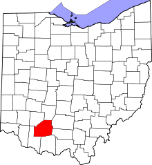 Location in the U.S. state of Ohio | ||
 Ohio's location in the U.S. | ||
| Founded | May 1, 1805[1] | |
| Named for | hilly topography which divides the Little Miami and Scioto river watersheds | |
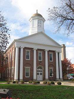
| Seat | Hillsboro | |
| Largest city | Hillsboro | |
| Area | ||
| • Total | 558 sq mi (1,445 km2) | |
| • Land | 553 sq mi (1,432 km2) | |
| • Water | 4.7 sq mi (12 km2), 0.8% | |
| Population | ||
| • (2010) | 43,589 | |
| • Density | 79/sq mi (31/km2) | |
| Congressional district | 2nd | |
| Time zone | Eastern: UTC−5/−4 | |
| Website |
co | |
.svg.png)
Highland County is a county located in the U.S. state of Ohio. As of the 2010 census, the population was 43,589.[2] Its county seat is Hillsboro.[3] The county is named for the topography which is hilly and divides the watersheds of the Little Miami and Scioto Rivers.[4]
Geography
According to the U.S. Census Bureau, the county has a total area of 558 square miles (1,450 km2), of which 553 square miles (1,430 km2) is land and 4.7 square miles (12 km2) (0.8%) is water.[5]
Adjacent counties
- Fayette County (north)
- Ross County (northeast)
- Pike County (east)
- Adams County (southeast)
- Brown County (southwest)
- Clinton County (northwest)
Major highways
Demographics
| Historical population | |||
|---|---|---|---|
| Census | Pop. | %± | |
| 1810 | 5,766 | — | |
| 1820 | 12,308 | 113.5% | |
| 1830 | 16,345 | 32.8% | |
| 1840 | 22,269 | 36.2% | |
| 1850 | 25,781 | 15.8% | |
| 1860 | 27,773 | 7.7% | |
| 1870 | 29,133 | 4.9% | |
| 1880 | 30,281 | 3.9% | |
| 1890 | 29,048 | −4.1% | |
| 1900 | 30,982 | 6.7% | |
| 1910 | 28,711 | −7.3% | |
| 1920 | 27,610 | −3.8% | |
| 1930 | 25,416 | −7.9% | |
| 1940 | 27,099 | 6.6% | |
| 1950 | 28,188 | 4.0% | |
| 1960 | 29,716 | 5.4% | |
| 1970 | 28,996 | −2.4% | |
| 1980 | 33,477 | 15.5% | |
| 1990 | 35,728 | 6.7% | |
| 2000 | 40,875 | 14.4% | |
| 2010 | 43,589 | 6.6% | |
| Est. 2017 | 42,971 | [6] | −1.4% |
| U.S. Decennial Census[7] 1790-1960[8] 1900-1990[9] 1990-2000[10] 2010-2013[2] | |||
2000 census
As of the census[11] of 2010, there were 43,589 people living in Highland County. The population density is 78.8 people per square mile. The county is made up of 96.4% White, 1.5% Black or African American, 0.3% Native American, 0.3% Asian, 1.5% from two or more races, and 0.8% Hispanic or Latino.
This county is also made up of 6.2% of people under the age of 5, 24.7% of people under the age of 18, and 16.5% of people over the age of 65. The median age is 39.2. The county is also 51% female.
There are 16,963 households in Highland County as of the 2010 census. The average household size is 2.58 persons, while the average family size is 3.04 persons. According to the 2010 census, 41.9% of the houses in Highland County had children under the age of 18 living with them, 53.07% of the houses were married couples living together, 11.09% of the houses had a female householder with no husband present, and 29.91% of the houses were non-families. Individuals made up 24.33% of all households and 11.02% had someone living alone who was 65 years of age or older.
According to the census, 81.5% of people over the age of 25 is at least a high school graduate and 11.1% of people over the age of 25 have earned at least a bachelor's degree. The median household income is $39,641 and 17.6% of people live below the poverty line. The per capita income of Highland County is $19,557.
2010 census
As of the 2010 United States Census, there were 43,589 people, 16,693 households, and 11,819 families residing in the county.[12] The population density was 78.8 inhabitants per square mile (30.4/km2). There were 19,380 housing units at an average density of 35.0 per square mile (13.5/km2).[13] The racial makeup of the county was 96.5% white, 1.4% black or African American, 0.3% American Indian, 0.2% Asian, 0.1% from other races, and 1.5% from two or more races. Those of Hispanic or Latino origin made up 0.7% of the population.[12] In terms of ancestry, 23.8% were German, 14.9% were Irish, 14.3% were American, and 10.7% were English.[14]
Of the 16,693 households, 34.0% had children under the age of 18 living with them, 53.1% were married couples living together, 11.9% had a female householder with no husband present, 29.2% were non-families, and 24.3% of all households were made up of individuals. The average household size was 2.58 and the average family size was 3.04. The median age was 39.2 years.[12]
The median income for a household in the county was $39,844 and the median income for a family was $48,604. Males had a median income of $38,892 versus $29,167 for females. The per capita income for the county was $18,966. About 12.4% of families and 16.2% of the population were below the poverty line, including 22.2% of those under age 18 and 12.7% of those age 65 or over.[15]
Politics
| Year | Republican | Democratic | Third parties |
|---|---|---|---|
| 2016 | 75.4% 14,020 | 20.3% 3,773 | 4.3% 795 |
| 2012 | 63.8% 11,413 | 33.9% 6,054 | 2.3% 412 |
| 2008 | 61.9% 11,907 | 35.7% 6,856 | 2.4% 468 |
| 2004 | 66.1% 12,211 | 33.5% 6,194 | 0.4% 76 |
| 2000 | 63.0% 9,728 | 34.5% 5,328 | 2.5% 391 |
| 1996 | 48.4% 7,102 | 39.8% 5,837 | 11.8% 1,735 |
| 1992 | 46.1% 7,020 | 31.9% 4,866 | 22.0% 3,356 |
| 1988 | 66.6% 8,776 | 32.5% 4,278 | 0.9% 124 |
| 1984 | 69.9% 9,000 | 29.4% 3,784 | 0.7% 91 |
| 1980 | 59.4% 7,359 | 35.2% 4,363 | 5.5% 678 |
| 1976 | 51.4% 6,853 | 47.5% 6,327 | 1.1% 151 |
| 1972 | 69.7% 8,524 | 28.3% 3,464 | 2.0% 238 |
| 1968 | 51.8% 6,489 | 30.6% 3,828 | 17.6% 2,208 |
| 1964 | 45.1% 5,985 | 54.9% 7,281 | |
| 1960 | 62.3% 8,948 | 37.7% 5,423 | |
| 1956 | 63.5% 8,397 | 36.5% 4,826 | |
| 1952 | 62.2% 8,568 | 37.9% 5,219 | |
| 1948 | 54.6% 6,849 | 45.3% 5,675 | 0.1% 16 |
| 1944 | 59.9% 7,963 | 40.1% 5,336 | |
| 1940 | 55.2% 8,530 | 44.8% 6,921 | |
| 1936 | 47.8% 7,392 | 51.9% 8,011 | 0.3% 48 |
| 1932 | 49.0% 6,924 | 50.1% 7,079 | 1.0% 134 |
| 1928 | 68.1% 8,325 | 31.4% 3,836 | 0.5% 60 |
| 1924 | 57.2% 6,845 | 38.3% 4,583 | 4.6% 548 |
| 1920 | 57.1% 7,570 | 42.6% 5,654 | 0.3% 43 |
| 1916 | 47.8% 3,727 | 50.9% 3,964 | 1.4% 105 |
| 1912 | 37.0% 2,757 | 44.4% 3,314 | 18.6% 1,388 |
| 1908 | 51.2% 4,149 | 47.2% 3,823 | 1.6% 126 |
| 1904 | 54.0% 4,205 | 42.7% 3,321 | 3.4% 261 |
| 1900 | 49.5% 4,078 | 47.8% 3,938 | 2.6% 218 |
| 1896 | 50.3% 4,106 | 47.9% 3,909 | 1.8% 144 |
| 1892 | 49.1% 3,496 | 44.3% 3,153 | 6.5% 465 |
| 1888 | 48.6% 3,576 | 47.4% 3,489 | 4.0% 292 |
| 1884 | 50.8% 3,683 | 47.5% 3,438 | 1.7% 124 |
| 1880 | 50.9% 3,648 | 48.7% 3,490 | 0.4% 27 |
| 1876 | 50.1% 3,341 | 49.8% 3,323 | 0.2% 10 |
| 1872 | 51.9% 3,171 | 48.0% 2,933 | 0.1% 5 |
Education
School districts
Highland County is home to five school districts: Greenfield Exempted Village Schools in Greenfield,[17] Hillsboro City Schools in Hillsboro,[18] Fairfield Local School District in Leesburg,[19] Bright Local School District in Mowrystown,[20] and Lychburg-Clay Local School District in Lynchburg.[21]
Libraries
The Highland County District Library is the public library system serving Highland County, Ohio. The main library is in Hillsboro, with three branches located in Greenfield, Leesburg, and Lynchburg. The library is a member of the SEO Consortium which allows patrons access to over 6.9 million items owned by member libraries.
 Hillsboro Library
 Greenfield Library
 Leesburg Library
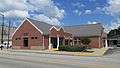 Lynchburg Library
Recreation
There are currently several recreational areas in Highland County. There is Rocky Fork State Park[22] which is located 5 miles east of Hillsboro. It provides opportunities to go camping, fishing, boating, swimming, hunting, putt-putt, and disc golf amongst other activities.
There is also Paint Creek State Park[23] located 13 miles east of Hillsboro. Paint Creek offers many of the same activities as Rocky Fork but also offers horse riding, mountain biking, and winter recreational activities.
Fort Hill State Memorial is a memorial built by the Hopewell people that is located 10 miles southeast of Hillsboro[24] and is believed to be around 2000 years old.
Fallsville Wildlife Area[25] is located 4 miles north of Hillsboro. It offers fishing, hunting, hiking, and wildlife watching.
Non-profits
Habitat for Humanity of Highland County was established in 2000, and has since built three homes: one on Johnson St. in Hillsboro and two on 2nd St. in Greenfield. Highland County Habitat is a locally run affiliate of Habitat for Humanity International, a nonprofit, ecumenical Christian housing organization. Habitat for Humanity works in partnership with people in need to build and renovate decent, affordable housing. The houses then are sold to those in need at no profit and with no interest charged.
Highlands Sanctuary is a chain of nature preserves centered in Highland County and owned by an organization of the same name.
Communities

City
- Hillsboro (county seat)
Villages
Townships
https://web.archive.org/web/20160715023447/http://www.ohiotownships.org/township-websites
Census-designated places
Unincorporated communities
- Allensburg
- Belfast
- Berrysville
- Boston
- Bridges
- Careytown
- Carmel
- Centerfield
- Danville
- Dodsonville
- East Danville
- East Monroe
- Elmville
- Fairfax
- Fairview
- Folsom
- Gist Settlement
- Hariett
- Harwood
- Hoagland
- Hollowtown
- Marshall
- New Market
- New Petersburg
- Pricetown
- Rainsboro
- Russell
- Samantha
- Shackleton
- Stringtown
- Sugar Tree Ridge
- Taylorsville
- Willettsville
See also
References
- ↑ "Ohio County Profiles: Highland County" (PDF). Ohio Department of Development. Archived from the original (PDF) on 2007-06-21. Retrieved 2007-04-28.
- 1 2 "State & County QuickFacts". United States Census Bureau. Archived from the original on July 11, 2011. Retrieved February 8, 2015.
- ↑ "Find a County". National Association of Counties. Archived from the original on 2011-05-31. Retrieved 2011-06-07.
- ↑ "Highland County data". Ohio State University Extension Data Center. Retrieved 2007-04-28.
- ↑ "2010 Census Gazetteer Files". United States Census Bureau. August 22, 2012. Archived from the original on May 4, 2014. Retrieved February 8, 2015.
- ↑ "Population and Housing Unit Estimates". Retrieved June 9, 2017.
- ↑ "U.S. Decennial Census". United States Census Bureau. Archived from the original on May 12, 2015. Retrieved February 8, 2015.
- ↑ "Historical Census Browser". University of Virginia Library. Retrieved February 8, 2015.
- ↑ Forstall, Richard L., ed. (March 27, 1995). "Population of Counties by Decennial Census: 1900 to 1990". United States Census Bureau. Retrieved February 8, 2015.
- ↑ "Census 2000 PHC-T-4. Ranking Tables for Counties: 1990 and 2000" (PDF). United States Census Bureau. April 2, 2001. Retrieved February 8, 2015.
- ↑ "American FactFinder". United States Census Bureau. Archived from the original on 2013-09-11. Retrieved 2008-01-31.
- 1 2 3 "DP-1 Profile of General Population and Housing Characteristics: 2010 Demographic Profile Data". United States Census Bureau. Retrieved 2015-12-27.
- ↑ "Population, Housing Units, Area, and Density: 2010 - County". United States Census Bureau. Retrieved 2015-12-27.
- ↑ "DP02 SELECTED SOCIAL CHARACTERISTICS IN THE UNITED STATES – 2006-2010 American Community Survey 5-Year Estimates". United States Census Bureau. Retrieved 2015-12-27.
- ↑ "DP03 SELECTED ECONOMIC CHARACTERISTICS – 2006-2010 American Community Survey 5-Year Estimates". United States Census Bureau. Retrieved 2015-12-27.
- ↑ Leip, David. "Dave Leip's Atlas of U.S. Presidential Elections". uselectionatlas.org. Retrieved 2018-05-02.
- ↑ "Greenfield Exempted Village Schools". Retrieved 2014-07-24.
- ↑ "Hillsboro City Schools". Retrieved 2014-07-24.
- ↑ "Leesburg Fairfield School District". Retrieved 2014-07-24.
- ↑ "Bight Local School District". Retrieved 2014-07-24.
- ↑ "Lynchburg-Clay School District". Retrieved 2014-07-24.
- ↑ "Rocky Fork State Park".
- ↑ "Paint Creek State Park".
- ↑ "Arc of Appalachia Preserve System". Archived from the original on 2014-08-11.
- ↑ "Fallsville Wildlife Area".
External links
Places adjacent to Highland County, Ohio | ||||||||||
|---|---|---|---|---|---|---|---|---|---|---|
| ||||||||||
Municipalities and communities of Highland County, Ohio, United States | ||
|---|---|---|
| City | | |
| Villages | ||
| Townships | ||
| CDPs | ||
| Unincorporated communities | ||
| Footnotes | ‡This populated place also has portions in an adjacent county or counties | |
