Muskingum County, Ohio
| Muskingum County, Ohio | ||
|---|---|---|
 Muskingum County Courthouse | ||
| ||
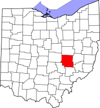 Location in the U.S. state of Ohio | ||
 Ohio's location in the U.S. | ||
| Founded | March 1, 1804[1] | |
| Named for | A Native American word meaning "swampy ground" | |
| Seat | Zanesville | |
| Largest city | Zanesville | |
| Area | ||
| • Total | 673 sq mi (1,743 km2) | |
| • Land | 665 sq mi (1,722 km2) | |
| • Water | 8.0 sq mi (21 km2), 1.2% | |
| Population | ||
| • (2010) | 86,074 | |
| • Density | 130/sq mi (50/km2) | |
| Congressional districts | 6th, 12th | |
| Time zone | Eastern: UTC−5/−4 | |
| Website |
www | |

Muskingum County is a county located in the U.S. state of Ohio. As of the 2010 census, the population was 86,074.[2] Its county seat is Zanesville.[3] Nearly bisected by the Muskingum River, the county name is based on a Delaware American Indian word translated as "town by the river"[4] or "elk's eye".[5]
Muskingum County comprises the Zanesville, OH Micropolitan Statistical Area, which is also included in the Columbus-Marion-Zanesville, OH Combined Statistical Area.
Geography
According to the U.S. Census Bureau, the county has a total area of 673 square miles (1,740 km2), of which 665 square miles (1,720 km2) is land and 8.0 square miles (21 km2) (1.2%) is water.[6] It is the fourth-largest county in Ohio by land area.
Adjacent counties
- Coshocton County (north)
- Guernsey County (east)
- Noble County (southeast)
- Morgan County (south)
- Perry County (southwest)
- Licking County (west)
Demographics
| Historical population | |||
|---|---|---|---|
| Census | Pop. | %± | |
| 1810 | 10,036 | — | |
| 1820 | 17,824 | 77.6% | |
| 1830 | 29,334 | 64.6% | |
| 1840 | 38,749 | 32.1% | |
| 1850 | 45,049 | 16.3% | |
| 1860 | 44,416 | −1.4% | |
| 1870 | 44,886 | 1.1% | |
| 1880 | 49,774 | 10.9% | |
| 1890 | 51,210 | 2.9% | |
| 1900 | 53,185 | 3.9% | |
| 1910 | 57,488 | 8.1% | |
| 1920 | 57,980 | 0.9% | |
| 1930 | 67,398 | 16.2% | |
| 1940 | 69,795 | 3.6% | |
| 1950 | 74,535 | 6.8% | |
| 1960 | 79,159 | 6.2% | |
| 1970 | 77,826 | −1.7% | |
| 1980 | 83,340 | 7.1% | |
| 1990 | 82,068 | −1.5% | |
| 2000 | 84,585 | 3.1% | |
| 2010 | 86,074 | 1.8% | |
| Est. 2017 | 86,149 | [7] | 0.1% |
| U.S. Decennial Census[8] 1790-1960[9] 1900-1990[10] 1990-2000[11] 2010-2017[2] | |||
2000 census
As of the census[12] of 2000, there were 84,585 people, 32,518 households, and 22,860 families residing in the county. The population density was 127 people per square mile (49/km²). There were 35,163 housing units at an average density of 53 per square mile (20/km²). The racial makeup of the county was 93.91% White, 4.01% Black or African American, 0.21% Native American, 0.27% Asian, 0.02% Pacific Islander, 0.20% from other races, and 1.37% from two or more races. 0.52% of the population were Hispanic or Latino of any race.
There were 32,518 households out of which 33.30% had children under the age of 18 living with them, 54.30% were married couples living together, 12.00% had a female householder with no husband present, and 29.70% were non-families. 24.90% of all households were made up of individuals and 10.90% had someone living alone who was 65 years of age or older. The average household size was 2.53 and the average family size was 3.01.
In the county, the population was spread out with 25.90% under the age of 18, 9.40% from 18 to 24, 27.70% from 25 to 44, 22.60% from 45 to 64, and 14.30% who were 65 years of age or older. The median age was 36 years. For every 100 females there were 92.00 males. For every 100 females age 18 and over, there were 88.40 males.
The median income for a household in the county was $35,185, and the median income for a family was $41,938. Males had a median income of $31,537 versus $22,151 for females. The per capita income for the county was $17,533. About 9.90% of families and 12.90% of the population were below the poverty line, including 17.90% of those under age 18 and 10.00% of those age 65 or over.
2010 census
As of the 2010 United States Census, there were 86,074 people, 34,271 households, and 23,125 families residing in the county.[13] The population density was 129.5 inhabitants per square mile (50.0/km2). There were 38,074 housing units at an average density of 57.3 per square mile (22.1/km2).[14] The racial makeup of the county was 93.0% white, 3.8% black or African American, 0.3% Asian, 0.2% American Indian, 0.2% from other races, and 2.5% from two or more races. Those of Hispanic or Latino origin made up 0.8% of the population.[13] In terms of ancestry, 25.2% were German, 15.5% were Irish, 11.1% were American, and 10.9% were English.[15]
Of the 34,271 households, 32.3% had children under the age of 18 living with them, 49.1% were married couples living together, 13.2% had a female householder with no husband present, 32.5% were non-families, and 26.9% of all households were made up of individuals. The average household size was 2.46 and the average family size was 2.95. The median age was 39.5 years.[13]
The median income for a household in the county was $39,538 and the median income for a family was $48,425. Males had a median income of $40,183 versus $28,668 for females. The per capita income for the county was $20,561. About 13.0% of families and 16.6% of the population were below the poverty line, including 24.6% of those under age 18 and 9.3% of those age 65 or over.[16]
Education
The County is served by 7 high schools: East Muskingum High School (better known as John Glenn High School) located in New Concord, Franklin Local High School (better known as Philo) located in Duncan Falls, Maysville High School located in South Zanesville (Maysville), Roscrans High School (Catholic High School in Downtown Zanesville), Tri-Valley High School located in Dresden, West Muskingum High School located in Zanesville, and Zanesville High School which, as the name implies, is in Zanesville.
Each high school is the only high school in school districts of the same name, the exception being Roscrans as the district is referred to as Bishop Fenwick.
The county is also served by three colleges, Muskingum University, Zane State College, and a branch campus of Ohio University known as Ohio University Zanesville.
Politics
| Year | Republican | Democratic | Third parties |
|---|---|---|---|
| 2016 | 64.6% 24,056 | 29.9% 11,123 | 5.5% 2,066 |
| 2012 | 51.8% 19,264 | 45.7% 17,002 | 2.5% 913 |
| 2008 | 52.4% 20,549 | 45.2% 17,730 | 2.4% 946 |
| 2004 | 57.3% 22,254 | 42.3% 16,421 | 0.5% 191 |
| 2000 | 55.2% 17,995 | 41.1% 13,415 | 3.7% 1,214 |
| 1996 | 42.0% 13,861 | 41.9% 13,813 | 16.1% 5,298 |
| 1992 | 40.8% 14,168 | 33.6% 11,670 | 25.6% 8,882 |
| 1988 | 62.3% 19,736 | 36.9% 11,691 | 0.8% 247 |
| 1984 | 68.0% 21,821 | 31.3% 10,037 | 0.8% 243 |
| 1980 | 54.8% 17,921 | 38.5% 12,584 | 6.7% 2,183 |
| 1976 | 51.1% 15,358 | 47.2% 14,178 | 1.8% 534 |
| 1972 | 64.0% 19,897 | 33.2% 10,313 | 2.8% 884 |
| 1968 | 48.1% 15,260 | 41.3% 13,089 | 10.6% 3,356 |
| 1964 | 35.9% 11,635 | 64.1% 20,792 | |
| 1960 | 61.9% 21,518 | 38.1% 13,254 | |
| 1956 | 69.3% 22,788 | 30.7% 10,110 | |
| 1952 | 63.0% 21,244 | 37.0% 12,490 | |
| 1948 | 55.5% 16,049 | 44.2% 12,765 | 0.3% 81 |
| 1944 | 58.0% 17,577 | 42.0% 12,729 | |
| 1940 | 55.2% 19,395 | 44.8% 15,753 | |
| 1936 | 47.4% 15,454 | 49.9% 16,265 | 2.6% 854 |
| 1932 | 54.0% 16,366 | 44.2% 13,378 | 1.8% 541 |
| 1928 | 76.8% 22,120 | 22.6% 6,507 | 0.6% 171 |
| 1924 | 65.7% 15,571 | 28.3% 6,709 | 6.0% 1,417 |
| 1920 | 58.6% 13,862 | 39.9% 9,437 | 1.6% 372 |
| 1916 | 51.3% 7,597 | 42.8% 6,328 | 5.9% 877 |
| 1912 | 29.6% 4,134 | 38.5% 5,376 | 31.9% 4,463 |
| 1908 | 52.4% 8,080 | 42.6% 6,576 | 5.0% 775 |
| 1904 | 54.5% 7,597 | 39.6% 5,511 | 5.9% 820 |
| 1900 | 51.1% 7,365 | 46.3% 6,667 | 2.7% 382 |
| 1896 | 50.7% 7,245 | 48.1% 6,871 | 1.3% 183 |
| 1892 | 47.8% 6,123 | 48.6% 6,230 | 3.6% 461 |
| 1888 | 50.0% 6,234 | 47.2% 5,884 | 2.9% 357 |
| 1884 | 50.3% 5,896 | 48.5% 5,696 | 1.2% 142 |
| 1880 | 51.6% 5,804 | 47.5% 5,336 | 0.9% 102 |
| 1876 | 48.7% 5,232 | 50.8% 5,457 | 0.6% 63 |
| 1872 | 51.3% 4,558 | 48.4% 4,304 | 0.3% 27 |
Culture
The Muskingum County Library System serves the communities of Muskingum County from its administrative offices in Zanesville, Ohio. This includes service to Dresden, Duncan Falls, New Concord, and Roseville. In 2005, the library loaned more than 918,000 items to its 73,000 cardholders. Total holding are over 328,000 volumes with over 190 periodical subscriptions.[18]
The Wilds is a 9,154 acres (37.04 km2) wildlife preserve open to visitation for a fee.
Historical Maps

Communities
City
- Zanesville (county seat)
Villages
Townships
https://web.archive.org/web/20160715023447/http://www.ohiotownships.org/township-websites

Census-designated places
Other unincorporated communities
Historical places
- Irville - Former populated place in Licking Township, removed for the creation of Dillon Lake.
- Mattingly Settlement - Named for the many members of the Mattingly family who settled in Muskingum Township.
See also
References
- ↑ "Ohio County Profiles: Muskingum County" (PDF). Ohio Department of Development. Archived from the original (PDF) on 2004-02-16. Retrieved 2007-04-28.
- 1 2 "State & County QuickFacts". United States Census Bureau. Archived from the original on July 15, 2011. Retrieved February 9, 2015.
- ↑ "Find a County". National Association of Counties. Archived from the original on 2011-05-31. Retrieved 2011-06-07.
- ↑ "History" Archived 2010-01-16 at the Wayback Machine., Muskingum County Website, accessed 10 January 2010
- ↑ "Muskingum County data". Ohio State University Extension Data Center. Retrieved 2007-04-28.
- ↑ "2010 Census Gazetteer Files". United States Census Bureau. August 22, 2012. Archived from the original on May 4, 2014. Retrieved February 9, 2015.
- ↑ "Population and Housing Unit Estimates". Retrieved June 9, 2017.
- ↑ "U.S. Decennial Census". United States Census Bureau. Archived from the original on May 12, 2015. Retrieved February 9, 2015.
- ↑ "Historical Census Browser". University of Virginia Library. Retrieved February 9, 2015.
- ↑ Forstall, Richard L., ed. (March 27, 1995). "Population of Counties by Decennial Census: 1900 to 1990". United States Census Bureau. Retrieved February 9, 2015.
- ↑ "Census 2000 PHC-T-4. Ranking Tables for Counties: 1990 and 2000" (PDF). United States Census Bureau. April 2, 2001. Retrieved February 9, 2015.
- ↑ "American FactFinder". United States Census Bureau. Archived from the original on 2013-09-11. Retrieved 2008-01-31.
- 1 2 3 "DP-1 Profile of General Population and Housing Characteristics: 2010 Demographic Profile Data". United States Census Bureau. Retrieved 2015-12-27.
- ↑ "Population, Housing Units, Area, and Density: 2010 - County". United States Census Bureau. Retrieved 2015-12-27.
- ↑ "DP02 SELECTED SOCIAL CHARACTERISTICS IN THE UNITED STATES – 2006-2010 American Community Survey 5-Year Estimates". United States Census Bureau. Retrieved 2015-12-27.
- ↑ "DP03 SELECTED ECONOMIC CHARACTERISTICS – 2006-2010 American Community Survey 5-Year Estimates". United States Census Bureau. Retrieved 2015-12-27.
- ↑ Leip, David. "Dave Leip's Atlas of U.S. Presidential Elections". uselectionatlas.org. Retrieved 2018-05-03.
- ↑ "2005 Ohio Public Library Statistics:Statistics by County and Town". State Library of Ohio. Archived from the original on September 24, 2006. Retrieved October 30, 2006.
Further reading
- King, John W. (1866). The Silent Dead, or Roll of Honor; Comprising the names of all Soldiers from Muskingum County, who lost their lives in battle or by disease, during the War of Rebellion. Zanesville, Ohio: Logan & Dodd. LCCN 01021599. OL 22893426M – via Internet Archive.
- Thomas, William Lewis. (1928). History of Southeastern Ohio and the Muskingum Valley, 1788-1928. In Three Volumes. Chicago: S.J. Clarke Publishing Co.
External links
| Wikimedia Commons has media related to Muskingum County, Ohio. |
Places adjacent to Muskingum County, Ohio | ||||||||||
|---|---|---|---|---|---|---|---|---|---|---|
| ||||||||||
Municipalities and communities of Muskingum County, Ohio, United States | ||
|---|---|---|
| City | | |
| Villages | ||
| Townships | ||
| CDPs | ||
| Unincorporated communities |
| |
| Footnotes | ‡This populated place also has portions in an adjacent county or counties | |

| Authority control |
|---|