Koochiching County, Minnesota
| Koochiching County, Minnesota | |
|---|---|
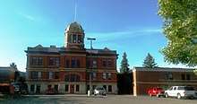 International Falls landmark. | |
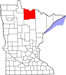 Location in the U.S. state of Minnesota | |
 Minnesota's location in the U.S. | |
| Founded | December 19, 1906[1] |
| Named for | An Ojibway word meaning "neighbor lake and river" for Rainy Lake and Rainy River |
| Seat | International Falls |
| Largest city | International Falls |
| Area | |
| • Total | 3,154 sq mi (8,169 km2) |
| • Land | 3,104 sq mi (8,039 km2) |
| • Water | 50 sq mi (129 km2), 1.6% |
| Population (est.) | |
| • (2016) | 12,628 |
| • Density | 4.3/sq mi (1.7/km2) |
| Congressional district | 8th |
| Time zone | Central: UTC−6/−5 |
| Website |
www |
Koochiching County (/ˈkuːtʃɪtʃɪŋ/ KOO-chitch-ing) is a county located in the U.S. state of Minnesota. As of the 2010 census, the population was 13,311.[2] Its county seat is International Falls.[3] A portion of the Bois Forte Indian Reservation is in the county. A small part of Voyageurs National Park extends into its boundary, with Lake of the Woods County to its northwest.
History
Historymakers of Koochiching County were of many occupations. They were explorers, traders, homesteaders, and lumberjacks. They also were teachers, preachers, merchants, engineers, and builders of industry. Settlers came at the beginning of the 1900s and suffered through isolation, illness, harsh weather, and poverty. They built schools, churches, and good roads. Koochiching County is the second largest county in area next to Saint Louis County. It is also one of the youngest counties in the state having been created in 1906 after it was separated from Itasca County. The name "Koochiching" comes from either the Ojibwe word Gojijiing or Cree Kocicīhk (recorded in some documents as "Ouchichiq"), both meaning "at the place of inlets," referring to the neighboring Rainy Lake and River. Reverend J.A. Gilfillan recorded their meaning, "according to some, Neighbor lake, according to others a lake somewhere," possibly referring to the neighbouring Rainy Lake and to Lake Couchiching located in southern Ontario. Early European (French) inhabitants gave the names Lac à la Pluie (Rainy Lake) and Rivière à la Pluie (Rainy River) to the nearby bodies of water because of the mist-like rain present at the falls of Rainy River and then to the settlement that became known as International Falls. About 10,000 years ago almost 90% of Koochiching County was covered by Lake Agassiz. When it receded it left low areas of decayed vegetation (muskeg); as a result, three-quarters of northern Koochiching are underlain with 2 to 50 feet of peat.[4][5]
Geography

According to the U.S. Census Bureau, the county has a total area of 3,154 square miles (8,170 km2), of which 3,104 square miles (8,040 km2) is land and 50 square miles (130 km2) (1.6%) is water.[6] It is the second-largest county in Minnesota by land area and third-largest by total area.
Major rivers in the county are Big Fork River, Little Fork River, Rat Root River, Black River, and Rapid River. The highest altitude in the county is in the Northome area which is 1426 feet above sea level which is about 325 feet higher than Rainy Lake. The land surface is mostly flat with swampy areas where Lake Agassiz basin was deepest. There are also deposits of peat from 1½ to 50 feet in the low areas which is a result from vegetation. The general surface of Koochiching County is flat with spots of land broken in places by ledges of precambrian rock. Bed rock in the area includes Ely greenstone and greenstone schists that are said to be among the oldest on the planet. In the northeastern tip of the county is a section of Voyageurs National Park and Black Bay. Franz Jevne State Park is located on Rainy River between International Falls and Baudette.
Major highways
Adjacent counties
- Rainy River District, Ontario (north)
- Saint Louis County (east)
- Itasca County (south)
- Beltrami County (southwest)
- Lake of the Woods County (northwest)
National protected areas
- Superior National Forest (part)
- Voyageurs National Park (part)
Lakes
- Bartlett Lake
- Battle Lake
- Cameron Lake
- Clear Lake
- Dark Lake
- Franklin Lake
- Larson Lake
- Little Constance Lake
- Little Lake
- Lost Lake
- Moose Lake
- Myrtle Lake
- Nett Lake
- Pine Lake
- Pocquette Lake
- Rainy Lake
- Rat Root Lake
- Seretha Lake
- Silversack Lake
- Teufer Lake
Demographics
| Historical population | |||
|---|---|---|---|
| Census | Pop. | %± | |
| 1910 | 6,431 | — | |
| 1920 | 13,520 | 110.2% | |
| 1930 | 14,078 | 4.1% | |
| 1940 | 16,930 | 20.3% | |
| 1950 | 16,910 | −0.1% | |
| 1960 | 18,190 | 7.6% | |
| 1970 | 17,131 | −5.8% | |
| 1980 | 17,571 | 2.6% | |
| 1990 | 16,299 | −7.2% | |
| 2000 | 14,355 | −11.9% | |
| 2010 | 13,311 | −7.3% | |
| Est. 2016 | 12,628 | [7] | −5.1% |
| U.S. Decennial Census[8] 1790-1960[9] 1900-1990[10] 1990-2000[11] 2010-2016[2] | |||

As of the 2000 census, there were 14,355 people, 6,040 households, and 3,962 families residing in the county. The population density was 5 people per square mile (2/km²). There were 7,719 housing units at an average density of 2 per square mile (1/km²). The racial makeup of the county was 96.12% White, 0.19% Black or African American, 2.15% Native American, 0.17% Asian, 0.06% Pacific Islander, 0.08% from other races, and 1.23% from two or more races. 0.56% of the population were Hispanic or Latino of any race. 21.2% were of Norwegian, 19.8% German, 12.3% Swedish and 7.0% Irish ancestry.
There were 6,040 households out of which 28.40% had children under the age of 18 living with them, 53.30% were married couples living together, 8.50% had a female householder with no husband present, and 34.40% were non-families. 30.40% of all households were made up of individuals and 14.50% had someone living alone who was 65 years of age or older. The average household size was 2.33 and the average family size was 2.88.
In the county, the population was spread out with 23.90% under the age of 18, 6.40% from 18 to 24, 25.80% from 25 to 44, 26.00% from 45 to 64, and 18.00% who were 65 years of age or older. The median age was 42 years. For every 100 females there were 98.50 males. For every 100 females age 18 and over, there were 95.20 males.
The median income for a household in the county was $36,262, and the median income for a family was $43,608. Males had a median income of $40,642 versus $22,261 for females. The per capita income for the county was $19,167. About 8.40% of families and 12.10% of the population were below the poverty line, including 16.10% of those under age 18 and 13.40% of those age 65 or over.
Politics
| Year | Republican | Democratic | Third parties |
|---|---|---|---|
| 2016 | 56.1% 3,569 | 36.2% 2,306 | 7.7% 488 |
| 2012 | 44.0% 2,841 | 53.4% 3,451 | 2.6% 166 |
| 2008 | 43.6% 2,962 | 53.7% 3,649 | 2.8% 191 |
| 2004 | 48.4% 3,539 | 50.1% 3,662 | 1.5% 108 |
| 2000 | 51.2% 3,523 | 42.2% 2,903 | 6.6% 453 |
| 1996 | 30.9% 2,080 | 51.6% 3,472 | 17.5% 1,178 |
| 1992 | 26.2% 1,954 | 46.5% 3,474 | 27.3% 2,037 |
| 1988 | 41.9% 2,842 | 57.0% 3,867 | 1.1% 71 |
| 1984 | 44.8% 3,466 | 54.7% 4,238 | 0.5% 38 |
| 1980 | 41.6% 3,433 | 50.7% 4,181 | 7.7% 636 |
| 1976 | 36.1% 2,893 | 60.5% 4,846 | 3.4% 268 |
| 1972 | 50.9% 3,681 | 47.0% 3,396 | 2.1% 153 |
| 1968 | 29.6% 2,104 | 66.0% 4,697 | 4.4% 315 |
| 1964 | 21.4% 1,602 | 78.5% 5,878 | 0.2% 11 |
| 1960 | 39.9% 3,055 | 59.8% 4,578 | 0.3% 23 |
| 1956 | 42.6% 2,757 | 57.1% 3,695 | 0.3% 16 |
| 1952 | 40.0% 2,742 | 59.5% 4,078 | 0.5% 31 |
| 1948 | 24.7% 1,718 | 71.3% 4,968 | 4.1% 282 |
| 1944 | 28.5% 1,607 | 70.6% 3,981 | 0.9% 51 |
| 1940 | 28.5% 2,095 | 71.0% 5,219 | 0.5% 39 |
| 1936 | 20.2% 1,316 | 77.8% 5,065 | 2.0% 132 |
| 1932 | 28.7% 1,427 | 63.3% 3,148 | 8.0% 399 |
| 1928 | 53.7% 2,599 | 43.6% 2,110 | 2.8% 134 |
| 1924 | 37.4% 1,536 | 5.4% 222 | 57.2% 2,347 |
| 1920 | 55.3% 1,786 | 26.6% 859 | 18.1% 585 |
| 1916 | 25.7% 474 | 59.0% 1,089 | 15.3% 283 |
| 1912 | 12.6% 239 | 33.7% 638 | 53.7% 1,015[13] |
| 1908 | 56.0% 826 | 28.5% 420 | 15.5% 229 |
Communities
Koochiching County is unique in Minnesota, in the sense that there are no organized civil township governments within the county, due to legislative action taken by the county to absorb existing township governments. Survey townships, as defined by the Public Land Survey System exist but none are organized. Six city governments have been created, and the rest of the county consists of unorganized territories and unincorporated communities.
Cities
- Big Falls
- International Falls (county seat)
- Littlefork
- Mizpah
- Northome
- Ranier
Unorganized territories
Census-designated place
- Nett Lake (part)
Other unincorporated communities
Ghost towns
- Border
- Fairland
- Falls Junction
- Gates Corner
- Laurel
- Manitou
- Nakoda
- Rainy Lake City
- Ridge
- South International Falls
- The Pines
- Wayland
In popular culture
Koochiching County is the location of the fictional town of Frostbite Falls, the home of the animated characters Rocky and Bullwinkle. Frostbite Falls is widely assumed to have been named in honor of International Falls.
See also
References
- ↑ "Minnesota Place Names". Minnesota Historical Society. Retrieved March 18, 2014.
- 1 2 "State & County QuickFacts". United States Census Bureau. Archived from the original on July 13, 2011. Retrieved September 1, 2013.
- ↑ "Find a County". National Association of Counties. Archived from the original on May 31, 2011. Retrieved 2011-06-07.
- ↑ Schwankl, Hermoine Gordon (1983). "THE HISTORY OF KOOCHICHING COUNTY". Koochiching County. Archived from the original on April 5, 2010. Retrieved 7 August 2010.
- ↑ Soper, E. K. (1919). "The Peat Deposits of Minnesota". Bulletin of the Minnesota Geological Survey (16): 172.
- ↑ "2010 Census Gazetteer Files". United States Census Bureau. August 22, 2012. Archived from the original on September 21, 2013. Retrieved October 18, 2014.
- ↑ "Population and Housing Unit Estimates". Retrieved June 9, 2017.
- ↑ "U.S. Decennial Census". United States Census Bureau. Archived from the original on May 12, 2015. Retrieved October 18, 2014.
- ↑ "Historical Census Browser". University of Virginia Library. Retrieved October 18, 2014.
- ↑ "Population of Counties by Decennial Census: 1900 to 1990". United States Census Bureau. Retrieved October 18, 2014.
- ↑ "Census 2000 PHC-T-4. Ranking Tables for Counties: 1990 and 2000" (PDF). United States Census Bureau. Retrieved October 18, 2014.
- ↑ Leip, David. "Dave Leip's Atlas of U.S. Presidential Elections". uselectionatlas.org. Retrieved 2018-09-19.
- ↑ The leading "other" candidate, Progressive Theodore Roosevelt, received 522 votes, while Socialist candidate Eugene Debs received 460 votes, Prohibition candidate Eugene Chafin received 16 votes, and Socialist Labor candidate Arthur Reimer received 17 votes.
External links
| Wikimedia Commons has media related to Koochiching County, Minnesota. |
- County website
- Minnesota Department of Transportation maps (Southwest, Southeast, Northwest, Northeast)
- Koochiching County Historical Museum (Int'l Falls)
Places adjacent to Koochiching County, Minnesota | ||||||||||
|---|---|---|---|---|---|---|---|---|---|---|
| ||||||||||
Municipalities and communities of Koochiching County, Minnesota, United States | ||
|---|---|---|
| Cities | | |
| Unorganized territories | ||
| Unincorporated communities | ||
| Indian reservations | ||
| Ghost towns | ||
| Footnotes | ‡This populated place also has portions in an adjacent county or counties | |