Lincoln County, Minnesota
| Lincoln County, Minnesota | |
|---|---|
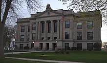 Lincoln County Courthouse | |
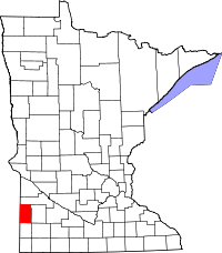 Location in the U.S. state of Minnesota | |
 Minnesota's location in the U.S. | |
| Founded | March 6, 1873[1] |
| Named for | Abraham Lincoln[2] |
| Seat | Ivanhoe |
| Largest city | Tyler |
| Area | |
| • Total | 548 sq mi (1,419 km2) |
| • Land | 537 sq mi (1,391 km2) |
| • Water | 12 sq mi (31 km2), 2.1% |
| Population (est.) | |
| • (2016) | 5,783 |
| • Density | 11/sq mi (4/km2) |
| Congressional district | 7th |
| Time zone | Central: UTC−6/−5 |
| Website |
www |
Lincoln County is a county located in the U.S. state of Minnesota. As of the 2010 census, the population was 5,896.[3] Its county seat is Ivanhoe.[4]
History
Lincoln County was created in 1873 from the western portion of Lyon County.[5] After numerous changes, its county seat has been Ivanhoe since 1904.
Geography
According to the U.S. Census Bureau, the county has a total area of 548 square miles (1,420 km2), of which 537 square miles (1,390 km2) is land and 12 square miles (31 km2) (2.1%) is water.[6]
Lakes
- Ash Lake: in Ash Lake Township
- Curtis Lake: in Ash Lake Township
- Dead Coon Lake: in Marshfield Township
- Drietz Lake: in Royal Township
- Gislason Lake: in Lake Stay Township
- Hawks Nest Lake: western half is in Royal Township; eastern half is in Limestone Township
- Lake Benton: about two thirds of the lake is in Diamond Lake Township; a small part stretches eastward into Marshfield Township and the southern third is in Lake Benton Township
- Lake Hendricks: eastern half is in Hendricks Township, western half is in South Dakota
- Lake Shaokatan: in Shaokatan Township
- Lake Stay: in Lake Stay Township
- Oak Lake: in Royal Township
- Perch Lake: in Royal Township
- Steep Bank Lake: almost entirely within Hendricks Township, but the northern edge is in Marble Township and the eastern edge is in Royal Township
- Twin Lakes: in Hansonville Township
- West Lake Stay: in Lake Stay Township
Major highways
Adjacent counties
- Yellow Medicine County (north)
- Lyon County (east)
- Pipestone County (south)
- Brookings County, South Dakota (west)
- Deuel County, South Dakota (northwest)
Demographics
| Historical population | |||
|---|---|---|---|
| Census | Pop. | %± | |
| 1880 | 2,945 | — | |
| 1890 | 5,691 | 93.2% | |
| 1900 | 8,966 | 57.5% | |
| 1910 | 9,874 | 10.1% | |
| 1920 | 11,268 | 14.1% | |
| 1930 | 11,303 | 0.3% | |
| 1940 | 10,797 | −4.5% | |
| 1950 | 10,150 | −6.0% | |
| 1960 | 9,651 | −4.9% | |
| 1970 | 8,143 | −15.6% | |
| 1980 | 8,207 | 0.8% | |
| 1990 | 6,890 | −16.0% | |
| 2000 | 6,429 | −6.7% | |
| 2010 | 5,896 | −8.3% | |
| Est. 2016 | 5,783 | [8] | −1.9% |
| U.S. Decennial Census[9] 1790-1960[10] 1900-1990[11] 1990-2000[12] 2010-2016[3] | |||

As of the census of 2000,[13] there were 6,429 people, 2,653 households, and 1,785 families residing in the county. The population density was 12 people per square mile (5/km²). There were 3,043 housing units at an average density of 6 per square mile (2/km²). The racial makeup of the county was 98.82% White, 0.05% Black or African American, 0.28% Native American, 0.20% Asian, 0.42% from other races, and 0.23% from two or more races. 0.86% of the population were Hispanic or Latino of any race. 36.1% were of German, 25% English, 17.5% Norwegian, 10.9% Polish and 10.5% Danish ancestry.
There were 2,653 households out of which 27.00% had children under the age of 18 living with them, 59.70% were married couples living together, 4.60% had a female householder with no husband present, and 32.70% were non-families. 30.50% of all households were made up of individuals and 16.80% had someone living alone who was 65 years of age or older. The average household size was 2.35 and the average family size was 2.93.
In the county, the population was spread out with 23.70% under the age of 18, 6.10% from 18 to 24, 23.00% from 25 to 44, 22.70% from 45 to 64, and 24.50% who were 65 years of age or older. The median age was 43 years. For every 100 females there were 97.30 males. For every 100 females age 18 and over, there were 94.80 males.
The median income for a household in the county was $31,607, and the median income for a family was $38,605. Males had a median income of $26,494 versus $20,083 for females. The per capita income for the county was $16,009. About 7.00% of families and 9.70% of the population were below the poverty line, including 9.60% of those under age 18 and 15.00% of those age 65 or over.
Communities
Cities
- Arco
- Hendricks
- Ivanhoe (county seat)
- Lake Benton
- Tyler
Townships
Unincorporated communities
Politics
| Year | Republican | Democratic | Third parties |
|---|---|---|---|
| 2016 | 64.0% 1,931 | 28.5% 860 | 7.6% 228 |
| 2012 | 51.1% 1,595 | 45.8% 1,429 | 3.1% 96 |
| 2008 | 47.7% 1,491 | 48.5% 1,517 | 3.8% 118 |
| 2004 | 51.9% 1,736 | 46.6% 1,558 | 1.4% 48 |
| 2000 | 46.1% 1,513 | 48.4% 1,590 | 5.5% 181 |
| 1996 | 35.5% 1,199 | 48.6% 1,641 | 15.9% 538 |
| 1992 | 29.8% 1,084 | 42.8% 1,555 | 27.4% 997 |
| 1988 | 43.2% 1,479 | 55.2% 1,891 | 1.6% 55 |
| 1984 | 50.1% 1,905 | 48.0% 1,827 | 1.9% 71 |
| 1980 | 51.5% 2,122 | 39.8% 1,640 | 8.7% 359 |
| 1976 | 37.5% 1,599 | 60.8% 2,594 | 1.7% 74 |
| 1972 | 45.9% 1,881 | 52.5% 2,148 | 1.6% 66 |
| 1968 | 43.0% 1,732 | 52.3% 2,109 | 4.7% 189 |
| 1964 | 31.5% 1,393 | 68.3% 3,024 | 0.3% 11 |
| 1960 | 46.1% 2,147 | 53.7% 2,500 | 0.2% 10 |
| 1956 | 46.9% 2,060 | 52.8% 2,316 | 0.3% 14 |
| 1952 | 59.0% 2,746 | 40.6% 1,892 | 0.4% 19 |
| 1948 | 32.1% 1,312 | 65.9% 2,694 | 2.1% 84 |
| 1944 | 40.9% 1,600 | 58.8% 2,302 | 0.4% 15 |
| 1940 | 46.4% 2,220 | 53.0% 2,536 | 0.7% 33 |
| 1936 | 27.7% 1,199 | 61.4% 2,662 | 10.9% 473 |
| 1932 | 24.0% 974 | 72.9% 2,963 | 3.1% 127 |
| 1928 | 48.2% 1,952 | 51.0% 2,064 | 0.8% 34 |
| 1924 | 48.0% 1,657 | 7.3% 252 | 44.7% 1,541 |
| 1920 | 75.3% 2,548 | 19.9% 673 | 4.8% 163 |
| 1916 | 38.2% 777 | 57.7% 1,174 | 4.1% 84 |
| 1912 | 16.4% 264 | 34.0% 548 | 49.6% 798 |
| 1908 | 53.5% 891 | 41.0% 683 | 5.5% 91 |
| 1904 | 79.7% 1,323 | 15.5% 258 | 4.8% 79 |
| 1900 | 59.6% 866 | 36.4% 528 | 4.0% 58 |
| 1896 | 46.9% 674 | 48.9% 703 | 4.2% 60 |
| 1892 | 28.7% 318 | 35.7% 396 | 35.7% 396 |
See also
References
- ↑ "Minnesota Place Names". Minnesota Historical Society. Retrieved March 18, 2014.
- ↑ Gannett, Henry (1905). The Origin of Certain Place Names in the United States. U.S. Government Printing Office. p. 187.
- 1 2 "State & County QuickFacts". United States Census Bureau. Archived from the original on July 13, 2011. Retrieved September 1, 2013.
- ↑ "Find a County". National Association of Counties. Retrieved 2011-06-07.
- ↑ Upham, Warren (1920). Minnesota Geographic Names: Their Origin and Historic Significance. Minnesota Historical Society. p. 306.
- ↑ "2010 Census Gazetteer Files". United States Census Bureau. August 22, 2012. Archived from the original on September 21, 2013. Retrieved October 21, 2014.
- ↑ Nelson, Steven (2011). Savanna Soils of Minnesota. Minnesota: Self. pp. 69 - 70. ISBN 978-0-615-50320-2.
- ↑ "Population and Housing Unit Estimates". Retrieved June 9, 2017.
- ↑ "U.S. Decennial Census". United States Census Bureau. Retrieved October 21, 2014.
- ↑ "Historical Census Browser". University of Virginia Library (link permanently closed. edit June 7, 2018). Retrieved October 21, 2014.
- ↑ "Population of Counties by Decennial Census: 1900 to 1990". United States Census Bureau. Retrieved October 21, 2014.
- ↑ "Census 2000 PHC-T-4. Ranking Tables for Counties: 1990 and 2000" (PDF). United States Census Bureau. Retrieved October 21, 2014.
- ↑ "American FactFinder". United States Census Bureau. Retrieved 2008-01-31.
- ↑ Leip, David. "Dave Leip's Atlas of U.S. Presidential Elections". uselectionatlas.org. Retrieved 9 October 2018.
External links
| Wikimedia Commons has media related to Lincoln County, Minnesota. |
Places adjacent to Lincoln County, Minnesota | ||||||||||
|---|---|---|---|---|---|---|---|---|---|---|
| ||||||||||
Municipalities and communities of Lincoln County, Minnesota, United States | ||
|---|---|---|
| Cities | | |
| Townships | ||
| Unincorporated communities | ||