Carver County, Minnesota
| Carver County, Minnesota | |
|---|---|
.jpg) Carver County Sheriff's Office and Justice Center in Chaska, Minnesota | |
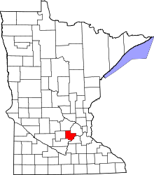 Location in the U.S. state of Minnesota | |
 Minnesota's location in the U.S. | |
| Founded | February 20, 1855[1] |
| Named for | Jonathan Carver |
| Seat | Chaska |
| Largest city | Chaska |
| Area | |
| • Total | 376 sq mi (974 km2) |
| • Land | 354 sq mi (917 km2) |
| • Water | 22 sq mi (57 km2), 5.8% |
| Population (est.) | |
| • (2016) | 100,262 |
| • Density | 257/sq mi (99/km2) |
| Congressional districts | 3rd, 6th |
| Time zone | Central: UTC−6/−5 |
| Website |
www |
Carver County is a county in the U.S. state of Minnesota. As of the 2010 census, the population was 91,042.[2] Its county seat is Chaska.[3] Carver County is named after the explorer Jonathan Carver, who in 1766–67, traveled from Boston to the Minnesota River, and wintered among the Sioux near the site of New Ulm.[4]
Carver County is part of the Minneapolis-St. Paul-Bloomington, MN-WI Metropolitan Statistical Area.
Geography
According to the U.S. Census Bureau, the county has a total area of 376 square miles (970 km2), of which 354 square miles (920 km2) is land and 22 square miles (57 km2) (5.8%) is water.[5] It is Minnesota's second-smallest county by land area and third-smallest by total area.
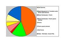
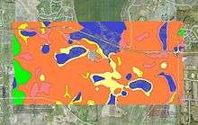
Carver is one of seven southern Minnesota counties with no forest soils; only prairie ecosystems of savannas and prairies can be found in Carver County. It is also one of 17 Minnesota counties where savanna soils dominate.
Lakes
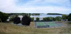
Carver County is home to seven lakes, 235 acres or larger. Carver's largest and most notable lake is Lake Waconia. The lake is Minnesota's 73rd largest lake and the Twin Cities' second largest lake, with an area of 2,996 acres.[7]
| Township | Lakes |
|---|---|
| Benton Township | Barlous Lake, Benton Lake, Maria Lake, Meuwissen Lake, Myers Lake, Rice Lake, Winkler Lake |
| Camden Township | Berliner Lake, Eagle Lake, Smith Lake |
| Dahlgren Township | Aue Lake |
| Hancock Township | Assumption Lake, Gaystock Lake, Maria Lake, Miller Lake, |
| Hollywood Township | Lippert Lake |
| Laketown Township | Carl Krey Lake, Lake Auburn, Lake Virginia, Lake Waconia, Lake Zumbra, Lunsten Lake, Marsh Lake, Parley Lake, Piersons Lake, Reitz Lake, Schutz Lake, Stieger Lake, Sunny Lake, Turbid Lake, Wasserman Lake, Lake Bavaria |
| San Francisco Township | Hallquist Lake, Kelly Lake, Long Lake, Scott Lake, |
| Waconia Township | Burandt Lake, Donders Lake, Goose Lake, Hydes Lake, Lake Minnewashta, Lake Patterson, Lake Waconia, Rutz Lake, Swan Lake |
| Watertown Township | Buck Lake, Goose Lake, Lippert Lake, Mud Lake, Oak Lake, Swede Lake |
| Young America Township | Barnes Lake, Brand Lake, Braunworth Lake, Tiger Lake, Young America Lake |
Major highways
.svg.png)


- Carver County Road 10
- Carver County Road 11
- Carver County Road 33
- Other county roads
Adjacent counties
- Wright County (north)
- Hennepin County (northeast)
- Scott County (southeast)
- Sibley County (southwest)
- McLeod County (west)
National protected area
Climate and weather
In recent years, average temperatures in the county seat of Chaska have ranged from a low of 4 °F (−16 °C) in January to a high of 81 °F (27 °C) in July, although a record low of −41 °F (−41 °C) was recorded in January 1970 and a record high of 105 °F (41 °C) was recorded in July 1988. Average monthly precipitation ranged from 0.66 inches (17 mm) in February to 5.05 inches (128 mm) in August.[8]
| Climate chart for Carver County, Minnesota | ||||||||||||||||||||||||||||||||||||||||||||||||||||||||||||||||||||||||||||||||||||||||||||||||||||||||||||||||||||||||||||
|---|---|---|---|---|---|---|---|---|---|---|---|---|---|---|---|---|---|---|---|---|---|---|---|---|---|---|---|---|---|---|---|---|---|---|---|---|---|---|---|---|---|---|---|---|---|---|---|---|---|---|---|---|---|---|---|---|---|---|---|---|---|---|---|---|---|---|---|---|---|---|---|---|---|---|---|---|---|---|---|---|---|---|---|---|---|---|---|---|---|---|---|---|---|---|---|---|---|---|---|---|---|---|---|---|---|---|---|---|---|---|---|---|---|---|---|---|---|---|---|---|---|---|---|---|
| ||||||||||||||||||||||||||||||||||||||||||||||||||||||||||||||||||||||||||||||||||||||||||||||||||||||||||||||||||||||||||||
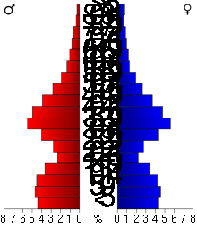
Demographics
| Historical population | |||
|---|---|---|---|
| Census | Pop. | %± | |
| 1860 | 5,106 | — | |
| 1870 | 11,586 | 126.9% | |
| 1880 | 14,140 | 22.0% | |
| 1890 | 16,532 | 16.9% | |
| 1900 | 17,544 | 6.1% | |
| 1910 | 17,455 | −0.5% | |
| 1920 | 16,946 | −2.9% | |
| 1930 | 16,936 | −0.1% | |
| 1940 | 17,606 | 4.0% | |
| 1950 | 18,155 | 3.1% | |
| 1960 | 21,358 | 17.6% | |
| 1970 | 28,331 | 32.6% | |
| 1980 | 37,046 | 30.8% | |
| 1990 | 47,915 | 29.3% | |
| 2000 | 70,205 | 46.5% | |
| 2010 | 91,042 | 29.7% | |
| Est. 2016 | 100,262 | [9] | 10.1% |
| U.S. Decennial Census[10] 1790–1960[11] 1900–1990[12] 1990–2000[13] 2010–2016[2] | |||
2010
The ethnic makeup of the county, according to the 2010 census, was the following:
- 93.7% White
- 1.5% Black
- 0.3% American Indian
- 2.9% Asian
- 0.0% Native Hawaiian or Pacific Islander
- 1.6% Two or more races
- 0.3% Other races
- 4.1% Hispanic or Latino (of any race)
There were 33,486 households out of which 42.1% had children under the age of 18 living with them, 62.9% were married couples living together, 7.6% had a female householder with no husband present, and 25.9% were non-families. 21.0% of all households were made up of individuals and 6.9% had someone living alone who was 65 years of age or older. The average household size was 2.74 and the average family size was 3.22.
The median income for a household in the county was $83,773, and the median income for a family was $96,913. Males had a median income of $66,150 versus $46,696 for females. The per capita income for the county was $37,457. About 3.3% of families and 4.9% of the population were below the poverty line, including 5.5% of those under age 18 and 7.8% of those age 65 or over.[14]
2000
As of the 2000 census, there were 70,205 people, 24,356 households, and 18,778 families residing in the county. The population density was 197 people per square mile (76/km²). There were 24,883 housing units at an average density of 70 per square mile (27/km²). The racial makeup of the county was 95.95% White, 0.59% Black or African American, 0.18% Native American, 1.56% Asian, 0.01% Pacific Islander, 0.87% from other races, and 0.82% from two or more races. 2.55% of the population were Hispanic or Latino of any race. 44.3% were of German, 12.1% Norwegian, 7.1% Irish and 6.2% Swedish ancestry.
There were 24,356 households out of which 45.20% had children under the age of 18 living with them, 66.40% were married couples living together, 7.30% had a female householder with no husband present, and 22.90% were non-families. 18.10% of all households were made up of individuals and 6.10% had someone living alone who was 65 years of age or older. The average household size was 2.84 and the average family size was 3.26.
In the county, the population was spread out with 31.50% under the age of 18, 6.90% from 18 to 24, 34.70% from 25 to 44, 19.50% from 45 to 64, and 7.50% who were 65 years of age or older. The median age was 34 years. For every 100 females there were 100.00 males. For every 100 females age 18 and over, there were 98.00 males.
The median income for a household in the county was $65,540, and the median income for a family was $73,577 (these figures had risen to $78,035 and $89,100 respectively as of a 2007 estimate). Males had a median income of $47,271 versus $32,107 for females. The per capita income for the county was $28,486. About 2.30% of families and 3.50% of the population were below the poverty line, including 3.60% of those under age 18 and 6.90% of those age 65 or over.
Government and politics
Government
Like all counties in Minnesota, Carver is governed by an elected and nonpartisan board of commissioners. Each commissioner represents a district of approximately equal population.
County commissioners
The county commission elects a chair who presides at meetings. Commissioners as of July 2015:
| District | Commissioner | In office since | Current term expires on Dec. 31 of |
|---|---|---|---|
| 1st | Gayle O. Degler | 2002 | 2016 |
| 2nd | Tom Workman | 2002 | 2018 |
| 3rd | Randy Maluchnik | 2006 | 2016 |
| 4th | Tim Lynch | 2004 | 2018 |
| 5th | James Ische | 1996 | 2016 |
Politics
Carver County has long been known as a Republican stronghold in state and federal elections. Since World War II, the county has never voted for a Democratic candidate for president. The last time Carver County voted for a Democrat was in 1932, Franklin D. Roosevelt's landslide win against incumbent Herbert Hoover,[15] and the only other occurrence since 1896 was Woodrow Wilson in 1912, when the Republicans were bitterly divided. Since 1944, the only time Carver County voted for a non-Republican candidate in a gubernatorial race was in 1998, Jesse Ventura’s historic third party upset.[16]
Carver County is divided into two congressional districts. While the eastern area, adjacent to Hennepin County and Scott County, is represented by Minnesota's 3rd congressional district (CPVI R+2) and the remainder of the county is represented by Minnesota's 6th congressional district (CPVI R+10).
| Year | Republican | Democratic | Third parties |
|---|---|---|---|
| 2016 | 52.2% 29,056 | 38.6% 21,508 | 9.2% 5,132 |
| 2012 | 58.9% 31,155 | 39.2% 20,745 | 1.9% 999 |
| 2008 | 56.7% 28,156 | 41.6% 20,654 | 1.8% 873 |
| 2004 | 62.8% 28,510 | 36.2% 16,456 | 1.0% 445 |
| 2000 | 59.4% 20,790 | 35.6% 12,462 | 5.1% 1,769 |
| 1996 | 44.0% 12,380 | 41.0% 11,554 | 15.0% 4,234 |
| 1992 | 38.3% 10,201 | 31.4% 8,349 | 30.3% 8,054 |
| 1988 | 59.2% 12,560 | 39.8% 8,439 | 1.1% 229 |
| 1984 | 63.6% 11,963 | 35.8% 6,725 | 0.6% 121 |
| 1980 | 53.6% 9,909 | 35.8% 6,621 | 10.6% 1,951 |
| 1976 | 50.2% 8,199 | 46.3% 7,574 | 3.5% 574 |
| 1972 | 61.5% 8,546 | 34.9% 4,852 | 3.7% 507 |
| 1968 | 56.4% 6,649 | 39.0% 4,590 | 4.6% 541 |
| 1964 | 51.4% 5,424 | 48.5% 5,123 | 0.1% 11 |
| 1960 | 60.9% 6,231 | 38.9% 3,982 | 0.1% 14 |
| 1956 | 72.5% 6,226 | 27.2% 2,334 | 0.3% 29 |
| 1952 | 75.4% 6,674 | 24.4% 2,159 | 0.2% 15 |
| 1948 | 61.2% 4,582 | 37.6% 2,816 | 1.1% 84 |
| 1944 | 78.4% 5,823 | 21.1% 1,565 | 0.5% 39 |
| 1940 | 78.6% 6,528 | 21.1% 1,753 | 0.3% 22 |
| 1936 | 42.4% 3,095 | 38.6% 2,814 | 19.0% 1,383 |
| 1932 | 36.3% 2,508 | 62.7% 4,328 | 1.0% 66 |
| 1928 | 57.7% 3,983 | 41.8% 2,885 | 0.5% 33 |
| 1924 | 40.2% 2,214 | 6.5% 358 | 53.3% 2,936 |
| 1920 | 87.3% 5,073 | 9.7% 562 | 3.0% 175 |
| 1916 | 65.6% 1,950 | 32.3% 960 | 2.2% 64 |
| 1912 | 26.9% 742 | 36.5% 1,008 | 36.6% 1,012[18] |
| 1908 | 60.0% 1,739 | 38.0% 1,101 | 2.0% 57 |
| 1904 | 70.4% 1,735 | 27.3% 672 | 2.3% 56 |
| 1900 | 59.5% 1,775 | 38.4% 1,146 | 2.0% 60 |
| 1896 | 58.3% 1,856 | 39.8% 1,268 | 2.0% 62 |
| 1892 | 40.4% 1,191 | 49.5% 1,462 | 10.1% 299 |
Communities
Cities
Townships
Unincorporated communities
Ghost town
Notable residents
See also
References
- ↑ "Minnesota Place Names". Minnesota Historical Society. Retrieved March 17, 2014.
- 1 2 "State & County QuickFacts". United States Census Bureau. Retrieved August 31, 2013.
- ↑ "Find a County". National Association of Counties. Archived from the original on 2011-05-31. Retrieved 2011-06-07.
- ↑ Gannett, Henry (1905). The Origin of Certain Place Names in the United States. Govt. Print. Off. p. 70.
- ↑ "2010 Census Gazetteer Files". United States Census Bureau. August 22, 2012. Archived from the original on October 6, 2014. Retrieved October 6, 2014.
- ↑ Nelson, Steven (2011). Savanna Soils of Minnesota. Minnesota: Self. pp. 49 – 52. ISBN 978-0-615-50320-2.
- ↑ "Fisheries Lake Surveys | Minnesota Department of Natural Resources". www.dnr.state.mn.us. Retrieved 2018-04-17.
- 1 2 "Monthly Averages for Chaska, Minnesota". The Weather Channel. Retrieved 2011-11-06.
- ↑ "Population and Housing Unit Estimates". Retrieved June 9, 2017.
- ↑ "U.S. Decennial Census". United States Census Bureau. Archived from the original on April 22, 2013. Retrieved October 6, 2014.
- ↑ "Historical Census Browser". University of Virginia Library. Retrieved October 6, 2014.
- ↑ "Population of Counties by Decennial Census: 1900 to 1990". United States Census Bureau. Retrieved October 6, 2014.
- ↑ "Census 2000 PHC-T-4. Ranking Tables for Counties: 1990 and 2000" (PDF). United States Census Bureau. Retrieved October 6, 2014.
- ↑ http://quickfacts.census.gov/qfd/states/27/27019.html
- ↑ Sullivan, Robert David; ‘How the Red and Blue Map Evolved Over the Past Century’; America Magazine in The National Catholic Review; June 29, 2016
- ↑ "Election Results – Minnesota Legislative Reference Library". www.leg.state.mn.us. Retrieved 2018-04-17.
- ↑ Leip, David. "Dave Leip's Atlas of U.S. Presidential Elections". uselectionatlas.org. Retrieved 2018-04-17.
- ↑ The leading "other" candidate, Progressive Theodore Roosevelt, received 933 votes, while Socialist candidate Eugene Debs received 41 votes, Prohibition candidate Eugene Chafin received 30 votes, and Socialist Labor candidate Arthur Reimer received 8 votes.
External links
| Wikimedia Commons has media related to Carver County, Minnesota. |
Places adjacent to Carver County, Minnesota | ||||||||||
|---|---|---|---|---|---|---|---|---|---|---|
| ||||||||||
Municipalities and communities of Carver County, Minnesota, United States | ||
|---|---|---|
| Cities | | |
| Townships | ||
| Unincorporated communities | ||
| Ghost town | ||
| Footnotes | ‡This populated place also has portions in an adjacent county or counties | |