Lake County, Minnesota
| Lake County, Minnesota | |
|---|---|
 | |
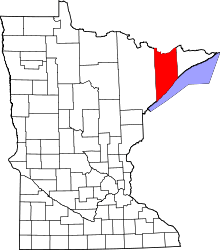 Location in the U.S. state of Minnesota | |
 Minnesota's location in the U.S. | |
| Founded | March 1, 1856[1] |
| Named for | Lake Superior |
| Seat | Two Harbors |
| Largest city | Two Harbors |
| Area | |
| • Total | 2,991 sq mi (7,747 km2) |
| • Land | 2,109 sq mi (5,462 km2) |
| • Water | 881 sq mi (2,282 km2), 29% |
| Population (est.) | |
| • (2016) | 10,625 |
| • Density | 5.2/sq mi (2.0/km2) |
| Congressional district | 8th |
| Time zone | Central: UTC−6/−5 |
| Website |
www |
Lake County is a county located in the U.S. state of Minnesota. As of the 2010 census, the population was 10,866.[2] Its county seat is Two Harbors.[3]
History
Lake County was founded on February 20, 1855, as Superior County, though its name was changed on March 3, of that year to Saint Louis County. On March 1, 1856, Saint Louis County became Lake County, while Newton County to the west was renamed Saint Louis County.
Prior to the arrival of Europeans, the area had long been inhabited by Native American groups. At the time of European contact, the principal Native American groups in the region were the Dakota (Sioux) and Ojibwe (also called Anishinabe or Chippewa). The economy of these groups was based on hunting, fishing and gathering, with wild rice being of particular importance. The first Europeans to explore the area were the French in the late 17th century[4] who were followed by trappers, fur traders, missionaries, and explorers. Beaver Bay was the first city in Lake County in 1855.
In 1868, iron ore was discovered on the Vermilion Range by George Stuntz. In 1884, the first shipment of ore left Agate Bay, marking Minnesota's entry into the iron ore industry. During the late 1880s, commercial fishing began on Lake Superior with the coming of Swedish and Norwegian immigrants to the North Shore. In 1890, the Merritt brothers discovered the Mesabi Range. The Two Harbors Lighthouse was built on Agate Bay in 1892. Ten years later, five Two Harbors businessmen signed the articles of incorporation for a new mining company named 3M. Today, 3M Corporation has over 70,000 employees worldwide and produces more than 50,000 adhesive household products, now has its headquarters in Saint Paul.
In 1906, the Court House, which stands to this day, was built. In 1907, one of the nation's first steel ore docks was built in Two Harbors. In 1944, one of the first HMOs in the United States was created in Lake County to serve railroad employees. A second iron ore boom took place in the 1950s with the development of the taconite beneficiation process for turning lean, low-grade iron ore into a shippable product.
Geography
According to the U.S. Census Bureau, the county has a total area of 2,991 square miles (7,750 km2), of which 2,109 square miles (5,460 km2) is land and 881 square miles (2,280 km2) (29%) is water.[5] It is the fifth-largest county in Minnesota by area.
Lake County is located in the Arrowhead Region of Northeastern Minnesota covering 2,062 miles. Within the county's boundaries are four state parks and a National Forest. Lake County offers hiking, camping, fishing and winter recreational activities. Lake County has Lake Superior, the largest freshwater lake in the world at its side. With its natural environment and shoreline, Lake County offers recreational opportunities as well as historical shipwrecks, two operating lighthouses and two public marinas. Lake County is home to mining, logging, wood products, lumbering, shipping and transportation, manufacturers, health care and tourism.
Major highways
Adjacent counties
- Rainy River District, Ontario (north)
- Cook County (east)
- Ashland County, Wisconsin (southeast)
- Bayfield County, Wisconsin (south)
- Douglas County, Wisconsin (south)
- Saint Louis County (west)
National protected areas
Demographics
| Historical population | |||
|---|---|---|---|
| Census | Pop. | %± | |
| 1860 | 248 | — | |
| 1870 | 135 | −45.6% | |
| 1880 | 106 | −21.5% | |
| 1890 | 1,299 | 1,125.5% | |
| 1900 | 4,654 | 258.3% | |
| 1910 | 8,011 | 72.1% | |
| 1920 | 8,251 | 3.0% | |
| 1930 | 7,068 | −14.3% | |
| 1940 | 6,956 | −1.6% | |
| 1950 | 7,781 | 11.9% | |
| 1960 | 13,702 | 76.1% | |
| 1970 | 13,351 | −2.6% | |
| 1980 | 13,043 | −2.3% | |
| 1990 | 10,415 | −20.1% | |
| 2000 | 11,058 | 6.2% | |
| 2010 | 10,866 | −1.7% | |
| Est. 2016 | 10,625 | [6] | −2.2% |
| U.S. Decennial Census[7] 1790-1960[8] 1900-1990[9] 1990-2000[10] 2010-2016[2] | |||

As of the 2000 census[11], there were 11,058 people, 4,646 households, and 3,140 families residing in the county. The population density was 5 people per square mile (2/km²). There were 6,840 housing units at an average density of 3 per square mile (1/km²). The racial makeup of the county was 97.99% White, 0.10% Black or African American, 0.70% Native American, 0.18% Asian, 0.01% Pacific Islander, 0.14% from other races, and 0.88% from two or more races. 0.57% of the population were Hispanic or Latino of any race. 22.3% were of Norwegian, 17.8% German, 14.3% Swedish, 8.4% Finnish, 6.3% Irish and 5.4% English ancestry.
There were 4,646 households out of which 27.10% had children under the age of 18 living with them, 57.80% were married couples living together, 6.60% had a female householder with no husband present, and 32.40% were non-families. 28.00% of all households were made up of individuals and 12.70% had someone living alone who was 65 years of age or older. The average household size was 2.32 and the average family size was 2.83.
In the county, the population was spread out with 22.30% under the age of 18, 6.60% from 18 to 24, 24.50% from 25 to 44, 26.70% from 45 to 64, and 20.00% who were 65 years of age or older. The median age was 43 years. For every 100 females there were 99.70 males. For every 100 females age 18 and over, there were 99.60 males.
The median income for a household in the county was $40,402, and the median income for a family was $46,980. Males had a median income of $39,719 versus $26,500 for females. The per capita income for the county was $19,761. About 5.50% of families and 7.40% of the population were below the poverty line, including 9.40% of those under age 18 and 5.70% of those age 65 or over.
Politics
Lake County has a historic Democratic/Labor lean. It was the top county for Socialist Party of America candidate Eugene V. Debs in 1908,[12] 1912,[13] and 1920.[14] The last Republican to carry the county was Herbert Hoover’s failed run for re-election in 1932,[15] although in the 1932 election Socialist Norman Thomas received 19.32% of the county’s vote, one of the highest percentages in the country.[16] Ironically, Lake County was the only county in Minnesota to vote for Hoover in 1932. In 2016, Lake County was the whitest county in the entire country to vote for Democrat Hillary Clinton over Republican Donald Trump.[17] Trump, however, got the highest percentage of the vote of any Republican since 1928.
| Year | Republican | Democratic | Third parties |
|---|---|---|---|
| 2016 | 45.0% 2,932 | 47.2% 3,077 | 7.9% 512 |
| 2012 | 38.3% 2,610 | 59.3% 4,043 | 2.5% 167 |
| 2008 | 37.8% 2,636 | 59.9% 4,174 | 2.3% 159 |
| 2004 | 39.2% 2,769 | 59.6% 4,212 | 1.3% 90 |
| 2000 | 37.6% 2,465 | 54.5% 3,579 | 7.9% 519 |
| 1996 | 27.9% 1,684 | 56.2% 3,388 | 15.9% 957 |
| 1992 | 23.1% 1,465 | 53.7% 3,415 | 23.2% 1,477 |
| 1988 | 31.8% 1,838 | 67.3% 3,887 | 0.9% 50 |
| 1984 | 30.7% 2,003 | 68.4% 4,468 | 0.9% 58 |
| 1980 | 34.8% 2,414 | 55.8% 3,864 | 9.4% 653 |
| 1976 | 35.1% 2,313 | 60.2% 3,973 | 4.7% 313 |
| 1972 | 40.7% 2,575 | 57.5% 3,640 | 1.8% 112 |
| 1968 | 22.9% 1,351 | 72.4% 4,266 | 4.7% 274 |
| 1964 | 20.3% 1,205 | 79.4% 4,704 | 0.3% 16 |
| 1960 | 36.8% 2,276 | 62.9% 3,888 | 0.3% 16 |
| 1956 | 40.0% 2,055 | 59.9% 3,079 | 0.2% 9 |
| 1952 | 33.8% 1,451 | 65.6% 2,814 | 0.6% 24 |
| 1948 | 24.8% 924 | 68.5% 2,555 | 6.7% 250 |
| 1944 | 24.5% 792 | 74.1% 2,401 | 1.4% 46 |
| 1940 | 25.0% 933 | 73.7% 2,750 | 1.3% 50 |
| 1936 | 18.2% 617 | 80.2% 2,717 | 1.7% 56 |
| 1932 | 43.0% 1,290 | 35.3% 1,059 | 21.8% 653 |
| 1928 | 72.8% 2,014 | 22.4% 618 | 4.8% 133 |
| 1924 | 46.6% 1,251 | 2.2% 60 | 51.1% 1,372 |
| 1920 | 40.9% 990 | 24.6% 594 | 34.5% 835 |
| 1916 | 30.2% 401 | 38.1% 506 | 31.7% 420 |
| 1912 | 14.4% 182 | 15.4% 195 | 70.2% 889 |
| 1908 | 51.2% 584 | 13.3% 152 | 35.4% 404 |
| 1904 | 67.5% 603 | 8.6% 77 | 23.9% 214 |
| 1900 | 67.0% 639 | 29.1% 278 | 3.9% 37 |
| 1896 | 64.1% 595 | 34.5% 320 | 1.5% 14 |
| 1892 | 60.0% 290 | 26.1% 126 | 13.9% 67 |
Communities
Cities
- Beaver Bay
- Silver Bay
- Two Harbors (county seat)
Townships
Census-designated place
Other unincorporated communities
Unorganized territories
Ghost towns
- Avon
- Avoy
- Beaver
- Britton
- Buell
- Case
- Clark
- Crystal
- Darby Junction
- Drummond
- Eclfo
- Emetta
- Fernburg Tower
- Forest Center
- Freedom
- Green
- Greenwood Junction
- Howlett
- Jordan
- Kent
- London
- Malmota (Marmata)
- Maple
- Marble Lake
- Moose
- Morris
- Murfin
- Nigadoo
- Norshore Junction
- North Branch
- Riblet
- Scott Junction
- Silver
- Splitrock
- Stafford
- Summit
- Swift
- Thomas
- Waldo
- Wanless
- Westover
- Whyte
- Wolf
- York
See also
References
- ↑ "Minnesota Place Names". Minnesota Historical Society. Retrieved March 18, 2014.
- 1 2 "State & County QuickFacts". United States Census Bureau. Archived from the original on July 13, 2011. Retrieved September 1, 2013.
- ↑ "Find a County". National Association of Counties. Retrieved 2011-06-07.
- ↑ http://events.mnhs.org/TimePieces/Timeline.cfm
- ↑ "2010 Census Gazetteer Files". United States Census Bureau. August 22, 2012. Archived from the original on September 21, 2013. Retrieved October 21, 2014.
- ↑ "Population and Housing Unit Estimates". Retrieved June 9, 2017.
- ↑ "U.S. Decennial Census". United States Census Bureau. Retrieved October 21, 2014.
- ↑ "Historical Census Browser". University of Virginia Library. Retrieved October 21, 2014.
- ↑ "Population of Counties by Decennial Census: 1900 to 1990". United States Census Bureau. Retrieved October 21, 2014.
- ↑ "Census 2000 PHC-T-4. Ranking Tables for Counties: 1990 and 2000" (PDF). United States Census Bureau. Retrieved October 21, 2014.
- ↑ "American FactFinder". United States Census Bureau. Retrieved 2008-01-31.
- ↑ "Dave Leip's Atlas of US Presidential Elections for 1908". Retrieved 19 September 2018.
- ↑ "Dave Leip's Atlas of US Presidential Elections for 1912". Retrieved 19 September 2018.
- ↑ "Dave Leip's Atlas of US Presidential Elections for 1920". Retrieved 19 September 2018.
- ↑ "Presidential election of 1932 - Map by counties". geoelections.free.fr. Retrieved 19 September 2018.
- ↑ "Dave Leip's Atlas of US Presidential Elections for 1932". Retrieved 19 September 2018.
- ↑ "Election Day 2016 by the numbers - News, Sports, Jobs - Adirondack Daily Enterprise". www.adirondackdailyenterprise.com. Retrieved 19 September 2018.
- ↑ Leip, David. "Dave Leip's Atlas of U.S. Presidential Elections". uselectionatlas.org. Retrieved 19 September 2018.
External links
- County website
- Lake County Visitor Information Website
- Mn/DOT – maps of Lake County (Southern portion, Central portion, Northern portion)
Places adjacent to Lake County, Minnesota | |
|---|---|
Municipalities and communities of Lake County, Minnesota, United States | ||
|---|---|---|
| Cities | | |
| Townships | ||
| CDP | ||
| Unincorporated communities | ||
| Unorganized territories | ||
| Ghost town | ||