Fillmore County, Minnesota
| Fillmore County, Minnesota | |
|---|---|
 Fillmore County Courthouse | |
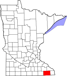 Location in the U.S. state of Minnesota | |
 Minnesota's location in the U.S. | |
| Founded | March 5, 1853[1] |
| Named for | Millard Fillmore |
| Seat | Preston |
| Largest city | Spring Valley |
| Area | |
| • Total | 862 sq mi (2,233 km2) |
| • Land | 861 sq mi (2,230 km2) |
| • Water | 0.8 sq mi (2 km2), 0.09% |
| Population (est.) | |
| • (2016) | 21,003 |
| • Density | 24/sq mi (9/km2) |
| Congressional district | 1st |
| Time zone | Central: UTC−6/−5 |
| Website |
www |
Fillmore County is a county located in the U.S. state of Minnesota. As of the 2010 census, the population was 20,866.[2] Its county seat is Preston.[3]
Fillmore County is included in the Rochester, MN Metropolitan Statistical Area.
History
Fillmore County was established in 1853.[4] It is named for Millard Fillmore, thirteenth President of the United States.[5] Located in Southeast Minnesota, Fillmore County was an early destination for Euro-American settlement following the United States' 1851 treaties with the Dakota nations. Norwegian immigrants were particularly numerous. In 1860 Fillmore was the most populous county in Minnesota.[6]
Geography
According to the U.S. Census Bureau, the county has a total area of 862 square miles (2,230 km2), of which 861 square miles (2,230 km2) is land and 0.8 square miles (2.1 km2) (0.09%) is water.[7]
The county is part of the Driftless Area, or in its own documents, the Paleozoic plateau. This part of Minnesota was ice-free during the last ice age. The county to the east is more rugged, but Fillmore County also displays a karst topography.
Major highways
Adjacent counties
- Winona County (northeast)
- Houston County (east)
- Winneshiek County, Iowa (southeast)
- Howard County, Iowa (southwest)
- Mower County (west)
- Olmsted County (northwest)
Demographics
| Historical population | |||
|---|---|---|---|
| Census | Pop. | %± | |
| 1860 | 13,542 | — | |
| 1870 | 24,887 | 83.8% | |
| 1880 | 28,162 | 13.2% | |
| 1890 | 25,996 | −7.7% | |
| 1900 | 28,288 | 8.8% | |
| 1910 | 25,680 | −9.2% | |
| 1920 | 25,330 | −1.4% | |
| 1930 | 24,748 | −2.3% | |
| 1940 | 25,830 | 4.4% | |
| 1950 | 24,465 | −5.3% | |
| 1960 | 23,768 | −2.8% | |
| 1970 | 21,916 | −7.8% | |
| 1980 | 21,930 | 0.1% | |
| 1990 | 20,777 | −5.3% | |
| 2000 | 21,122 | 1.7% | |
| 2010 | 20,866 | −1.2% | |
| Est. 2016 | 21,003 | [9] | 0.7% |
| U.S. Decennial Census[10] 1790-1960[11] 1900-1990[12] 1990-2000[13] 2010-2016[2] | |||

As of the 2010 census,[14] there were 20,866 people, 8,545 households, and 5,763 families residing in the county. The population density was 24.2 people per square mile (9/km²). There were 9,732 housing units at an average density of 11.3 per square mile (4/km²). The racial makeup of the county was 98.2% White, 0.2% Black or African American, 0.10% Native American, 0.3% Asian, 0.3% from other races, and 0.8% from two or more races. 1% of the population were Hispanic or Latino of any race.
There were 8,545 households out of which 29.4% had children under the age of 18 living with them, 56.4% were married couples living together, 7% had a female householder with no husband present, 4% had a male householder with no wife present, and 32.60% were non-families. 28.30% of all households were made up of individuals and 7.32% had someone living alone who was 65 years of age or older. The average household size was 2.40 and the average family size was 2.94.
In the county, the population was spread out with 24.3% under the age of 18, 6.5% from 18 to 24, 21.9% from 25 to 44, 28.20% from 45 to 64, and 17.10% who were 65 years of age or older. The median age was 43 years. For every 100 females there were 97.30 males. For every 100 females age 18 and over, there were 98.80 males.
In 2010, the median income for a household in the county was $45,888, and the median income for a family was $59,034. Males had a median income of $39,239 versus $33,571 for females. 2015 estimates state the per capita income for the county was $26,348. In 2015, about 7.4% of families and 11.10% of the population were below the poverty line, including 16.50% of those under age 18 and 10.9% of those age 65 or over.[15]
Communities

Cities
- Canton
- Chatfield (partly in Olmsted County)
- Fountain
- Harmony
- Lanesboro
- Mabel
- Ostrander
- Peterson
- Preston (county seat)
- Rushford Village
- Rushford
- Spring Valley
- Whalan
- Wykoff
Townships
- Amherst Township
- Arendahl Township
- Beaver Township
- Bloomfield Township
- Bristol Township
- Canton Township
- Carimona Township
- Carrolton Township
- Chatfield Township
- Fillmore Township
- Forestville Township
- Fountain Township
- Harmony Township
- Holt Township
- Jordan Township
- Newburg Township
- Norway Township
- Pilot Mound Township
- Preble Township
- Preston Township
- Spring Valley Township
- Sumner Township
- York Township
Unincorporated communities
Politics
| Year | Republican | Democratic | Third parties |
|---|---|---|---|
| 2016 | 56.7% 6,271 | 35.0% 3,872 | 8.3% 912 |
| 2012 | 45.1% 4,913 | 52.5% 5,713 | 2.4% 266 |
| 2008 | 44.5% 4,993 | 52.7% 5,921 | 2.9% 320 |
| 2004 | 48.7% 5,694 | 49.8% 5,825 | 1.5% 179 |
| 2000 | 45.5% 4,646 | 49.1% 5,020 | 5.5% 557 |
| 1996 | 35.2% 3,466 | 48.0% 4,732 | 16.9% 1,663 |
| 1992 | 33.6% 3,583 | 37.3% 3,977 | 29.1% 3,098 |
| 1988 | 54.4% 5,004 | 44.7% 4,114 | 0.9% 82 |
| 1984 | 58.9% 6,342 | 40.4% 4,351 | 0.6% 67 |
| 1980 | 57.0% 6,452 | 35.5% 4,010 | 7.5% 850 |
| 1976 | 54.6% 5,984 | 43.4% 4,758 | 2.0% 215 |
| 1972 | 67.9% 7,107 | 30.2% 3,155 | 1.9% 198 |
| 1968 | 59.0% 6,257 | 36.9% 3,918 | 4.1% 432 |
| 1964 | 45.3% 4,824 | 54.6% 5,813 | 0.1% 14 |
| 1960 | 65.6% 7,507 | 34.3% 3,926 | 0.1% 11 |
| 1956 | 67.1% 7,004 | 32.8% 3,427 | 0.1% 9 |
| 1952 | 76.0% 8,405 | 23.6% 2,612 | 0.4% 40 |
| 1948 | 55.2% 5,587 | 43.6% 4,414 | 1.3% 127 |
| 1944 | 66.3% 6,339 | 33.3% 3,183 | 0.4% 40 |
| 1940 | 67.0% 7,839 | 32.7% 3,826 | 0.3% 39 |
| 1936 | 48.6% 5,054 | 45.8% 4,764 | 5.6% 586 |
| 1932 | 48.2% 4,979 | 50.0% 5,166 | 1.7% 180 |
| 1928 | 77.8% 7,719 | 21.6% 2,143 | 0.6% 63 |
| 1924 | 62.8% 5,550 | 5.2% 460 | 32.1% 2,835 |
| 1920 | 85.9% 7,341 | 10.5% 899 | 3.6% 304 |
| 1916 | 65.2% 2,945 | 29.1% 1,313 | 5.7% 259 |
| 1912 | 26.2% 1,169 | 22.2% 990 | 51.6% 2,301 |
| 1908 | 69.9% 3,259 | 24.7% 1,153 | 5.4% 254 |
| 1904 | 80.2% 3,242 | 13.7% 554 | 6.2% 249 |
| 1900 | 69.8% 3,741 | 25.5% 1,364 | 4.7% 254 |
| 1896 | 66.1% 4,195 | 30.5% 1,939 | 3.4% 217 |
| 1892 | 56.5% 2,925 | 26.0% 1,346 | 17.5% 903 |
See also
References
- ↑ "Minnesota Place Names". Minnesota Historical Society. Retrieved March 18, 2014.
- 1 2 "State & County QuickFacts". United States Census Bureau. Archived from the original on July 10, 2011. Retrieved August 31, 2013.
- ↑ "Find a County". National Association of Counties. Archived from the original on May 31, 2011. Retrieved 2011-06-07.
- ↑ Upham, Warren (1920). Minnesota Geographic Names: Their Origin and Historic Significance. Minnesota Historical Society. p. 190.
- ↑ Gannett, Henry (1905). The Origin of Certain Place Names in the United States. Govt. Print. Off. p. 125.
- ↑ Frame III, Robert M. (July 1981). "National Register of Historic Places Inventory—Nomination Form: Fillmore County Multiple Resource Area". National Park Service. Retrieved 2014-02-25.
- ↑ "2010 Census Gazetteer Files". United States Census Bureau. August 22, 2012. Archived from the original on September 21, 2013. Retrieved October 15, 2014.
- ↑ Nelson, Steven (2011). Savanna Soils of Minnesota. Minnesota: Self. pp. 43 - 48. ISBN 978-0-615-50320-2.
- ↑ "Population and Housing Unit Estimates". Retrieved June 9, 2017.
- ↑ "U.S. Decennial Census". United States Census Bureau. Archived from the original on May 12, 2015. Retrieved October 15, 2014.
- ↑ "Historical Census Browser". University of Virginia Library. Retrieved October 15, 2014.
- ↑ "Population of Counties by Decennial Census: 1900 to 1990". United States Census Bureau. Retrieved October 15, 2014.
- ↑ "Census 2000 PHC-T-4. Ranking Tables for Counties: 1990 and 2000" (PDF). United States Census Bureau. Retrieved October 15, 2014.
- ↑ "American FactFinder". Retrieved 2017-07-08.
- ↑ "American FactFinder". Retrieved 2017-07-18.
- ↑ Leip, David. "Dave Leip's Atlas of U.S. Presidential Elections". uselectionatlas.org. Retrieved 8 April 2018.
External links
Places adjacent to Fillmore County, Minnesota | ||||||||||
|---|---|---|---|---|---|---|---|---|---|---|
| ||||||||||
Municipalities and communities of Fillmore County, Minnesota, United States | ||
|---|---|---|
| Cities | | |
| Townships | ||
| Unincorporated communities | ||
| Ghost town | ||
| Footnotes | ‡This populated place also has portions in an adjacent county or counties | |
| Core city |  | |
|---|---|---|
| Incorporated Places | ||
| Counties | ||
‡ indicates that it is partially in the metropolitan area. † indicates a county seat. | ||