Minnetonka, Minnesota
| Minnetonka, Minnesota | |
|---|---|
| City | |
 Minnetonka Community Center | |
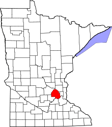
 Location of Minnetonka within Hennepin County, Minnesota | |
| Coordinates: 44°54′48″N 93°30′12″W / 44.91333°N 93.50333°WCoordinates: 44°54′48″N 93°30′12″W / 44.91333°N 93.50333°W | |
| Country | United States |
| State | Minnesota |
| County | Hennepin |
| Founded | 1850s |
| Incorporated | 1956 |
| Government | |
| • Mayor | Terry Schneider |
| Area[1] | |
| • City | 28.22 sq mi (73.09 km2) |
| • Land | 26.93 sq mi (69.75 km2) |
| • Water | 1.29 sq mi (3.34 km2) |
| Elevation | 889 ft (271 m) |
| Population (2010)[2] | |
| • City | 49,734 |
| • Estimate (2017)[3] | 53,085 |
| • Rank | US: 735th MN: 17th |
| • Density | 1,800/sq mi (680/km2) |
| • Metro | 3,524,583 (US: 16th) |
| Time zone | UTC-6 (Central (CST)) |
| • Summer (DST) | UTC-5 (CDT) |
| ZIP codes | 55305, 55343, 55345, 55391[4] |
| Area code(s) | 952 |
| FIPS code | 27-43252 |
| GNIS feature ID | 0647949[5] |
| Website | www.eminnetonka.com |
Minnetonka (/ˌmɪnɪˈtɒŋkə/ MIN-i-TONG-kə) is a suburban city in Hennepin County, Minnesota, United States, eight miles (13 km) west of Minneapolis. The population was 49,734 at the 2010 census.[6] The name comes from the Dakota Sioux mni tanka, meaning "great water". The city is the home of Cargill, the country's largest privately owned company, and UnitedHealth Group, the state's largest publicly owned company.
Geography
According to the United States Census Bureau, the city has a total area of 28.22 square miles (73.09 km2), of which 26.93 square miles (69.75 km2) is land and 1.29 square miles (3.34 km2) is water.[1] Part of the city includes the eastern tip of Lake Minnetonka, one of the largest lakes in Minnesota. The outlet of Lake Minnetonka is Minnehaha Creek, which winds through south Minneapolis and flows over Minnehaha Falls and into the Mississippi River. Minnetonka is located 8 miles (13 km) west of Minneapolis, in Hennepin County.
Economy
The headquarters of Carlson Companies are in Minnetonka.[7] The headquarters of Cargill are located in Minnetonka and are in the Wayzata Post Office area.[8][9][10] Founded in 1865, Cargill is the largest privately held corporation in the U.S. in terms of revenue.[11] Other companies based in Minnetonka include the uniform companies AmeriPride Services and G&K Services.
Top employers
According to the city's 2016 Comprehensive Annual Financial Report,[12] the top employers in the city are:
| # | Employer | # of Employees |
|---|---|---|
| 1 | UnitedHealth Group | 4,400 |
| 2 | Cargill | 3,400 |
| 3 | Carlson | 3,100 |
| 4 | Minnetonka Public Schools | 1,671 |
| 5 | Rosemount Engineering (Emerson) | 1,600 |
| 6 | Medica Health Plans | 1,300 |
| 7 | Starkey Hearing Technologies | 1,300 |
| 8 | St. Jude Medical | 1,300 |
| 9 | SuperValu | 1,265 |
| 10 | MTS | 800 |
History
Since the mid-19th century, Minnetonka has evolved from heavily wooded wilderness through extensive farming and thriving industrialization to its present primarily residential suburban character. The Dakota and Ojibwe Indians were the first people to settle in the area. They believed the land around Lake Minnetonka (minne meaning water and tonka meaning big) was the legendary home of an extinct race. The first recorded exploration of the area by European settlers was in 1822, when a group from newly constructed Fort Snelling made its way up Minnehaha Creek (then known as Brown's Creek or Falls Creek) to the lake. In 1851, the Dakota sold the area including Minnetonka to the United States with the Treaty of Traverse des Sioux. The first census, the Territorial Census of 1857, lists 41 households. Twenty-nine of the heads of households are listed as farmers. The occupations of the remaining twelve are associated with the operations of Minnetonka Mill and a nearby hotel.[13]
In 1852, a claim was staked on Minnehaha Creek near McGinty Road. The sawmill that was constructed in the thick woods of maple, oak, elm, red cedar and basswood was the first privately operated mill in Minnesota west of the Mississippi River. Oak timbers from this mill were used to build the first suspension bridge across the Mississippi River at Saint Anthony Falls in 1853. The settlement of Minnetonka Mills that grew up around the mill was the first permanent European–American settlement west of Minneapolis in Hennepin County. In 1855, a two-story sawmill was constructed with a furniture factory on the second floor. A building for varnishing furniture was built on the south side of the creek, at the present Bridge Street. Production consisted mainly of chairs and bedsteads. The Minnetonka Republican at St. Anthony published a short article describing the area. The February 12, 1857, issue said:
| “ | Minnetonka City - We have already called attention to the thrift and activity of that little town. Large investments are made there. On January 1, 40 hands were being employed turning out weekly 500 chairs and 200 bedsteads. By April it will be 2000 weekly. 1,000,000 board feet (2,400 m3) of lumber is in the pond, half of it nicely seasoned. Machinery is on the way for a flour mill. J. P. Miller is erecting a new hotel. | ” |


In 1860, after only 8 years of operation, the sawmill closed. In 1869, a flour and grist mill were constructed and operated until the late 1880s. In 1874, Charles H. Burwell came to manage the Minnetonka Mill Company, and he built a Victorian home on the north bank of Minnehaha Creek (Minnetonka Boulevard at McGinty Road East) for his family. The Charles H. Burwell House is now on the National Register of Historic Places and is owned by the city. There were two other mills in Minnetonka. The St. Alban's Mill, which was less than 1 mile (2 km) downstream from Minnetonka Mills on Minnehaha Creek, operated as a flour mill from 1874 to 1881. A grist mill built on Purgatory Creek was washed out in a flood shortly after construction. Minnetonka Mills, with its post office and port for Lake Minnetonka, was the principal business and trading center for a large area until the 1870s.
Between 1883 and 1956, the area within the original 36-square-mile (93 km2) township grew smaller as Wayzata, Hopkins, Deephaven, Woodland and Saint Louis Park incorporated or annexed portions of then-Minnetonka Township. Excellent transportation facilities to Hopkins and Minneapolis began to transform the township's economy. Train service to Minneapolis had been available since the 1880s, and in 1905 streetcar service began. The attraction to become a city wage earner was great and rapid transit made it possible. In 1956, as a maneuver to prevent neighboring villages from continuing to annex portions of then-Minnetonka Township, residents in 1956 voted to establish a village out of the remaining 28 square miles (73 km2), and the area was incorporated as Minnetonka Village. However, Minnetonka Village lasted only thirteen years. The complexities and the heavy demands of administering a rapidly developing community required professional management and larger representation. In 1969, a city charter was approved to serve the 35,000 residents. Ridgedale Center is located in Minnetonka.
Education
Public schools
The city of Minnetonka is covered by three independent school districts.[14] The Hopkins School District, which encompasses the central and eastern part of Minnetonka; the Minnetonka School District, in the western part of city north of Lake Minnetonka; and the Wayzata School District, which covers an area along the southern boundary of the city. Some students attend public schools in other school districts chosen by their families under Minnesota's open enrollment statute.[15]
| Public Schools in Minnetonka (Minnetonka School District) | ||
|---|---|---|
| Elementary School | Junior High School | Senior High School |
| Clear Springs Elementary | Minnetonka Middle School East | Minnetonka High School |
| Groveland Elementary | ||
| Scenic Heights Elementary | ||
The Minnetonka School District also includes four schools outside of the city of Minnetonka: Deephaven Elementary School (Deephaven, MN),Excelsior Elementary School (Excelsior, MN), Minnewashta Elementary School (Shorewood, MN), and Minnetonka Middle School West (Chanhassen, MN)
| Public Schools in Minnetonka (Hopkins School District) | ||
|---|---|---|
| Elementary Schools | Junior High School | Senior High School |
| Gatewood Elementary School | Hopkins West Junior High School | Hopkins High School |
| Glen Lake Elementary School | Hopkins North Junior High School | |
The Hopkins School District comprises two thirds of the city of Minnetonka, the entirety of Hopkins, and portions of the cities of Golden Valley, Edina, St. Louis Park, Wayzata, and Plymouth. In addition to schools located within Minnetonka, the Hopkins School District also includes four schools in the cities of Hopkins and Golden Valley: Eisenhower Elementary School/Xin Xing Academy (Hopkins, MN), Alice Smith Elementary School (Hopkins, MN), Meadowbrook Elementary School (Golden Valley, MN), and Harley Hopkins Early Childhood/Family Center (Hopkins, MN).
Private schools
There are three private and parochial schools within Minnetonka's city limits:
- Accell Academy, an accredited private college preparatory school serving grades K-12
- Immaculate Heart of Mary Catholic School, preschool through eighth grade
- Minnetonka Christian Academy
Public libraries
The Hennepin County Library has its headquarters in the Ridgedale Library in Minnetonka.[16] In addition the system operates the Minnetonka Library.[17]
Demographics
| Historical population | |||
|---|---|---|---|
| Census | Pop. | %± | |
| 1880 | 161 | — | |
| 1960 | 25,037 | — | |
| 1970 | 35,776 | 42.9% | |
| 1980 | 38,683 | 8.1% | |
| 1990 | 48,370 | 25.0% | |
| 2000 | 51,301 | 6.1% | |
| 2010 | 49,734 | −3.1% | |
| Est. 2017 | 53,085 | [3] | 6.7% |
| U.S. Decennial Census[18] 2017 Estimate[19] | |||
2010 census
As of the census[2] of 2010, there were 49,734 people, 21,901 households, and 13,619 families residing in the city. The population density was 1,846.8 inhabitants per square mile (713.1/km2). There were 23,294 housing units at an average density of 865.0 per square mile (334.0/km2). The racial makeup of the city was 90.0% White, 3.7% African American, 0.3% Native American, 3.1% Asian, 0.7% from other races, and 2.1% from two or more races. Hispanic or Latino of any race were 2.4% of the population.
There were 21,901 households of which 25.9% had children under the age of 18 living with them, 52.1% were married couples living together, 7.3% had a female householder with no husband present, 2.8% had a male householder with no wife present, and 37.8% were non-families. 31.1% of all households were made up of individuals and 11.9% had someone living alone who was 65 years of age or older. The average household size was 2.25 and the average family size was 2.85.
The median age in the city was 45 years. 20.8% of residents were under the age of 18; 6% were between the ages of 18 and 24; 23.2% were from 25 to 44; 33.3% were from 45 to 64; and 16.7% were 65 years of age or older. The gender makeup of the city was 47.5% male and 52.5% female.
2000 census
As of the census of 2000, there were 51,301 people, 21,393 households, and 14,097 families residing in the city. The population density was 1,893.0 persons per square mile (729.7/km²). There were 22,228 housing units at an average density of 818.9 per square mile (316.2/km²). The racial makeup of the city was 94.40% White, 1.50% African American, 0.20% Native American, 2.29% Asian, 0.03% Pacific Islander, 0.57% from other races, and 1.03% from two or more races. Hispanic or Latino of any race were 1.28% of the population. 24.7% were of German, 13.8% Norwegian, 9.1% Irish, 8.2% Swedish and 6.7% English ancestry.
There were 21,393 households out of which 29.1% had children under the age of 18 living with them, 56.6% were married couples living together, 6.8% had a female householder with no husband present, and 34.1% were non-families. 27.3% of all households are made up of single individuals and 9.3% had someone living alone who was 65 years of age or older. The average household size was 2.37 and the average family size was 2.92.
In the city, the population was spread out with 23.1% under the age of 18, 6.0% from 18 to 24, 28.5% from 25 to 44, 28.4% from 45 to 64, and 14.0% who were 65 years of age or older. The median age was 41 years. For every 100 females, there were 91.8 males. For every 100 females age 18 and over, there were 88.7 males.
According to the 2000 US Census, the median income for a household in the city was $83,437.
Government

The City Council of Minnetonka consists of the mayor and six council members. Of the six council members, two are elected at large and the remaining four are elected from wards. The council exercises the legislative power of the city and determines all matters of policy. It has the responsibility of basic decisions for the community, including appointment of the city manager. The city manager is responsible for putting council policies into effect and administering affairs of city government.[20]
The United States Postal Service operates the Minnetonka Post Office and the Minnetonka Carrier Annex.[21][22] In addition, Minnetonka is served by four zip codes: one representing Minnetonka (55345), two representing Hopkins, MN (55305, 55343) and one representing Wayzata, MN (55391).
Politics
Minnetonka is located in Minnesota's 3rd congressional district, represented by Republican Erik Paulsen.
Sports
The Minnetonka Dynamo, a bandy club, became national champions of bandy in 1994, 1998 and 2000.
The Minnetonka Millers, a Class A baseball club, became state champions in 2015, 2016, and 2017.[23] The Millers play at Veterans Field, located on the campus of Minnetonka High School.
Notable people
- Eric Freeman - former actor
- Jake Gardiner – professional hockey player currently with the Toronto Maple Leafs
- Jack Hillen – retired professional ice hockey player
- Kris Humphries – professional basketball player currently with the Atlanta Hawks
- Gary Jacobsen - professional golfer.[24]
- Ryan McCartan - Disney channel actor
- Tom Petters – former CEO of Petters Group Worldwide convicted of running a 3.65 billion dollar Ponzi scheme.
- Al Quie – former Governor of Minnesota (1979–1983)[25]
- Gretchen Quie - artist and former First Lady of Minnesota (1979–1983)[25]
- Mike Ramsey – member of United States 1980 Olympic Gold Medal hockey team, the "Miracle Team"
- Dave Snuggerud – professional ice hockey player drafted by the Buffalo Sabres
- Jill Trenary - professional figure skater
- Terrell Sinkfield – American football cornerback who is currently a member of the Minnesota Vikings
- Wesley So - chess grandmaster
- Beau Allen - Defensive Tackle, NFL, Philadelphia Eagles
References
- 1 2 "US Gazetteer files 2010". United States Census Bureau. Archived from the original on 2012-01-24. Retrieved 2012-11-13.
- 1 2 "American FactFinder". United States Census Bureau. Retrieved 2012-11-13.
- 1 2 "Population and Housing Unit Estimates". Retrieved May 30, 2018.
- ↑ Hennepin co zip code map Archived 2008-06-25 at the Wayback Machine.
- ↑ "US Board on Geographic Names". United States Geological Survey. 2007-10-25. Retrieved 2008-01-31.
- ↑ "2010 Census Redistricting Data (Public Law 94-171) Summary File". American FactFinder. U.S. Census Bureau, 2010 Census. Archived from the original on 21 July 2011. Retrieved 23 April 2011.
- ↑ "Contact." Carlson Companies. Retrieved on February 9, 2011. "Carlson 701 Carlson Parkway Minnetonka, MN 55305 U.S.A."
- ↑ "Wayzata city, Minnesota." U.S. Census Bureau. Retrieved on December 23, 2010.
- ↑ "Twin Cities Locations Archived 2011-07-26 at the Wayback Machine.." Cargill. Retrieved on December 23, 2010. "15407 McGinty Rd Wayzata, MN 55391"
- ↑ "Privacy." Cargill. Retrieved on December 23, 2010. "Our headquarters are in Wayzata, Minnesota in the United States of America."
- ↑ "#1 Cargill - Forbes.com". www.forbes.com. Retrieved 1 April 2018.
- ↑ City of Minnetonka CAFR Archived 2013-12-03 at the Wayback Machine.
- ↑ A Brief History of Minnetonka Archived 2006-06-04 at the Wayback Machine., Minnetonka Historical Society
- ↑ City of Minnetonka covered by three school districts Archived 2008-06-22 at the Wayback Machine., City of Minnetonka webpage
- ↑ "Open Enrollment". Minnesota Department of Education. Archived from the original on 26 August 2010. Retrieved 19 November 2010.
- ↑ "About Hennepin County Library Archived 2010-02-25 at the Wayback Machine.." Hennepin County Library. Retrieved on March 24, 2010.
- ↑ "Minnetonka Library." Hennepin County Library. Retrieved on March 24, 2010.
- ↑ United States Census Bureau. "Census of Population and Housing". Retrieved July 23, 2014.
- ↑ "Population Estimates". United States Census Bureau. Archived from the original on October 19, 2016. Retrieved May 30, 2018.
- ↑ http://www.eminnetonka.com/your_government/departments/city_manager.cfm%5Bpermanent+dead+link%5D
- ↑ "Post Office Location - MINNETONKA Archived 2010-12-31 at the Wayback Machine.." United States Postal Service. Retrieved on December 23, 2010.
- ↑ "Post Office Location - MINNETONKA CARRIER ANNEX Archived 2010-12-21 at the Wayback Machine.." United States Postal Service. Retrieved on December 23, 2010.
- ↑ http://minnetonkamillers.com/
- ↑ "Lawrence Journal-World - Google News Archive Search". news.google.com. Retrieved 1 April 2018.
- 1 2 Salisbury, Bill (2015-12-14). "Gretchen Quie, opened governor's house to public, dies at 88". St. Paul Pioneer Press. Retrieved 2016-01-02.
External links
| Wikivoyage has a travel guide for Minnetonka. |
Municipalities and communities of Hennepin County, Minnesota, United States | ||
|---|---|---|
| Cities |
|  |
| Unorganized territory | ||
| Footnotes | ‡This populated place also has portions in an adjacent county or counties | |