Kittson County, Minnesota
| Kittson County, Minnesota | |
|---|---|
 | |
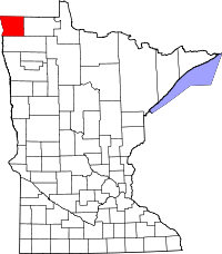 Location in the U.S. state of Minnesota | |
 Minnesota's location in the U.S. | |
| Founded | March 9, 1878[1] |
| Named for | Norman Wolfred Kittson |
| Seat | Hallock |
| Largest city | Hallock |
| Area | |
| • Total | 1,104 sq mi (2,859 km2) |
| • Land | 1,099 sq mi (2,846 km2) |
| • Water | 4.8 sq mi (12 km2), 0.4% |
| Population (est.) | |
| • (2016) | 4,333 |
| • Density | 4.1/sq mi (1.6/km2) |
| Congressional district | 7th |
| Time zone | Central: UTC−6/−5 |
| Website |
www |
Kittson County is a county located in the U.S. state of Minnesota along the Canada–US border. As of the 2010 census, the population was 4,552.[2] Its county seat is Hallock.[3] It is named after Canadian fur trader and railroad entrepreneur Norman Kittson. The county was officially organized on February 25, 1879, having been part of the Pembina District prior to that time. The county also included the western portion of what is now Roseau County until 1894.
Skull Lake is Kittson County's only natural lake. Lake Bronson, for which the city of Lake Bronson takes its name, is man-made.
Kittson County is south from the Canadian province of Manitoba.
Etymology
The county is named after Norman W. Kittson,[5] an early fur trader and partner of the American Fur Company. He increased the fur trading traffic significantly by increasing the use of oxcarts. He was also responsible for the pioneering of the steamboat in the Red River and was active with James J. Hill in the development of the railroad. His contributions played an important role in the settlement of the county.
History
Evidence of occupation dating back 1800 years has been confirmed through archaeological expeditions done in the 1930s and the 1970s around the burial mounds that are located on the sand ridges in the eastern part of the county. These mounds date back to the Woodland Period. Evidence has been found that the Laurel, Arvilla, St. Croix & Blackduck complexes were the early occupants of the county. However, approximately 400 years ago, the Cree, Assiniboine, Sioux and Ojibway inhabited the county.
The early explorers of the region were the fur traders. Pembina, North Dakota's oldest settlement, which was located just across the Red River of the North, dates its beginning to 1797 when the first trading post was established by Charles Baptiste Chaboillez of the Northwest Fur Company. The Hudson Bay and the American Fur Companies were also situated in Pembina as the fur trading industry increased. The fur traders and voyageurs traveled on the eastern side of the Red, which eventually would be Kittson County. Alexander Henry the younger, who erected a fort for the North West Company in Pembina, is considered to be the first white man to test agriculture in the valley. Joe Rolette, who started a fur post for the American Fur Company in Pembina, and Norman W. Kittson, were two "explorers" that predominately opened this area by developing the Red River Ox Cart trails and broadening the use of the ox carts. The need for the ox carts diminished as the steamboats became the new mode for transporting furs and supplies, Eventually, the steamboats were replaced by the railroad.
St. Vincent, which is located directly across the Red River from Pembina, was settled in 1857. With rumors of a railroad coming through, settlers moved across the river from Pembina to stake their claims. Many of these early settlers were Métis, a mixture of native and naturalized North Americans, Nearly twenty years later, in 1878, the St. Paul & Pacific Railroad line finally reached St. Vincent and opened up the area to settlement. This railroad extended through the western portion of the county. The communities of Donaldson, Kennedy, Hallock, Northcote, Humboldt and St. Vincent were established along this line. It wasn't until the early 1900s when the eastern portion of the county was settled. The Soo Line railroad was completed in 1904 and the communities of Karlstad, Halma, Bronson, Lancaster, Orleans and Noyes were established. Scandinavians, Ukrainians, Polish, Scottish, Irish, English, Germans, French Canadians and Métis all contributed to Kittson County's "melting pot."
Once home to over 10,000 residents, the county population declined below 5000 in 2006.[6]
Historic sites
There are currently three sites in the county that are listed in the National Register of Historic Places. They include the St. Nicholas Orthodox Church, located in Caribou Township, the burial mounds referred to as the "Lake Bronson Site" which is located in Norway & Percy Twps. and the Lake Bronson State Park WPA/Rustic Style Historic Resources which include an observation tower and several buildings. The Lake Bronson State Park also has interpretive sites for the tower, a pioneer cemetery and the WPA camp.
Geography
According to the U.S. Census Bureau, the county has a total area of 1,104 square miles (2,860 km2), of which 1,099 square miles (2,850 km2) is land and 4.8 square miles (12 km2) (0.4%) is water.[7]
Kittson County was once part of glacial Lake Agassiz. Evidence of this prehistoric lake can still be seen in the topography of the county today. Remnants of "McCauleyville Beach" of Lake Agassiz, can be found on the eastern portion of the county. This is an area of sandy soil and sand ridges. Other evidence of the glacier and Lake Agassiz is the approximately 140' drop in elevation from the eastern portion of the county to the western part, near the Red River. This is where one can find the black, rich soil that the Red River Valley is famous for.
Major highways
Adjacent counties and rural municipalities
- Town of Emerson, Manitoba (north)
- Rural Municipality of Franklin, Manitoba (north)
- Rural Municipality of Stuartburn, Manitoba (north)
- Roseau County, Minnesota (east)
- Marshall County, Minnesota (south)
- Walsh County, North Dakota (southwest)
- Pembina County, North Dakota (west)
Demographics
| Historical population | |||
|---|---|---|---|
| Census | Pop. | %± | |
| 1860 | 1,612 | — | |
| 1870 | 64 | −96.0% | |
| 1880 | 905 | 1,314.1% | |
| 1890 | 5,387 | 495.2% | |
| 1900 | 7,889 | 46.4% | |
| 1910 | 9,669 | 22.6% | |
| 1920 | 10,638 | 10.0% | |
| 1930 | 9,688 | −8.9% | |
| 1940 | 10,717 | 10.6% | |
| 1950 | 9,649 | −10.0% | |
| 1960 | 8,343 | −13.5% | |
| 1970 | 6,853 | −17.9% | |
| 1980 | 6,672 | −2.6% | |
| 1990 | 5,767 | −13.6% | |
| 2000 | 5,285 | −8.4% | |
| 2010 | 4,552 | −13.9% | |
| Est. 2016 | 4,333 | [8] | −4.8% |
| U.S. Decennial Census[9] 1790-1960[10] 1900-1990[11] 1990-2000[12] 2010-2016[2] | |||
As of the 2000 census, there were 5,285 people, 2,167 households, and 1,447 families residing in the county. The population density was 5 people per square mile (2/km2). There were 2,719 housing units at an average density of 2 per square mile (1/km2). The racial makeup of the county was 98.09% White, 0.15% Black or African American, 0.26% Native American, 0.25% Asian, 0.38% from other races, and 0.87% from two or more races. 1.27% of the population were Hispanic or Latino of any race. 30.1% were of Norwegian, 25.7% Swedish, 13.7% German and 6.6% Polish ancestry. Kittson County has the highest percentage of Swedish speakers of any county in the United States.
There were 2,167 households out of which 29.20% had children under the age of 18 living with them, 57.40% were married couples living together, 6.00% had a female householder with no husband present, and 33.20% were non-families. 30.50% of all households were made up of individuals and 16.30% had someone living alone who was 65 years of age or older. The average household size was 2.37 and the average family size was 2.96.

In the county, the population was spread out with 25.10% under the age of 18, 5.50% from 18 to 24, 23.70% from 25 to 44, 24.20% from 45 to 64, and 21.60% who were 65 years of age or older. The median age was 42 years. For every 100 females there were 98.40 males. For every 100 females age 18 and over, there were 98.60 males.
The median income for a household in the county was $32,515, and the median income for a family was $40,072. Males had a median income of $30,240 versus $21,320 for females. The per capita income for the county was $16,525. About 8.00% of families and 10.20% of the population were below the poverty line, including 11.30% of those under age 18 and 10.40% of those age 65 or over.
Communities
Cities
- Donaldson
- Hallock (county seat)
- Halma
- Humboldt
- Karlstad
- Kennedy
- Lake Bronson
- Lancaster
- St. Vincent
Townships
- Arveson Township
- Cannon Township
- Caribou Township
- Clow Township
- Davis Township
- Deerwood Township
- Granville Township
- Hallock Township
- Hampden Township
- Hazelton Township
- Hill Township
- Jupiter Township
- Norway Township
- Pelan Township
- Percy Township
- Poppleton Township
- Richardville Township
- St. Joseph Township
- St. Vincent Township
- Skane Township
- South Red River Township
- Spring Brook Township
- Svea Township
- Tegner Township
- Teien Township
- Thompson Township
Unincorporated communities
Unorganized territories
Ghost town
Politics
| Year | Republican | Democratic | Third parties |
|---|---|---|---|
| 2016 | 56.6% 1,349 | 34.5% 823 | 8.9% 213 |
| 2012 | 45.3% 1,095 | 51.3% 1,241 | 3.5% 84 |
| 2008 | 39.6% 1,016 | 58.1% 1,492 | 2.3% 60 |
| 2004 | 48.7% 1,307 | 49.7% 1,333 | 1.6% 42 |
| 2000 | 51.3% 1,353 | 42.0% 1,107 | 6.7% 177 |
| 1996 | 38.4% 1,055 | 50.7% 1,394 | 10.9% 300 |
| 1992 | 36.8% 1,098 | 43.8% 1,307 | 19.4% 579 |
| 1988 | 45.2% 1,381 | 54.0% 1,650 | 0.9% 26 |
| 1984 | 51.2% 1,716 | 48.1% 1,610 | 0.7% 23 |
| 1980 | 52.4% 1,875 | 39.3% 1,407 | 8.2% 295 |
| 1976 | 42.9% 1,555 | 55.3% 2,008 | 1.8% 66 |
| 1972 | 52.7% 1,832 | 45.5% 1,584 | 1.8% 63 |
| 1968 | 40.9% 1,436 | 53.9% 1,894 | 5.2% 183 |
| 1964 | 29.2% 1,153 | 70.7% 2,790 | 0.1% 2 |
| 1960 | 46.5% 1,937 | 53.3% 2,218 | 0.2% 10 |
| 1956 | 41.3% 1,569 | 58.5% 2,222 | 0.2% 7 |
| 1952 | 43.1% 1,837 | 56.0% 2,387 | 0.9% 40 |
| 1948 | 24.7% 1,035 | 71.0% 2,970 | 4.3% 178 |
| 1944 | 26.2% 983 | 73.3% 2,752 | 0.6% 22 |
| 1940 | 28.6% 1,279 | 70.7% 3,167 | 0.8% 34 |
| 1936 | 25.3% 1,080 | 73.3% 3,127 | 1.5% 62 |
| 1932 | 27.8% 950 | 68.3% 2,332 | 3.9% 134 |
| 1928 | 56.8% 1,957 | 40.2% 1,383 | 3.1% 105 |
| 1924 | 42.9% 1,333 | 8.0% 249 | 49.1% 1,527 |
| 1920 | 74.7% 2,485 | 18.0% 599 | 7.4% 245 |
| 1916 | 44.0% 709 | 46.5% 749 | 9.6% 154 |
| 1912 | 12.8% 185 | 25.0% 362 | 62.3% 903 |
| 1908 | 62.2% 969 | 32.0% 499 | 5.8% 91 |
| 1904 | 81.3% 1,076 | 11.9% 157 | 6.9% 91 |
| 1900 | 59.0% 885 | 37.4% 562 | 3.6% 54 |
| 1896 | 48.4% 753 | 48.9% 762 | 2.7% 42 |
| 1892 | 32.5% 408 | 24.4% 307 | 43.1% 542 |
See also
References
- ↑ "Minnesota Place Names". Minnesota Historical Society. Retrieved March 18, 2014.
- 1 2 "State & County QuickFacts". United States Census Bureau. Archived from the original on July 13, 2011. Retrieved September 1, 2013.
- ↑ "Find a County". National Association of Counties. Archived from the original on 2011-05-31. Retrieved 2011-06-07.
- ↑ Nelson, Steven (2011). Savanna Soils of Minnesota. Minnesota: Self. pp. 57 - 60. ISBN 978-0-615-50320-2.
- ↑ Gannett, Henry (1905). The Origin of Certain Place Names in the United States. Government Printing Office. p. 177.
- ↑ Jane Helmke (2008). "Struggle for survival in Kittson County". KARE. Archived from the original on January 27, 2013. Retrieved November 24, 2009.
- ↑ "2010 Census Gazetteer Files". United States Census Bureau. August 22, 2012. Archived from the original on September 21, 2013. Retrieved October 18, 2014.
- ↑ "Population and Housing Unit Estimates". Retrieved June 9, 2017.
- ↑ "U.S. Decennial Census". United States Census Bureau. Archived from the original on May 12, 2015. Retrieved October 18, 2014.
- ↑ "Historical Census Browser". University of Virginia Library. Retrieved October 18, 2014.
- ↑ "Population of Counties by Decennial Census: 1900 to 1990". United States Census Bureau. Retrieved October 18, 2014.
- ↑ "Census 2000 PHC-T-4. Ranking Tables for Counties: 1990 and 2000" (PDF). United States Census Bureau. Retrieved October 18, 2014.
- ↑ Leip, David. "Dave Leip's Atlas of U.S. Presidential Elections". uselectionatlas.org. Retrieved 2018-09-19.
Places adjacent to Kittson County, Minnesota | |
|---|---|
Municipalities and communities of Kittson County, Minnesota, United States | ||
|---|---|---|
| Cities | | |
| Townships | ||
| Unorganized territories | ||
| Unincorporated communities | ||
| Ghost town | ||