Le Sueur County, Minnesota
| Le Sueur County, Minnesota | |
|---|---|
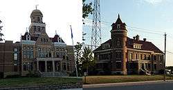 Le Sueur County Courthouse and Jail | |
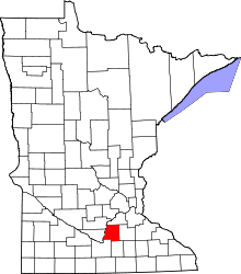 Location in the U.S. state of Minnesota | |
 Minnesota's location in the U.S. | |
| Founded | March 5, 1853[1] |
| Named for | Pierre-Charles Le Sueur |
| Seat | Le Center |
| Largest city | Le Sueur |
| Area | |
| • Total | 474 sq mi (1,228 km2) |
| • Land | 449 sq mi (1,163 km2) |
| • Water | 25 sq mi (65 km2), 5.3% |
| Population (est.) | |
| • (2016) | 27,591 |
| • Density | 62/sq mi (24/km2) |
| Congressional district | 1st |
| Time zone | Central: UTC−6/−5 |
| Website |
www |
Le Sueur County is a county in the U.S. state of Minnesota. As of the 2010 census, the population was 27,703.[2] Its county seat is Le Center.[3] The county is named for the French explorer Pierre-Charles Le Sueur who visited the area in 1700.[4]
Le Sueur County is part of the Minneapolis-St. Paul-Bloomington, MN-WI Metropolitan Statistical Area.
Geography
According to the U.S. Census Bureau, the county has an area of 474 square miles (1,230 km2), of which 449 square miles (1,160 km2) is land and 25 square miles (65 km2) (5.3%) is water.[5] Le Sueur is one of seven Minnesota savanna region counties where no forest soils exist and one of 17 counties where savanna soils dominate.
Lakes
- Borer Lake: in Montgomery Township
- Bossuot Lake: in Cordova Township
- Clear Lake: in Lexington Township
- Diamond Lake: in Kilkenny Township
- Dietz Lake: in Lanesburgh Township
- Dog Lake: in Cleveland Township
- Dora Lake: in Kilkenny Township
- Eggert Lake: in Lanesburgh Township
- Ely Lake: in Sharon Township
- Emily Lake: mostly in Cleveland Township, but the southern fifth is in Washington Township
- Fish Lake: in Elysian Township
- German Lake: mostly in Elysian Township, but the northern shore extends into Cordova Township
- Goldsmith Lake: in Cleveland Township
- Goose Lake: in Cordova Township
- Goose Lake: there is another Goose Lake in Waterville Township
- Gorman Lake: in Cordova Township
- Greenleaf Lake: in Montgomery Township
- Harkridge Lake: in Lexington Township
- Huoy Lake: in Cleveland Township
- Horseshoe Lake: western two thirds is in Waterville Township; the eastern two thirds is in Rice County
- Lake Emily: in Kasota Township
- Lake Frances: in Elysian Township
- Lake Henry: in Cleveland Township
- Lake Jefferson: the southwestern part is in Washington Township; the northwestern part is in Cleveland Township; the eastern part is in Elysian Township and the extreme northeastern part just barely reaches into Cordova Township
- Lake Mabel: in Kilkenny Township
- Lake Pepin: in Lanesburgh Township
- Lake Tustin: in Elysian Township
- Lake Volney: mostly in Kilkenny Township, but the northern part is in Montgomery Township, the northwestern part is in Lexington Township, and the southwestern part is in Cordova Township
- Lake Washington: the northeastern two thirds is in Washington Township and the southwestern third is in Kasota Township
- Mareks Lake: in Lexington Township
- Mary Lake: in Lexington Township
- Mud Lake: in Cordova Township
- Mud Lake: there is another Mud Lake in Lanesburgh Township
- Mud Lake: there is a third Mud Lake in Lexington Township
- North Goldsmith Lake: in Cleveland Township
- Perch Lake: in Elysian Township
- Rays Lake: in Elysian Township
- Rice Lake: in Montgomery Township
- Roemhildts Lake: in Elysian Township
- Round Lake: in Elysian Township
- Sabre Lake: in Kilkenny Township
- Sakatah Lake: western half is in Waterville Township; the eastern half is in Rice County
- Sanborn Lake: in Lanesburgh Township
- Sasse Lake: in Elysian Township
- Savidge Lake: in Cleveland Township
- Scotch Lake: in Cleveland Township
- Shanghai Lake: in Cordova Township
- Sheas Lake: in Derrynane Township
- Silver Lake: in Cleveland Township
- Silver Lake: there is another Silver Lake in Elysian Township
- Sleepy Eye Lake: in Cordova Township
- Steele Lake: in Elysian Township
- Sunfish Lake" almost entirely in Kilkenny Township, but the southern tip extends into Waterville Township
- Tetonka Lake (start of Cannon River): in Waterville Township
- Thomas Lake: in Derrynane Township
- Tyler Lake: in Lexington Township
National protected area
Major highways
Adjacent counties
- Scott County (north)
- Rice County (east)
- Waseca County (south)
- Blue Earth County (southwest)
- Nicollet County (west)
- Sibley County (northwest)
Demographics
| Historical population | |||
|---|---|---|---|
| Census | Pop. | %± | |
| 1860 | 5,318 | — | |
| 1870 | 11,607 | 118.3% | |
| 1880 | 16,303 | 40.5% | |
| 1890 | 19,057 | 16.9% | |
| 1900 | 20,234 | 6.2% | |
| 1910 | 18,609 | −8.0% | |
| 1920 | 17,870 | −4.0% | |
| 1930 | 17,990 | 0.7% | |
| 1940 | 19,227 | 6.9% | |
| 1950 | 19,088 | −0.7% | |
| 1960 | 19,906 | 4.3% | |
| 1970 | 21,331 | 7.2% | |
| 1980 | 23,434 | 9.9% | |
| 1990 | 23,929 | 2.1% | |
| 2000 | 25,426 | 6.3% | |
| 2010 | 27,703 | 9.0% | |
| Est. 2016 | 27,591 | [7] | −0.4% |
| U.S. Decennial Census[8] 1790-1960[9] 1900-1990[10] 1990-2000[11] 2010-2016[2] | |||

As of the 2000 census, there were 25,426 people, 9,630 households, and 6,923 families residing in the county. The population density was 57 people per square mile (22/km²). There were 10,858 housing units at an average density of 24 per square mile (9/km²). The racial makeup of the county was 96.56% White, 0.15% Black or African American, 0.26% Native American, 0.30% Asian, 0.04% Pacific Islander, 2.02% from other races, and 0.67% from two or more races. 3.92% of the population were Hispanic or Latino of any race. 44.9% were of German, 9.0% Czech, 9.0% Norwegian and 8.2% Irish ancestry. 94.0% spoke English, 3.5% Spanish and 1.7% Czech as their first language.
There were 9,630 households out of which 34.40% had children under the age of 18 living with them, 61.40% were married couples living together, 6.80% had a female householder with no husband present, and 28.10% were non-families. 23.70% of all households were made up of individuals and 10.90% had someone living alone who was 65 years of age or older. The average household size was 2.61 and the average family size was 3.10.
In the county, the population was spread out with 27.40% under the age of 18, 7.50% from 18 to 24, 27.80% from 25 to 44, 23.20% from 45 to 64, and 14.10% who were 65 years of age or older. The median age was 37 years. For every 100 females there were 100.30 males. For every 100 females age 18 and over, there were 99.70 males.
The median income for a household in the county was $45,933, and the median income for a family was $53,000. Males had a median income of $34,196 versus $24,214 for females. The per capita income for the county was $20,151. About 4.80% of families and 6.90% of the population were below the poverty line, including 7.50% of those under age 18 and 10.40% of those age 65 or over.
Communities
Cities
- Cleveland
- Elysian (partial)
- Heidelberg
- Kasota
- Le Center (county seat)
- Le Sueur (partial)
- Kilkenny
- Mankato (partial)
- Montgomery
- New Prague (partial)
- Waterville
Townships
Unincorporated communities
- Cordova
- Greenland
- Henderson Station
- Lexington
- Marysburg (partial)
- Ottawa
- St. Henry
- St. Thomas
- Union Hill (partial)
Politics
| Year | Republican | Democratic | Third parties |
|---|---|---|---|
| 2016 | 61.3% 9,182 | 30.9% 4,623 | 7.8% 1,166 |
| 2012 | 52.2% 7,715 | 45.6% 6,753 | 2.2% 327 |
| 2008 | 50.9% 7,636 | 46.6% 6,994 | 2.5% 379 |
| 2004 | 53.7% 7,746 | 44.8% 6,466 | 1.5% 212 |
| 2000 | 49.8% 6,138 | 43.5% 5,361 | 6.8% 832 |
| 1996 | 34.8% 3,902 | 48.7% 5,457 | 16.5% 1,850 |
| 1992 | 32.3% 3,858 | 39.0% 4,662 | 28.7% 3,434 |
| 1988 | 49.6% 5,415 | 49.5% 5,410 | 0.9% 100 |
| 1984 | 54.1% 6,033 | 45.5% 5,070 | 0.4% 48 |
| 1980 | 47.1% 5,478 | 44.4% 5,161 | 8.5% 986 |
| 1976 | 40.1% 4,565 | 57.6% 6,556 | 2.3% 260 |
| 1972 | 52.5% 5,388 | 46.0% 4,725 | 1.5% 149 |
| 1968 | 43.7% 4,189 | 53.2% 5,094 | 3.1% 298 |
| 1964 | 34.2% 3,191 | 65.6% 6,117 | 0.2% 17 |
| 1960 | 45.8% 4,426 | 54.1% 5,234 | 0.1% 10 |
| 1956 | 58.5% 5,026 | 41.4% 3,556 | 0.2% 17 |
| 1952 | 63.2% 5,776 | 36.6% 3,348 | 0.2% 16 |
| 1948 | 43.7% 3,858 | 55.4% 4,890 | 0.9% 80 |
| 1944 | 57.2% 4,560 | 42.2% 3,358 | 0.6% 49 |
| 1940 | 59.5% 5,543 | 40.3% 3,750 | 0.2% 20 |
| 1936 | 32.1% 2,849 | 57.3% 5,077 | 10.6% 939 |
| 1932 | 26.2% 2,121 | 72.6% 5,878 | 1.3% 101 |
| 1928 | 42.2% 3,401 | 57.3% 4,615 | 0.5% 38 |
| 1924 | 38.2% 2,475 | 18.5% 1,199 | 43.3% 2,807 |
| 1920 | 66.2% 4,059 | 30.2% 1,853 | 3.6% 218 |
| 1916 | 43.9% 1,430 | 52.9% 1,723 | 3.2% 105 |
| 1912 | 24.9% 886 | 41.9% 1,488 | 33.2% 1,180 |
| 1908 | 47.9% 1,819 | 44.7% 1,699 | 7.5% 283 |
| 1904 | 59.2% 2,086 | 35.5% 1,251 | 5.3% 187 |
| 1900 | 49.0% 1,941 | 46.9% 1,858 | 4.1% 161 |
| 1896 | 51.2% 2,235 | 45.9% 2,003 | 3.0% 131 |
| 1892 | 39.7% 1,465 | 49.4% 1,821 | 10.9% 401 |
See also
References
| Wikimedia Commons has media related to Le Sueur County, Minnesota. |
- ↑ "Minnesota Place Names". Minnesota Historical Society. Retrieved March 18, 2014.
- 1 2 "State & County QuickFacts". United States Census Bureau. Archived from the original on July 13, 2011. Retrieved September 1, 2013.
- ↑ "Find a County". National Association of Counties. Retrieved 2011-06-07.
- ↑ Gannett, Henry (1905). The Origin of Certain Place Names in the United States. U.S. Government Printing Office. p. 185.
- ↑ "2010 Census Gazetteer Files". United States Census Bureau. August 22, 2012. Archived from the original on September 21, 2013. Retrieved October 21, 2014.
- ↑ Nelson, Steven (2011)."Savanna Soils of Minnesota."Minnesota:Self.pp43 - 48. ISBN 978-0-615-50320-2
- ↑ "Population and Housing Unit Estimates". Retrieved June 9, 2017.
- ↑ "U.S. Decennial Census". United States Census Bureau. Retrieved October 21, 2014.
- ↑ "Historical Census Browser". University of Virginia Library. Retrieved October 21, 2014.
- ↑ "Population of Counties by Decennial Census: 1900 to 1990". United States Census Bureau. Retrieved October 21, 2014.
- ↑ "Census 2000 PHC-T-4. Ranking Tables for Counties: 1990 and 2000" (PDF). United States Census Bureau. Retrieved October 21, 2014.
- ↑ Leip, David. "Dave Leip's Atlas of U.S. Presidential Elections". uselectionatlas.org. Retrieved 2018-09-19.
External links
Places adjacent to Le Sueur County, Minnesota | ||||||||||
|---|---|---|---|---|---|---|---|---|---|---|
| ||||||||||
Municipalities and communities of Le Sueur County, Minnesota, United States | ||
|---|---|---|
| Cities | | |
| Townships | ||
| Unincorporated communities | ||
| Footnotes | ‡This populated place also has portions in an adjacent county or counties | |