Polk County, Minnesota
| Polk County, Minnesota | |
|---|---|
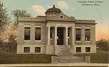 Postcard. Carnegie Public Library at Crookston, Minnesota. | |
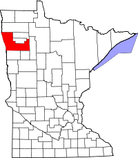 Location in the U.S. state of Minnesota | |
 Minnesota's location in the U.S. | |
| Founded |
July 20, 1858 (created) 1872 (organized)[1] |
| Named for | James Knox Polk[1] |
| Seat | Crookston |
| Largest city | East Grand Forks |
| Area | |
| • Total | 1,998 sq mi (5,175 km2) |
| • Land | 1,971 sq mi (5,105 km2) |
| • Water | 27 sq mi (70 km2), 1.3% |
| Population (est.) | |
| • (2017) | 31,619 |
| • Density | 16/sq mi (6/km2) |
| Congressional district | 7th |
| Time zone | Central: UTC−6/−5 |
| Website |
www |
Polk County is a county located in the U.S. state of Minnesota. The population was 37,600 at the 2010 census.[2] Its county seat is Crookston,[3] and the largest community is East Grand Forks.
Polk County is included in the Grand Forks, ND-MN Metropolitan Statistical Area.
History
Polk county was named after the country's 11th president, James K. Polk, who on March 3, 1849, signed the Congressional act organizing the Minnesota Territory. The county was formed on July 20, 1858 and formally organized in 1872-73.[1]
Geography
According to the U.S. Census Bureau, the county has a total area of 1,998 square miles (5,170 km2), of which 1,971 square miles (5,100 km2) is land and 27 square miles (70 km2) (1.3%) is water.[4]
Major highways
- Polk County 21: Major connector between Polk County and Thief River Falls. Connects with Pennington County 3.
- Polk County 11: First segment of US-2 Truck Bypass of Crookston. Runs east and west between US-2 in Crookston and Polk County 46 just west of Gentilly.
- Polk County 46: Second segment of US-2 Truck Bypass of Crookston. Runs north and south between Polk County 11 west of Gentilly and US-2.
- Polk County 9: East-west shortcut connecting US-75 and US-2 on the south side of Crookston. Also provides a shortcut to the south end of Grand Forks, North Dakota.
Adjacent counties
- Marshall County (north)
- Pennington County (northeast)
- Red Lake County (northeast)
- Clearwater County (east)
- Mahnomen County (southeast)
- Norman County (south)
- Traill County, North Dakota (southwest)
- Grand Forks County, North Dakota (west)
National protected areas
Demographics
| Historical population | |||
|---|---|---|---|
| Census | Pop. | %± | |
| 1880 | 11,433 | — | |
| 1890 | 30,192 | 164.1% | |
| 1900 | 35,429 | 17.3% | |
| 1910 | 36,001 | 1.6% | |
| 1920 | 37,090 | 3.0% | |
| 1930 | 36,019 | −2.9% | |
| 1940 | 37,734 | 4.8% | |
| 1950 | 35,900 | −4.9% | |
| 1960 | 36,182 | 0.8% | |
| 1970 | 34,435 | −4.8% | |
| 1980 | 34,844 | 1.2% | |
| 1990 | 32,498 | −6.7% | |
| 2000 | 31,369 | −3.5% | |
| 2010 | 37,600 | 19.9% | |
| Est. 2017 | 31,619 | [6] | −15.9% |
| U.S. Decennial Census[7] 1790-1960[8] 1900-1990[9] 1990-2000[10] | |||
As of the 2000 census, there were 31,369 people, 12,070 households, and 8,050 families residing in the county. The population density was 16 people per square mile (6/km²). There were 14,008 housing units at an average density of 7 per square mile (3/km²). The racial makeup of the county was 94.18% White, 0.33% Black or African American, 1.30% Native American, 0.30% Asian, 0.02% Pacific Islander, 2.57% from other races, and 1.30% from two or more races. 4.79% of the population were Hispanic or Latino of any race. 41.7% were of Norwegian, 19.7% German and 5.8% French ancestry.
There were 12,070 households out of which 32.30% had children under the age of 18 living with them, 54.90% were married couples living together, 8.50% had a female householder with no husband present, and 33.30% were non-families. 28.90% of all households were made up of individuals and 13.80% had someone living alone who was 65 years of age or older. The average household size was 2.47 and the average family size was 3.07.
In the county, the population was spread out with 25.90% under the age of 18, 9.70% from 18 to 24, 24.80% from 25 to 44, 22.20% from 45 to 64, and 17.40% who were 65 years of age or older. The median age was 38 years. For every 100 females, there were 98.10 males. For every 100 females age 18 and over, there were 95.50 males.
The median income for a household in the county was $35,105, and the median income for a family was $44,310. Males had a median income of $31,472 versus $21,535 for females. The per capita income for the county was $17,279. About 7.30% of families and 10.90% of the population were below the poverty line, including 13.30% of those under age 18 and 10.90% of those age 65 or over.
Communities
Cities
Townships
- Andover Township
- Angus Township
- Badger Township
- Belgium Township
- Brandsvold Township
- Brandt Township
- Brislet Township
- Bygland Township
- Chester Township
- Columbia Township
- Crookston Township
- Eden Township
- Esther Township
- Euclid Township
- Fairfax Township
- Fanny Township
- Farley Township
- Fisher Township
- Garden Township
- Garfield Township
- Gentilly Township
- Godfrey Township
- Grand Forks Township
- Grove Park-Tilden Township
- Gully Township
- Hammond Township
- Helgeland Township
- Higdem Township
- Hill River Township
- Hubbard Township
- Huntsville Township
- Johnson Township
- Kertsonville Township
- Keystone Township
- King Township
- Knute Township
- Lessor Township
- Liberty Township
- Lowell Township
- Nesbit Township
- Northland Township
- Onstad Township
- Parnell Township
- Queen Township
- Reis Township
- Rhinehart Township
- Roome Township
- Rosebud Township
- Russia Township
- Sandsville Township
- Scandia Township
- Sletten Township
- Sullivan Township
- Tabor Township
- Tynsid Township
- Vineland Township
- Winger Township
- Woodside Township
Unincorporated communities
Politics
| Year | Republican | Democratic | Third parties |
|---|---|---|---|
| 2016 | 60.7% 8,979 | 31.9% 4,712 | 7.5% 1,105 |
| 2012 | 51.8% 7,615 | 46.1% 6,773 | 2.1% 305 |
| 2008 | 46.6% 7,148 | 51.2% 7,850 | 2.2% 336 |
| 2004 | 55.7% 8,724 | 43.0% 6,729 | 1.4% 215 |
| 2000 | 53.8% 7,609 | 40.8% 5,764 | 5.4% 767 |
| 1996 | 40.9% 5,563 | 46.9% 6,369 | 12.2% 1,655 |
| 1992 | 39.0% 5,817 | 39.2% 5,850 | 21.9% 3,267 |
| 1988 | 48.0% 7,032 | 51.3% 7,523 | 0.7% 107 |
| 1984 | 54.6% 8,617 | 44.6% 7,033 | 0.8% 132 |
| 1980 | 51.2% 9,036 | 40.5% 7,151 | 8.3% 1,457 |
| 1976 | 40.9% 6,552 | 56.6% 9,078 | 2.5% 404 |
| 1972 | 51.2% 8,139 | 46.4% 7,366 | 2.4% 380 |
| 1968 | 40.0% 6,074 | 55.2% 8,380 | 4.7% 715 |
| 1964 | 31.3% 5,039 | 68.6% 11,052 | 0.1% 20 |
| 1960 | 44.5% 7,528 | 55.3% 9,346 | 0.2% 35 |
| 1956 | 46.1% 6,847 | 53.7% 7,980 | 0.2% 26 |
| 1952 | 53.1% 8,326 | 46.2% 7,244 | 0.7% 113 |
| 1948 | 32.0% 4,662 | 63.6% 9,279 | 4.4% 639 |
| 1944 | 33.1% 4,402 | 66.2% 8,808 | 0.8% 100 |
| 1940 | 32.5% 5,200 | 66.6% 10,652 | 0.8% 133 |
| 1936 | 24.3% 3,751 | 73.4% 11,337 | 2.3% 349 |
| 1932 | 27.3% 3,604 | 66.4% 8,751 | 6.3% 835 |
| 1928 | 56.1% 7,215 | 41.6% 5,357 | 2.3% 294 |
| 1924 | 43.9% 5,027 | 5.8% 663 | 50.3% 5,750 |
| 1920 | 69.5% 8,197 | 17.9% 2,111 | 12.6% 1,492 |
| 1916 | 37.9% 2,471 | 53.7% 3,498 | 8.4% 545 |
| 1912 | 12.8% 735 | 28.9% 1,662 | 58.3% 3,350 |
| 1908 | 55.2% 3,311 | 32.2% 1,928 | 12.6% 758 |
| 1904 | 71.7% 3,549 | 14.1% 696 | 14.2% 704 |
| 1900 | 49.6% 2,863 | 43.9% 2,533 | 6.5% 374 |
| 1896 | 35.4% 2,855 | 62.7% 5,054 | 2.0% 158 |
| 1892 | 23.4% 1,376 | 25.6% 1,510 | 51.0% 3,006 |
See also
Footnotes
- 1 2 3 Upham, Warren (1920). Minnesota Geographic Names: Their Origin and Historic Significance. Minnesota Historical Society. p. 421.
- ↑ "State & County QuickFacts". United States Census Bureau. Retrieved September 1, 2013.
- ↑ "Find a County". National Association of Counties. Retrieved 2011-06-07.
- ↑ "2010 Census Gazetteer Files". United States Census Bureau. August 22, 2012. Archived from the original on September 21, 2013. Retrieved October 24, 2014.
- ↑ Nelson, Steven (2011). Savanna Soils of Minnesota. Minnesota: Self. pp. 57-60. ISBN 978-0-615-50320-2.
- ↑ "Population and Housing Unit Estimates". Retrieved June 9, 2017.
- ↑ "U.S. Decennial Census". United States Census Bureau. Retrieved October 24, 2014.
- ↑ "Historical Census Browser". University of Virginia Library. Retrieved October 24, 2014.
- ↑ "Population of Counties by Decennial Census: 1900 to 1990". United States Census Bureau. Retrieved October 24, 2014.
- ↑ "Census 2000 PHC-T-4. Ranking Tables for Counties: 1990 and 2000" (PDF). United States Census Bureau. Retrieved October 24, 2014.
- ↑ Leip, David. "Dave Leip's Atlas of U.S. Presidential Elections". uselectionatlas.org. Retrieved 2018-10-10.
Further reading
- R.I. Holcombe and William H Bingham, Compendium of History and Biography of Polk County, Minnesota. Minneapolis: W. H. Bingham & Co., 1916.
- Huber D. McLellan, The History of the Early Settlement and Development of Polk County, Minnesota. PhD dissertation. Northwestern University, 1928.
- Polk County Historical Society, Bicentennial History of Polk County, Minnesota: Pioneers of the Valley. n.c.: Polk County Historical Society, 1976.
- Polk County Historical Society, The Polk County Historian. (journal)
- Claude Eugene Wentsel, Polk County, Minnesota, in the World War. Ada, MN: C.E. Wentsel, 1922.
- Winger Golden Jubilee Historical Committee, Golden Jubilee, Winger, Minnesota, 1904-1954. Winger, MN: Winger Enterprise, n.d. [1954].
- Maxine Workman, Minnesota Cemeteries, Polk County. West Fargo, ND: Red River Genealogy Society, 1988.
External links
Places adjacent to Polk County, Minnesota | |
|---|---|
Municipalities and communities of Polk County, Minnesota, United States | ||
|---|---|---|
| Cities | | |
| Townships |
| |
| Unincorporated communities | ||
| Indian reservation | ||
| Footnotes | ‡This populated place also has portions in an adjacent county or counties | |
| Counties | ||
|---|---|---|
| Main cities | ||
| Surrounding areas | ||
† - county seat | ||