Blue Earth County, Minnesota
| Blue Earth County, Minnesota | |
|---|---|
 | |
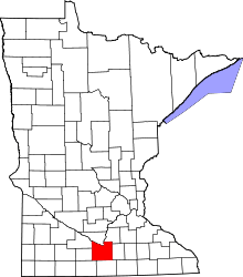 Location in the U.S. state of Minnesota | |
 Minnesota's location in the U.S. | |
| Founded | March 5, 1853[1] |
| Named for | Blue Earth River |
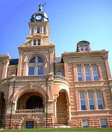
| Seat | Mankato |
| Largest city | Mankato |
| Area | |
| • Total | 766 sq mi (1,984 km2) |
| • Land | 748 sq mi (1,937 km2) |
| • Water | 18 sq mi (47 km2), 2.3% |
| Population (est.) | |
| • (2016) | 66,441 |
| • Density | 86/sq mi (33/km2) |
| Congressional district | 1st |
| Time zone | Central: UTC−6/−5 |
| Website |
www |
Blue Earth County is a county in the State of Minnesota. As of the 2010 census, the population was 64,013.[2] Its county seat is Mankato.[3] The county is named for the Blue Earth River and for the deposits of blue-green clay once evident along the banks of the Blue Earth River.
Blue Earth County is part of the Mankato–North Mankato, MN Metropolitan Statistical Area.
History
The area of Blue Earth County was once known as the "Big Woods" and occupied by the Dakota Indians. The French explorer Pierre-Charles Le Sueur was one of the first white people in this area, arriving where the Minnesota and Blue Earth rivers meet. There, he made an unsuccessful attempt to mine copper from the blue earth found in the area. The area remained under French control until 1803, but soon after passed to the United States in the Louisiana Purchase.
When Minnesota became a territory in 1849, the territorial government became interested in settling the river valley. In 1850 the first steamboat trip, starting in St. Paul, traveled on the Minnesota River and came to the Blue Earth River. The first white settlers, P.K. Johnson and Henry Jackson, came off the boat and settled in present-day Mankato. The ratification of the Mendota and Traverse des Sioux Treaties in 1851 effectively forced the Dakota to leave the area for nearby reservations.
The county of Blue Earth was created after a division of the Minnesota Territory on March 5, 1853, from portions of Dakota County and free territory. It was named after the Blue Earth River.[4] The first government officials were appointed by Alexander Ramsey, the territorial governor. That October the first election was held, with 22 ballots being taken.
Unfulfilled treaty promises and starvation on the reservation led to the Dakota War of 1862, which resulted in Dakota defeat and the largest mass execution in US history in Mankato. In 1868 the railroads' arrival helped with the growth and development of many areas, including Blue Earth. The railroads allowed many immigrants and Yankee settlers into the area.
Geography
According to the U.S. Census Bureau, the county has an area of 766 square miles (1,980 km2), of which 748 square miles (1,940 km2) is land and 18 square miles (47 km2) (2.3%) is water.[6] The Blue Earth River and Le Sueur River flow through a part of the county. The land surface is relatively flat with over 30 lakes in the county. There are many "closed forest savannas" that some call the big woods in the county's northeast. The rivers that flow out of the northeast are surrounded by these big woods. Most of the county is grassland prairie but scattered parts are wet prairie. Some spots that surround the rivers are oak openings and barren brushland.
Lakes
- Crystal Lake in Lake Crystal
- Albert Lake: in Jamestown Township
- Alice Lake: in Le Ray Township
- Armstrong Lake: in Butternut Valley Township
- Ballantyne Lake: in Jamestown Township
- Born Lake: in Le Ray Township
- Cottonwood Lake: in Medo Township
- Duck Lake: in Jamestown Township
- Eagle Lake: the southern half of the larger, northern lake is in Mankato Township and the northern half is in Lime Township with the eastern part of it just barely extending into Jamestown Township the eastern half of the smaller, southern lake is in Le Ray Township and the western half is in Mankato Township
- George Lake: in Jamestown Township
- Gilfillin Lake: mostly in Jamestown Township, but the extreme southern edge juts into Le Ray Township
- Ida Lake: in Shelby Township
- Indian Lake: is in Le Ray Township
- Knights Lake: western half is in Mapleton Township and eastern half is in Danville Township
- Lake Crystal mostly in Judson Township, but the southern third is in Garden City Township
- Lieberg Lake: in Butternut Valley Township
- Lily Lake: Judson Township
- Loon Lake: in Garden City Township
- Long Lake: in Jamestown Township
- Lura Lake: mostly in Sterling Township, but the eastern fifth extends into Mapleton Township and a very small part extends into Faribault County
- Madison Lake: southern three-quarters is in Le Ray Township and the northern quarter is in Jamestown Township
- Mennenga Lake: Judson Township
- Mills Lake: in Garden City Township
- Minnesota Lake: almost entirely in Faribault County, but the extreme northern edge extends into Danville Township
- Mud Lake: in Jamestown Township
- Perch Lake: mostly in Beauford Township, but the eastern fifth of the lake extends into Medo Township
- Porter Lake: in Ceresco Township
- Rice Lake: in McPherson Township
- Severson Lake: in Medo Township
- Strom Lake: in Butternut Valley Township
- Wita Lake: in Lime Township
Major highways
Adjacent counties
- Nicollet County (north)
- Le Sueur County (northeast)
- Waseca County (east)
- Faribault County (south)
- Martin County (southwest)
- Watonwan County (west)
- Brown County (northwest)
Climate and weather
| Mankato, Minnesota | ||||||||||||||||||||||||||||||||||||||||||||||||||||||||||||
|---|---|---|---|---|---|---|---|---|---|---|---|---|---|---|---|---|---|---|---|---|---|---|---|---|---|---|---|---|---|---|---|---|---|---|---|---|---|---|---|---|---|---|---|---|---|---|---|---|---|---|---|---|---|---|---|---|---|---|---|---|
| Climate chart (explanation) | ||||||||||||||||||||||||||||||||||||||||||||||||||||||||||||
| ||||||||||||||||||||||||||||||||||||||||||||||||||||||||||||
| ||||||||||||||||||||||||||||||||||||||||||||||||||||||||||||
In recent years, average temperatures in the county seat of Mankato have ranged from a low of 5 °F (−15 °C) in January to a high of 83 °F (28 °C) in July, although a record low of −35 °F (−37 °C) was recorded in February 1996 and a record high of 107 °F (42 °C) was recorded in August 1988. Average monthly precipitation ranged from 0.78 inches (20 mm) in February to 5.09 inches (129 mm) in June.[7]
Demographics
| Historical population | |||
|---|---|---|---|
| Census | Pop. | %± | |
| 1860 | 4,803 | — | |
| 1870 | 17,302 | 260.2% | |
| 1880 | 22,889 | 32.3% | |
| 1890 | 29,210 | 27.6% | |
| 1900 | 32,263 | 10.5% | |
| 1910 | 29,337 | −9.1% | |
| 1920 | 31,477 | 7.3% | |
| 1930 | 33,847 | 7.5% | |
| 1940 | 36,203 | 7.0% | |
| 1950 | 38,327 | 5.9% | |
| 1960 | 44,385 | 15.8% | |
| 1970 | 52,322 | 17.9% | |
| 1980 | 52,314 | 0.0% | |
| 1990 | 54,044 | 3.3% | |
| 2000 | 55,941 | 3.5% | |
| 2010 | 64,013 | 14.4% | |
| Est. 2016 | 66,441 | [8] | 3.8% |
| U.S. Decennial Census[9] 1790-1960[10] 1900-1990[11] 1990-2000[12] 2010-2016[2] | |||

As of the 2000 census, there were 55,941 people, 21,062 households, and 12,616 families residing in the county. The population density was 74 people per square mile (29/km²). There were 21,971 housing units at an average density of 29 per square mile (11/km²). The racial makeup of the county was 94.96% White, 1.19% Black or African American, 0.28% Native American, 1.79% Asian, 0.06% Pacific Islander, 0.69% from other races, and 1.03% from two or more races. 1.77% of the population were Hispanic or Latino of any race. 47.6% were of German, 13.6% Norwegian and 6.5% Irish ancestry.
There were 21,062 households out of which 29.10% had children under the age of 18 living with them, 48.60% were married couples living together, 7.80% had a female householder with no husband present, and 40.10% were non-families. 27.10% of all households were made up of individuals and 9.50% had someone living alone who was 65 years of age or older. The average household size was 2.46 and the average family size was 2.99.
In the county, the population was spread out with 21.40% under the age of 18, 22.10% from 18 to 24, 25.60% from 25 to 44, 18.80% from 45 to 64, and 12.10% who were 65 years of age or older. The median age was 30 years. For every 100 females, there were 99.10 males. For every 100 females age 18 and over, there were 97.40 males.
The median income for a household in the county was $38,940, and the median income for a family was $50,257. Males had a median income of $32,087 versus $22,527 for females. The per capita income for the county was $18,712. About 6.10% of families and 12.90% of the population were below the poverty line, including 10.50% of those under age 18 and 9.40% of those age 65 or over.
Communities
Cities
Townships
- Beauford Township
- Butternut Valley Township
- Cambria Township
- Ceresco Township
- Danville Township
- Decoria Township
- Garden City Township
- Jamestown Township
- Judson Township
- Le Ray Township
- Lime Township
- Lincoln Township
- Lyra Township
- Mankato Township
- Mapleton Township
- McPherson Township
- Medo Township
- Pleasant Mound Township
- Rapidan Township
- Shelby Township
- South Bend Township
- Sterling Township
- Vernon Center Township
Census-designated place
Unincorporated communities
Government and politics
Blue Earth County has voted for the winning candidate for president in 12 of the last 14 elections, the exceptions being in 1988 and 2004. Since 1988 it has tilted toward the Democratic party, but in 2000 and 2016 it voted for Republicans George W. Bush and Donald Trump respectively.
| Year | Republican | Democratic | Third parties |
|---|---|---|---|
| 2016 | 46.6% 15,667 | 43.0% 14,428 | 10.4% 3,498 |
| 2012 | 43.5% 14,916 | 53.0% 18,164 | 3.5% 1,194 |
| 2008 | 42.2% 14,782 | 55.1% 19,325 | 2.8% 963 |
| 2004 | 47.5% 15,737 | 50.9% 16,865 | 1.6% 517 |
| 2000 | 47.2% 12,942 | 45.0% 12,329 | 7.8% 2,131 |
| 1996 | 36.0% 9,082 | 49.2% 12,420 | 14.9% 3,759 |
| 1992 | 31.7% 8,813 | 41.4% 11,531 | 26.9% 7,503 |
| 1988 | 48.7% 11,959 | 50.4% 12,375 | 0.9% 218 |
| 1984 | 54.3% 14,298 | 45.1% 11,877 | 0.7% 172 |
| 1980 | 45.8% 11,966 | 41.8% 10,930 | 12.4% 3,242 |
| 1976 | 46.7% 11,998 | 50.3% 12,930 | 3.0% 760 |
| 1972 | 53.7% 12,702 | 45.0% 10,638 | 1.4% 322 |
| 1968 | 49.0% 9,571 | 47.4% 9,254 | 3.6% 712 |
| 1964 | 42.6% 8,009 | 56.9% 10,687 | 0.5% 101 |
| 1960 | 58.4% 11,328 | 41.5% 8,052 | 0.2% 33 |
| 1956 | 67.5% 11,398 | 32.4% 5,467 | 0.1% 21 |
| 1952 | 70.3% 11,867 | 29.4% 4,952 | 0.3% 51 |
| 1948 | 50.3% 7,520 | 48.6% 7,272 | 1.1% 162 |
| 1944 | 64.7% 9,429 | 35.0% 5,098 | 0.4% 54 |
| 1940 | 61.9% 9,642 | 37.7% 5,880 | 0.4% 62 |
| 1936 | 37.6% 5,550 | 55.9% 8,255 | 6.5% 964 |
| 1932 | 40.5% 5,550 | 57.9% 7,925 | 1.6% 216 |
| 1928 | 60.7% 8,120 | 38.7% 5,177 | 0.6% 79 |
| 1924 | 55.1% 6,773 | 9.1% 1,123 | 35.8% 4,399 |
| 1920 | 79.1% 8,894 | 17.6% 1,974 | 3.4% 383 |
| 1916 | 54.0% 2,864 | 41.7% 2,211 | 4.4% 233 |
| 1912 | 25.4% 1,344 | 38.3% 2,025 | 36.3% 1,922 |
| 1908 | 56.2% 3,297 | 37.3% 2,191 | 6.5% 379 |
| 1904 | 67.4% 3,573 | 26.8% 1,419 | 5.8% 308 |
| 1900 | 58.7% 3,647 | 36.3% 2,254 | 5.1% 314 |
| 1896 | 57.5% 4,055 | 38.9% 2,744 | 3.6% 253 |
| 1892 | 46.0% 2,680 | 41.2% 2,399 | 12.8% 747 |
See also
References
- ↑ "Minnesota Place Names". Minnesota Historical Society. Retrieved March 17, 2014.
- 1 2 "State & County QuickFacts". United States Census Bureau. Retrieved August 31, 2013.
- ↑ "Find a County". National Association of Counties. Archived from the original on 2011-05-31. Retrieved 2011-06-07.
- ↑ Upham, Warren (1920). Minnesota Geographic Names: Their Origin and Historic Significance. Minnesota Historical Society. p. 57.
- ↑ Nelson, Steven (2011). Savanna Soils of Minnesota. Minnesota: Self. pp. 65 - 67. ISBN 978-0-615-50320-2.
- ↑ "2010 Census Gazetteer Files". United States Census Bureau. August 22, 2012. Archived from the original on October 6, 2014. Retrieved October 5, 2014.
- 1 2 "Monthly Averages for Mankato, Minnesota". The Weather Channel. Retrieved 2011-11-06.
- ↑ "Population and Housing Unit Estimates". Retrieved June 9, 2017.
- ↑ "U.S. Decennial Census". United States Census Bureau. Archived from the original on May 12, 2015. Retrieved October 5, 2014.
- ↑ "Historical Census Browser". University of Virginia Library. Retrieved October 5, 2014.
- ↑ "Population of Counties by Decennial Census: 1900 to 1990". United States Census Bureau. Retrieved October 5, 2014.
- ↑ "Census 2000 PHC-T-4. Ranking Tables for Counties: 1990 and 2000" (PDF). United States Census Bureau. Retrieved October 5, 2014.
- ↑ Leip, David. "Dave Leip's Atlas of U.S. Presidential Elections". uselectionatlas.org. Retrieved 2018-04-17.
External links
Places adjacent to Blue Earth County, Minnesota | ||||||||||
|---|---|---|---|---|---|---|---|---|---|---|
| ||||||||||
Municipalities and communities of Blue Earth County, Minnesota, United States | ||
|---|---|---|
| Cities | | |
| Townships | ||
| CDP | ||
| Unincorporated communities | ||
| Footnotes | ‡This populated place also has portions in an adjacent county or counties | |
| Core Cities |  | ||||
|---|---|---|---|---|---|
| Incorporated Places |
| ||||
| Counties | |||||
† indicates a county seat. ‡ indicates that it is partially in the metropolitan area. | |||||