Winona County, Minnesota
| Winona County, Minnesota | |
|---|---|
 | |
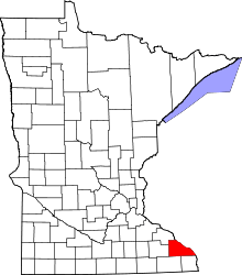 Location in the U.S. state of Minnesota | |
 Minnesota's location in the U.S. | |
| Founded | February 23, 1854[1] |
| Named for | Winona, a female cousin of Wabasha, who was the last of three successive chiefs of the Mississippi band of Dakota with that name. |
| Seat | Winona |
| Largest city | Winona |
| Area | |
| • Total | 642 sq mi (1,663 km2) |
| • Land | 626 sq mi (1,621 km2) |
| • Water | 15 sq mi (39 km2), 2.4% |
| Population (est.) | |
| • (2016) | 50,948 |
| • Density | 82/sq mi (32/km2) |
| Congressional district | 1st |
| Time zone | Central: UTC−6/−5 |
| Website |
www |
Winona County is a county located in the U.S. state of Minnesota. As of the 2010 census, the population was 51,461.[2] Its county seat is Winona.[3]
Winona County comprises the Winona, MN Micropolitan Statistical Area.
History
The name of the county is said to derive from a Dakota legend regarding a woman, referred to as Winona, who was betrothed to marry a warrior whom she did not love. Rather than marry him, she is said to have leapt to her death from a rock now called "Maiden's Rock" on Lake Pepin.[4] This legend is colloquially referred to as the Winona legend.[5]
Geography
According to the U.S. Census Bureau, the county has a total area of 642 square miles (1,660 km2), of which 626 square miles (1,620 km2) is land and 15 square miles (39 km2) (2.4%) is water.[6]
Bodies of water
- Airport Lake - Winona
- Bartlet Lake - Winona
- Bollers Lake - Goodview
- Hunters Lake - Winona
- Lake Goodview - Goodview
- Lake Winona - Winona
- Rileys Lake - vast majority in Winona, west edge in Goodview
- Mississippi River - forms county's eastern border with Wisconsin
- Whitewater River - flows northeast from the western side of the county
Major highways
Public airports
Adjacent counties
- Wabasha County (northwest)
- Buffalo County, Wisconsin (north)
- Trempealeau County, Wisconsin (northeast)
- La Crosse County, Wisconsin (east)
- Houston County (south)
- Fillmore County (southwest)
- Olmsted County (west)
National protected area
Demographics
| Historical population | |||
|---|---|---|---|
| Census | Pop. | %± | |
| 1860 | 9,208 | — | |
| 1870 | 22,319 | 142.4% | |
| 1880 | 27,107 | 21.5% | |
| 1890 | 33,797 | 24.7% | |
| 1900 | 35,686 | 5.6% | |
| 1910 | 33,398 | −6.4% | |
| 1920 | 33,653 | 0.8% | |
| 1930 | 35,144 | 4.4% | |
| 1940 | 37,795 | 7.5% | |
| 1950 | 39,841 | 5.4% | |
| 1960 | 40,937 | 2.8% | |
| 1970 | 44,409 | 8.5% | |
| 1980 | 46,256 | 4.2% | |
| 1990 | 47,828 | 3.4% | |
| 2000 | 49,985 | 4.5% | |
| 2010 | 51,461 | 3.0% | |
| Est. 2016 | 50,948 | [8] | −1.0% |
| U.S. Decennial Census[9] 1790-1960[10] 1900-1990[11] 1990-2000[12] 2010-2016[2] | |||

As of the census of 2000, there were 49,985 people, 18,744 households, and 11,696 families residing in the county. The population density was 80 people per square mile (31/km²). There were 19,551 housing units at an average density of 31 per square mile (12/km²). The racial makeup of the county was 95.80% White, 0.77% Black or African American, 0.19% Native American, 1.87% Asian, 0.02% Pacific Islander, 0.53% from other races, and 0.81% from two or more races. 1.37% of the population were Hispanic or Latino of any race. 41.8% were of German, 13.9% Norwegian, 9.9% Polish and 7.4% Irish ancestry.
There were 18,744 households out of which 30.20% had children under the age of 18 living with them, 51.30% were married couples living together, 7.80% had a female householder with no husband present, and 37.60% were non-families. 28.20% of all households were made up of individuals and 10.50% had someone living alone who was 65 years of age or older. The average household size was 2.46 and the average family size was 3.04.
In the county, the population was spread out with 22.80% under the age of 18, 18.60% from 18 to 24, 25.10% from 25 to 44, 20.50% from 45 to 64, and 13.10% who were 65 years of age or older. The median age was 33 years. For every 100 females there were 95.20 males. For every 100 females age 18 and over, there were 91.80 males.
The median income for a household in the county was $38,700, and the median income for a family was $49,845. Males had a median income of $31,926 versus $23,406 for females. The per capita income for the county was $18,077. About 5.60% of families and 12.00% of the population were below the poverty line, including 9.80% of those under age 18 and 9.30% of those age 65 or over.
In 2016, Winona County planning commissioners voted to approve new permits for existing commercial dog breeding operations, also known as "puppy mills", despite overwhelming evidence of animal cruelty and neglect. Due to the high number of kennels in the county, Winona county has earned the dubious title "Puppy Mill Capital of Minnesota".[13]
Micropolitan Statistical Area
The United States Office of Management and Budget (OMB) has designated Winona County as the Winona, MN Micropolitan Statistical Area (µSA).[14] The OMB designated Winona, Minnesota as the principal city of the µSA.[14] The United States Census Bureau ranked the µSA as the 582nd most populous Core Based Statistical Area of the United States as of July 1, 2012.[15]
Politics
| Year | Republican | Democratic | Third parties |
|---|---|---|---|
| 2016 | 46.5% 12,122 | 43.6% 11,366 | 9.9% 2,586 |
| 2012 | 42.2% 11,480 | 55.0% 14,980 | 2.8% 772 |
| 2008 | 39.3% 10,975 | 58.4% 16,308 | 2.3% 652 |
| 2004 | 46.3% 12,686 | 51.9% 14,231 | 1.8% 505 |
| 2000 | 45.0% 10,773 | 46.3% 11,069 | 8.7% 2,076 |
| 1996 | 36.8% 7,955 | 47.5% 10,272 | 15.7% 3,389 |
| 1992 | 35.0% 8,585 | 39.6% 9,707 | 25.4% 6,226 |
| 1988 | 50.9% 11,012 | 47.7% 10,310 | 1.4% 302 |
| 1984 | 55.0% 11,981 | 44.0% 9,577 | 1.0% 212 |
| 1980 | 45.1% 10,332 | 42.9% 9,814 | 12.0% 2,757 |
| 1976 | 47.6% 10,436 | 49.9% 10,939 | 2.5% 539 |
| 1972 | 56.5% 10,910 | 41.8% 8,080 | 1.7% 337 |
| 1968 | 45.9% 7,998 | 49.5% 8,627 | 4.7% 818 |
| 1964 | 35.7% 6,345 | 64.1% 11,397 | 0.2% 28 |
| 1960 | 52.1% 9,271 | 47.7% 8,484 | 0.1% 25 |
| 1956 | 61.3% 9,743 | 38.1% 6,048 | 0.6% 102 |
| 1952 | 64.5% 10,723 | 35.1% 5,834 | 0.4% 64 |
| 1948 | 44.9% 6,880 | 54.1% 8,281 | 1.0% 152 |
| 1944 | 57.2% 8,296 | 42.2% 6,117 | 0.6% 93 |
| 1940 | 56.8% 9,599 | 42.6% 7,187 | 0.6% 105 |
| 1936 | 34.4% 5,353 | 59.6% 9,268 | 6.0% 930 |
| 1932 | 35.7% 4,751 | 62.4% 8,305 | 1.9% 252 |
| 1928 | 53.2% 7,459 | 46.2% 6,484 | 0.6% 88 |
| 1924 | 43.5% 5,670 | 8.5% 1,111 | 48.0% 6,245 |
| 1920 | 69.8% 7,888 | 25.6% 2,896 | 4.6% 516 |
| 1916 | 47.9% 2,916 | 47.8% 2,907 | 4.3% 259 |
| 1912 | 16.5% 1,042 | 47.7% 3,004 | 35.8% 2,254 |
| 1908 | 48.2% 3,014 | 49.2% 3,072 | 2.6% 163 |
| 1904 | 61.2% 3,734 | 33.8% 2,063 | 5.0% 302 |
| 1900 | 47.4% 3,305 | 49.2% 3,436 | 3.4% 239 |
| 1896 | 51.5% 3,935 | 46.2% 3,528 | 2.3% 176 |
| 1892 | 40.0% 2,734 | 54.1% 3,701 | 6.0% 409 |
Winona County is represented in the Minnesota House of Representatives by Rep. Steve Drazkowski (R), and Rep. Gene Pelowski (DFL). Winona County is represented in the Minnesota Senate by Sen. Matt Schmit (DFL) and Sen. Jeremy Miller (R). Winona County is located in Minnesota's 1st Congressional District, represented by Rep. Tim Walz (DFL).
Communities
Cities
- Altura
- Dakota
- Elba
- Goodview
- La Crescent (partly in Houston County)
- Lewiston
- Minneiska (partly in Wabasha County)
- Minnesota City
- Rollingstone
- St. Charles
- Stockton
- Utica
- Winona (county seat)
Townships
Census-designated place
Other unincorporated communities
Ghost towns
See also
References
- ↑ "Minnesota Place Names". Minnesota Historical Society. Retrieved March 19, 2014.
- 1 2 "State & County QuickFacts". United States Census Bureau. Retrieved September 1, 2013.
- ↑ "Find a County". National Association of Counties. Retrieved 2011-06-07.
- ↑ Upham, Warren (1920). Minnesota Geographic Names: Their Origin and Historic Significance. Minnesota Historical Society. p. 581.
- ↑ Porter, Cynthya (Feb 1, 2009). "Homecoming To Explore Roles Of American Indian Women". Winona Daily News reprinted at Diversity Foundation. Retrieved 21 Oct 2015.
- ↑ "2010 Census Gazetteer Files". United States Census Bureau. August 22, 2012. Archived from the original on October 6, 2014. Retrieved October 25, 2014.
- ↑ Nelson, Steven (2011). Savanna Soils of Minnesota. Minnesota: Self. pp. 43 - 48. ISBN 978-0-615-50320-2.
- ↑ "Population and Housing Unit Estimates". Retrieved June 9, 2017.
- ↑ "U.S. Decennial Census". United States Census Bureau. Retrieved October 25, 2014.
- ↑ "Historical Census Browser". University of Virginia Library. Retrieved October 25, 2014.
- ↑ "Population of Counties by Decennial Census: 1900 to 1990". United States Census Bureau. Retrieved October 25, 2014.
- ↑ "Census 2000 PHC-T-4. Ranking Tables for Counties: 1990 and 2000" (PDF). United States Census Bureau. Retrieved October 25, 2014.
- ↑ Post, Winona. "Winona County's dirty little secret: It's the puppy mill capital of Minnesota - Winona Post > Opinion". www.winonapost.com. Retrieved 2018-09-05.
- 1 2 "OMB Bulletin No. 13-01: Revised Delineations of Metropolitan Statistical Areas, Micropolitan Statistical Areas, and Combined Statistical Areas, and Guidance on Uses of the Delineations of These Areas" (PDF). United States Office of Management and Budget. February 28, 2013. Retrieved April 1, 2013.
- ↑ "Table 1. Annual Estimates of the Population of Metropolitan and Micropolitan Statistical Areas: April 1, 2010 to July 1, 2012". 2012 Population Estimates. United States Census Bureau, Population Division. March 2013. Archived from the original (CSV) on April 1, 2013. Retrieved April 9, 2013.
- ↑ Leip, David. "Dave Leip's Atlas of U.S. Presidential Elections". uselectionatlas.org. Retrieved 10 April 2018.
Further reading
- DeLorme's Minnesota Atlas and Gazetteer ( ISBN 0-89933-333-8)
External links
Places adjacent to Winona County, Minnesota | |
|---|---|
Municipalities and communities of Winona County, Minnesota, United States | ||
|---|---|---|
| Cities | | |
| Townships | ||
| CDP | ||
| Unincorporated communities | ||
| Ghost towns | ||
| Footnotes | ‡This populated place also has portions in an adjacent county or counties | |