Rainy River District
| Rainy River District | |
|---|---|
| District | |
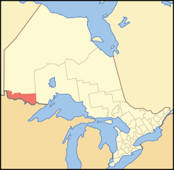 Location of Rainy River District in Ontario | |
| Coordinates: 48°50′N 92°00′W / 48.833°N 92.000°WCoordinates: 48°50′N 92°00′W / 48.833°N 92.000°W | |
| Country |
|
| Province |
|
| Region | Northwestern Ontario |
| Created | 1885 |
| Government | |
| • MPs | Don Rusnak (Liberal) |
| • MPPs | Judith Monteith-Farrell (NDP), Greg Rickford (PC) |
| Area[1] | |
| • Land | 15,484.83 km2 (5,978.73 sq mi) |
| Elevation[2] | 328 m (1,076 ft) |
| Population (2016)[3] | |
| • Total | 20,110 |
| • Density | 1.3/km2 (3/sq mi) |
| Time zone | UTC-6 (Central (CST)) |
| • Summer (DST) | UTC-5 (CDT) |
| Postal code span | P0W, P9A |
| Area code(s) | 807 |
| Largest communities [4] |
Fort Frances (7,952) Atikokan (2,787) |
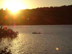
Rainy River District is a district and census division in Northwestern Ontario in the Canadian province of Ontario. It was created in 1885. It is the only division in Ontario that lies completely in the Central time zone, except of the township of Atikokan (including Sapawe and Kawene to the east) observing Eastern Standard Time year-round. Its seat is Fort Frances. It is known for its fishing and its location on the US border opposite International Falls, Minnesota and Baudette, Minnesota.
In 2016, the population was 20,110. The land area is 15,484.83 square kilometres (5,978.73 sq mi); the population density was 1.3 per square kilometre (3.4/sq mi).[5]
Subdivisions
Municipalities
| Status | Name | Population (2011) | Mayor or Reeve |
|---|---|---|---|
| Town | Fort Frances | 7,952 | Roy Avis |
| Township | Atikokan | 2,787 | Dennis Brown |
| Township | Emo | 1,252 | Jack Siemens |
| Township | La Vallee | 988 | Ken McKinnon |
| Township | Alberton | 864 | Michael Hammond |
| Town | Rainy River | 842 | Deborah Ewald |
| Township | Chapple | 741 | Peter Van Heyst |
| Township | Dawson | 563 | Bill Langner |
| Township | Morley | 474 | George Heyens |
| Township | Lake of the Woods | 296 | Valerie Pizey |
Unorganized area
- Rainy River, Unorganized (served by the Eva Marion Lake local services board)
First Nations reserves
- Agency 1
- Assabaska
- Big Grassy River 35G
- Big Island 31D
- Big Island 31E
- Big Island 31F
- Big Island 37
- Big Island Mainland 93
- Couchiching 16A
- Lake of the Woods 31H
- Lake of the Woods 34
- Long Sault 12
- Manitou Rapids 11
- Naongashing 31A
- Neguaguon Lake 25D
- Rainy Lake 17A
- Rainy Lake 17B
- Rainy Lake 18C
- Rainy Lake 26A
- Sabaskong Bay 35C
- Saug-a-Gaw-Sing 1
- Seine River 23A
- Seine River 23B
Demographics
| Canada census – Rainy River District community profile | |||
|---|---|---|---|
| 2016 | 2011 | 2006 | |
| Population: | 20,110 (-1.3% from 2011) | 20,370 (-5.5% from 2006) | 21,564 (-2.5% from 2001) |
| Land area: | 15,484.83 km2 (5,978.73 sq mi) | 15,472.94 km2 (5,974.14 sq mi) | |
| Population density: | 1.3/km2 (3.4/sq mi) | 1.4/km2 (3.6/sq mi) | |
| Median age: | 41.0 (M: 40.5, F: 41.3) | ||
| Total private dwellings: | 11,217 | 10,792 | 10,823 |
| Median household income: | |||
| References: 2016[3] 2011[5] 2006[6] earlier[7] | |||
Historic populations:[7]
- Population in 2001: 22,109
- Population in 1996: 23,138
Culture
As of 2013, the Rainy River District School Board has partnered with the Seven Generations Education Institute, the Ministry of Education, and local First Nations’ communities in development of new technologies and programs for revitalization of the Ojibwe language. [8]
See also
References
- ↑ "Rainy River District census profile". 2011 Census of Population. Statistics Canada. Retrieved 2012-03-20.
- ↑ Toe Protection for H-pileson Sloping Bedrock at Rainy River Archived 2016-04-01 at the Wayback Machine.
Page 2, "Mean river elevation is...328m" - 1 2 "2016 Community Profiles". Canada 2016 Census. Statistics Canada. February 21, 2017.
- ↑ Compilation of Northwestern Ontario's 2011 census data
- 1 2 "2011 Community Profiles". Canada 2011 Census. Statistics Canada. July 5, 2013. Retrieved 2012-03-20.
- ↑ "2006 Community Profiles". Canada 2006 Census. Statistics Canada. March 30, 2011. Retrieved 2012-03-20.
- 1 2 "2001 Community Profiles". Canada 2001 Census. Statistics Canada. February 17, 2012.
- ↑ Latter, Heather (2013-04-10). "Native language initiatives enhanced". Fort Frances Times Online. Retrieved 2013-04-14.
| Wikimedia Commons has media related to Rainy River District, Ontario. |
Places adjacent to Rainy River District | ||||||||||
|---|---|---|---|---|---|---|---|---|---|---|
| ||||||||||
| Regions | |
|---|---|
| Counties | |
| Districts | |
| Regional municipalities | |
| Single-tier municipalities | |
| Separated municipalities | |
| |
| Towns | 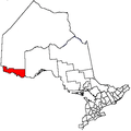 | |
|---|---|---|
| Townships | ||
| First Nations | ||
| Indian reserves |
| |
| Unorganized areas | ||
| Unincorporated communities | ||
| ||