Lyon County, Minnesota
| Lyon County, Minnesota | |
|---|---|
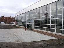 Student Center at Southwest Minnesota State University. | |
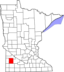 Location in the U.S. state of Minnesota | |
 Minnesota's location in the U.S. | |
| Founded | March 6, 1868[1] |
| Named for | Nathaniel Lyon[2] |
| Seat | Marshall |
| Largest city | Marshall |
| Area | |
| • Total | 722 sq mi (1,870 km2) |
| • Land | 715 sq mi (1,852 km2) |
| • Water | 7.1 sq mi (18 km2), 1.0% |
| Population (est.) | |
| • (2016) | 25,699 |
| • Density | 36/sq mi (14/km2) |
| Congressional district | 7th |
| Time zone | Central: UTC−6/−5 |
| Website |
www |
Lyon County is a county located in the U.S. state of Minnesota. As of the 2010 census, the population was 25,857.[3] Its county seat is Marshall.[4]
Lyon County comprises the Marshall, MN Micropolitan Statistical Area.
Geography
According to the U.S. Census Bureau, the county has a total area of 722 square miles (1,870 km2), of which 715 square miles (1,850 km2) is land and 7.1 square miles (18 km2) (1.0%) is water.[5]
Lakes
- Clear Lake: in Lyons Township
- Cottonwood Lake: in Lucas Township
- East Twin Lake: in Shelburne Township
- Goose Lake: in Island Lake Township
- Island Lake: in Island Lake Township
- Lady Slipper Lake: in Lucas Township
- Lake Marshall: in Lake Marshall Township
- Lake of the Hills: in Custer Township
- Lake Yankton: in Rock Lake Township
- Lone Tree Lake: almost entirely in Lucas Township, but the extreme northern tip extends into Yellow Medicine County
- Long Lake: mostly in Custer Township, but the southern part extends into Murray County
- McKay Lake: in Rock Lake Township
- North Twin Lake: in Monroe Township
- Rock Lake: in Rock Lake Township
- School Grove Lake: almost entirely in Lucas Township, but the eastern tip extends into Yellow Medicine County
- Sham Lake: in Lucas Township
- South Twin Lake: in Monroe Township
- West Twin Lake: in Shelburne Township
- Wood Lake: in Coon Creek Township
Major highways
Adjacent counties
- Yellow Medicine County (north)
- Redwood County (east)
- Murray County (south)
- Pipestone County (southwest)
- Lincoln County (west)
Demographics
| Historical population | |||
|---|---|---|---|
| Census | Pop. | %± | |
| 1880 | 6,257 | — | |
| 1890 | 9,501 | 51.8% | |
| 1900 | 14,591 | 53.6% | |
| 1910 | 15,722 | 7.8% | |
| 1920 | 18,837 | 19.8% | |
| 1930 | 19,328 | 2.6% | |
| 1940 | 21,569 | 11.6% | |
| 1950 | 22,253 | 3.2% | |
| 1960 | 22,655 | 1.8% | |
| 1970 | 24,273 | 7.1% | |
| 1980 | 25,207 | 3.8% | |
| 1990 | 24,789 | −1.7% | |
| 2000 | 25,425 | 2.6% | |
| 2010 | 25,857 | 1.7% | |
| Est. 2016 | 25,699 | [7] | −0.6% |
| U.S. Decennial Census[8] 1790-1960[9] 1900-1990[10] 1990-2000[11] 2010-2016[3] | |||
As of the 2000 census,[12] there were 25,425 people, 9,715 households, and 6,334 families residing in the county. The population density was 36 people per square mile (14/km²). There were 10,298 housing units at an average density of 14 per square mile (6/km²). The racial makeup of the county was 93.58% White, 1.49% Black or African American, 0.31% Native American, 1.67% Asian, 0.02% Pacific Islander, 1.89% from other races, and 1.04% from two or more races. 3.97% of the population were Hispanic or Latino of any race. 33.9% were of German, 15.5% Norwegian and 10.5% Belgian ancestry.
There were 9,715 households out of which 33.00% had children under the age of 18 living with them, 55.10% were married couples living together, 7.10% had a female householder with no husband present, and 34.80% were non-families. 27.90% of all households were made up of individuals and 12.40% had someone living alone who was 65 years of age or older. The average household size was 2.49 and the average family size was 3.09.
In the county, the population was spread out with 26.20% under the age of 18, 13.30% from 18 to 24, 26.50% from 25 to 44, 19.50% from 45 to 64, and 14.60% who were 65 years of age or older. The median age was 34 years. For every 100 females there were 95.70 males. For every 100 females age 18 and over, there were 93.20 males.
The median income for a household in the county was $38,996, and the median income for a family was $48,512. Males had a median income of $32,102 versus $21,445 for females. The per capita income for the county was $18,013. About 6.30% of families and 10.10% of the population were below the poverty line, including 10.00% of those under age 18 and 12.70% of those age 65 or over.
Communities
Cities
Townships
- Amiret Township
- Clifton Township
- Coon Creek Township
- Custer Township
- Eidsvold Township
- Fairview Township
- Grandview Township
- Island Lake Township
- Lake Marshall Township
- Lucas Township
- Lynd Township
- Lyons Township
- Monroe Township
- Nordland Township
- Rock Lake Township
- Shelburne Township
- Sodus Township
- Stanley Township
- Vallers Township
- Westerheim Township
Unincorporated communities
Politics
| Year | Republican | Democratic | Third parties |
|---|---|---|---|
| 2016 | 59.4% 7,256 | 31.3% 3,825 | 9.3% 1,134 |
| 2012 | 53.2% 6,594 | 44.1% 5,465 | 2.7% 329 |
| 2008 | 49.7% 6,315 | 48.1% 6,110 | 2.2% 283 |
| 2004 | 56.8% 7,203 | 41.8% 5,292 | 1.4% 178 |
| 2000 | 53.0% 6,087 | 41.2% 4,737 | 5.8% 665 |
| 1996 | 43.0% 4,932 | 44.1% 5,062 | 12.9% 1,483 |
| 1992 | 37.3% 4,591 | 36.4% 4,481 | 26.4% 3,252 |
| 1988 | 50.9% 5,969 | 48.2% 5,657 | 0.9% 110 |
| 1984 | 56.6% 7,170 | 42.6% 5,389 | 0.8% 100 |
| 1980 | 45.3% 5,852 | 43.6% 5,626 | 11.1% 1,433 |
| 1976 | 40.4% 5,036 | 57.2% 7,122 | 2.4% 300 |
| 1972 | 50.0% 5,820 | 48.3% 5,614 | 1.7% 196 |
| 1968 | 43.5% 4,331 | 53.4% 5,317 | 3.2% 318 |
| 1964 | 32.2% 3,165 | 67.7% 6,649 | 0.1% 8 |
| 1960 | 46.0% 4,740 | 53.9% 5,550 | 0.2% 15 |
| 1956 | 55.3% 5,188 | 44.6% 4,190 | 0.1% 8 |
| 1952 | 59.7% 6,015 | 40.0% 4,030 | 0.2% 24 |
| 1948 | 32.9% 3,054 | 66.2% 6,144 | 1.0% 88 |
| 1944 | 43.6% 3,617 | 55.9% 4,640 | 0.5% 38 |
| 1940 | 45.0% 4,305 | 54.7% 5,234 | 0.4% 36 |
| 1936 | 30.3% 2,551 | 61.3% 5,163 | 8.4% 710 |
| 1932 | 30.7% 2,264 | 67.6% 4,989 | 1.8% 130 |
| 1928 | 54.9% 4,058 | 44.3% 3,274 | 0.8% 56 |
| 1924 | 53.7% 3,519 | 5.1% 334 | 41.2% 2,700 |
| 1920 | 73.2% 4,557 | 19.8% 1,232 | 7.1% 440 |
| 1916 | 39.0% 1,389 | 53.1% 1,893 | 7.9% 282 |
| 1912 | 15.7% 460 | 36.3% 1,068 | 48.0% 1,411 |
| 1908 | 56.7% 1,618 | 36.6% 1,043 | 6.8% 193 |
| 1904 | 81.8% 2,394 | 11.3% 330 | 6.9% 202 |
| 1900 | 64.6% 1,844 | 30.8% 879 | 4.6% 131 |
| 1896 | 52.8% 1,623 | 44.0% 1,351 | 3.2% 98 |
| 1892 | 50.9% 1,068 | 23.2% 486 | 26.0% 545 |
See also
References
- ↑ "Minnesota Place Names". Minnesota Historical Society. Retrieved March 18, 2014.
- ↑ Gannett, Henry (1905). The Origin of Certain Place Names in the United States. U.S. Government Printing Office. p. 193.
- 1 2 "State & County QuickFacts". United States Census Bureau. Archived from the original on July 14, 2011. Retrieved September 1, 2013.
- ↑ "Find a County". National Association of Counties. Retrieved 2011-06-07.
- ↑ "2010 Census Gazetteer Files". United States Census Bureau. August 22, 2012. Archived from the original on September 21, 2013. Retrieved October 21, 2014.
- ↑ Nelson, Steven (2011). Savanna Soils of Minnesota. Minnesota: Self. pp. 69 - 70. ISBN 978-0-615-50320-2.
- ↑ "Population and Housing Unit Estimates". Retrieved June 9, 2017.
- ↑ "U.S. Decennial Census". United States Census Bureau. Retrieved October 21, 2014.
- ↑ "Historical Census Browser". University of Virginia Library. Retrieved October 21, 2014.
- ↑ "Population of Counties by Decennial Census: 1900 to 1990". United States Census Bureau. Retrieved October 21, 2014.
- ↑ "Census 2000 PHC-T-4. Ranking Tables for Counties: 1990 and 2000" (PDF). United States Census Bureau. Retrieved October 21, 2014.
- ↑ "American FactFinder". United States Census Bureau. Retrieved 2008-01-31.
- ↑ Leip, David. "Dave Leip's Atlas of U.S. Presidential Elections". uselectionatlas.org. Retrieved 2018-10-09.
External links
| Wikimedia Commons has media related to Lyon County, Minnesota. |
Places adjacent to Lyon County, Minnesota | ||||||||||
|---|---|---|---|---|---|---|---|---|---|---|
| ||||||||||
Municipalities and communities of Lyon County, Minnesota, United States | ||
|---|---|---|
| Cities | | |
| Townships | ||
| Unincorporated communities | ||