Jackson County, Minnesota
| Jackson County, Minnesota | |
|---|---|
 Jackson County Courthouse in Jackson | |
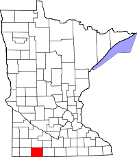 Location in the U.S. state of Minnesota | |
 Minnesota's location in the U.S. | |
| Founded | May 23, 1857[1] |
| Named for | Henry Jackson |
| Seat | Jackson |
| Largest city | Jackson |
| Area | |
| • Total | 719 sq mi (1,862 km2) |
| • Land | 703 sq mi (1,821 km2) |
| • Water | 16 sq mi (41 km2), 2.3% |
| Population (est.) | |
| • (2016) | 9,944 |
| • Density | 15/sq mi (6/km2) |
| Congressional district | 1st |
| Time zone | Central: UTC−6/−5 |
| Website |
www |
Jackson County is a county located in the U.S. state of Minnesota. As of the 2010 census, the population was 10,266.[2] Its county seat is Jackson.[3]
History
The county was named for Henry Jackson, the first merchant in St. Paul.[4][5]
Geography
According to the U.S. Census Bureau, the county has a total area of 719 square miles (1,860 km2), of which 703 square miles (1,820 km2) is land and 16 square miles (41 km2) (2.3%) is water.[6]
Lakes
There are 18 lakes completely within Jackson County and three lakes which extend into it from other counties.
- Boot Lake: Belmont Township
- Chandler Lake: in Middletown Township
- Clear Lake: almost completely in Southbrook Township of Cottonwood County, but the southern tip of the lake extends into La Crosse Township
- Clear Lake: another Clear Lake is located mostly in Des Moines Township, but the extreme western side extends into Hunter Township
- Fish Lake: southern two thirds in Christiania Township; northern third in Lakeside Township of Cottonwood County
- Illinois Lake: in Round Lake Township
- Independence Lake: Christiania Township
- Heron Lake: there are four distinct lakes, all connected by streams, that are called Heron Lake. All but the largest, southernmost lake is completely in Weimer Township. The southern parts of it extend into West Heron Lake Township
- Lake Flaherty: in Heron Lake Township
- Laurs Lake: Christiania Township
- Little Spirit Lake: in Minneota Township
- Loon Lake: western two thirds in Minneota Township; eastern third in Middletown Township
- Round Lake: in Round Lake Township
- Rush Lake: in Sioux Valley Township
- Rush Lake: there is another Rush Lake in Minneota Township
- Skunk Lake: in Sioux Valley Township
- South Heron Lake: western three quarters in West Heron Lake Township; southeastern quarter in Heron Lake Township
- Spirit Lake: in Minneota Township
- String Lakes: the two northern String Lakes are completely within Great Bend Township of Cottonwood County, the southern tip of the southernmost String lake extends into Delafield Township
- Teal Lake: Delafield Township
- Timber Lake: eastern half in Delafield Township; western half in Weimer Township
Major highways
Adjacent counties
- Cottonwood County (north)
- Watonwan County (northeast)
- Martin County (east)
- Emmet County, Iowa (southeast)
- Dickinson County, Iowa (south)
- Osceola County, Iowa (southwest)
- Nobles County (west)
Demographics
| Historical population | |||
|---|---|---|---|
| Census | Pop. | %± | |
| 1860 | 181 | — | |
| 1870 | 1,825 | 908.3% | |
| 1880 | 4,806 | 163.3% | |
| 1890 | 8,924 | 85.7% | |
| 1900 | 14,793 | 65.8% | |
| 1910 | 14,491 | −2.0% | |
| 1920 | 15,955 | 10.1% | |
| 1930 | 15,863 | −0.6% | |
| 1940 | 16,805 | 5.9% | |
| 1950 | 16,306 | −3.0% | |
| 1960 | 15,501 | −4.9% | |
| 1970 | 14,352 | −7.4% | |
| 1980 | 13,690 | −4.6% | |
| 1990 | 11,677 | −14.7% | |
| 2000 | 11,268 | −3.5% | |
| 2010 | 10,266 | −8.9% | |
| Est. 2016 | 9,944 | [8] | −3.1% |
| U.S. Decennial Census[9] 1790-1960[10] 1900-1990[11] 1990-2000[12] 2010-2016[2] | |||
As of the 2000 census,[13] there were 11,268 people, 4,556 households, and 3,116 families residing in the county. The population density was 16 people per square mile (6/km²). There were 5,092 housing units at an average density of 7 per square mile (3/km²). The racial makeup of the county was 97.07% White, 0.09% Black or African American, 0.12% Native American, 1.38% Asian, 0.97% from other races, and 0.38% from two or more races. 1.86% of the population were Hispanic or Latino of any race. 51.9% were of German, 14.1% Norwegian and 5.6% American ancestry.
There were 4,556 households out of which 29.80% had children under the age of 18 living with them, 60.00% were married couples living together, 5.40% had a female householder with no husband present, and 31.60% were non-families. 28.50% of all households were made up of individuals and 13.40% had someone living alone who was 65 years of age or older. The average household size was 2.40 and the average family size was 2.95.
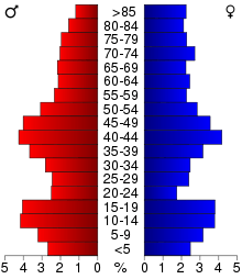
In the county, the population was spread out with 24.50% under the age of 18, 7.00% from 18 to 24, 25.30% from 25 to 44, 22.60% from 45 to 64, and 20.50% who were 65 years of age or older. The median age was 41 years. For every 100 females there were 100.60 males. For every 100 females age 18 and over, there were 99.30 males.
The median income for a household in the county was $36,746, and the median income for a family was $43,426. Males had a median income of $29,123 versus $20,860 for females. The per capita income for the county was $17,499. About 5.20% of families and 8.60% of the population were below the poverty line, including 11.00% of those under age 18 and 8.40% of those age 65 or over.
Communities
Cities
Townships
- Alba Township
- Belmont Township
- Christiania Township
- Delafield Township
- Des Moines Township
- Enterprise Township
- Ewington Township
- Heron Lake Township
- Hunter Township
- Kimball Township
- La Crosse Township
- Middletown Township
- Minneota Township
- Petersburg Township
- Rost Township
- Round Lake Township
- Sioux Valley Township
- Weimer Township
- West Heron Lake Township
- Wisconsin Township
Census-designated place
Unincorporated communities
Politics
| Year | Republican | Democratic | Third parties |
|---|---|---|---|
| 2016 | 65.8% 3,609 | 27.2% 1,492 | 7.0% 383 |
| 2012 | 56.1% 3,044 | 41.8% 2,268 | 2.2% 118 |
| 2008 | 50.8% 2,858 | 46.6% 2,618 | 2.6% 147 |
| 2004 | 52.3% 3,024 | 45.9% 2,652 | 1.8% 103 |
| 2000 | 51.0% 2,773 | 43.5% 2,364 | 5.5% 301 |
| 1996 | 36.9% 2,153 | 46.7% 2,727 | 16.4% 959 |
| 1992 | 29.2% 1,824 | 39.7% 2,481 | 31.1% 1,947 |
| 1988 | 44.1% 2,629 | 55.0% 3,275 | 0.9% 55 |
| 1984 | 47.3% 3,131 | 51.9% 3,437 | 0.8% 55 |
| 1980 | 48.0% 3,391 | 43.4% 3,062 | 8.7% 611 |
| 1976 | 39.4% 2,870 | 59.2% 4,311 | 1.5% 106 |
| 1972 | 51.5% 3,599 | 47.3% 3,304 | 1.2% 86 |
| 1968 | 42.7% 2,886 | 52.0% 3,515 | 5.4% 365 |
| 1964 | 34.8% 2,441 | 65.2% 4,576 | 0.1% 4 |
| 1960 | 47.9% 3,591 | 52.0% 3,898 | 0.2% 13 |
| 1956 | 52.2% 3,543 | 47.6% 3,232 | 0.1% 9 |
| 1952 | 62.1% 4,558 | 37.7% 2,771 | 0.2% 13 |
| 1948 | 32.8% 2,288 | 65.2% 4,541 | 2.0% 140 |
| 1944 | 44.8% 2,789 | 54.9% 3,417 | 0.4% 24 |
| 1940 | 45.3% 3,387 | 54.3% 4,065 | 0.4% 30 |
| 1936 | 23.3% 1,676 | 72.1% 5,187 | 4.6% 332 |
| 1932 | 26.5% 1,524 | 71.7% 4,129 | 1.9% 108 |
| 1928 | 55.1% 3,099 | 44.5% 2,503 | 0.5% 26 |
| 1924 | 49.0% 2,760 | 7.2% 407 | 43.8% 2,470 |
| 1920 | 83.6% 4,313 | 13.9% 715 | 2.5% 130 |
| 1916 | 52.0% 1,503 | 44.0% 1,272 | 4.1% 118 |
| 1912 | 17.1% 468 | 33.4% 913 | 49.4% 1,350 |
| 1908 | 58.9% 1,575 | 37.9% 1,013 | 3.1% 84 |
| 1904 | 76.1% 2,032 | 20.7% 554 | 3.2% 85 |
| 1900 | 61.4% 1,757 | 34.7% 993 | 4.0% 114 |
| 1896 | 56.5% 1,558 | 41.7% 1,150 | 1.8% 49 |
| 1892 | 46.2% 901 | 36.9% 721 | 16.9% 330 |
See also
References
- ↑ "Minnesota Place Names". Minnesota Historical Society. Retrieved March 18, 2014.
- 1 2 "State & County QuickFacts". United States Census Bureau. Archived from the original on July 12, 2011. Retrieved September 1, 2013.
- ↑ "Find a County". National Association of Counties. Archived from the original on May 31, 2011. Retrieved 2011-06-07.
- ↑ Gannett, Henry (1905). The Origin of Certain Place Names in the United States. Govt. Print. Off. p. 167.
- ↑ "Henry Jackson Member Record". Minnesota Legislative Reference Library. Retrieved 8 October 2013.
- ↑ "2010 Census Gazetteer Files". United States Census Bureau. August 22, 2012. Archived from the original on September 21, 2013. Retrieved October 18, 2014.
- ↑ Nelson, Steven (2011). Savanna Soils of Minnesota. Minnesota: Self. pp. 65 - 67. ISBN 978-0-615-50320-2.
- ↑ "Population and Housing Unit Estimates". Retrieved June 9, 2017.
- ↑ "U.S. Decennial Census". United States Census Bureau. Archived from the original on May 12, 2015. Retrieved October 18, 2014.
- ↑ "Historical Census Browser". University of Virginia Library. Retrieved October 18, 2014.
- ↑ "Population of Counties by Decennial Census: 1900 to 1990". United States Census Bureau. Retrieved October 18, 2014.
- ↑ "Census 2000 PHC-T-4. Ranking Tables for Counties: 1990 and 2000" (PDF). United States Census Bureau. Retrieved October 18, 2014.
- ↑ "American FactFinder". United States Census Bureau. Archived from the original on September 11, 2013. Retrieved 2008-01-31.
- ↑ Leip, David. "Dave Leip's Atlas of U.S. Presidential Elections". uselectionatlas.org. Retrieved 19 September 2018.
External links
Places adjacent to Jackson County, Minnesota | ||||||||||
|---|---|---|---|---|---|---|---|---|---|---|
| ||||||||||
Municipalities and communities of Jackson County, Minnesota, United States | ||
|---|---|---|
| Cities | | |
| Townships | ||
| CDP | ||
| Unincorporated communities | ||