Benton County, Minnesota
| Benton County, Minnesota | ||
|---|---|---|
 | ||
| ||
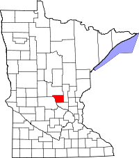 Location in the U.S. state of Minnesota | ||
 Minnesota's location in the U.S. | ||
| Founded |
October 27, 1849 (created) 1850 (organized)[1] | |
| Named for | Thomas Hart Benton | |
| Seat | Foley | |
| Largest city | Sauk Rapids | |
| Area | ||
| • Total | 413 sq mi (1,070 km2) | |
| • Land | 408 sq mi (1,057 km2) | |
| • Water | 4.8 sq mi (12 km2), 1.2% | |
| Population (est.) | ||
| • (2016) | 39,992 | |
| • Density | 94/sq mi (36/km2) | |
| Congressional district | 6th | |
| Time zone | Central: UTC−6/−5 | |
| Website |
www | |

Benton County is a county located in the U.S. state of Minnesota. As of the 2010 census, the population was 38,451.[2] Its county seat is Foley.[3] Established in 1849 and organized in 1850, the county is one of the oldest in Minnesota.[4] Benton County was named for Thomas Hart Benton, a U.S. Senator from Missouri.[5]
Benton County is part of the St. Cloud, MN Metropolitan Statistical Area, which is also included in the Minneapolis-St. Paul, MN-WI Combined Statistical Area.
Geography
According to the U.S. Census Bureau, the county has a total area of 413 square miles (1,070 km2), of which 408 square miles (1,060 km2) is land and 4.8 square miles (12 km2) (1.2%) is water.[6] It is the fifth-smallest county in Minnesota by land area and fourth-smallest by total area.
Lakes
- Donovan Lake - vast majority in Minden Township, west edge in St. Cloud
- Graham Lake - Langola Township
- Little Rock Lake - south half in Watab Township, north half in Langola Township
- Mayhew Lake - Mayhew Lake Township
Source: United States Census Bureau 2007 TIGER/Line Shapefiles[8]
Major highways
Adjacent counties
- Mille Lacs County (northeast)
- Sherburne County (southeast)
- Stearns County (southwest)
- Morrison County (northwest)
Climate and weather
| Foley, Minnesota | ||||||||||||||||||||||||||||||||||||||||||||||||||||||||||||
|---|---|---|---|---|---|---|---|---|---|---|---|---|---|---|---|---|---|---|---|---|---|---|---|---|---|---|---|---|---|---|---|---|---|---|---|---|---|---|---|---|---|---|---|---|---|---|---|---|---|---|---|---|---|---|---|---|---|---|---|---|
| Climate chart (explanation) | ||||||||||||||||||||||||||||||||||||||||||||||||||||||||||||
| ||||||||||||||||||||||||||||||||||||||||||||||||||||||||||||
| ||||||||||||||||||||||||||||||||||||||||||||||||||||||||||||
In recent years, average temperatures in the county seat of Foley have ranged from a low of 2 °F (−17 °C) in January to a high of 82 °F (28 °C) in July, although a record low of −43 °F (−42 °C) was recorded in January 1977 and a record high of 107 °F (42 °C) was recorded in July 1936. Average monthly precipitation ranged from 0.62 inches (16 mm) in February to 4.17 inches (106 mm) in June.[9]
Demographics
| Historical population | |||
|---|---|---|---|
| Census | Pop. | %± | |
| 1850 | 418 | — | |
| 1860 | 627 | 50.0% | |
| 1870 | 1,558 | 148.5% | |
| 1880 | 3,012 | 93.3% | |
| 1890 | 6,284 | 108.6% | |
| 1900 | 9,912 | 57.7% | |
| 1910 | 11,615 | 17.2% | |
| 1920 | 14,073 | 21.2% | |
| 1930 | 15,056 | 7.0% | |
| 1940 | 16,106 | 7.0% | |
| 1950 | 15,911 | −1.2% | |
| 1960 | 17,287 | 8.6% | |
| 1970 | 20,841 | 20.6% | |
| 1980 | 25,187 | 20.9% | |
| 1990 | 30,185 | 19.8% | |
| 2000 | 34,226 | 13.4% | |
| 2010 | 38,451 | 12.3% | |
| Est. 2016 | 39,992 | [10] | 4.0% |
| U.S. Decennial Census[11] 1790-1960[12] 1900-1990[13] 1990-2000[14] 2010-2016[2] | |||

As of the census of 2000,[15] there were 34,226 people, 13,065 households, and 8,518 families residing in the county. The population density was 84 people per square mile (32/km²). There were 13,460 housing units at an average density of 33 per square mile (13/km²). The racial makeup of the county was 96.22% White, 0.78% Black or African American, 0.52% Native American, 1.15% Asian, 0.05% Pacific Islander, 0.35% from other races, and 0.94% from two or more races. 0.90% of the population were Hispanic or Latino of any race. 47.8% were of German, 12.1% Polish and 8.8% Norwegian ancestry.
There were 13,065 households out of which 35.30% had children under the age of 18 living with them, 52.10% were married couples living together, 8.80% had a female householder with no husband present, and 34.80% were non-families. 25.80% of all households were made up of individuals and 8.90% had someone living alone who was 65 years of age or older. The average household size was 2.56 and the average family size was 3.14.
In the county, the population was spread out with 27.10% under the age of 18, 12.20% from 18 to 24, 31.00% from 25 to 44, 18.70% from 45 to 64, and 11.00% who were 65 years of age or older. The median age was 32 years. For every 100 females, there were 99.60 males. For every 100 females age 18 and over, there were 96.30 males.
The median income for a household in the county was $41,968, and the median income for a family was $51,277. Males had a median income of $33,214 versus $22,737 for females. The per capita income for the county was $19,008. About 4.50% of families and 7.10% of the population were below the poverty line, including 6.30% of those under age 18 and 12.60% of those age 65 or over.
Communities
Cities
Townships
Census-designated place
Unincorporated communities
Ghost towns
- East St. Cloud
- Esteville (partial)
- Minden
Politics
| Year | Republican | Democratic | Third parties |
|---|---|---|---|
| 2016 | 64.2% 12,872 | 28.1% 5,640 | 7.7% 1,546 |
| 2012 | 55.3% 10,849 | 41.7% 8,173 | 3.0% 597 |
| 2008 | 53.5% 10,338 | 43.7% 8,454 | 2.8% 547 |
| 2004 | 54.6% 10,043 | 43.8% 8,059 | 1.5% 282 |
| 2000 | 51.4% 7,663 | 40.3% 6,009 | 8.3% 1,236 |
| 1996 | 36.5% 4,835 | 45.4% 6,006 | 18.1% 2,392 |
| 1992 | 35.2% 5,053 | 35.9% 5,156 | 29.0% 4,162 |
| 1988 | 50.3% 6,060 | 48.7% 5,861 | 1.0% 119 |
| 1984 | 57.5% 6,830 | 41.4% 4,922 | 1.1% 131 |
| 1980 | 46.8% 5,513 | 44.8% 5,272 | 8.5% 997 |
| 1976 | 37.4% 4,099 | 56.9% 6,235 | 5.8% 631 |
| 1972 | 49.4% 4,652 | 45.4% 4,282 | 5.2% 492 |
| 1968 | 43.3% 3,470 | 50.2% 4,022 | 6.5% 524 |
| 1964 | 37.5% 2,818 | 62.2% 4,679 | 0.3% 23 |
| 1960 | 44.2% 3,324 | 55.6% 4,175 | 0.2% 16 |
| 1956 | 57.8% 3,591 | 42.0% 2,609 | 0.3% 16 |
| 1952 | 59.5% 3,856 | 40.0% 2,587 | 0.5% 33 |
| 1948 | 38.2% 2,297 | 60.4% 3,632 | 1.4% 86 |
| 1944 | 56.8% 2,988 | 42.9% 2,258 | 0.3% 18 |
| 1940 | 55.8% 3,491 | 43.8% 2,742 | 0.5% 28 |
| 1936 | 30.7% 1,783 | 53.5% 3,111 | 15.8% 919 |
| 1932 | 24.8% 1,329 | 72.9% 3,901 | 2.2% 120 |
| 1928 | 46.3% 2,373 | 53.3% 2,732 | 0.4% 21 |
| 1924 | 41.9% 1,629 | 14.7% 572 | 43.4% 1,687 |
| 1920 | 78.8% 2,920 | 15.0% 554 | 6.2% 230 |
| 1916 | 49.1% 1,020 | 45.5% 945 | 5.4% 113 |
| 1912 | 24.4% 468 | 29.3% 562 | 46.4% 890 |
| 1908 | 54.1% 1,001 | 41.4% 765 | 4.5% 84 |
| 1904 | 71.9% 1,205 | 25.8% 433 | 2.3% 38 |
| 1900 | 51.6% 849 | 45.6% 751 | 2.8% 46 |
| 1896 | 46.6% 778 | 52.0% 867 | 1.4% 24 |
| 1892 | 25.6% 426 | 34.7% 577 | 39.7% 659 |
See also
References
- ↑ "Minnesota Place Names". Minnesota Historical Society. Retrieved March 17, 2014.
- 1 2 "State & County QuickFacts". United States Census Bureau. Retrieved August 31, 2013.
- ↑ "Find a County". National Association of Counties. Archived from the original on 2011-05-31. Retrieved 2011-06-07.
- ↑
- ↑ Upham, Warren (1920). Minnesota Geographic Names: Their Origin and Historic Significance. Minnesota Historical Society. p. 49.
- ↑ "2010 Census Gazetteer Files". United States Census Bureau. August 22, 2012. Archived from the original on October 6, 2014. Retrieved October 5, 2014.
- ↑ Nelson, Steven (2011). Savanna Soils of Minnesota. Minnesota: Self. pp. 61 - 64. ISBN 978-0-615-50320-2.
- ↑ "United States Census Bureau 2007 TIGER/Line Shapefiles". Archived from the original on 2007-03-10.
- 1 2 "Monthly Averages for Foley, Minnesota". The Weather Channel. Retrieved 2011-11-06.
- ↑ "Population and Housing Unit Estimates". Retrieved June 9, 2017.
- ↑ "U.S. Decennial Census". United States Census Bureau. Archived from the original on May 12, 2015. Retrieved October 5, 2014.
- ↑ "Historical Census Browser". University of Virginia Library. Retrieved October 5, 2014.
- ↑ "Population of Counties by Decennial Census: 1900 to 1990". United States Census Bureau. Retrieved October 5, 2014.
- ↑ "Census 2000 PHC-T-4. Ranking Tables for Counties: 1990 and 2000" (PDF). United States Census Bureau. Retrieved October 5, 2014.
- ↑ "American FactFinder". United States Census Bureau. Archived from the original on 2013-09-11. Retrieved 2008-01-31.
- ↑ Leip, David. "Dave Leip's Atlas of U.S. Presidential Elections". uselectionatlas.org. Retrieved 2018-04-17.
External links
- Benton County Government’s website
- Minnesota DOT's official highway map of Benton County
- Benton County Fair
- Benton County Historical Society and Museum - Located in Sauk Rapids, MN
- Sartell Historical Society - Sartell, MN
- MNGenUSGen Web Site for Benton County, Minnesota - Genealogy
- Sauk Rapids and Benton County - Images of America Series - Approximately 200 vintage photographs
- Benton County Map
Places adjacent to Benton County, Minnesota | ||||||||||
|---|---|---|---|---|---|---|---|---|---|---|
| ||||||||||
Municipalities and communities of Benton County, Minnesota, United States | ||
|---|---|---|
| Cities | | |
| Townships | ||
| CDP | ||
| Unincorporated communities | ||
| Ghost town | ||
| Footnotes | ‡This populated place also has portions in an adjacent county or counties | |
| Core City | 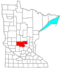 | ||||
|---|---|---|---|---|---|
| Surrounding communities |
| ||||
| Counties | |||||
‡ indicates that it is partially in the metropolitan area. § indicates a CDP | |||||