Grand Falls, Minnesota
| Grand Falls, Minnesota | |
|---|---|
| Unincorporated community | |
 Grand Falls, Minnesota Location of the community of Grand Falls within Koochiching County  Grand Falls, Minnesota Grand Falls, Minnesota (the US) | |
| Coordinates: 48°11′55″N 93°47′34″W / 48.19861°N 93.79278°WCoordinates: 48°11′55″N 93°47′34″W / 48.19861°N 93.79278°W | |
| Country | United States |
| State | Minnesota |
| County | Koochiching |
| Elevation | 1,227 ft (374 m) |
| Population | |
| • Total | 30 |
| Time zone | UTC-6 (Central (CST)) |
| • Summer (DST) | UTC-5 (CDT) |
| ZIP code | 56627 |
| Area code(s) | 218 |
| GNIS feature ID | 654732[1] |
Grand Falls is an unincorporated community in Koochiching County, Minnesota, United States.
The community is located immediately north of Big Falls at the junction of County Roads 13 and 31; and U.S. Highway 71.
Grand Falls is located within ZIP code 56627 based in Big Falls.
Geography
Grand Falls is located within South Koochiching Unorganized Territory.
Big Falls Municipal Airport is nearby.
The community of Grand Falls is located across the Big Fork River from the city of Big Falls. Grand Falls is also located 38 miles southwest of International Falls.
History
A post office was established at Grand Falls from 1906 until 1911.[2] The community took its name from a nearby waterfall.[3]
References
- ↑ "Grand Falls, Minnesota". Geographic Names Information System. United States Geological Survey.
- ↑ "Koochiching County". Jim Forte Postal History. Retrieved 17 July 2015.
- ↑ Warren Upham (1920). Minnesota Geographic Names: Their Origin and Historic Significance. Minnesota Historical Society. p. 283.
- Rand McNally Road Atlas – 2007 edition – Minnesota entry
- Official State of Minnesota Highway Map – 2011/2012 edition
- Mn/DOT map of Koochiching County – Sheet 1 – 2011 edition
Municipalities and communities of Koochiching County, Minnesota, United States | ||
|---|---|---|
| Cities | 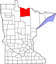 | |
| Unorganized territories | ||
| Unincorporated communities | ||
| Indian reservations | ||
| Ghost towns | ||
| Footnotes | ‡This populated place also has portions in an adjacent county or counties | |
This article is issued from
Wikipedia.
The text is licensed under Creative Commons - Attribution - Sharealike.
Additional terms may apply for the media files.