Bellemont, North Carolina
| Bellemont, North Carolina | |
|---|---|
| Unincorporated community | |
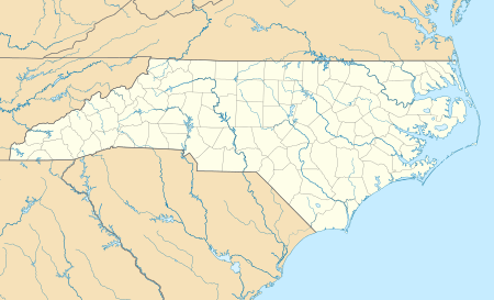
 Location of Bellemont in North Carolina  Bellemont, North Carolina (the US) | |
| Coordinates: 36°01′32″N 79°26′35″W / 36.02556°N 79.44306°WCoordinates: 36°01′32″N 79°26′35″W / 36.02556°N 79.44306°W | |
| Country | United States |
| State | North Carolina |
| County | Alamance |
| Elevation[1] | 561 ft (171 m) |
| Time zone | UTC-5 (Eastern (EST)) |
| • Summer (DST) | UTC-4 (EDT) |
| Area code(s) | 336 |
| GNIS feature ID | 1019072[1] |
| [2] | |
Bellemont is an unincorporated community in Alamance County, North Carolina, United States.
Bellemont is located on North Carolina Highway 49, east of Alamance, and 4.3 miles south-southeast of downtown Burlington. The community is located at the junction with Bellemont Alamance/Mt. Hermon Road.
The Bellemont Mill Village Historic District and Kernodle-Pickett House are listed on the National Register of Historic Places.[3]
Notable residents
- Leo Moon, Cleveland Indians pitcher[4]
Belmont is located at 35°14′40″N 81°2′8″W / 35.24444°N 81.03556°W / 35.24444; -81.03556 (35.244496, -81.035650).
References
- 1 2 U.S. Geological Survey Geographic Names Information System: Bellemont, North Carolina. Retrieved on 2008-03-25.
- ↑ "Alamance County North Carolina Area Codes". HomeTownLocator.com. Retrieved 2008-03-25.
- ↑ National Park Service (2010-07-09). "National Register Information System". National Register of Historic Places. National Park Service.
- ↑ "Leo Moon Statistics - The Baseball Cube". Archived from the original on 2008-11-18. Retrieved 2008-03-25.
External links
This article is issued from
Wikipedia.
The text is licensed under Creative Commons - Attribution - Sharealike.
Additional terms may apply for the media files.