Gatesville, North Carolina
Gatesville is a town in Gates County, North Carolina, United States.[3] The population was 321 at the 2010 census. It is the county seat of Gates County.[4]
Gatesville, North Carolina | |
|---|---|
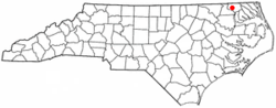 Location of Gatesville, North Carolina | |
| Coordinates: 36°24′13″N 76°45′11″W | |
| Country | United States |
| State | North Carolina |
| County | Gates |
| Area | |
| • Total | 0.4 sq mi (1.1 km2) |
| • Land | 0.4 sq mi (1.1 km2) |
| • Water | 0.0 sq mi (0.0 km2) |
| Elevation | 23 ft (7 m) |
| Population (2010) | |
| • Total | 321 |
| • Estimate (2016)[1] | 305 |
| • Density | 800/sq mi (290/km2) |
| Time zone | UTC-5 (Eastern (EST)) |
| • Summer (DST) | UTC-4 (EDT) |
| ZIP code | 27938 |
| Area code(s) | 252 |
| FIPS code | 37-25680[2] |
| GNIS feature ID | 1025334[3] |
History
Gatesville is named for Horatio Gates, a commander in the American Revolutionary War.[5]
The Elmwood Plantation, Eure-Roberts House, Gates County Courthouse, Roberts-Carter House, Rountree Family Farm and Reid's Grove School are listed on the National Register of Historic Places.[6][7]
Geography
According to the United States Census Bureau, the town has a total area of 0.4 square miles (1.0 km2), all of it land.
Demographics
| Historical population | |||
|---|---|---|---|
| Census | Pop. | %± | |
| 1870 | 156 | — | |
| 1880 | 187 | 19.9% | |
| 1890 | 232 | 24.1% | |
| 1900 | 200 | −13.8% | |
| 1910 | 203 | 1.5% | |
| 1930 | 320 | — | |
| 1940 | 297 | −7.2% | |
| 1950 | 323 | 8.8% | |
| 1960 | 460 | 42.4% | |
| 1970 | 338 | −26.5% | |
| 1980 | 363 | 7.4% | |
| 1990 | 308 | −15.2% | |
| 2000 | 281 | −8.8% | |
| 2010 | 321 | 14.2% | |
| Est. 2016 | 305 | [1] | −5.0% |
| U.S. Decennial Census[8] | |||
At the 2000 census there were 281 people, 117 households, and 80 families in the town. The population density was 675.8 people per square mile (258.3/km²). There were 142 housing units at an average density of 341.5 per square mile (130.5/km²). The racial makeup of the town was 87.54% White, 11.03% African American, 0.36% Native American, and 1.07% from two or more races. Hispanic or Latino of any race were 0.36%.[2]
Of the 117 households 29.9% had children under the age of 18 living with them, 59.0% were married couples living together, 7.7% had a female householder with no husband present, and 30.8% were non-families. 29.1% of households were one person and 17.9% were one person aged 65 or older. The average household size was 2.40 and the average family size was 3.00.
The age distribution was 25.3% under the age of 18, 5.3% from 18 to 24, 24.6% from 25 to 44, 24.2% from 45 to 64, and 20.6% 65 or older. The median age was 41 years. For every 100 females there were 82.5 males. For every 100 females age 18 and over, there were 85.8 males.
The median household income was $49,375 and the median family income was $62,500. Males had a median income of $40,625 versus $27,500 for females. The per capita income for the town was $18,190. About 2.8% of families and 3.9% of the population were below the poverty line, including 5.4% of those under the age of eighteen and 9.8% of those sixty five or over.
References
- "Population and Housing Unit Estimates". Retrieved June 9, 2017.
- "U.S. Census website". United States Census Bureau. Retrieved 2008-01-31.
- U.S. Geological Survey Geographic Names Information System: Gatesville
- "Find a County". National Association of Counties. Archived from the original on 2011-05-31. Retrieved 2011-06-07.
- Gannett, Henry (1905). The Origin of Certain Place Names in the United States. Govt. Print. Off. pp. 135.
- "National Register Information System". National Register of Historic Places. National Park Service. July 9, 2010.
- "National Register of Historic Places Listings". Weekly List of Actions Taken on Properties: 8/29/11 through 9/02/11. National Park Service. 2011-09-09.
- "Census of Population and Housing". Census.gov. Retrieved June 4, 2015.
Municipalities and communities of Gates County, North Carolina, United States | ||
|---|---|---|
| Town | 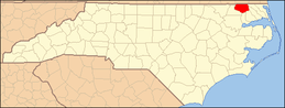 Gates County map | |
| CDP | ||
| Unincorporated communities | ||