Anson County, North Carolina
Anson County is a county located in the U.S. state of North Carolina. As of the 2010 census, the population was 26,948.[1] Its county seat is Wadesboro.[2]
Anson County | |
|---|---|
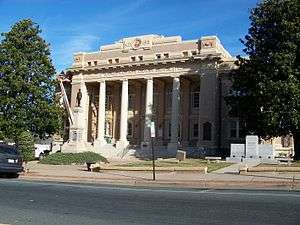 Anson County Courthouse in Wadesboro | |
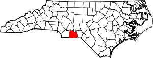 Location within the U.S. state of North Carolina | |
 North Carolina's location within the U.S. | |
| Coordinates: 34°58′N 80°06′W | |
| Country | |
| State | |
| Founded | 1750 |
| Named for | George Anson, Baron Anson |
| Seat | Wadesboro |
| Largest town | Wadesboro |
| Area | |
| • Total | 537 sq mi (1,390 km2) |
| • Land | 531 sq mi (1,380 km2) |
| • Water | 5.6 sq mi (15 km2) 1.1%% |
| Population | |
| • Estimate (2019) | 24,446 |
| • Density | 51/sq mi (20/km2) |
| Time zone | UTC−5 (Eastern) |
| • Summer (DST) | UTC−4 (EDT) |
| Congressional district | 9th |
| Website | www |
History
The county was formed in 1750 from Bladen County. It was named for George Anson, Baron Anson, a British admiral, who circumnavigated the globe from 1740 to 1744, and later became First Lord of the Admiralty. Anson purchased land in the state.[3]
Like its parent county Bladen, Anson County was originally a vast territory with indefinite northern and western boundaries. Reductions in its extent began in 1753, when the northern part of it became Rowan County. In 1762 the western part of Anson County became Mecklenburg County. In 1779 the northern part of what remained of Anson County became Montgomery County, and the part east of the Pee Dee River became Richmond County. Finally, in 1842 the western part of Anson County was combined with the southeastern part of Mecklenburg County to become Union County.[4]
Geography
According to the U.S. Census Bureau, the county has a total area of 537 square miles (1,390 km2), of which 531 square miles (1,380 km2) is land and 5.6 square miles (15 km2) (1.1%) is water.[5]
National protected area
Law and government
Anson County is a member of the regional Centralina Council of Governments.[6]
As of the 2000 Census, Anson County is located entirely in North Carolina's 9th congressional district, which is currently represented by Republican Dan Bishop.
| Year | Republican | Democratic | Third parties |
|---|---|---|---|
| 2016 | 42.7% 4,506 | 55.6% 5,859 | 1.7% 180 |
| 2012 | 37.0% 4,166 | 62.4% 7,019 | 0.6% 71 |
| 2008 | 39.2% 4,207 | 60.2% 6,456 | 0.7% 70 |
| 2004 | 41.2% 3,796 | 58.7% 5,413 | 0.2% 16 |
| 2000 | 39.6% 3,161 | 60.0% 4,792 | 0.4% 32 |
| 1996 | 28.8% 2,193 | 64.2% 4,890 | 7.0% 530 |
| 1992 | 27.3% 2,334 | 61.7% 5,269 | 11.0% 936 |
| 1988 | 36.5% 2,782 | 63.3% 4,831 | 0.3% 20 |
| 1984 | 42.5% 3,719 | 57.3% 5,015 | 0.3% 26 |
| 1980 | 27.8% 1,968 | 70.2% 4,973 | 2.1% 146 |
| 1976 | 25.0% 1,608 | 74.7% 4,796 | 0.3% 18 |
| 1972 | 60.9% 3,551 | 37.5% 2,188 | 1.6% 94 |
| 1968 | 18.4% 1,474 | 37.1% 2,969 | 44.6% 3,571 |
| 1964 | 29.3% 1,721 | 70.7% 4,144 | |
| 1960 | 27.9% 1,597 | 72.1% 4,120 | |
| 1956 | 31.3% 1,640 | 68.7% 3,598 | |
| 1952 | 30.8% 1,843 | 69.2% 4,143 | |
| 1948 | 12.1% 447 | 72.5% 2,692 | 15.4% 572 |
| 1944 | 12.5% 510 | 87.5% 3,582 | |
| 1940 | 7.5% 371 | 92.5% 4,552 | |
| 1936 | 7.6% 381 | 92.4% 4,629 | |
| 1932 | 5.0% 223 | 94.9% 4,252 | 0.1% 5 |
| 1928 | 19.8% 726 | 80.2% 2,947 | |
| 1924 | 8.6% 225 | 90.5% 2,372 | 1.0% 25 |
| 1920 | 12.0% 433 | 88.0% 3,175 | |
| 1916 | 12.8% 301 | 87.2% 2,046 | |
| 1912 | 7.2% 125 | 86.0% 1,487 | 6.8% 118 |
Demographics
| Historical population | |||
|---|---|---|---|
| Census | Pop. | %± | |
| 1790 | 5,133 | — | |
| 1800 | 8,146 | 58.7% | |
| 1810 | 8,831 | 8.4% | |
| 1820 | 12,534 | 41.9% | |
| 1830 | 14,095 | 12.5% | |
| 1840 | 15,077 | 7.0% | |
| 1850 | 13,489 | −10.5% | |
| 1860 | 13,664 | 1.3% | |
| 1870 | 12,428 | −9.0% | |
| 1880 | 17,994 | 44.8% | |
| 1890 | 20,027 | 11.3% | |
| 1900 | 21,870 | 9.2% | |
| 1910 | 25,465 | 16.4% | |
| 1920 | 28,334 | 11.3% | |
| 1930 | 29,349 | 3.6% | |
| 1940 | 28,443 | −3.1% | |
| 1950 | 26,781 | −5.8% | |
| 1960 | 24,962 | −6.8% | |
| 1970 | 23,488 | −5.9% | |
| 1980 | 25,649 | 9.2% | |
| 1990 | 23,474 | −8.5% | |
| 2000 | 25,275 | 7.7% | |
| 2010 | 26,948 | 6.6% | |
| Est. 2019 | 24,466 | [8] | −9.2% |
| U.S. Decennial Census[9] 1790-1960[10] 1900-1990[11] 1990-2000[12] 2010-2014[1] | |||
As of the census[13] of 2000, there were 25,275 people, 9,204 households, and 6,663 families residing in the county. The population density was 48 people per square mile (18/km²). There were 10,221 housing units at an average density of 19 per square mile (7/km²). The racial makeup of the county was 51.64% Black or African American, 48.53% White, 0.45% Native American, 0.57% Asian, 0.02% Pacific Islander, 0.32% from other races, and 0.46% from two or more races. 0.83% of the population were Hispanic or Latino of any race.
There were 9,204 households out of which 31.00% had children under the age of 18 living with them, 47.80% were married couples living together, 19.80% had a female householder with no husband present, and 27.60% were non-families. 25.10% of all households were made up of individuals and 11.00% had someone living alone who was 65 years of age or older. The average household size was 2.59 and the average family size was 3.09.
In the county, the population was spread out with 25.20% under the age of 18, 8.60% from 18 to 24, 29.00% from 25 to 44, 22.80% from 45 to 64, and 14.40% who were 65 years of age or older. The median age was 37 years. For every 100 females there were 96.50 males. For every 100 females age 18 and over, there were 95.80 males.
The median income for a household in the county was $29,849, and the median income for a family was $35,870. Males had a median income of $27,297 versus $20,537 for females. The per capita income for the county was $14,853. About 15.50% of families and 17.80% of the population were below the poverty line, including 23.90% of those under age 18 and 16.70% of those age 65 or over.
Education
There are 11 schools in the Anson County Schools system that serve the students of the county.[14]
South Piedmont Community College has a campus on Highway 74 near Polkton that serves Anson County residents.
Communities

Towns
- Ansonville
- Lilesville
- McFarlan
- Morven
- Peachland
- Polkton
- Wadesboro (county seat)
Unincorporated communities
- Burnsville
- Pee Dee
Ghost town
Population ranking
The population ranking of the following table is based on the 2010 census of Anson County.[15]
† county seat
| Rank | City/Town/etc. | Municipal type | Population (2010 Census) |
|---|---|---|---|
| 1 | † Wadesboro | Town | 5,813 |
| 2 | Polkton | Town | 3,375 |
| 3 | Ansonville | Town | 631 |
| 4 | Lilesville | Town | 536 |
| 5 | Morven | Town | 511 |
| 6 | Peachland | Town | 437 |
| 7 | McFarlan | Town | 117 |
Notable people
- Stephone Anthony, linebacker with the New Orleans Saints of the National Football League
- Hugh Hammond Bennett, soil conservation specialist
- John Culpepper (1761–1841), born near Wadesboro, United States Congressman from North Carolina, long-tenured Baptist minister
- James Holland (1754–1823), born in Anson County, United States Congressman from North Carolina.[16]
- Blind Boy Fuller (1907–1941), American blues guitarist and vocalist.
- Leonidas Lafayette Polk (1837–1892), first North Carolina Commissioner of Agriculture
- Sylvester Ritter (1952–1998), born in Anson County, professional wrestler also known as The Junkyard Dog.
In popular culture
Steven Spielberg filmed The Color Purple mostly in Lilesville, and a large white farmhouse (the Huntley house, which is located in Lilesville, NC and is an old farmhouse located few miles off Highway 74) was used extensively as the main exterior location in that film. Most of the town scenes were done in nearby Marshville, NC in Union County, NC which is a small town in the county directly to the west of Anson County; the store is an actual store called Apple Jacks and dirt was laid out of over pavement during filming.
See also
- National Register of Historic Places listings in Anson County, North Carolina
- Anson County Regiment militia in the American Revolution
References
- "State & County QuickFacts". United States Census Bureau. Archived from the original on July 6, 2011. Retrieved October 17, 2013.
- "Find a County". National Association of Counties. Archived from the original on 2011-05-31. Retrieved 2011-06-07.
- Gannett (1905). The Origin of Certain Place Names (PDF). Washington DC: United States Geological Survey. p. 26.
- Medley, Mary Louise (1976). Anson County Historical Association (ed.). "History of Anson County, North Carolina, 1750-1976". Heritage Printer, Inc., Charlotte, North Carolina. Retrieved March 3, 2019.
- "2010 Census Gazetteer Files". United States Census Bureau. August 22, 2012. Archived from the original on January 12, 2015. Retrieved January 11, 2015.
- "Centralina Council of Governments". Retrieved August 10, 2019.
- Leip, David. "Dave Leip's Atlas of U.S. Presidential Elections". uselectionatlas.org. Retrieved 2018-03-14.
- "Population and Housing Unit Estimates". Retrieved April 30, 2020.
- "U.S. Decennial Census". United States Census Bureau. Retrieved January 11, 2015.
- "Historical Census Browser". University of Virginia Library. Retrieved January 11, 2015.
- Forstall, Richard L., ed. (March 27, 1995). "Population of Counties by Decennial Census: 1900 to 1990". United States Census Bureau. Retrieved January 11, 2015.
- "Census 2000 PHC-T-4. Ranking Tables for Counties: 1990 and 2000" (PDF). United States Census Bureau. April 2, 2001. Retrieved January 11, 2015.
- "U.S. Census website". United States Census Bureau. Retrieved 2008-01-31.
- "Search for Public School Districts – District Detail for Anson County Schools". National Center for Education Statistics. Institute of Education Sciences. Retrieved December 4, 2012.
- "2010 U.S. Census website". United States Census Bureau. Retrieved 2015-12-06.
- Who Was Who in America, Historical Volume, 1607-1896. Chicago: Marquis Who's Who. 1963.
External links
Places adjacent to Anson County, North Carolina | ||||||||||
|---|---|---|---|---|---|---|---|---|---|---|
| ||||||||||
Municipalities and communities of Anson County, North Carolina, United States | ||
|---|---|---|
| Towns | 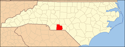 | |
| Unincorporated community | ||
| Ghost town | ||
|  | ||||||||||||
|
| |||||||||||||


| Authority control |
|
|---|