Winnebago County, Wisconsin
| Winnebago County, Wisconsin | |
|---|---|
 Winnebago County Courthouse | |
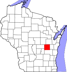 Location in the U.S. state of Wisconsin | |
 Wisconsin's location in the U.S. | |
| Founded | 1848 |
| Seat | Oshkosh |
| Largest city | Oshkosh |
| Area | |
| • Total | 579 sq mi (1,500 km2) |
| • Land | 434 sq mi (1,124 km2) |
| • Water | 144 sq mi (373 km2), 25% |
| Population | |
| • (2010) | 166,994 |
| • Density | 384/sq mi (148/km2) |
| Congressional districts | 6th, 8th |
| Time zone | Central: UTC−6/−5 |
| Website |
www |
Winnebago County is a county in the U.S. state of Wisconsin. As of the 2010 census, the population was 166,994.[1] Its county seat is Oshkosh.[2] It was named for the historic Winnebago people, a federally recognized Native American tribe now known as the Ho-Chunk Nation. Chief Oshkosh was a leader in the area.
Winnebago County comprises the Oshkosh-Neenah, WI Metropolitan Statistical Area, which is included in the Appleton-Oshkosh-Neenah, WI Combined Statistical Area.
History
The region was occupied by several Native American tribes in the period of European encounter, including the Sauk, Fox, Menominee, and Ojibwa (known as Chippewa in the US). French traders from what is now Canada had early interaction with them, as did French Jesuit missionaries, who sought to convert them to Catholicism. European and American settlement encroached on their traditional territories, and the United States negotiated treaties in the mid-19th century to keep pushing the Indians to the west.
Winnebago County was created in 1840 by European Americans and organized in 1848.[3] The name Winnebago is of Algonquin origin, with variations used by the Fox and Potowatomi to refer to the Fox River below Lake Winnebago, which sometimes got muddy and full of fish.[4] It means 'people dwelling by the fetid or ill-smelling water', which may also refer to a sulfur spring.[5] The county seat, Oshkosh, was incorporated as a city in 1853, when it already had a population of nearly 2,800.[6]
Chief Oshkosh was the namesake for the county seat. A leader of the Menominee in the region, he was successful in gaining authorization from the federal government for 2500 of his people to remain in Wisconsin, at a time when the government was pushing for their removal west of the Mississippi River.
Geography
According to the U.S. Census Bureau, the county has a total area of 579 square miles (1,500 km2), of which 434 square miles (1,120 km2) is land and 144 square miles (370 km2) (25%) is water.[7]
Adjacent counties
- Waupaca County - northwest
- Outagamie County - northeast
- Calumet County - east
- Fond du Lac County - south
- Green Lake County - southwest
- Waushara County - west
Major highways
Airport
Wittman Regional Airport (KOSH) serves the county and surrounding communities.
Brennan Airport (79C) in the Town of Clayton is a major recreational aircraft hub year-round.
Commercial airline service for Winnebago County is provided by Appleton International Airport in the neighboring Outagamie County.
Demographics

| Historical population | |||
|---|---|---|---|
| Census | Pop. | %± | |
| 1840 | 135 | — | |
| 1850 | 10,167 | 7,431.1% | |
| 1860 | 23,770 | 133.8% | |
| 1870 | 37,279 | 56.8% | |
| 1880 | 42,740 | 14.6% | |
| 1890 | 50,097 | 17.2% | |
| 1900 | 58,225 | 16.2% | |
| 1910 | 62,116 | 6.7% | |
| 1920 | 63,897 | 2.9% | |
| 1930 | 76,622 | 19.9% | |
| 1940 | 80,507 | 5.1% | |
| 1950 | 91,103 | 13.2% | |
| 1960 | 107,928 | 18.5% | |
| 1970 | 129,931 | 20.4% | |
| 1980 | 131,703 | 1.4% | |
| 1990 | 140,320 | 6.5% | |
| 2000 | 156,763 | 11.7% | |
| 2010 | 166,994 | 6.5% | |
| Est. 2016 | 169,886 | [8] | 1.7% |
| U.S. Decennial Census[9] 1790–1960[10] 1900–1990[11] 1990–2000[12] 2010–2014[1] | |||
As of the census[13] of 2000, there were 156,763 people, 61,157 households, and 39,568 families residing in the county. The population density was 357 per square mile (138/km2). There were 64,721 housing units at an average density of 148 per square mile (57/km2). The racial makeup of the county was 94.92% White, 1.12% Black or African American, 0.46% Native American, 1.84% Asian, 0.02% Pacific Islander, 0.72% from other races, and 0.92% from two or more races. 1.96% of the population were Hispanic or Latino of any race. 52.4% were of German, 6.2% Irish and 5.7% Polish ancestry according to Census 2000. 94.6% spoke English, 2.5% Spanish and 1.0% Hmong as their first language.
There were 61,157 households out of which 31.00% had children under the age of 18 living with them, 53.00% were married couples living together, 8.30% had a female householder with no husband present, and 35.30% were non-families. 27.60% of all households were made up of individuals and 9.90% had someone living alone who was 65 years of age or older. The average household size was 2.43 and the average family size was 2.99.
By age, 23.80% of the population was under 18, 11.80% from 18 to 24, 30.40% from 25 to 44, 21.50% from 45 to 64, and 12.50% were 65 or older. The median age was 35 years. For every 100 females there were 99.40 males. For every 100 females age 18 and over, there were 97.80 males.
Government
Winnebago County is governed by the 36-member Winnebago County Board of Supervisors. Supervisors are elected to the board in a nonpartisan election held the first Tuesday of April in even numbered years and serve two-year terms. The board has several committees. It meets on the third Tuesday of each month at the Winnebago County Courthouse in Oshkosh.
Politics
Winnebago County has become a swing county in recent decades. It has voted for the winning presidential candidate in every election since 1980, except in 1992 when it supported George Bush.
| Year | Republican | Democratic | Third parties |
|---|---|---|---|
| 2016 | 49.9% 43,445 | 42.5% 37,047 | 7.6% 6,643 |
| 2012 | 47.2% 42,122 | 51.0% 45,449 | 1.8% 1,602 |
| 2008 | 43.3% 37,946 | 54.9% 48,167 | 1.8% 1,564 |
| 2004 | 52.5% 46,542 | 46.2% 40,943 | 1.3% 1,111 |
| 2000 | 50.4% 38,330 | 44.7% 33,983 | 5.0% 3,767 |
| 1996 | 42.7% 27,880 | 45.3% 29,564 | 12.0% 7,803 |
| 1992 | 43.6% 33,709 | 35.2% 27,234 | 21.3% 16,443 |
| 1988 | 54.8% 35,085 | 44.5% 28,508 | 0.6% 410 |
| 1984 | 62.7% 39,014 | 36.7% 22,791 | 0.6% 378 |
| 1980 | 53.3% 34,286 | 37.6% 24,203 | 9.1% 5,864 |
| 1976 | 55.4% 32,149 | 42.2% 24,485 | 2.5% 1,448 |
| 1972 | 57.3% 29,488 | 39.7% 20,450 | 3.0% 1,544 |
| 1968 | 53.8% 25,361 | 39.5% 18,605 | 6.7% 3,138 |
| 1964 | 47.0% 21,084 | 52.7% 23,636 | 0.3% 115 |
| 1960 | 61.7% 28,598 | 38.1% 17,656 | 0.2% 80 |
| 1956 | 71.4% 28,759 | 27.6% 11,115 | 0.9% 380 |
| 1952 | 68.2% 28,172 | 31.5% 13,016 | 0.3% 140 |
| 1948 | 55.2% 17,165 | 42.2% 13,116 | 2.7% 829 |
| 1944 | 59.6% 19,310 | 39.6% 12,841 | 0.8% 269 |
| 1940 | 54.1% 18,697 | 45.1% 15,570 | 0.8% 268 |
| 1936 | 36.9% 11,679 | 58.6% 18,522 | 4.5% 1,420 |
| 1932 | 41.3% 11,505 | 56.0% 15,591 | 2.7% 756 |
| 1928 | 61.1% 16,191 | 37.7% 9,995 | 1.2% 315 |
| 1924 | 48.7% 11,239 | 7.8% 1,801 | 43.5% 10,038 |
| 1920 | 69.5% 12,035 | 19.6% 3,397 | 10.8% 1,876 |
| 1916 | 50.5% 5,923 | 44.7% 5,242 | 4.8% 566 |
| 1912 | 17.0% 1,922 | 41.0% 4,631 | 42.0% 4,743[15] |
| 1908 | 52.2% 6,797 | 42.4% 5,511 | 5.4% 703 |
| 1904 | 62.6% 7,720 | 32.5% 4,006 | 4.9% 600 |
| 1900 | 55.7% 7,467 | 41.8% 5,605 | 2.6% 342 |
| 1896 | 59.2% 7,898 | 38.2% 5,089 | 2.6% 347 |
| 1892 | 45.1% 5,354 | 49.6% 5,893 | 5.3% 635 |
Communities
Cities
- Appleton (mostly in Outagamie County and Calumet County)
- Menasha (partly in Calumet County)
- Neenah
- Omro
- Oshkosh (county seat)
Villages
Towns
Census-designated places
Unincorporated communities
- Adella Beach
- Allenville
- Black Wolf
- Black Wolf Point
- Clarks Point
- Decorah Beach
- Elo
- Fairview Beach
- Fisk
- Fitzgerald
- Harbor Springs
- Highland Shore
- Indian Shores
- Island Park
- Larsen
- Lasleys Point
- Leonards Point
- Little Point
- Koro
- Medina Junction
- Melrose Park
- Metz (partial)
- Mikesville
- Minden
- Nichols Shore Acres
- Oakwood
- Orihula
- Paukotuk
- Piacenza
- Pickett
- Plummer Point
- Point Comfort
- Reighmoor
- Ricker Bay
- Ring
- Rivermoor
- Rush Lake
- Shangri La Point
- Snells
- Sunrise Bay
- Waverly Beach (partial)
- Winnebago
- Zion
- Zittau
Ghost towns/neighborhoods
See also
References
- 1 2 "State & County QuickFacts". United States Census Bureau. Retrieved January 24, 2014.
- ↑ "Find a County". National Association of Counties. Retrieved 2011-06-07.
- ↑ "Wisconsin: Individual County Chronologies". Wisconsin Atlas of Historical County Boundaries. The Newberry Library. 2007. Retrieved August 15, 2015.
- ↑ "Winnebago", Dictionary.com
- ↑ "Winnebago Took Its Name from an Indian Tribe". The Post-Crescent. December 28, 1963. p. 14. Retrieved August 25, 2014 – via Newspapers.com.

- ↑ City of Oshkosh. About Us.
- ↑ "2010 Census Gazetteer Files". United States Census Bureau. August 22, 2012. Retrieved August 9, 2015.
- ↑ "Population and Housing Unit Estimates". Retrieved June 9, 2017.
- ↑ "U.S. Decennial Census". United States Census Bureau. Retrieved August 9, 2015.
- ↑ "Historical Census Browser". University of Virginia Library. Retrieved August 9, 2015.
- ↑ Forstall, Richard L., ed. (March 27, 1995). "Population of Counties by Decennial Census: 1900 to 1990". United States Census Bureau. Retrieved August 9, 2015.
- ↑ "Census 2000 PHC-T-4. Ranking Tables for Counties: 1990 and 2000" (PDF). United States Census Bureau. April 2, 2001. Retrieved August 9, 2015.
- ↑ "American FactFinder". United States Census Bureau. Retrieved 2011-05-14.
- ↑ Leip, David. "Dave Leip's Atlas of U.S. Presidential Elections". uselectionatlas.org. Retrieved 2018-08-14.
- ↑ The leading "other" candidate, Progressive Theodore Roosevelt, received 4,098 votes, while Socialist candidate Eugene Debs received 478 votes, Prohibition candidate Eugene Chafin received 146 votes, and Independent candidate Arthur Reimer received 21 votes.
Further reading
- Commemorative Biographical Record of the Fox River Valley Counties of Brown, Outagamie and Winnebago. Chicago: J. H. Beers, 1895.
- Lawson, Publius V. (ed.) History, Winnebago County, Wisconsin: Its Cities, Towns, Resources, People. Chicago: C. F. Cooper, 1908.
External links
- Winnebago County official website
- Winnebago County map from the Wisconsin Department of Transportation
Places adjacent to Winnebago County, Wisconsin | ||||||||||
|---|---|---|---|---|---|---|---|---|---|---|
| ||||||||||
| Core cities |  | |
|---|---|---|
| Largest municipalities over 10,000 in 2010 | ||
| Municipalities under 10,000 in 2010 |
| |
| Counties | ||
| ||
Municipalities and communities of Winnebago County, Wisconsin, United States | ||
|---|---|---|
| Cities | | |
| Villages | ||
| Towns | ||
| CDPs | ||
| Unincorporated communities |
| |
| Ghost towns/neighborhoods | ||
| Footnotes | ‡This populated place also has portions in an adjacent county or counties | |
