Butte des Morts, Wisconsin
| Butte des Morts, Wisconsin | |
|---|---|
| Census-designated place | |
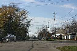 Downtown Butte des Morts | |
 Butte des Morts Location in state of Wisconsin | |
| Coordinates: 44°5′57″N 88°39′14″W / 44.09917°N 88.65389°W | |
| Country | United States |
| State | Wisconsin |
| County | Winnebago |
| Area | |
| • Total | 1.24 sq mi (3.22 km2) |
| • Land | 1.22 sq mi (3.17 km2) |
| • Water | 0.02 sq mi (0.05 km2) |
| Elevation | 775 ft (236 m) |
| Population (2010) | |
| • Total | 962 |
| • Density | 786/sq mi (303.5/km2) |
| Time zone | UTC-6 (Central (CST)) |
| • Summer (DST) | UTC-5 (CDT) |
| ZIP code | 54927 |
| Area code(s) | 920 |
| FIPS code | 55-11500[1] |
| GNIS feature ID | 1562472[2] |
Butte des Morts is an unincorporated census-designated place in the town of Winneconne, in Winnebago County, Wisconsin, United States.[3] As of the 2010 census, its population was 962.[4] The community is located at the north side of (Big) Lake Butte des Morts [5] on the former route of Wisconsin Highway 110. The name means "hill of the dead" in French.[6] Butte des Morts uses the ZIP code 54927. The Augustin Grignon Hotel, listed on the National Register of Historic Places, is located within the community. Butte des Morts has an area of 1.246 square miles (3.23 km2); 1.225 square miles (3.17 km2) of this is land, and 0.021 square miles (0.054 km2) is water.
Images
 Post office
 City welcome sign
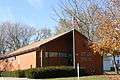
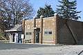 Lions club
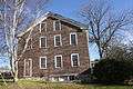 Austin Grignon Hotel
References
- ↑ "American FactFinder". United States Census Bureau. Archived from the original on 2013-09-11. Retrieved 2008-01-31.
- ↑ "US Board on Geographic Names". United States Geological Survey. 2007-10-25. Retrieved 2008-01-31.
- ↑ http://wisconsin.hometownlocator.com/wi/winnebago/butte-des-morts.cfm
- ↑ "American FactFinder". U.S. Census Bureau. Retrieved 29 March 2011.
- ↑ Lake Butte des Morts
- ↑ http://www.wisconsinhistory.org/dictionary/index.asp?action=view&term_id=11330&keyword=origin+name
| Wikimedia Commons has media related to Butte des Morts, Wisconsin. |
Municipalities and communities of Winnebago County, Wisconsin, United States | ||
|---|---|---|
| Cities | 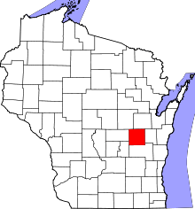 | |
| Villages | ||
| Towns | ||
| CDPs | ||
| Unincorporated communities |
| |
| Ghost towns/neighborhoods | ||
| Footnotes | ‡This populated place also has portions in an adjacent county or counties | |
Coordinates: 44°05′58″N 88°39′14″W / 44.09944°N 88.65389°W
This article is issued from
Wikipedia.
The text is licensed under Creative Commons - Attribution - Sharealike.
Additional terms may apply for the media files.