Neenah, Wisconsin
| Neenah | |
|---|---|
| City | |
| City of Neenah | |
| Nickname(s): The Paper City | |
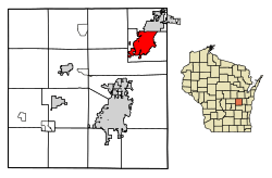 Location of Neenah in Winnebago County, Wisconsin. | |
 Neenah Location within the state of Wisconsin | |
| Coordinates: 44°10′27″N 88°28′7″W / 44.17417°N 88.46861°WCoordinates: 44°10′27″N 88°28′7″W / 44.17417°N 88.46861°W | |
| Country | United States |
| State | Wisconsin |
| County | Winnebago |
| Government | |
| • Type | Mayor-council |
| • Mayor | Dean R. Kaufert (R) |
| Area[1] | |
| • Total | 1.66 sq mi (4.29 km2) |
| • Land | 1.37 sq mi (3.55 km2) |
| • Water | 0.29 sq mi (0.74 km2) |
| Elevation | 750 ft (230 m) |
| Population (2010)[2] | |
| • Total | 25,501 |
| • Estimate (2016)[3] | 25,914 |
| • Density | 18,901.53/sq mi (7,299.87/km2) |
| Time zone | UTC−6 (Central (CST)) |
| • Summer (DST) | UTC−5 (CDT) |
| ZIP codes | 54956 |
| Area code(s) | 920 |
| FIPS code | 55-55750 |
| Website |
www |
Neenah is a city in Winnebago County, Wisconsin, in the north central United States. It is situated on the banks of Lake Winnebago, Little Lake Butte des Morts, and the Fox River, approximately forty miles (60 km) southwest of Green Bay.
Neenah is bordered by the Town of Neenah. The city is the southwestern-most of the Fox Cities of northeast Wisconsin. It is the smaller of the two principal cities of the Oshkosh-Neenah Metropolitan Statistical Area, which is included in the Appleton-Oshkosh-Neenah Combined Statistical Area. It is sometimes referred to as a twin city with Menasha, with which it shares Doty Island.
Neenah's population was 25,501 at the 2010 census.
History
Neenah was named by Governor James Duane Doty from the Winnebago word for "water" or "running water".[4] It was the site of a Ho-Chunk village in the late 18th century. It is Nįįňą in the Hoocąk language.[5]
The government initially designated this area in 1835 as an industrial and agricultural mission to the Menominee Indians of the area. Early settlement by European Americans began a few years later, stimulated in large part by the proximity of the area to the Fox River.[6]
Kimberly-Clark corporation was formed here in 1872.[7] It founded a major paper mill here in 1873, as the region had become a center of lumbering.[8] Profits from lumber stimulated the development of businesses and a variety of professions. Some people relocated to Neenah after the disastrous fire in Oshkosh in 1875.
Geography
Neenah is located at 44°10′26″N 88°28′6″W / 44.17389°N 88.46833°W (44.174035, −88.468508).[9]
According to the United States Census Bureau, the city has a total area of 9.61 square miles (24.89 km2), of which, 9.23 square miles (23.91 km2) is land and 0.38 square miles (0.98 km2) is water.[10]
Demographics
| Historical population | |||
|---|---|---|---|
| Census | Pop. | %± | |
| 1860 | 1,296 | — | |
| 1870 | 2,655 | 104.9% | |
| 1880 | 4,202 | 58.3% | |
| 1890 | 5,083 | 21.0% | |
| 1900 | 5,954 | 17.1% | |
| 1910 | 5,734 | −3.7% | |
| 1920 | 7,171 | 25.1% | |
| 1930 | 9,151 | 27.6% | |
| 1940 | 10,645 | 16.3% | |
| 1950 | 12,437 | 16.8% | |
| 1960 | 18,057 | 45.2% | |
| 1970 | 22,902 | 26.8% | |
| 1980 | 22,432 | −2.1% | |
| 1990 | 23,219 | 3.5% | |
| 2000 | 24,507 | 5.5% | |
| 2010 | 25,501 | 4.1% | |
| Est. 2016 | 25,914 | [3] | 1.6% |
| U.S. Decennial Census[11] | |||
2010 census
As of the census[2] of 2010, there were 25,501 people, 10,694 households, and 6,700 families residing in the city. The population density was 2,762.8 inhabitants per square mile (1,066.7/km2). There were 11,313 housing units at an average density of 1,225.7 per square mile (473.2/km2). The racial makeup of the city was 93.7% White, 1.3% African American, 0.7% Native American, 1.4% Asian, 1.3% from other races, and 1.5% from two or more races. Hispanic or Latino of any race were 3.8% of the population.
There were 10,694 households of which 32.2% had children under the age of 18 living with them, 47.6% were married couples living together, 10.5% had a female householder with no husband present, 4.6% had a male householder with no wife present, and 37.3% were non-families. 30.7% of all households were made up of individuals and 10.7% had someone living alone who was 65 years of age or older. The average household size was 2.36 and the average family size was 2.96.
The median age in the city was 37.1 years. 25% of residents were under the age of 18; 7.8% were between the ages of 18 and 24; 27.6% were from 25 to 44; 27% were from 45 to 64; and 12.7% were 65 years of age or older. The gender makeup of the city was 48.9% male and 51.1% female.
2000 census
As of the census[12] of 2000, there were 24,507 people, 9,834 households and 6,578 families residing in the city. The population density was 2,971.7 people per square mile (1,146.9/km²). There were 10,198 housing units at an average density of 1,236.6 per square mile (477.3/km²). The racial makeup of the city was 96.08% White, 0.34% Black or African American, 0.55% Native American, 0.96% Asian, 0.86% from other races, and 1.20% from two or more races. 2.02% of the population were Hispanic or Latino of any race.
Thirty-five percent of the households had children under the age of 18 living with them, 53.8% were married couples living together, 9.8% had a female householder with no husband present, and 33.1% were non-families. 27.5% of all households were made up of individuals and 10.1% had someone living alone who was 65 years of age or older. The average household size was 2.47 and the average family size was 3.03.
In the city, the population was spread out with 27.5% under the age of 18, 7.6% from 18 to 24, 32.0% from 25 to 44, 20.3% from 45 to 64, and 12.5% who were 65 years of age or older. The median age was 35 years. For every 100 females, there were 94.6 males. For every 100 females age 18 and over, there were 91.8 males.
The median income for a household in the city was $45,773, and the median income for a family was $55,329. Males had a median income of $39,140 versus $25,666 for females. The per capita income for the city was $24,280. About 3.3% of families and 5.4% of the population were below the poverty line, including 6.4% of those under age 18 and 7.2% of those age 65 or over.
Transportation
Interstate 41 runs north to south through the center of the city. Bus service is operated by Valley Transit. Brennand Airport provides general aviation service for the city. Appleton International Airport provides commercial airline service for the city.
Economy
Neenah hosts significant steel and paper industries. Some paper companies include Clearwater Paper, SCA Tissue, Kimberly-Clark and Neenah Paper. Kimberly-Clark was founded in Neenah and maintains significant operations there, though its headquarters moved to Irving, Texas, in the 1980s. Manhole covers manufactured at Neenah Foundry can be found throughout the central United States and parts of Europe.
Neenah is the headquarters of Plexus, a developer and manufacturer of electronic products, which also has engineering and manufacturing operations in the city. Also headquartered here are Cobblestone Hotel Group, Bemis Co, Inc., Miron Construction, Menasha Corporation, Theda Clark Hospital, NM Transfer, and Checker Logistics. Business process outsourcing organizations also contributed to the economy of the city.
Culture
Founded in 1959, Neenah's Bergstrom-Mahler Museum has a collection of glass art comprising over 3,000 pieces. It concentrates in historic paperweights and Germanic glasswork.[13]
Notable people
- Jack Ankerson, NFL player
- William Arnemann, politician
- Havilah Babcock, businessman and a founder of Kimberly Clark
- James R. Barnett, politician
- George Bergstrom, designer of The Pentagon
- Robert D. Bohn, U.S. Marine Corps major general
- John A. Bryan, U.S. diplomat
- Elmer J. Burr, Medal of Honor recipient
- Merritt L. Campbell, politician
- Charles B. Clark, U.S. Representative and a founder of Kimberly-Clark
- Laura Coenen, basketball all-American, 3-time Olympian - team handball
- Kenneth John Conant, architectural historian, professor at Harvard University
- Samuel A. Cook, U.S. Representative
- Philip Daly, Edmonton, Alberta Alderman
- George Danielson, politician
- Julius H. Dennhardt, politician
- William Draheim, politician
- A. D. Eldridge, politician
- Michael Ellis, politician
- James C. Fritzen, politician
- Robert Frederick Froehlke, businessman and government official
- Jim Hall, professional boxer
- Marcus Lee Hansen, historian and Pulitzer Prize winner, born in Neenah
- William C. Hansen, politician
- Howard Hawks, film director, Rio Bravo, Red River, The Big Sleep
- William Hawks, film producer
- Christopher T. Hill, author and theoretical physicist
- Dick Jorgensen, NFL referee, Super Bowl XXIV
- Frank Bateman Keefe, U.S. Representative
- Kris Kelderman, MLS player and assistant coach
- John A. Kimberly, a founder of Kimberly-Clark
- Judith Klusman, politician
- Peter Konz, NFL Player
- Wayne Kreklow, NBA player, head coach of the Missouri Tigers women's volleyball team
- Nels Larson, politician and businessman
- Henry Leavens, politician
- Rich Loiselle, MLB player
- Ernst Mahler, chemist and business leader
- David Martin, politician
- Azel W. Patten, businessman and politician
- Charles H. Pfennig, politician
- Roger Ream, educator
- Reid Ribble, politician
- Nathaniel S. Robinson, physician and politician[14]
- Mike Rohrkaste, politician and businessman
- John Schneller, NFL player
- Richard J. Steffens, politician
- John Stevens, inventor of the roller flour mill
- John Strange, Lieutenant Governor of Wisconsin
- Kenneth E. Stumpf, Medal of Honor recipient
- Konrad Tuchscherer, professor
- Ryan G. Van Cleave, author and educator
- Edwin Wheeler, politician and jurist
- John Whitlinger, tennis player, born in Neenah
- Tami Whitlinger, WTA player
- Edwin A. Williams, legislator, educator, businessman, mayor
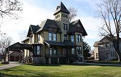
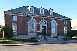
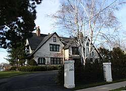
Images
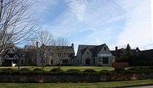
 Neenah Post Office
 Library


References
- ↑ "2016 U.S. Gazetteer Files". United States Census Bureau. Retrieved Jul 14, 2017.
- 1 2 "American FactFinder". United States Census Bureau. Retrieved 2012-11-18.
- 1 2 "Population and Housing Unit Estimates". Retrieved June 9, 2017.
- ↑ Neenah [origin of place name]
- ↑ "Physical Spatial Place". (2010, June 1). Hocąk Teaching Materials Volume 1, p. 454.
- ↑ "City of Neenah, Wisconsin: Heritage"
- ↑ Dictionary of Wisconsin History article
- ↑ Neenah Paper history
- ↑ "US Gazetteer files: 2010, 2000, and 1990". United States Census Bureau. 2011-02-12. Retrieved 2011-04-23.
- ↑ "US Gazetteer files 2010". United States Census Bureau. Archived from the original on 2012-01-24. Retrieved 2012-11-18.
- ↑ "Census of Population and Housing". Census.gov. Retrieved June 4, 2015.
- ↑ "American FactFinder". United States Census Bureau. Retrieved 2008-01-31.
- ↑ "Inspiring Glass Stories". Bmmglass.com. Bergstrom-Mahler Museum of Glass. 2014. Retrieved September 9, 2015.
- ↑ 'Wisconsin Blue Book 1875,' Biographical Sketch of Nathaniel S. Robinson, pg. 338
External links
| Wikimedia Commons has media related to Neenah, Wisconsin. |
- City of Neenah
- Neenah Public Library Local History Collection at the University of Wisconsin Digital Collections center
- Sanborn fire insurance maps at the Wisconsin Historical Society
- Trade Worries Led Wisconsin Mill Town to Trump. It's Still Uneasy - The New York Times
| Core cities |  | |
|---|---|---|
| Largest municipalities over 10,000 in 2010 | ||
| Municipalities under 10,000 in 2010 |
| |
| Counties | ||
| ||
Municipalities and communities of Winnebago County, Wisconsin, United States | ||
|---|---|---|
| Cities | 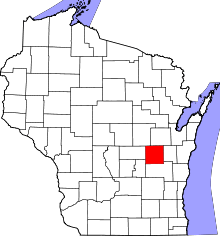 | |
| Villages | ||
| Towns | ||
| CDPs | ||
| Unincorporated communities |
| |
| Ghost towns/neighborhoods | ||
| Footnotes | ‡This populated place also has portions in an adjacent county or counties | |